
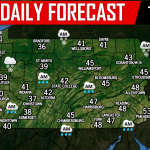
Highs in the 30s Wednesday with lows in the 20s will set the stage for a rare mid-November winter storm that will have significant impacts on much of the state. A strong high pressure in northern New England will keep low level temperatures cold enough to produce a widespread ice event. A coastal low pressure to our south will move north-northeast Wednesday Night into Thursday, partnering with a cut-off low to our west. Let’s get into the timing for this storm.
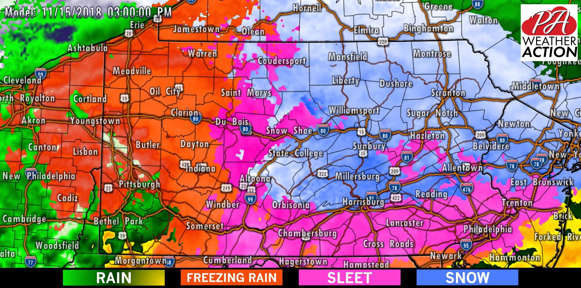
Snow and sleet will begin to move into Southern PA just after the Thursday Morning Commute. By 11 AM, snow will overspread Western PA, Central PA, and Southeast PA. However, snow will be short-lived in Southwest PA and the Laurel Highlands. As you can see below, sleet and freezing rain will begin to break out in these areas before noon. Here is the Hi-Res NAM simulated radar for 11:00 AM Thursday.

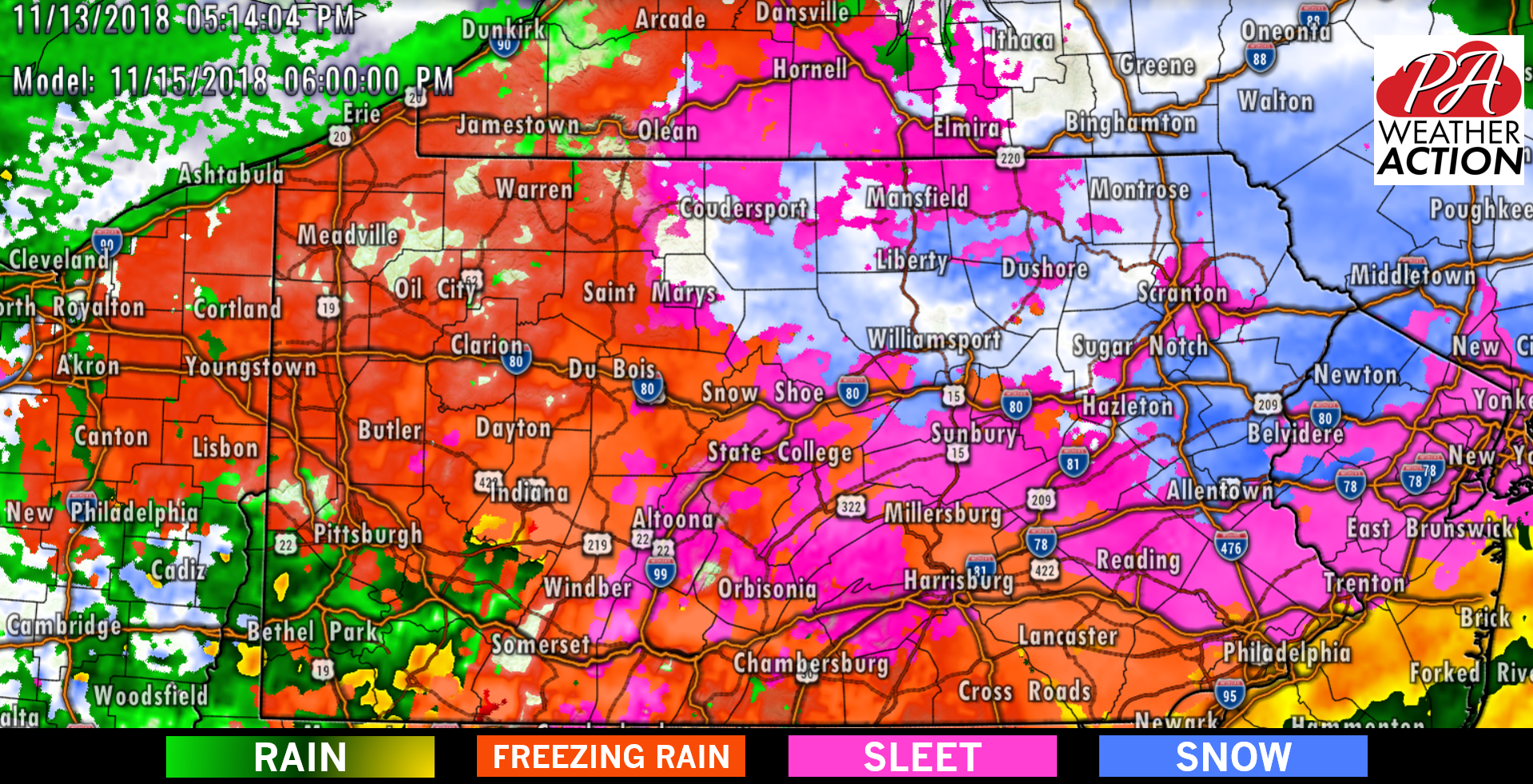
As the afternoon progresses, snow will switch to sleet, followed by freezing rain near and south of the PA Turnpike and i-78. Freezing rain will take over in the majority of Western PA, with snow continuing in areas north of Allentown, Harrisburg and State College. Below is the Hi-Res NAM for 3:00 PM Thursday Afternoon:
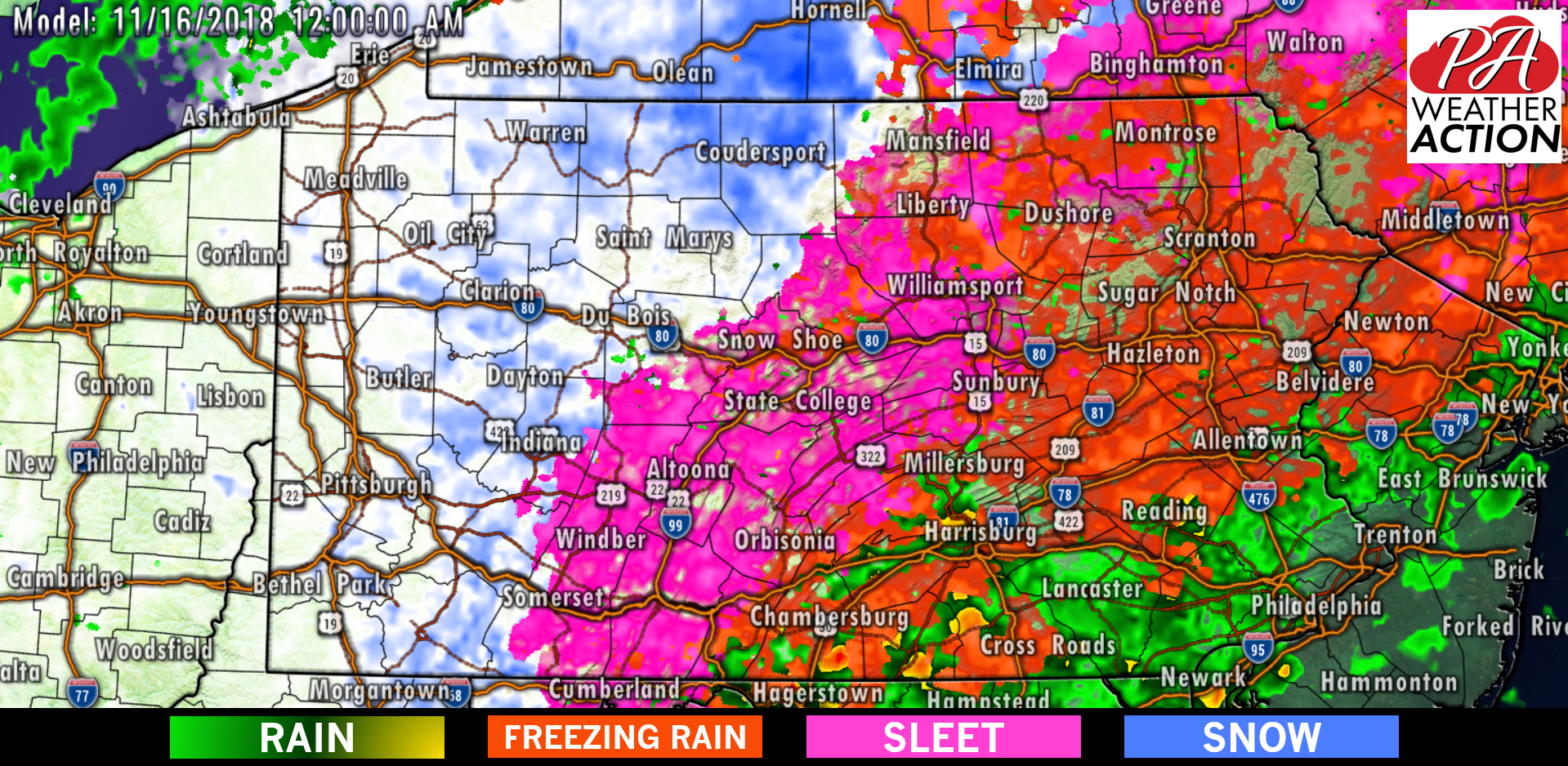
The strengthening upper level low swinging to our south will cause snow to break out in Western PA around 12:00 AM Friday, while freezing rain and sleet hanging on in Central PA and north of i-78 in Eastern PA. Below is the Hi-Res NAM model for 12:00 AM Friday:
Central and Eastern PA may switch over to all snow early morning Friday, but we don’t expect that to last long as the system will be exiting the area.
The Friday Morning Commute will likely be messy in regions along and north of i-81.
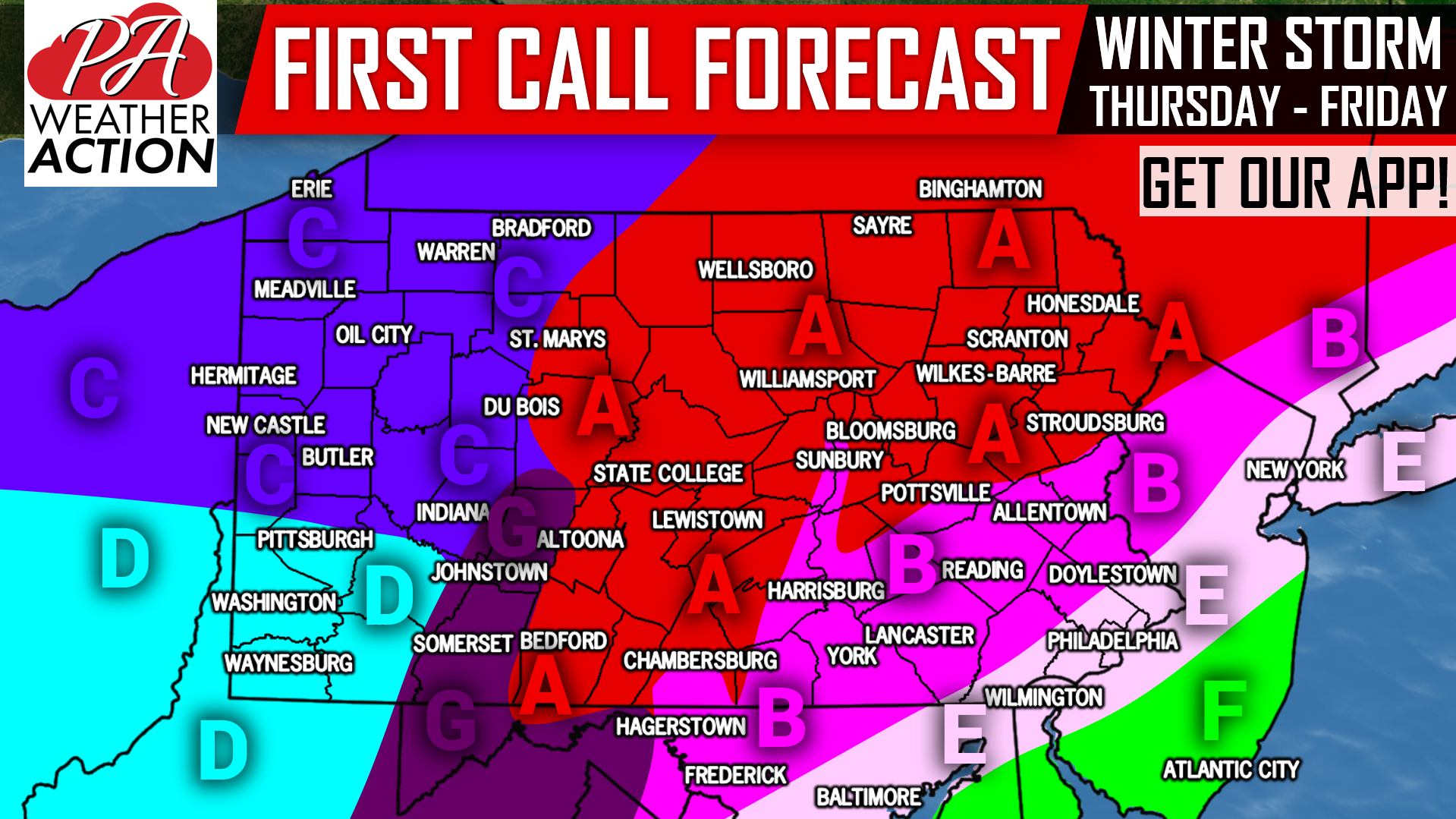
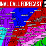
FIRST CALL SNOW & ICE FORECAST AMOUNTS

Area A: Moderate snow will overspread the area from south to north mid-late Thursday Morning. Snow will then switch to sleet from south to north by Thursday Afternoon, and begin to change to freezing rain by the evening commute. Freezing rain will continue until 1-3 AM, before changing back over to snow until sunrise. Snow accumulations of 3-5″ are expected, with isolated locations in the northern section of this zone recieving as much as 7″, along with a tenth to a quarter inch of ice accumulation. Travel will be difficult especially on secondary roads early Thursday Afternoon through mid Friday Morning.
Area B: Moderate snow will move into the area from south to north mid-late Thursday Morning. We expect a two to four hour period of snow, before changing to sleet and freezing rain mid to late Thursday Afternoon. Temperatures should warm just above freezing by 8-10 PM, changing precipitation over to plain rain. Precipitation will then end around 12:00 AM Friday, before a brief round of sleet and snow move back in around sunrise Friday. Snow accumulations of 1-3″ are expected, with isolated locations on the north edge of this area receiving up to 4″. Ice accumulation of a tenth to a fifth of an inch likely. Travel will be difficult mainly on secondary roads early Thursday Afternoon through late Thursday Evening.
Area C: Precipitation will likely begin as snow for a few hours late Thursday Morning and early afternoon before changing to sleet, then freezing rain between 3-5 PM from south to north. Sleet and freezing will then continue through the evening commute, before changing back over to snow by 8-10 PM Thursday. Light to moderate snow will last until just before sunrise, leading to additional snow accumulations on top of an ice layer that is on top of a thin layer of snow. Snow accumulations of 1-2″ are expected late Thursday Morning and early afternoon, with an addition 1-2″ expected late Thursday Evening through sunrise Friday. Ice accumulation of .05″ to .10″ is anticipated.
Area D: Precipitation will more than likely begin as freezing rain during or just after the Thursday Morning Commute. Freezing rain will continue through the early afternoon, before temperatures rise above 32 degrees, changing precipitation type to plain rain by the mid afternoon. But no, it doesn’t end there. Rain will switch back over to snow by 6-8 PM Thursday Evening, which will last until just before sunrise Friday. Snow accumulations of 1-3″ are likely Thursday Night, with ice accumulation of up to a tenth of an inch expected.
Area F: Besides for maybe a brief rain/snow mix near Area E late Thursday Morning, this region will see plain rain out of this system. It’s simply too early for the coast.
Area G: Snow will move in mid Thursday Morning, before quickly changing over to freezing rain and sleet. Freezing rain will then continue through the daytime and evening, before switching over to snow around 12 AM Friday. Snow will last until mid morning Friday. Snow accumulations of 1-3″ are expected, on top of ice accumulations of .15″ to .30″. Power outages are possible.
Stay tuned for our Final Call Forecast Wednesday Evening by liking our facebook page (Click Here), and downloading our app (Click Here).
Don’t forget to share this important forecast with your friends and family using the button below!
Pick up an inexpensive, high quality fleece jacket or sweatshirt, or our “Typical Weather in PA” long-sleeve tee on our store >>> Store Link
You must be logged in to post a comment.