
Before we get into the details about Tuesday Evening into Wednesday, a disturbance is still projected to move through the state Tonight and into Tomorrow Morning bringing with it a mix of rain and snow. Our call from last night still stands with this system. If you missed our call, click here>>>https://paweatheraction.com/light-snow-sunday-night-wintry-mix-arrives-mid-week
As for the bigger storm potential, we are tracking a Winter Storm set to begin Tuesday Evening and lasting through Wednesday Morning. A low pressure system will develop in the South and track its way Northward before transferring its energy into a coastal low. Over the last 36-48 hours, guidance has been steadily trending colder and colder for this system. While this still won’t be an all snow event for most of us, this will lead to a longer duration of snow versus rain for many locations.
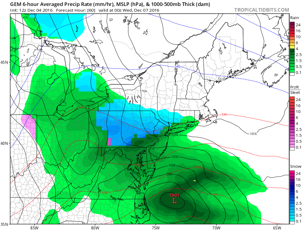
For a visual on this, below is the Canadian Model valid 7 PM Tuesday Evening.
The further North you are in PA and the higher your elevation is will increase your chances of receiving accumulating snowfall. Many low elevated valleys will receive a slushy mix or just a cold rain.
It is projected as this storm wraps up and the precipitation weakens, most locations end in the form of light rain.
Timing: Tuesday Evening into Wednesday Morning
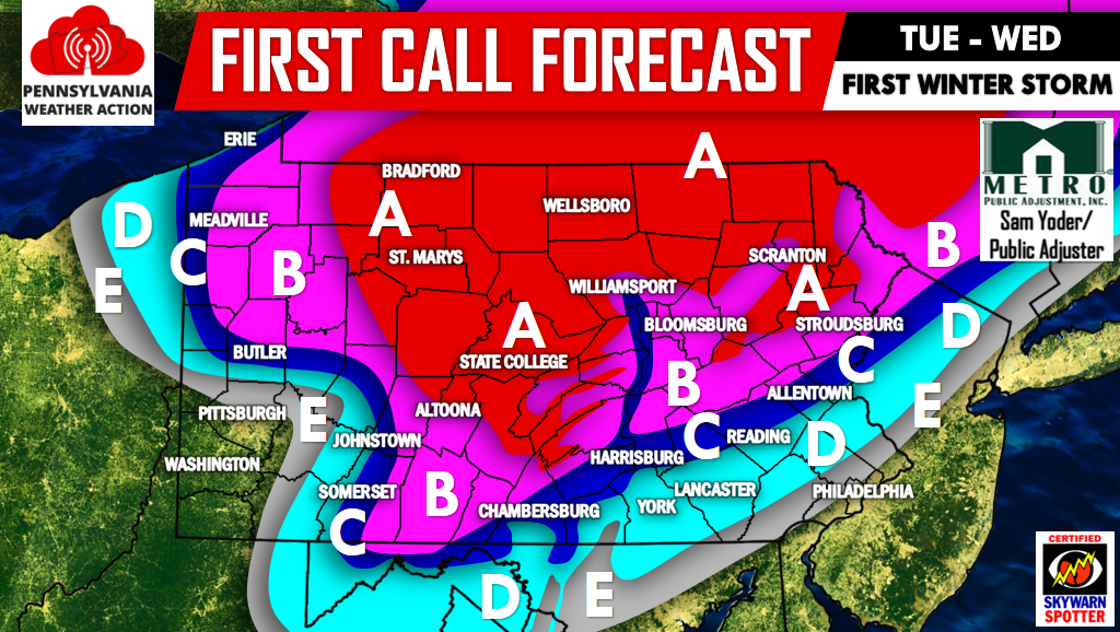
MAP FORECAST FOR WINTER STORM TUESDAY INTO WEDNESDAY
Area A: 4 to 6 inches of heavy wet snow is possible, ending as a brief period of drizzle. Isolated power outages would be possible in these areas as the snow would weigh on power lines and tree limbs.
Area B: 2 to 4 inches of wet snow is possible, ending as a period of light rain.
Area C: 1 to 2 inches of wet snow is possible before changing to a period of rain.
Area D: Up to 1 inch of wet snow is possible before changing to rain.
Area E: Up to a coating of wet snow is possible before changing to rain.
For future updates regarding this Winter Storm and the rest of this Winter make sure you have us liked on Facebook by clicking here>>>PA Weather Action on Facebook!
Also remember to share the forecast below with your friends and family. Stay safe!
You must be logged in to post a comment.