
The Final Call Snow & Ice Forecast for this weekend’s winter storm has been posted. Please view the article below.
Final Call Snowfall & Ice Forecast for Weekend Winter Storm in Pennsylvania
You will never believe it, another wintry mix to rain! This one comes Saturday into Sunday, with some moderate snow expected on the front-end before a swift transition to freezing rain and then plain rain. Typical areas like Southwest PA won’t see much of any winter weather, while farther north and east will.
Regardless, this will all changeover to plain rain Saturday evening or Sunday morning, depending on where you are, as the low pressure moves right over our head. The heaviest snow with this storm will be from Southern Ontario to the Adirondacks and Northern New England.
With that said, snowfall rates of above a half-inch per hour will lead to a build up of slush on our roads Saturday afternoon. Let’s get into timing.
WINTER WEATHER TIMING
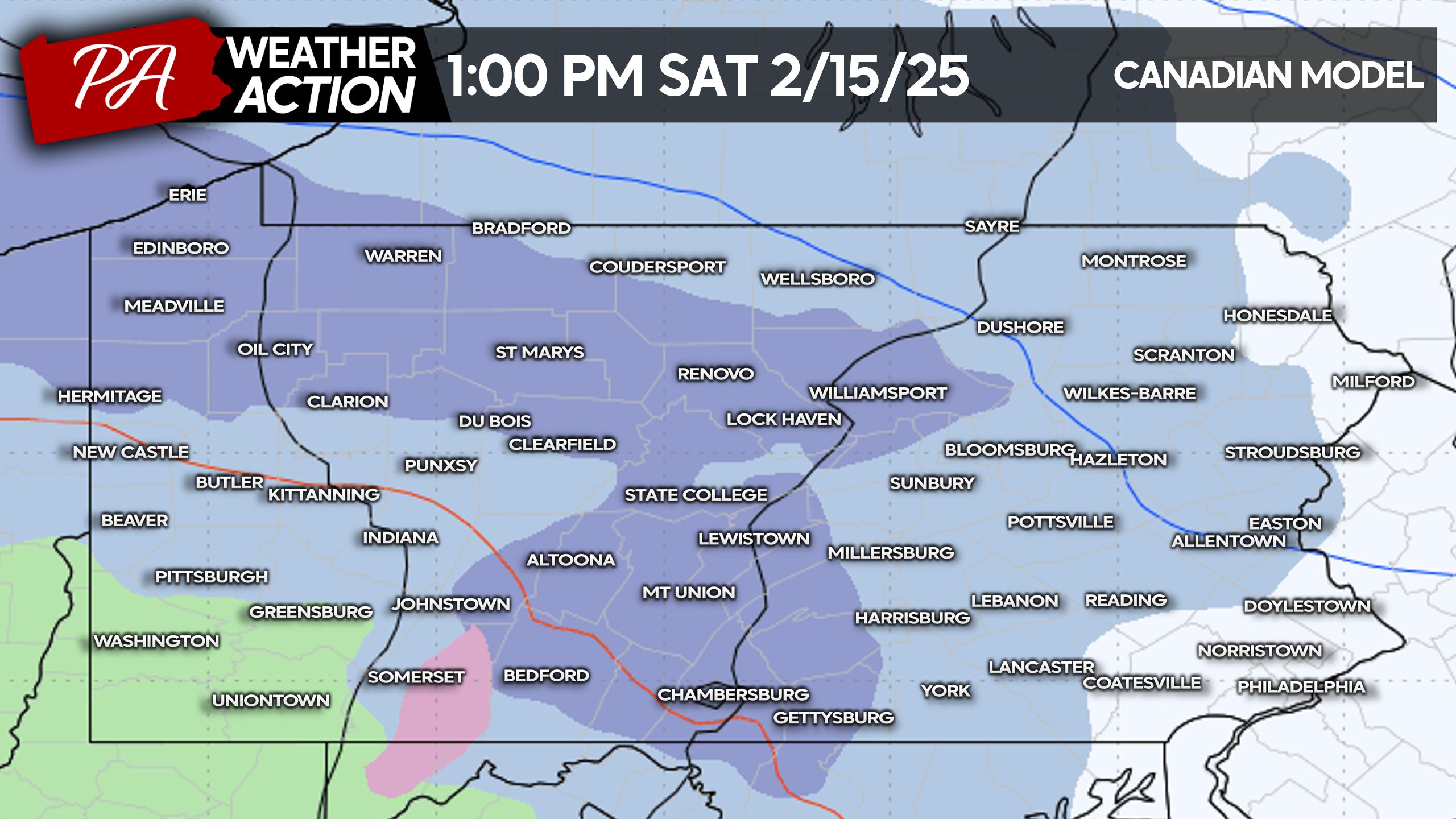
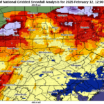
Snow will move into Northwest PA, generally along and north of I-80, late Saturday morning. The Pittsburgh Metro may see brief snow before changing to rain. That snow will quickly move into Central PA. Some models have a precipitation gap in Southern PA, so areas near and north of I-80 are more of a lock for snow around 1:00 PM Saturday, as shown below.
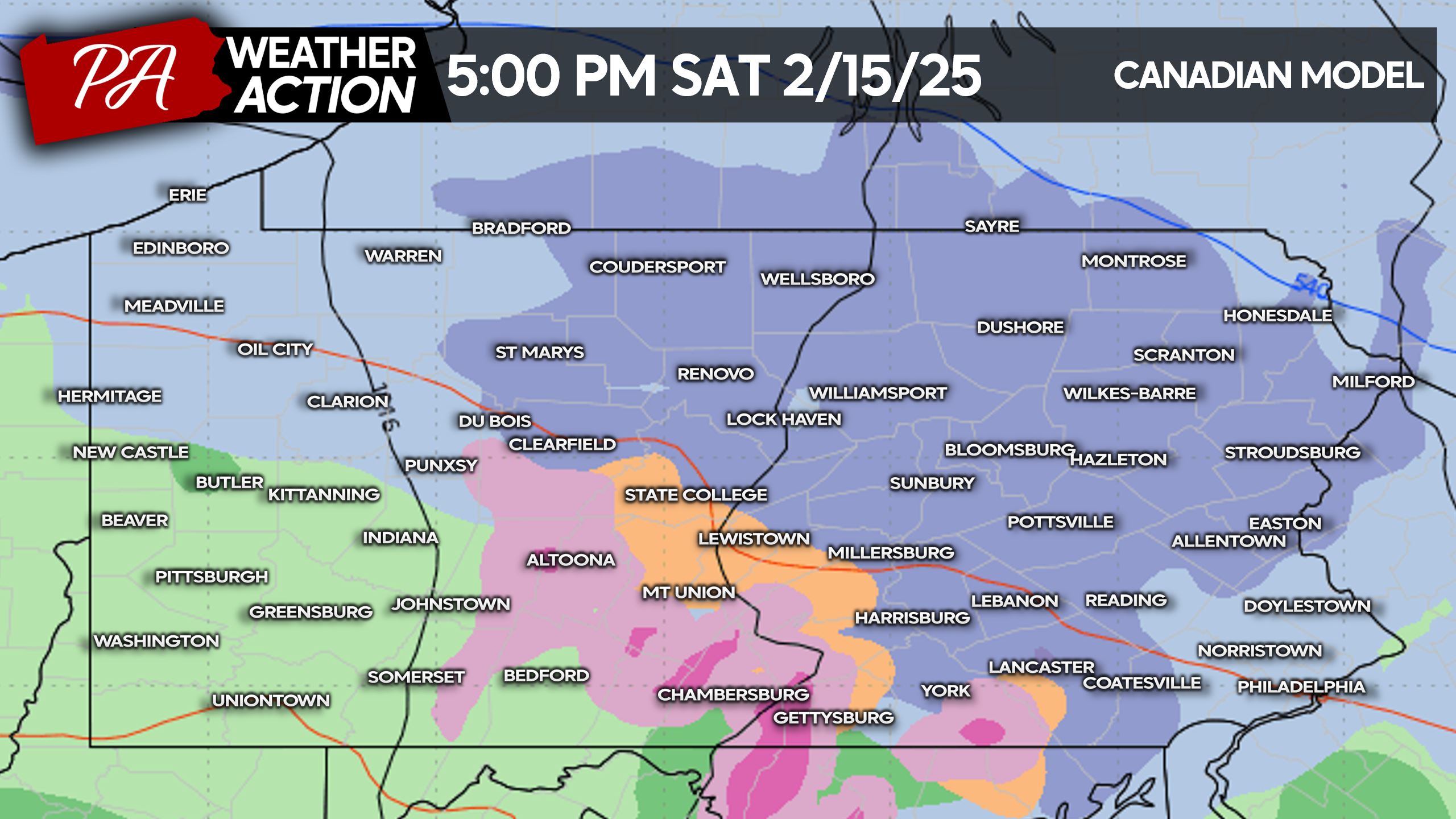
As we head later in Saturday afternoon, that snow will continue from North Central PA into much of Eastern PA. Meanwhile, areas south of State College in Central PA will already begin changing to sleet and freezing rain.
Below is the Canadian model for 5:00 PM Saturday, showing that snow especially from the Lehigh Valley into Northeast Pennsylvania.
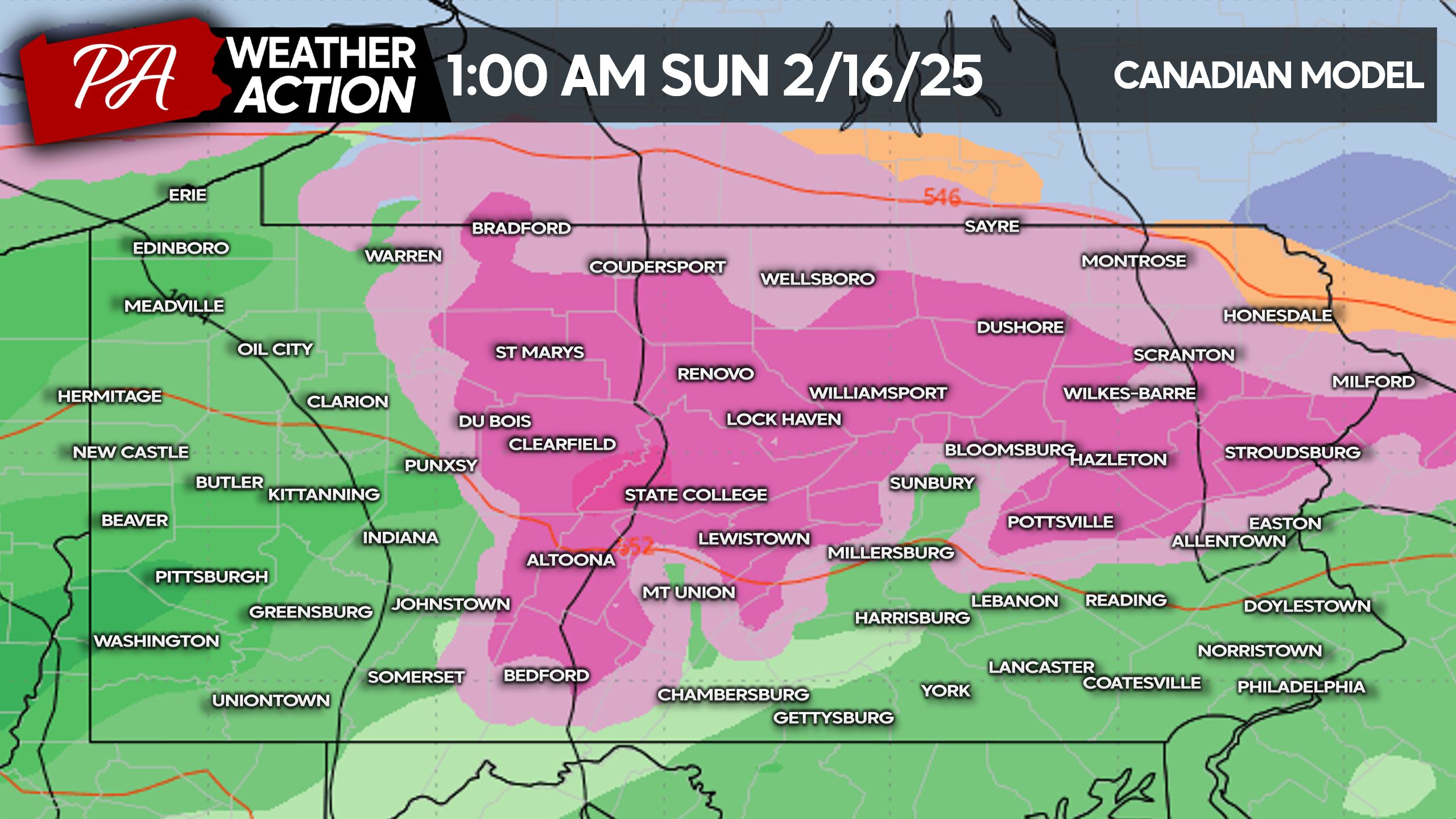
There may be a short lull in precipitation Saturday evening before more moves in. By very late Saturday or early Sunday morning, we anticipate freezing rain across locations above 1100′ elevation. The model below doesn’t show every little valley, but places like Williamsport, Bloomsburg, and the Wyoming Valley of NEPA are all below that elevation and will likely be seeing plain rain.
Here is the Canadian model for 1:00 AM Sunday, showing that ice in much of Central and NEPA. Mountainous areas along I-80 and I-81 will likely be icy.
By sunrise Sunday, the entire state will be above freezing and the winter weather threat will be over.
FIRST CALL ICE FORECAST FOR SATURDAY PM – SUNDAY AM
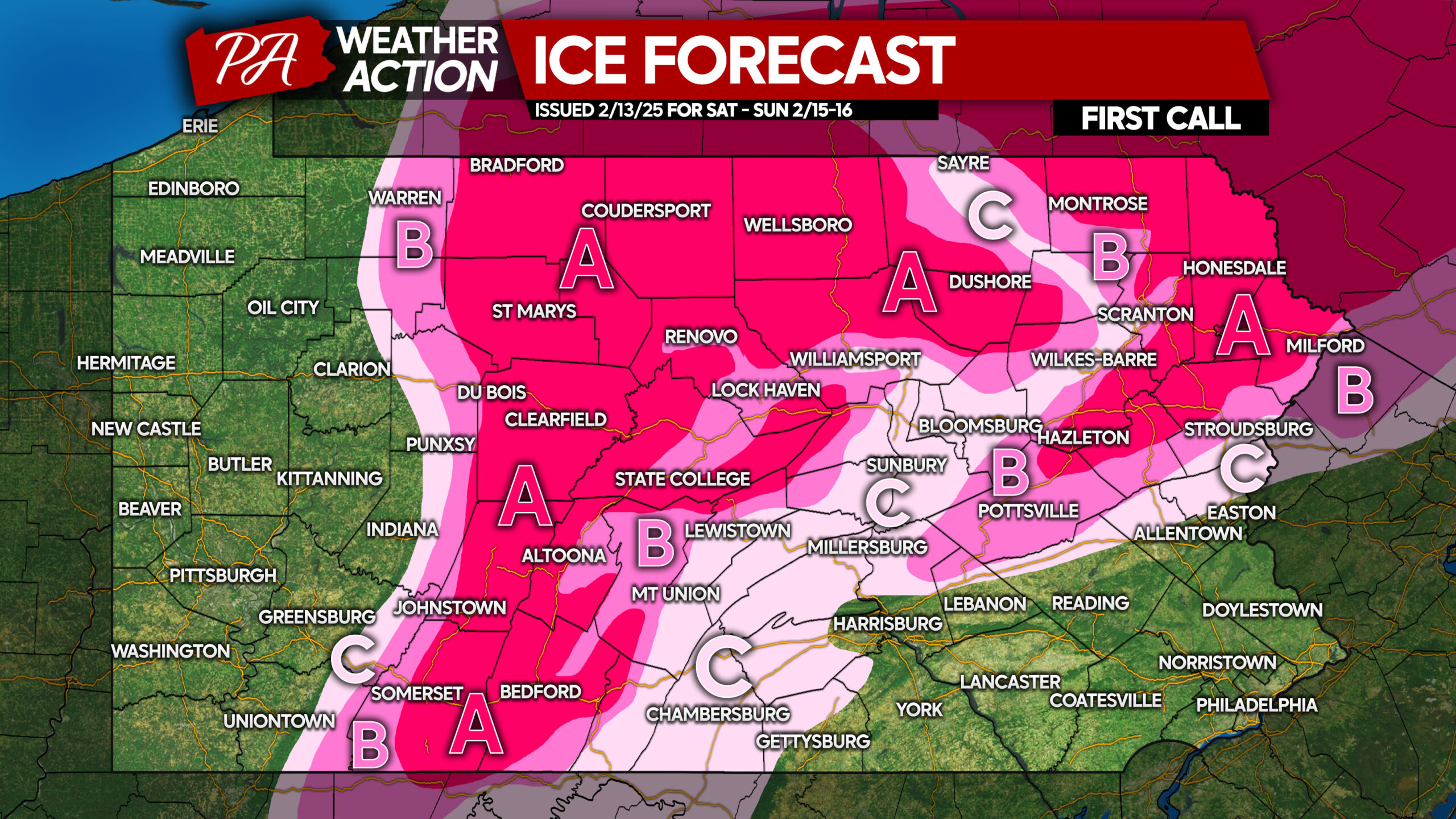
Area A: Ice accumulation between a tenth and a quarter-inch expected. Untreated roadways will likely become icy, leading to unsafe travel.
Area B: Ice accumulation between a twentieth and a tenth-inch anticipated. Untreated roadways, especially mountain roads, will get icy.
Area C: Ice accumulation between a hundredth and a twentieth-inch expected. Ice will mainly accumulate on elevation surfaces, but mountain roads may be slick.
FIRST CALL SNOWFALL FORECAST FOR SATURDAY
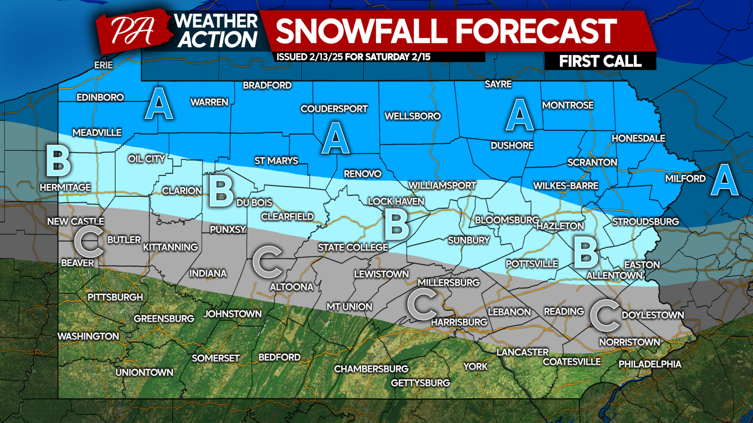
Area A: Snowfall accumulation of 2 – 4″ expected. Snow-covered and slushy roads will lead to slippery travel.
Area B: Snowfall accumulation of 1 – 2″ anticipated. Roads will become slushy during times of heavier snow.
Area C: Snowfall accumulation of less than 1″ expected. Roads should be unaffected.
We will have our Final Call Forecast out on Friday evening.
Don’t forget to share this forecast with family and friends in affected areas!
You must be logged in to post a comment.