
FINAL CALL FORECAST POSTED:
Final Call Snow & Ice Forecast for Monday Afternoon – Tuesday Morning’s Significant Winter Storm
After three weeks of central and eastern PA getting most of the snow, the infamous southeast ridge will do its best to give western PA their fair share. A significant winter storm will impact the area Monday into Tuesday morning, bringing snow to western and northern PA and ice to much of the southern and eastern parts of the state. We are also tracking another potential storm that may have similar impacts on the state Thursday.
STORM TIMING
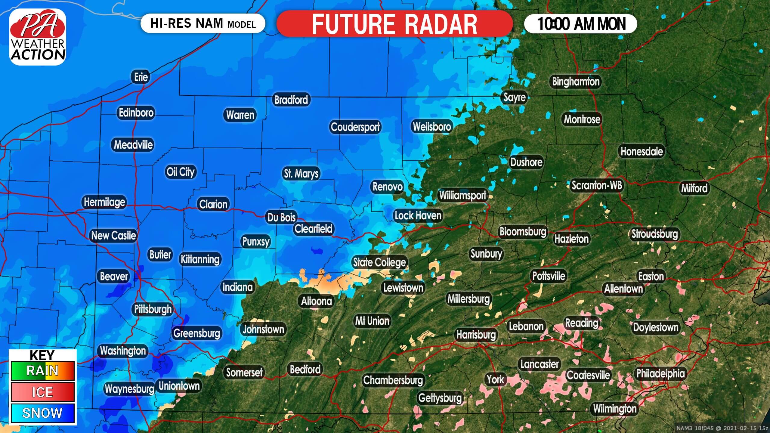
Snow will move into western PA late Monday morning. Temperatures will be in the 20s, meaning snow will stick to all untreated surfaces immediately. Below is future radar for 10:00 AM Monday.
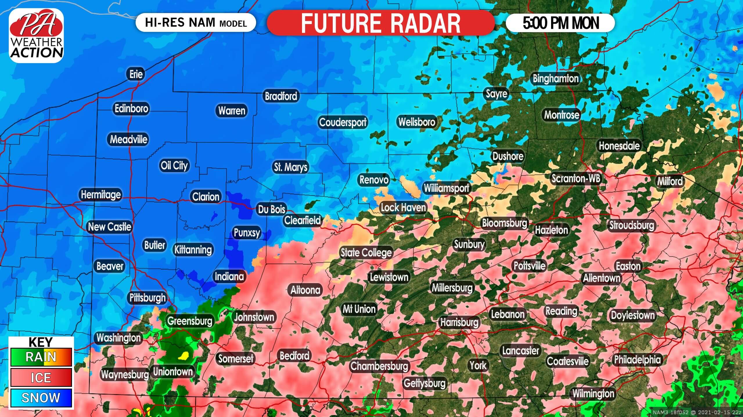
Heading into Monday afternoon, precipitation will overspread most of the state. Freezing rain will be likely in central and eastern PA, south of State College and Scranton. Meanwhile, snow will be continuing in northern and western Pennsylvania. Here is future radar for 5:00 PM Monday.
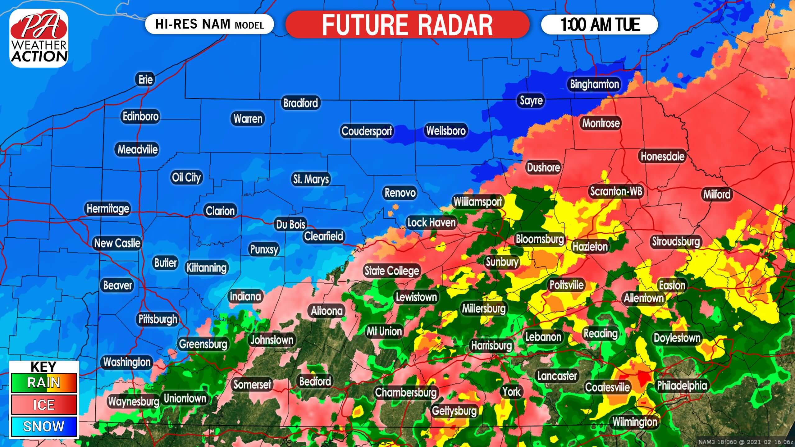
Monday evening is really when we expect worst travel conditions to be across the state. Snow and ice covered roads will make travel very hazardous. By early Tuesday morning, warm air from the south may cause temperatures to rise above freezing in parts of southern and eastern PA, resulting in just plain rain, shown in green on the future radar. Meanwhile, snow will persist in much of western and northern PA. Below is future radar for 1:00 AM Tuesday.
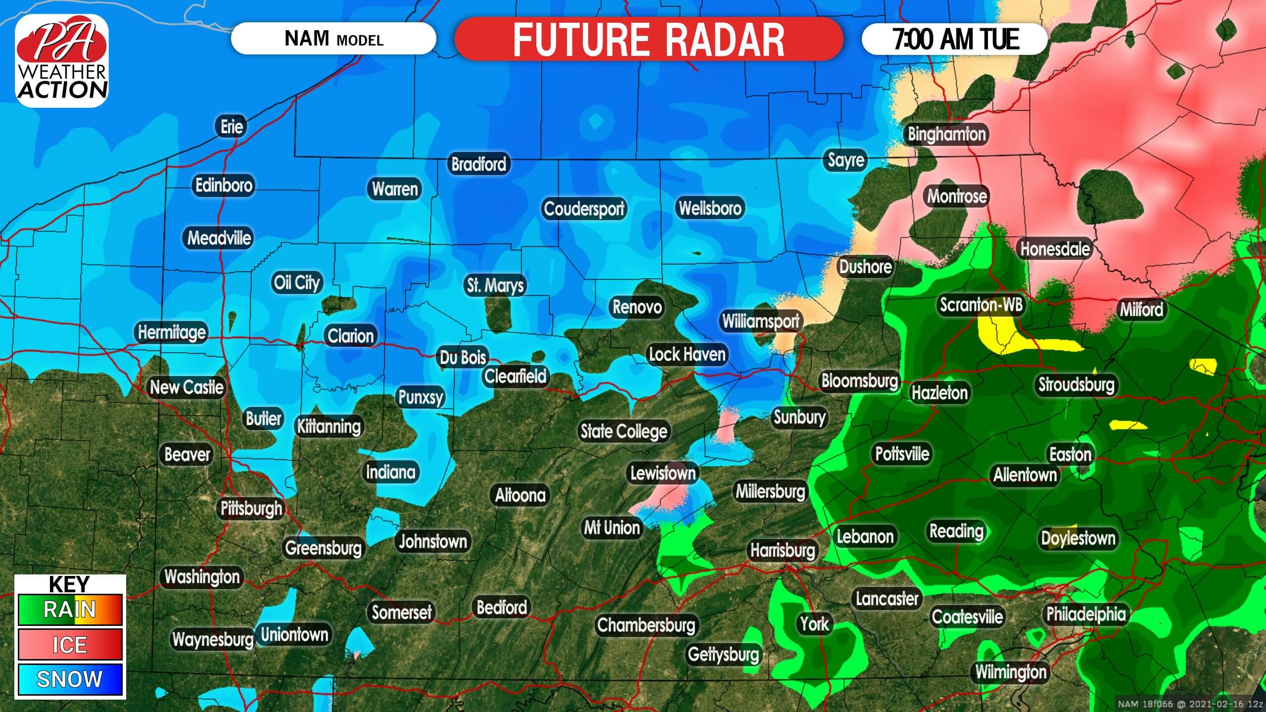
The storm will finally lift northeast by mid-morning Tuesday, likely in the form of snow in the northern tier and rain in eastern PA. Here is future radar for 7:00 AM Tuesday.
FIRST CALL MONDAY – TUESDAY AM ICE FORECAST
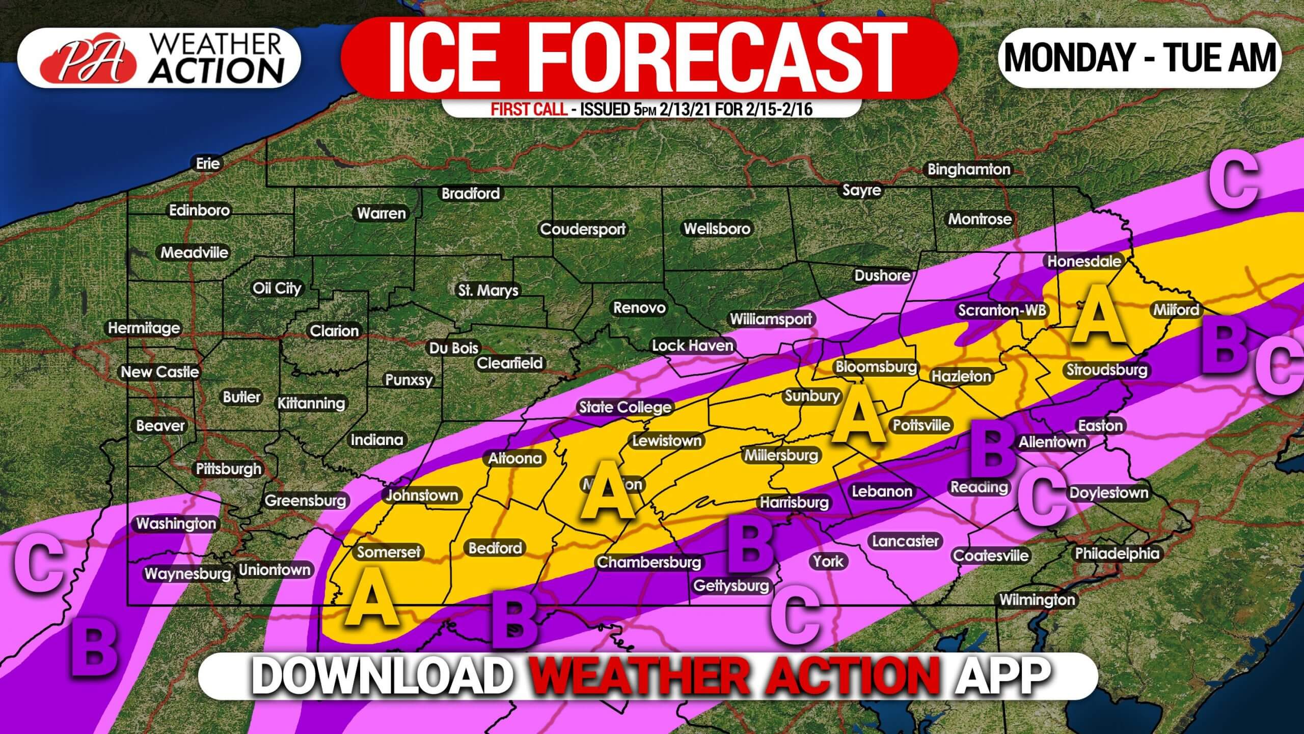
Freezing rain will cause ice to accumulate in these areas.
Area A: Ice accumulation of .25 – .50″ expected. Scattered power outages are likely, along with dangerous travel Monday evening into Tuesday morning.
Area B: Ice accumulation of .10 – .25″ expected. Scattered power outages are possible, along with hazardous travel Monday evening into Tuesday morning.
Area C: Ice accumulation of .01 – .10″ expected. Isolated power outages are possible, along with slippery travel Monday evening into Tuesday morning.
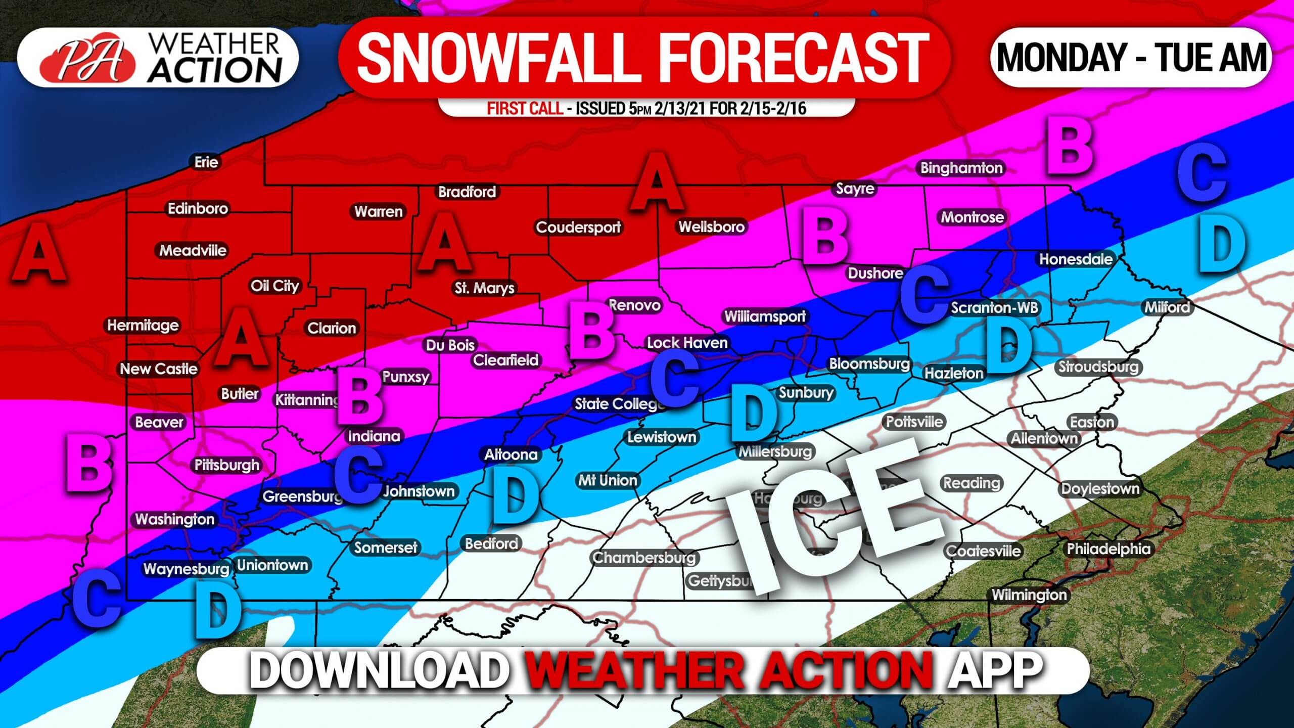
FIRST CALL MONDAY – TUESDAY AM SNOWFALL FORECAST
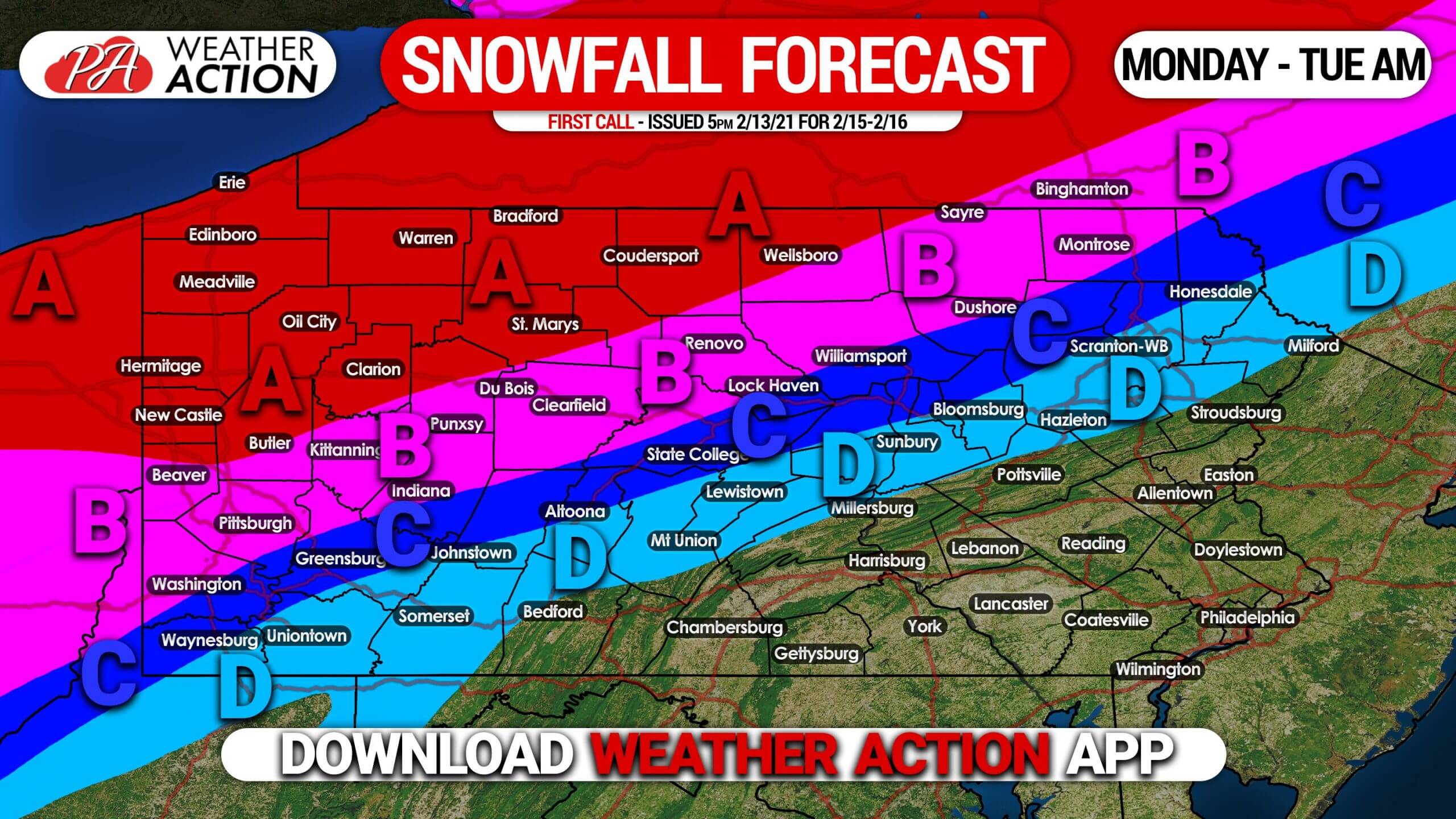
Area A: Snowfall accumulation of 8 – 14″ expected. Snow-packed roads will make travel very difficult Monday afternoon into Tuesday.
Area B: Snowfall accumulation of 5 – 8″ expected. After starting as snow, sleet and freezing rain may mix in close to the southern edge of this area, before changing back to snow. Snow-packed roads will make travel very difficult Monday afternoon into Tuesday.
Area C: Snowfall accumulation of 3 – 5″ expected. This area will start as snow, then switch over to sleet and freezing rain for much of the storm, possibly ending as another brief period of snow. Travel will be very difficult due to snow and ice-covered roads Monday afternoon into Tuesday.
Area D: Snowfall accumulation of 1 – 3″ expected. After briefly starting as snow, sleet and then mostly freezing rain is likely, before possibly ending with a brief period of snow. Travel will be very difficult due to snow and ice-covered roads Monday afternoon into Tuesday.
This is a high-confidence forecast, but there may still be a slight shift north or south with the snow and ice amounts in the final call forecast. To receive that forecast, and the many more winter updates we will have this season, download our app! Get it here >>> Weather Action App
Don’t forget to share this article with family and friends, and please do not downplay the impacts ice can have on roads if traveling during this storm!

You must be logged in to post a comment.