
We have had no shortage of freezing rain/ice, and more is on the way after a bit of snow early this workweek. A low pressure system coming out of the plains will move east-northeast over our area. Most of us will start off with a period of light to moderate snow, followed by freezing rain, then rain. However, parts of northern PA may stay all snow.
STORM TIMING
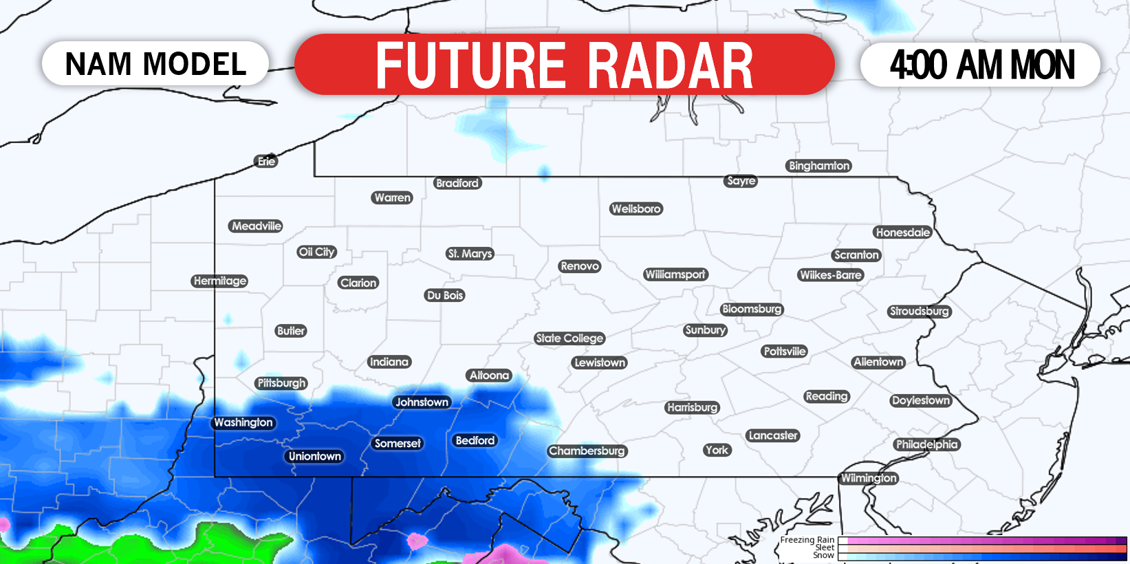
This will be a relatively long-duration event, as it will have two separate waves of precipitation. The first wave will come in the form of snow in southern PA, beginning Monday morning. It will move in from east to west, and temperatures will be a few degrees below freezing. Below is the future radar for 4:00 AM Monday, showing that snow moving in closest to the Mason-Dixon line.
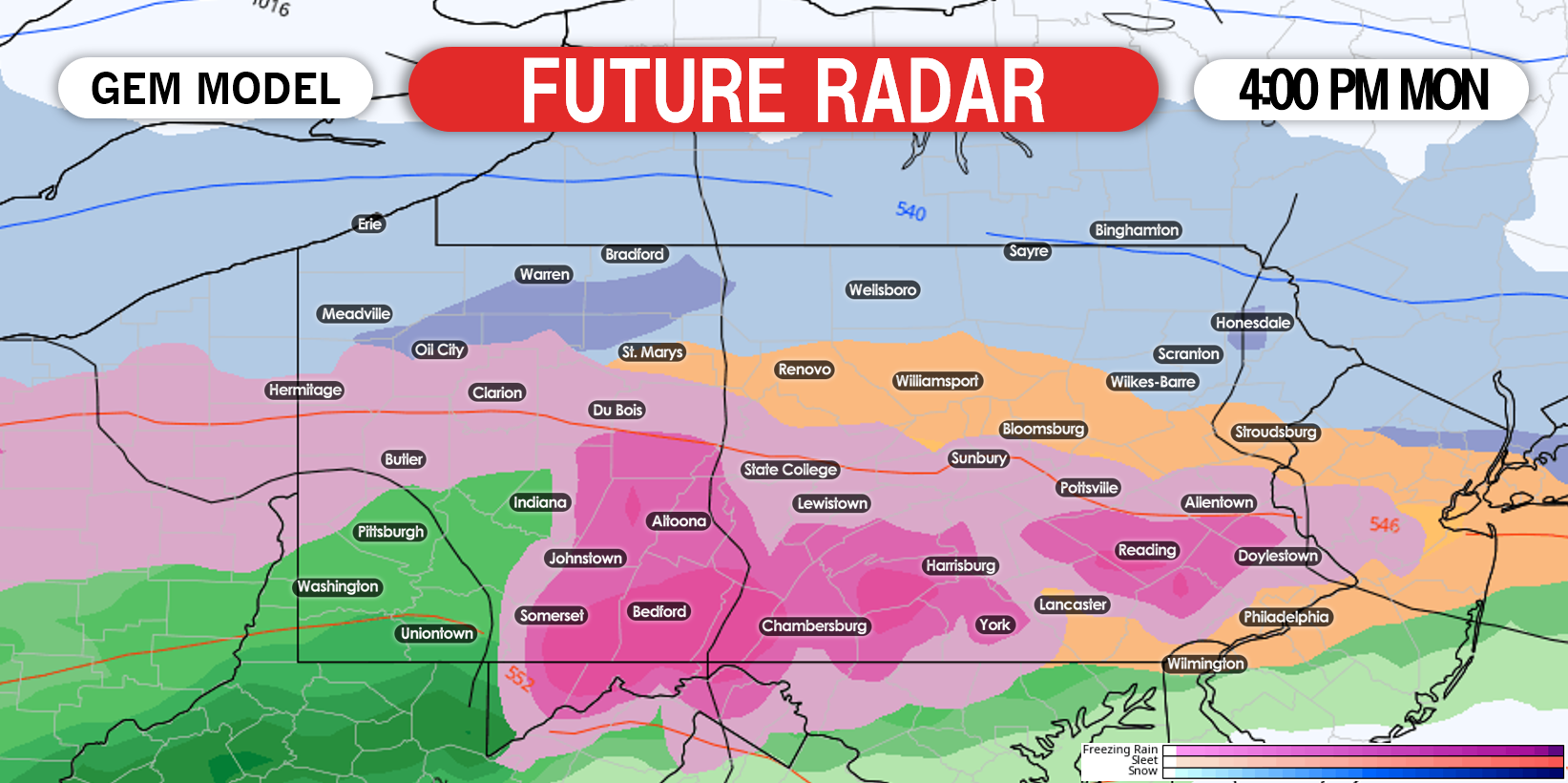
Heading into Monday afternoon, upper level temperatures will quickly raise above freezing south of i80, resulting in a changeover to freezing rain across the entire area. Future radar for 4:00 PM Monday afternoon is shown below.
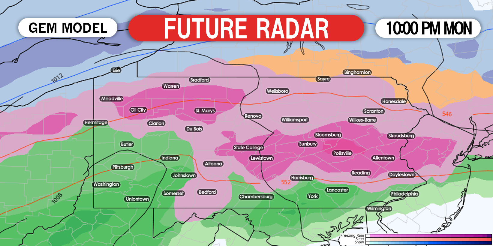
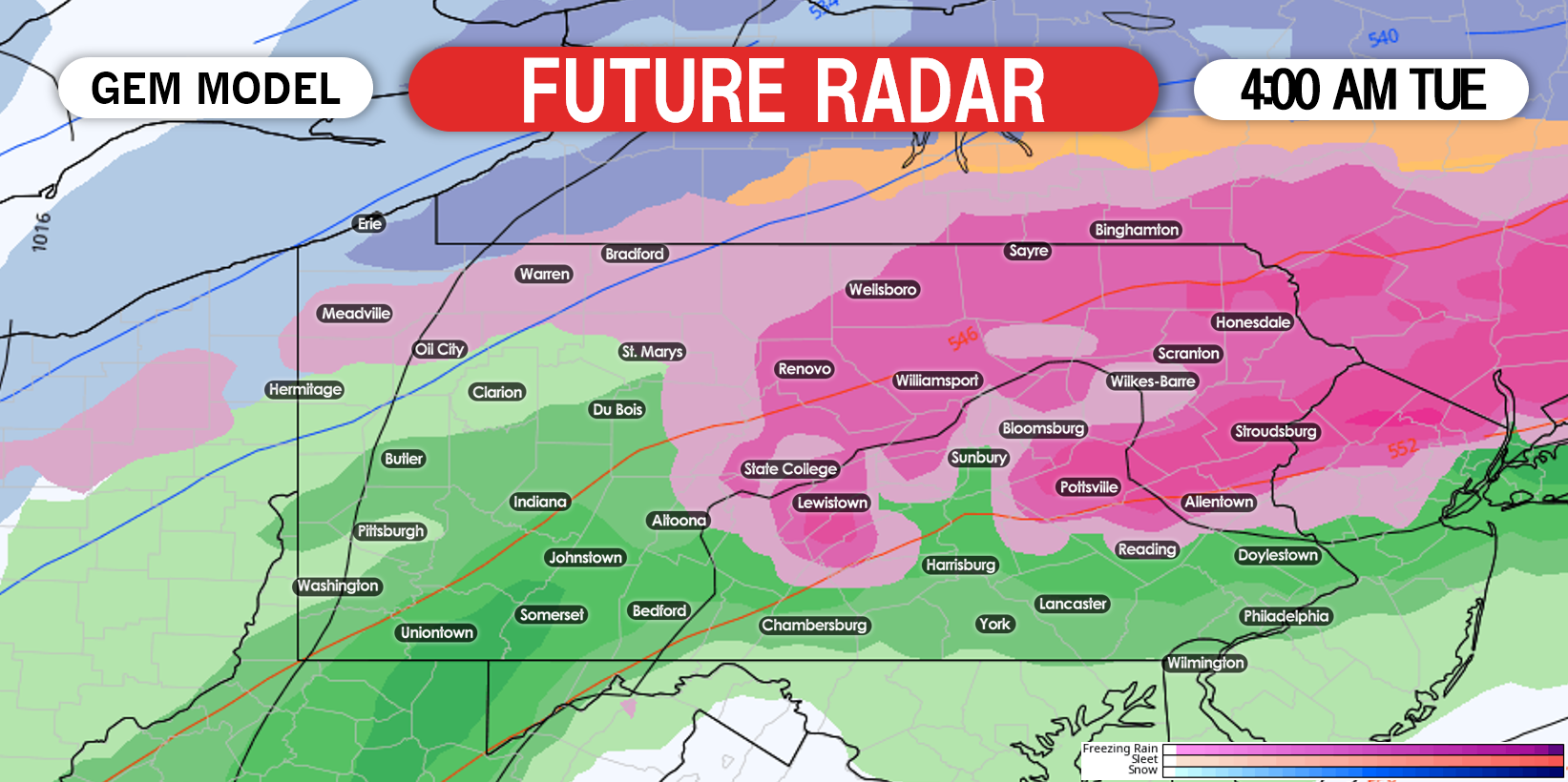
By early Tuesday morning, temperatures should warm up a few degrees as the low pressure moves overhead. However much of the northern half of the state is expected to stay near 32°, meaning freezing rain will continue. Below is future radar for 4:00 AM Tuesday.
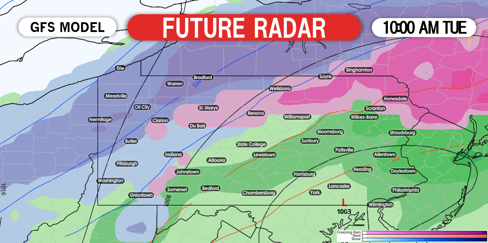
The storm will finally begin to exit around lunchtime on Tuesday. By then, most of the state should be over to plain rain. Far northern PA may still be dealing with freezing rain or snow. Here is the future radar for 10:00 AM Tuesday.
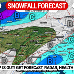
FIRST CALL SNOWFALL FORECAST FOR MONDAY – TUESDAY
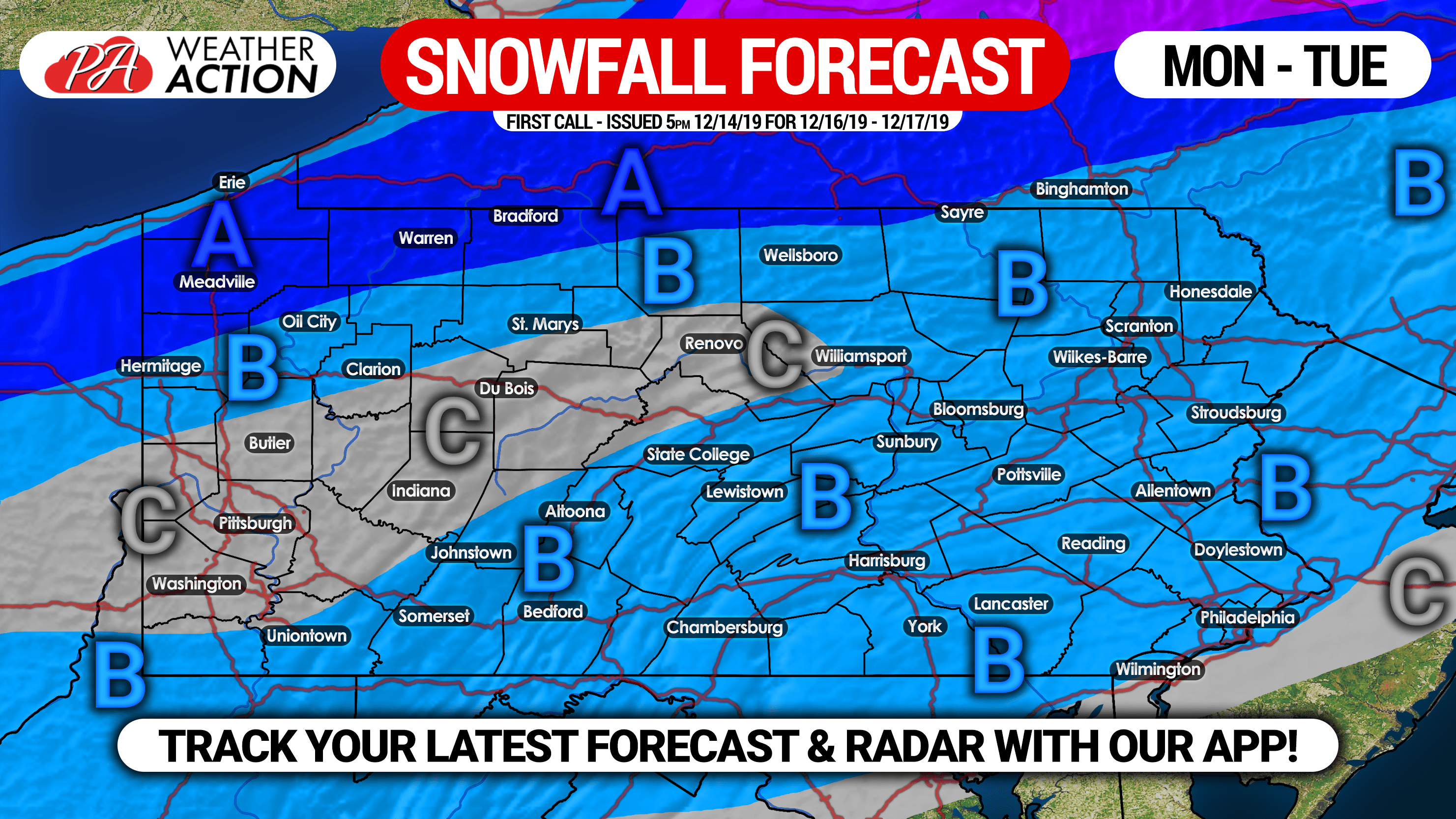
Area A: Snow accumulation of 3 – 5″ expected. Higher totals possible if the system tracks south of the state.
Area B: Snow accumulation of 1 – 3″ expected. Untreated roads will become slushy on Monday.
Area C: Snow accumulation of less than 1″ expected.
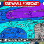
FIRST CALL ICE FORECAST FOR MONDAY – TUESDAY
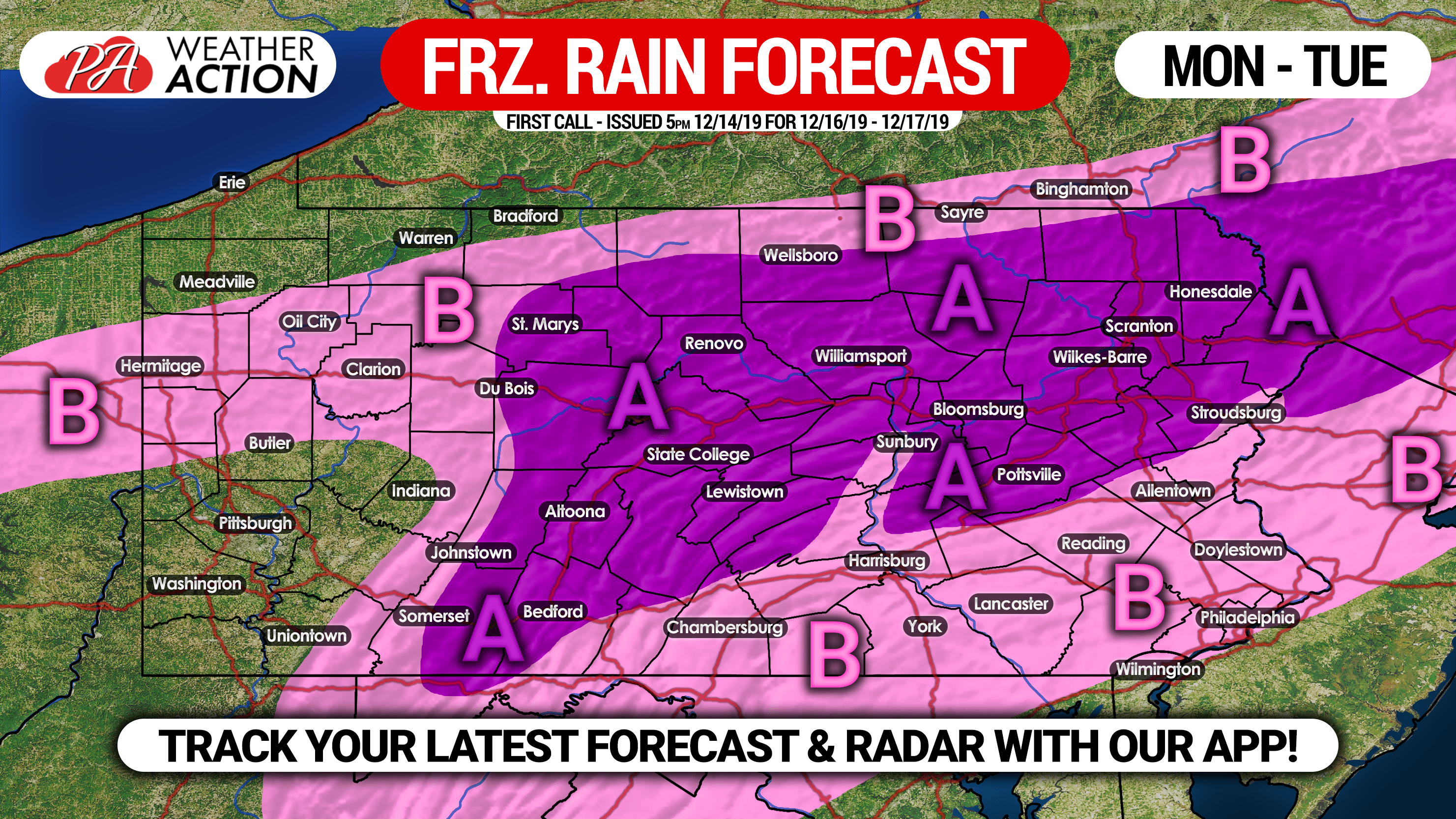
Area A: Ice accrual of .10 – .20″ expected. Icy roads likely Monday into Tuesday morning.
Area B: Ice accrual of .01 – .10″ expected. Icy roads likely Monday.
Don’t forget to share this article with your friends and family, as school delays/closings are likely due to hazardous travel. Stay tuned for our final call forecast on this event, which will be posted Sunday evening.
You can always download our free app to stay ahead of the winter weather this winter! To download it, tap this link >>> Weather Action App
You must be logged in to post a comment.