
Before we begin to talk about Monday night into Tuesday, we have to first talk about a weak storm system that will bring light snow to the area Sunday night into Monday morning. Initially it appeared this system would fall apart and only produce scattered snow showers. Instead, some of us will be looking at a period of light, but steady snow Sunday night into early Monday morning.
Snow will begin to overspread Western PA Sunday evening. The snow will move in from west to east. Below is a look at 7:00 PM Sunday evening: 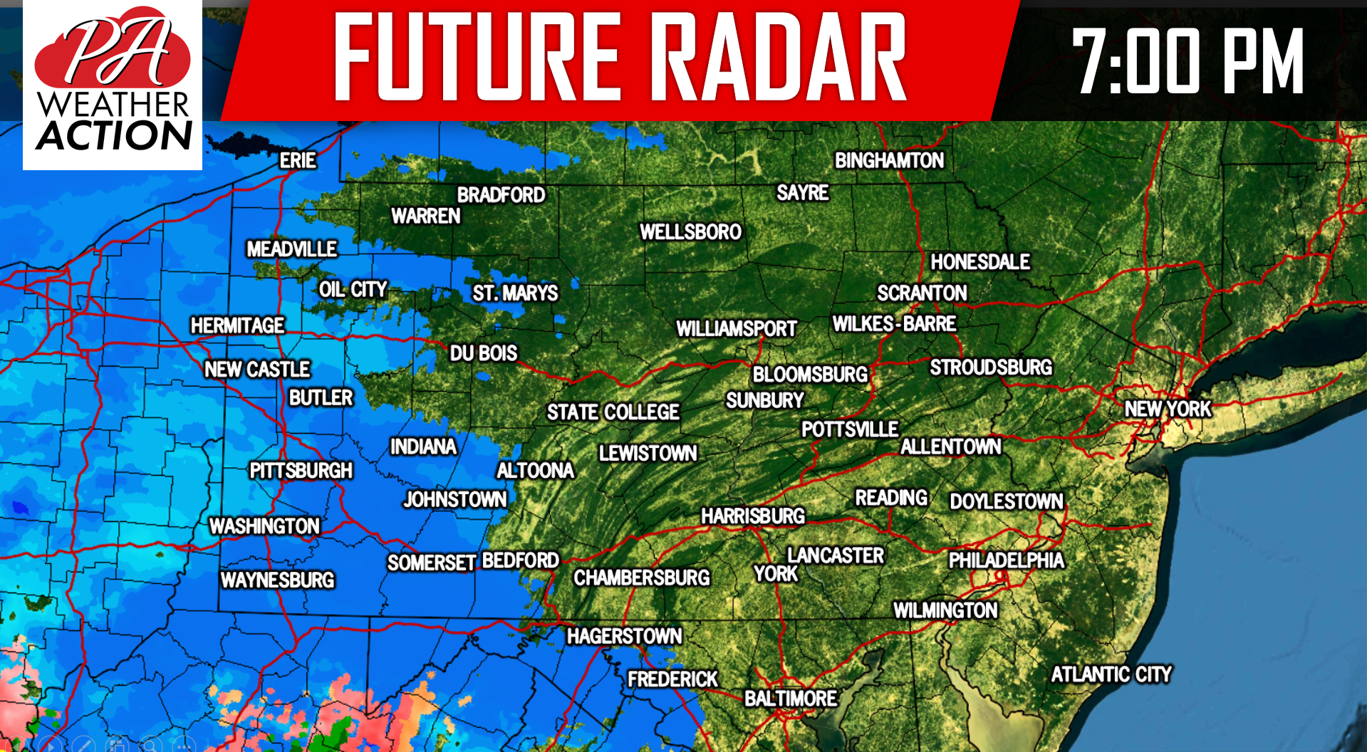
Most of us should expect a several hour period of light snow Sunday night into early Monday Morning. We’ll take the future radar out to 1:00 AM Monday morning because we want to talk more about the larger storm Monday night into Tuesday. By 1:00 AM Monday morning, snow will overspread all of the state. Guidance is suggesting that there could be an enhancement of more moderate snow across Southeast PA leading to slightly higher snow totals for these areas: 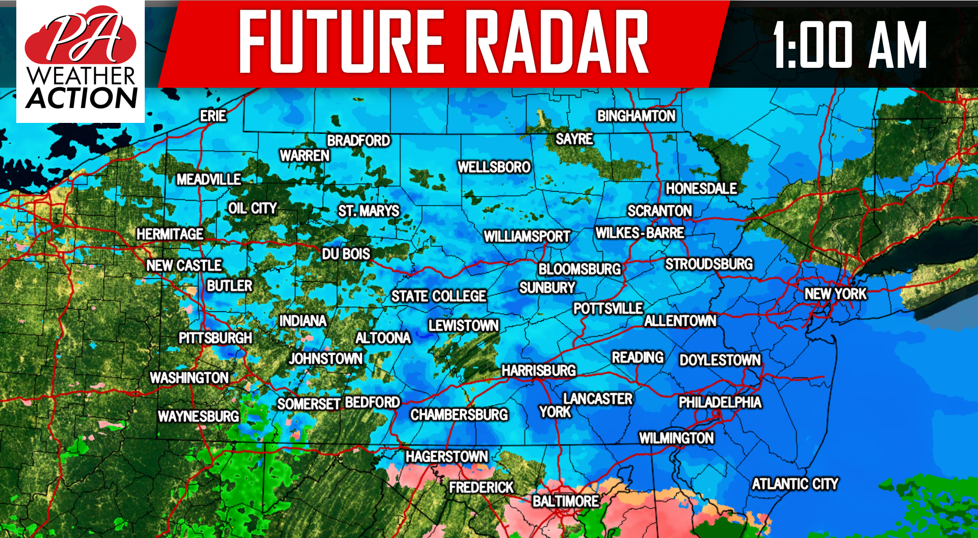
EXPECTED SNOWFALL SUNDAY EVENING INTO EARLY MONDAY MORNING:
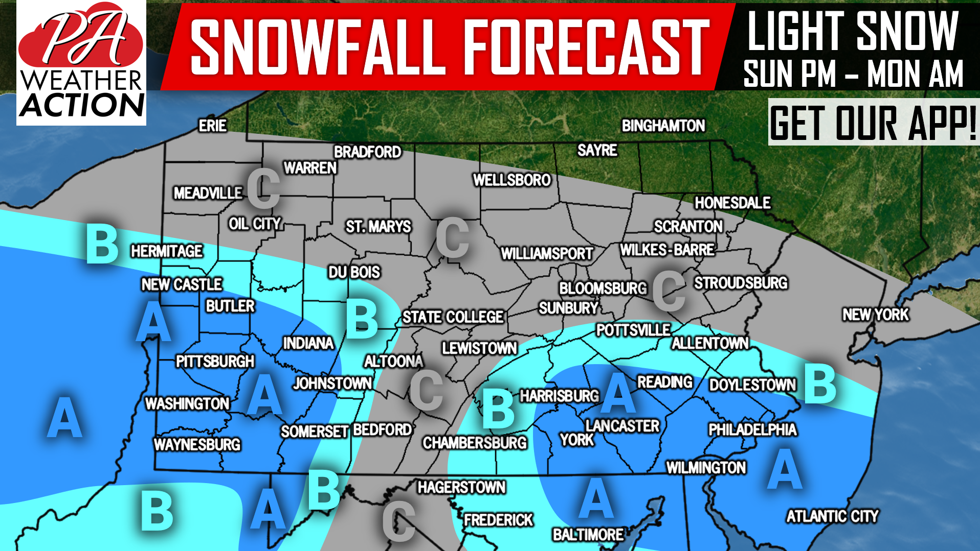 Area A: Snow accumulation of 1.5 – 2.5″ expected. School delays are possible due to slippery roads Monday Morning.
Area B: Snow accumulation of 1 – 1.5″ expected. School delays are possible in rural areas due to slippery roads Monday Morning.
Area C: Snow accumulation of a coating to 1″ expected.
ONTO THE MAIN EVENT
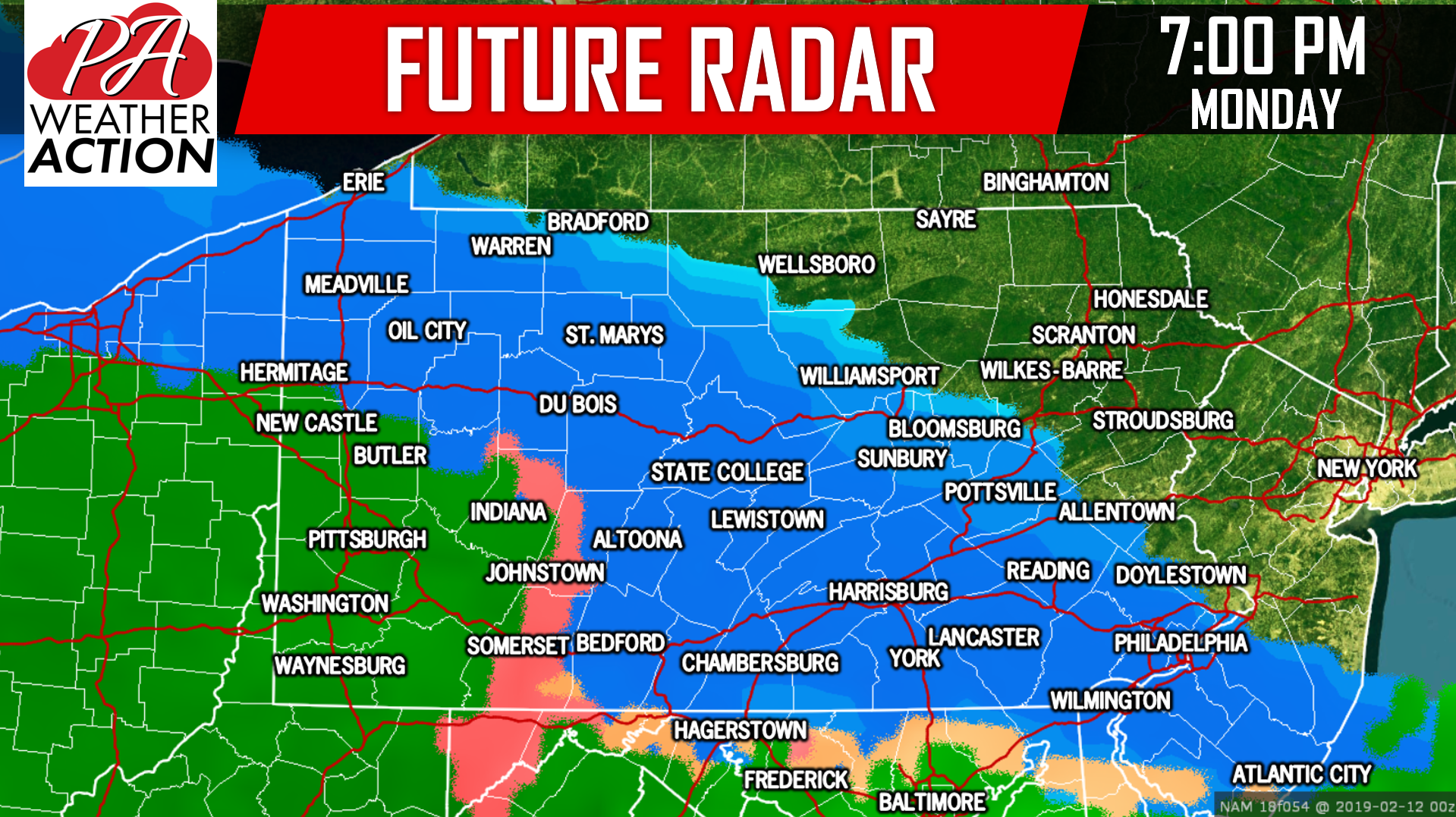
There will be a lull period during the late morning and early afternoon hours of Monday between the first round of snow and the main event. By late Monday afternoon, precipitation will begin to arrive from the southwest. Just about all of should at least begin as a period of snow, except Southwest PA. We have a very strong high pressure that will be anchored over Canada to our north, which will help both our surface temperatures and upper levels stay cold enough for snow initially. Take a look at the future radar for 7:00 PM Monday evening:
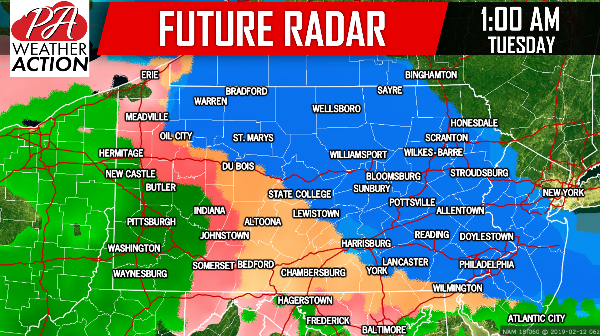
 As we advance later into Monday night, the high pressure will begin to push off to the northeast. This will allow for the upper levels and the surface temperatures to warm up. However, it will take a lot longer for surface temperatures to warm up than upper levels. This will lead to a prolonged period of sleet and freezing rain for many locations. Below is a look at the future radar valid for 1:00 AM Tuesday morning:
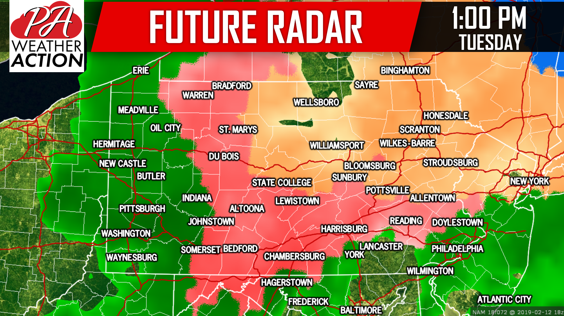
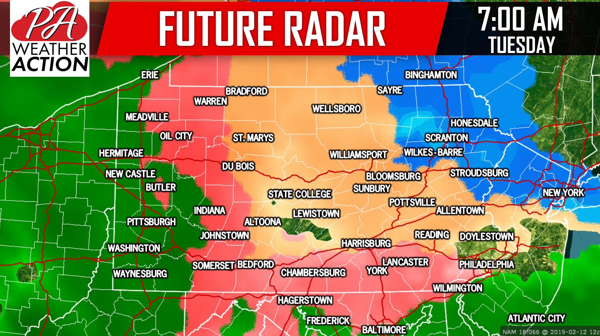 Freezing rain will continue to be a major issue in central and eastern parts of the state heading into Tuesday Afternoon. Areas from Lancaster to Philadelphia are likely to warm above freezing around noon. Below is future radar for 1:00 PM Tuesday Afternoon:
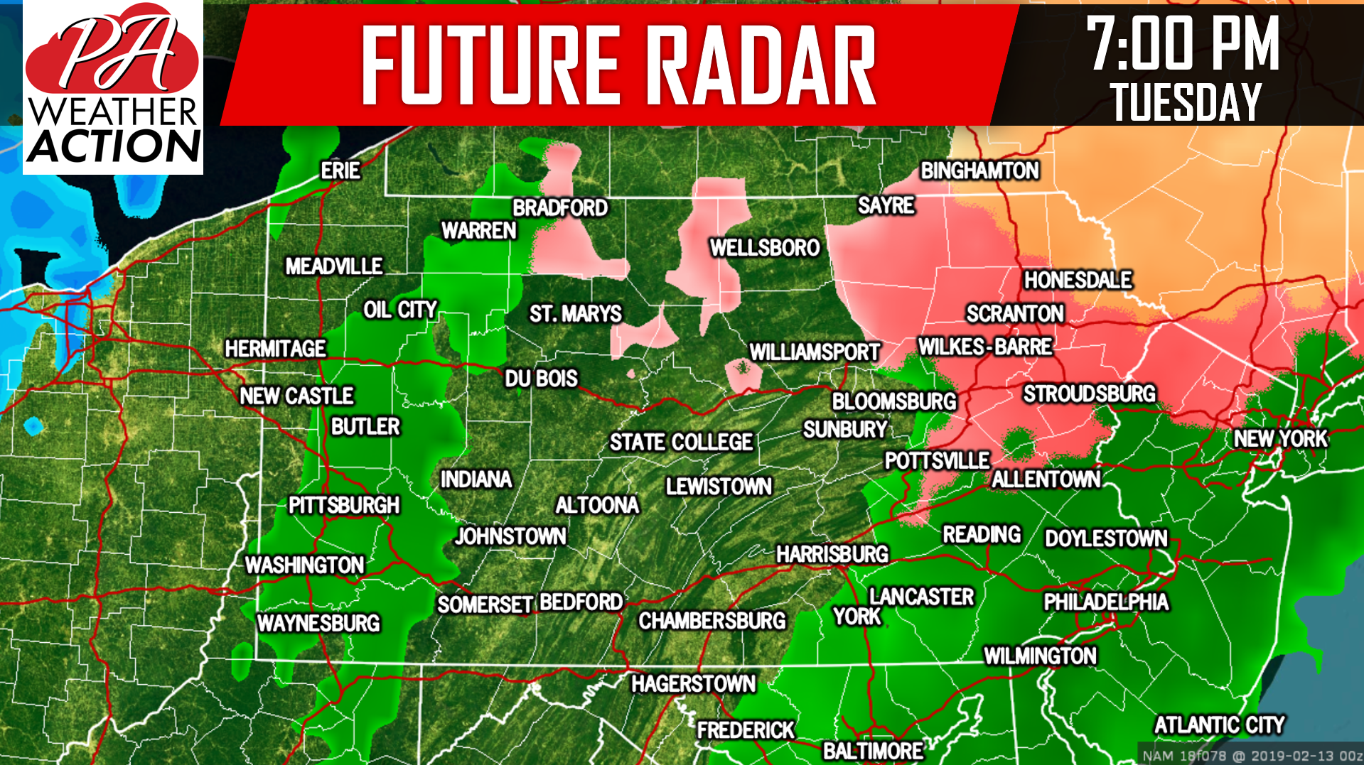
 Precipitation will wrap up in western and central PA by 7 PM Tuesday, with a sleet/freezing rain mix coming to an end in Northeast PA, and plain rain in SEPA. Finally, here is a look at future radar for 7:00 PM Tuesday Evening:
SNOWFALL FORECAST FOR MONDAY EVENING – TUESDAY EVENING
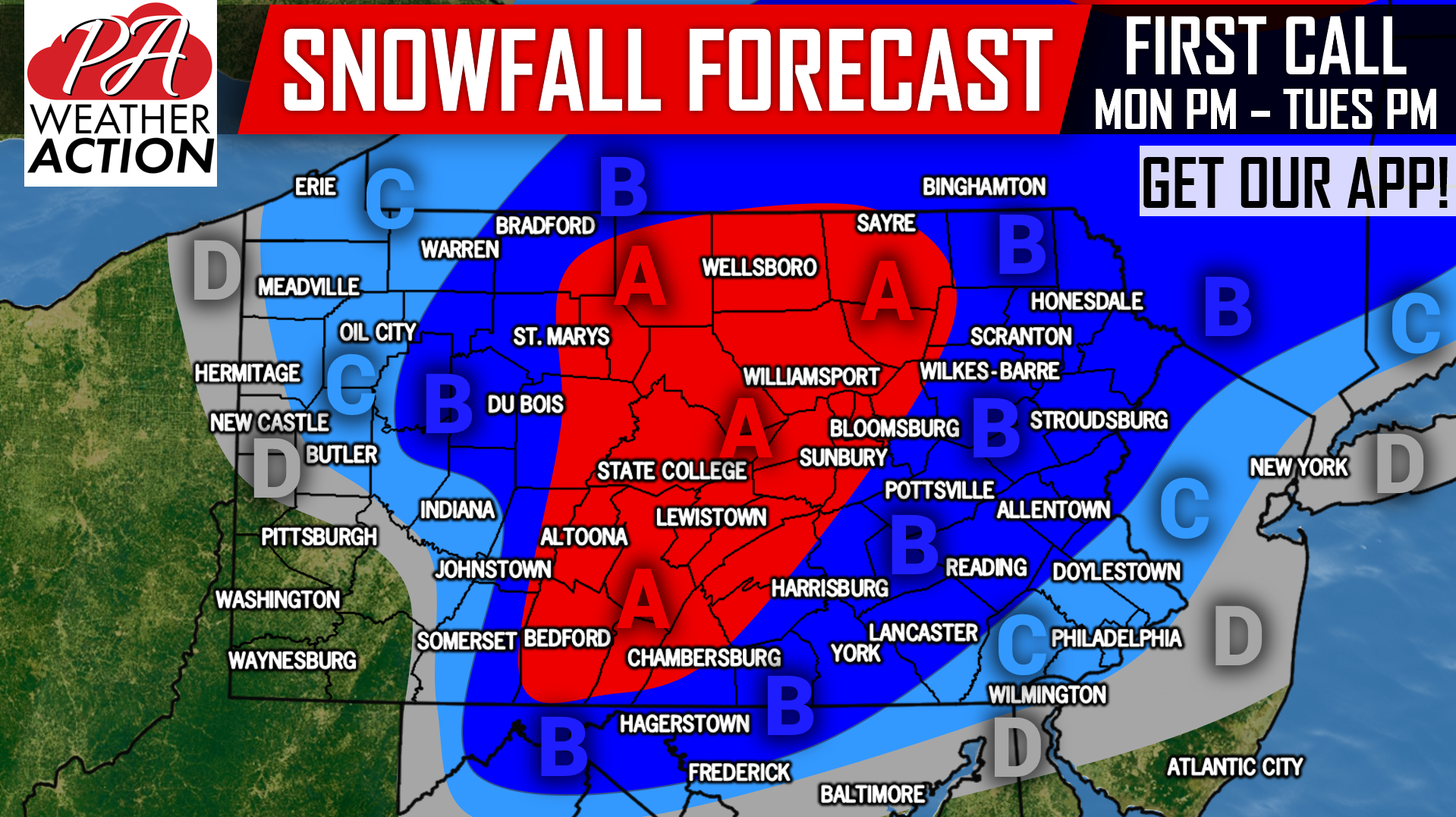
Area A: Snow accumulation of 4 – 7″ anticipated, before turning to sleet and freezing rain. School cancellations are likely Tuesday as roads will be extremely hazardous from the early morning hours of Tuesday, through Tuesday Night. View the ice forecast below.
Area B: Snow accumulation of 2 – 4″ expected, before turning to sleet and freezing rain. School cancellations are likely Tuesday as roads will be very hazardous from the early morning hours of Tuesday, through Tuesday Evening. The bigger story in this area will be ice.
Area C: Snow accumulation of 1 – 2″ anticipated, before turning to sleet, freezing rain, and rain. School delays and cancellations are possible Tuesday due to icy roads in the morning. Be sure to view the ice forecast under this.
Area D: Snow accumulation of less than 1″ expected.
ICE FORECAST FOR MONDAY EVENING – TUESDAY EVENING
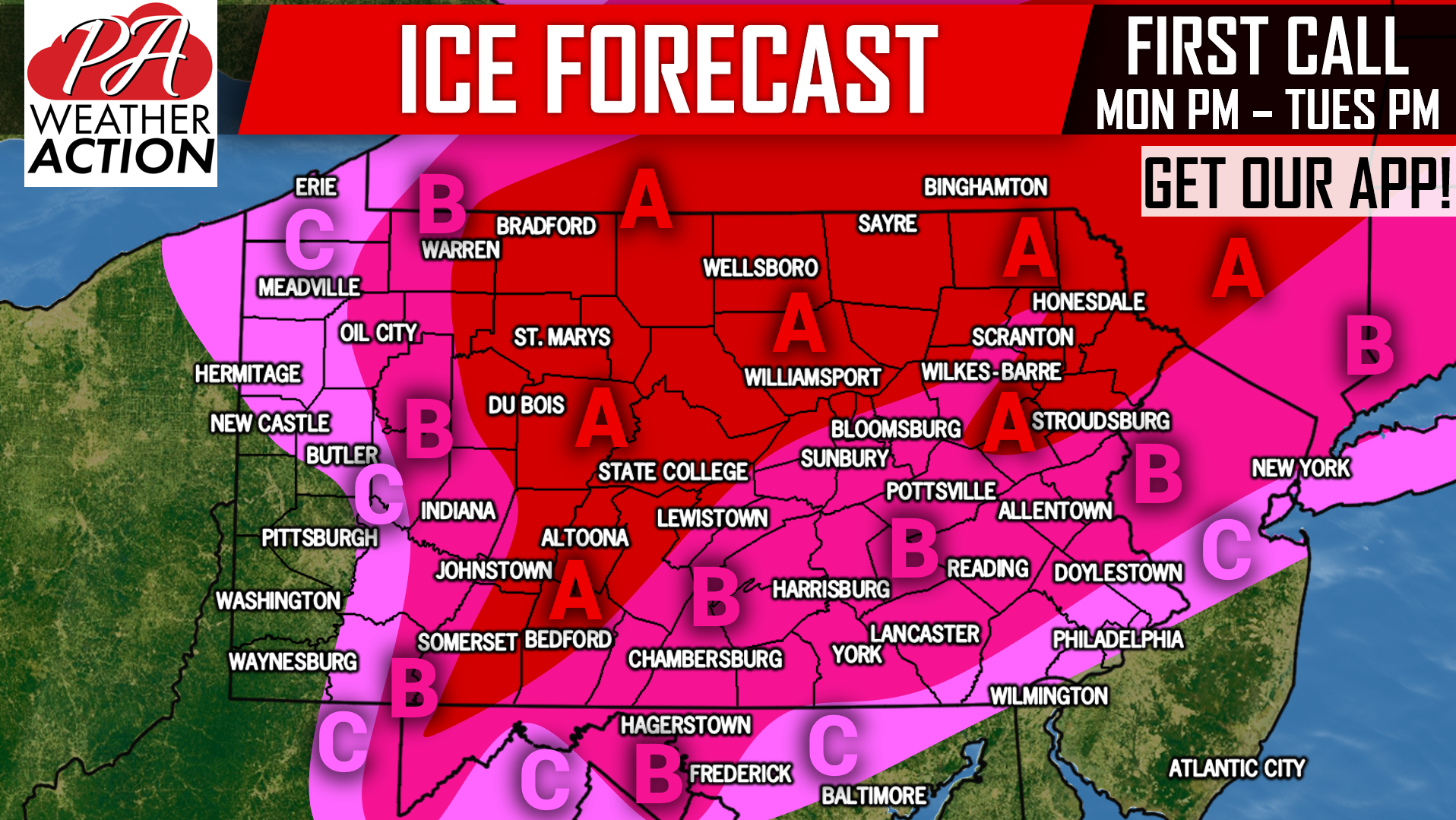 Area A: Ice accretion (accumulation) of .25 – .50″ expected. Scattered power outages likely.
Area B: Ice accretion of .10 – .25″ anticipated. Scattered power outages possible.
Area C: ice accretion of .01 – .10″ expected.
You won’t want to miss Sunday’s Final Call Snow & Ice Forecast! Download our free app to receive it as well as your hourly & daily forecast and radar >>> PA Weather App Link
Be sure to like us on Facebook for future updates if you haven’t already >>> PA Weather Action Facebook Page
Share this important update with your friends and family using the button below, as many plans may need to be adjusted.
You must be logged in to post a comment.