
FINAL CALL Snowfall, Sleet, & Freezing Rain Forecast for Tonight – Friday Morning’s Winter Storm
Our Final Call Forecast has been posted, view the article above.
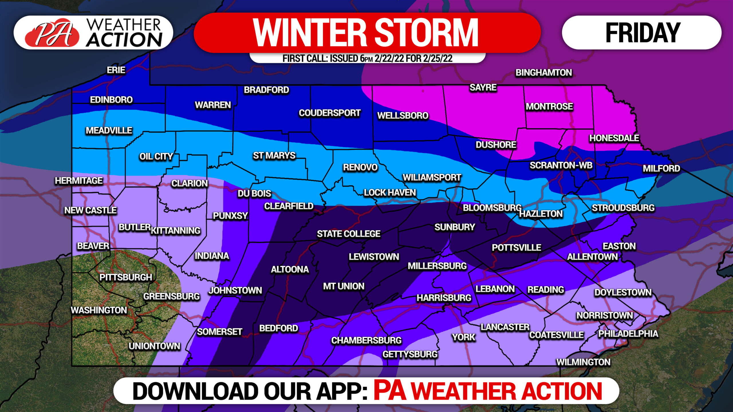
After a long break from widespread impactful winter weather, we finally find ourselves facing the potential for quite the mess of snow and ice for many areas across the state Thursday Night into Friday.
A low pressure will push northeast in the Ohio Valley, making its way into Western Pennsylvania by Friday Morning before transferring to a coastal low that will develop off tip of Long Island. Unfortunately for snow lovers in PA, that’s not a favorable track for us, but more so around the I-90 corridor. The issue for us will be the strong high pressure to the north, which will make for any icy situation in many of the usual areas.
Precipitation will move in late Thursday evening, starting as snow for some generally north of I-80 in WPA and CPA and north of I-78 in EPA, and freezing rain or sleet south of there in CPA and EPA. As usual with this type of system running into WPA, plain rain is expected in and south of Pittsburgh.
This will be an absolute mess, and tough to describe what will happen in all areas of the state at any given time. Please view the FutureCast video below for a good estimate on timing of precipitation types in your area.
Being 60 hours out from impact, details are still being fine-tuned around how much snow will fall before sleet and freezing rain begin as warm air moves in aloft. Exactly where the worst area of freezing rain will occur is also being heavily monitored.
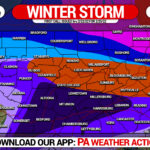
FIRST CALL SNOWFALL FORECAST FOR THURS NIGHT – FRIDAY
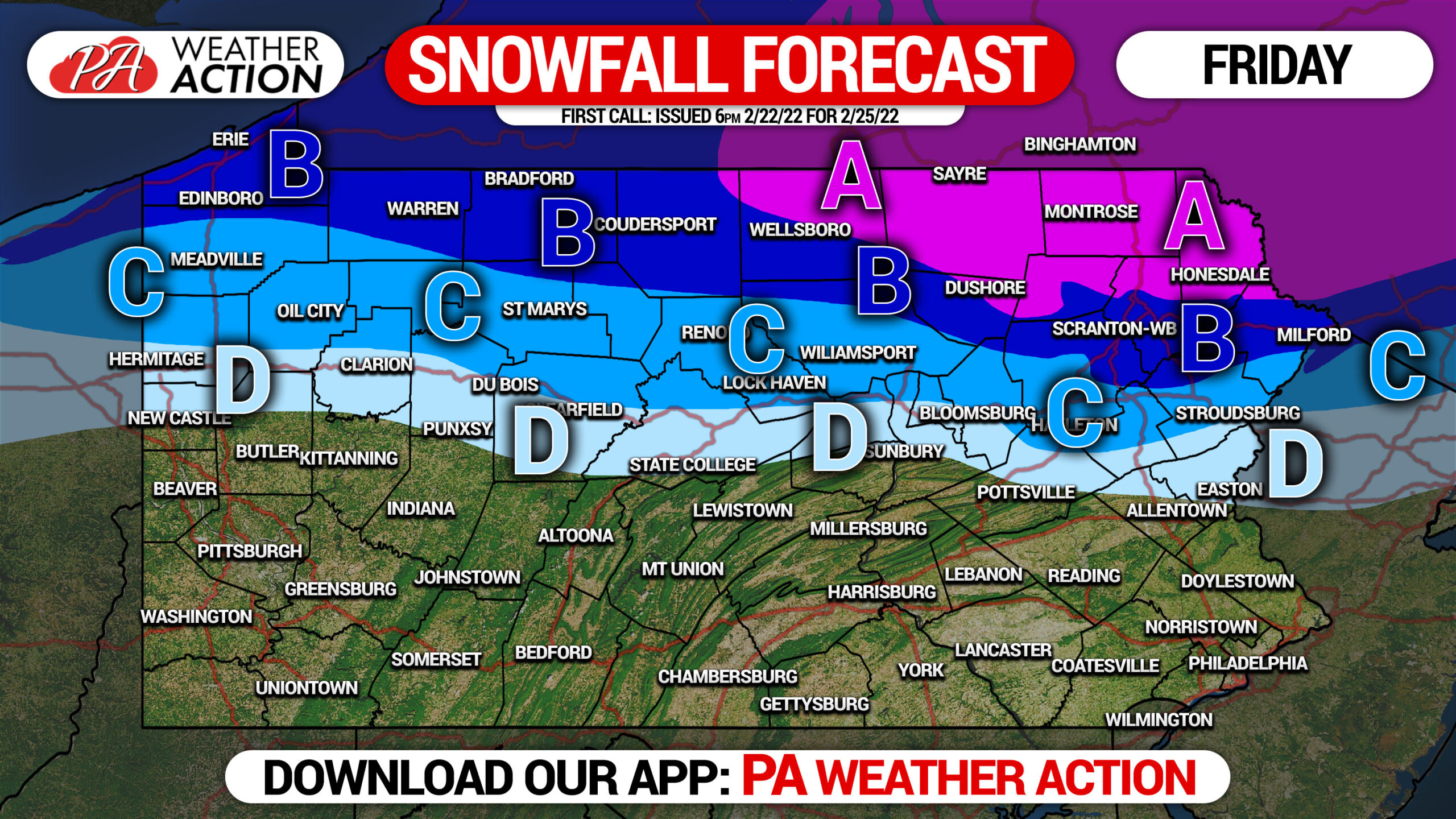
Paved surfaces will be warmer than non-paved and elevated surfaces. Therefore, expect accumulations to be depend on type of surface. The accumulations stated below are maximum accumulations on any surface.
Area A: Snow and sleet accumulation of 6 – 8″ expected.
Area B: Snow and sleet accumulation of 4 – 6″ expected.
Area C: Snow and sleet accumulation of 2 – 4″ expected.
Area D: Snow and sleet accumulation of 1 – 2″ expected.
FIRST CALL ICE FORECAST FOR THURS NIGHT – FRIDAY
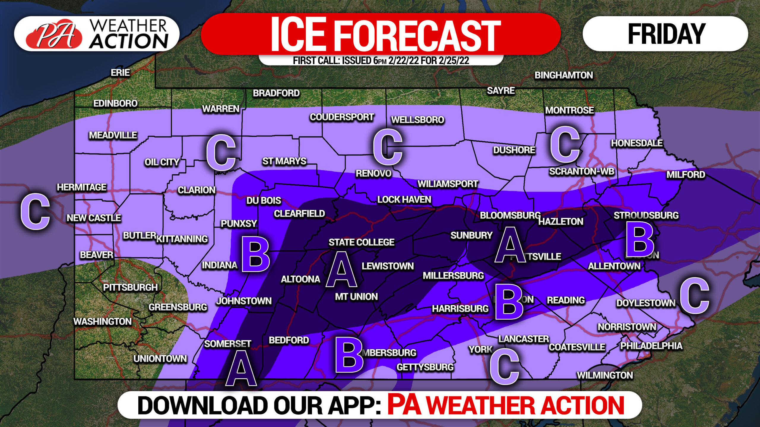
Paved surfaces will be warmer than non-paved and elevated surfaces. Therefore, expect accumulations to be depend on type of surface. The accumulations stated below are maximum accumulations on any surface.
Area A: Ice accumulation of .25 – .50″ expected. Scattered power outages likely.
Area B: Ice accumulation of .10 – .25″ expected. Scattered power outages possible.
Area C: Ice accumulation of .01 – .10″ expected.
Stay tuned for our second call forecast Wednesday evening. Areas of heaviest snow and ice will probably be modified slightly in the coming days.
Don’t forget to share this forecast with family and friends!
[social_warfare]
Tap the banner below to get our latest forecasts, premium radar layers, road cams and more.
You must be logged in to post a comment.