
FINAL CALL FORECAST POSTED:
It’s hard to believe we just crossed the halfway point of winter both in date and average snowfall. January felt like it lasted about two months, very much like January 2025 which was actually colder than this January.
Heading into February, we have a volatile pattern coming up with east of the Rockies warming up next week. Unfortunately for us, we may hold out with average temperatures before returning below average shortly after. All of this may open the door for a storm opportunity around Valentine’s Day.
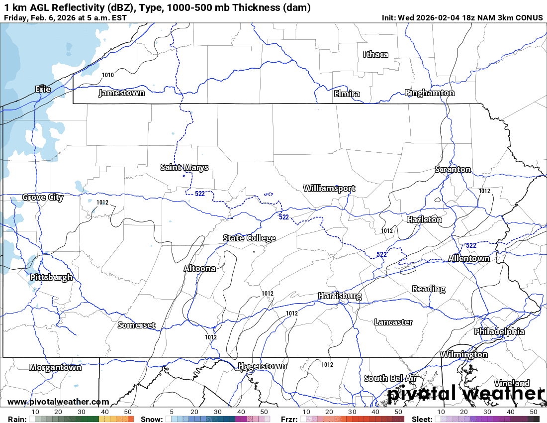
As for this clipper, it’s looking fairly weak with minor to moderate snow accumulations on and west of the Allegheny Front, and very light accumulations east of the mountains.
Light snow will begin around sunrise Friday morning in Western PA before slowly making its way into Central PA by the early afternoon. In Eastern PA, patchy light snow will reach the area by dinnertime Friday. Highest snowfall rates will be up to a half-inch per hour in Western PA and a quarter-inch per hour in Central and Eastern PA.
Light snow will wind down late Friday evening into early Saturday morning in all areas. Below is the latest High Resolution NAM model for this weak clipper.
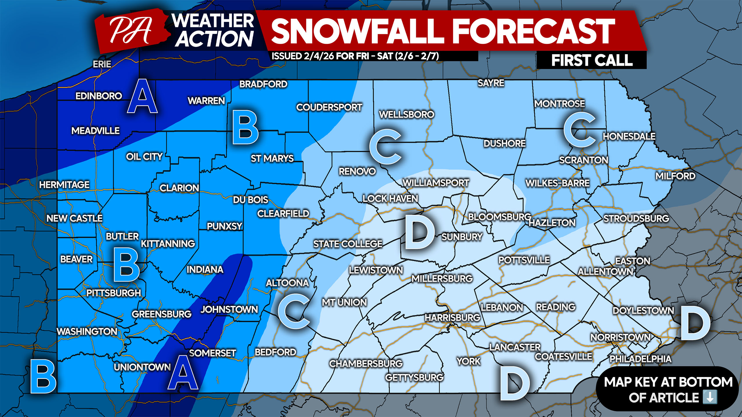
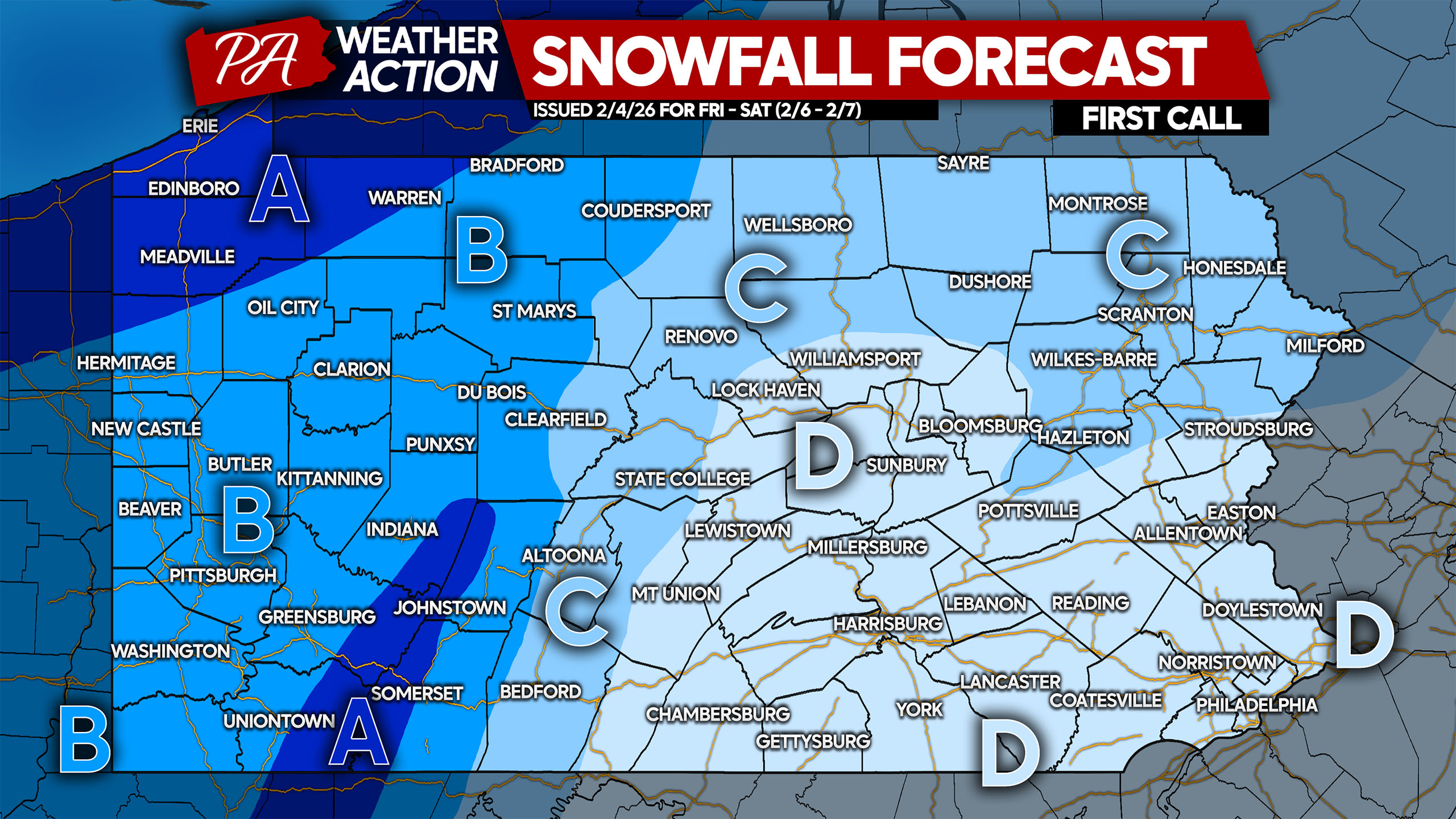
FIRST CALL SNOWFALL FORECAST FOR EARLY WEEKEND CLIPPER
Temperatures will be in the low 20s as snow is falling, and roads may not be treated in many areas. As a result, roads will likely become snow-covered. An inch of snow can be just as slippery as higher amounts, so keep this in mind for Friday evening plans.
Area A: Snowfall accumulation of 3 – 5″ expected. Very gusty winds are likely late Friday evening into Saturday, creating ground blizzard conditions.
Area B: Snowfall accumulation of 2 – 3″ expected. Very gusty winds are likely late Friday evening into Saturday, creating ground blizzard conditions.
Area C: Snowfall accumulation of 1 – 2″ expected. Very gusty winds are likely late Friday evening into Saturday, creating occasional blizzard conditions.
Area D: Snowfall accumulation of less than 1″ expected. Very gusty winds are likely late Friday evening into Saturday, creating drifts on rural roads and occasional low visibility.
Share this forecast with friends and family who may have plans Friday evening or Saturday morning!
You must be logged in to post a comment.