
This week continues to be active in the weather field as we are tracking yet another snow event for this Friday. While we do not expect this storm to be a major storm, we do anticipate light to moderate snowfall accumulations south of I-80. Temperatures Friday will once again be cold, likely in the teens and lower 20s for most of us. This will lead to snow ratios greater than 10:1. We are more likely to experience snow ratios of 15-20:1.
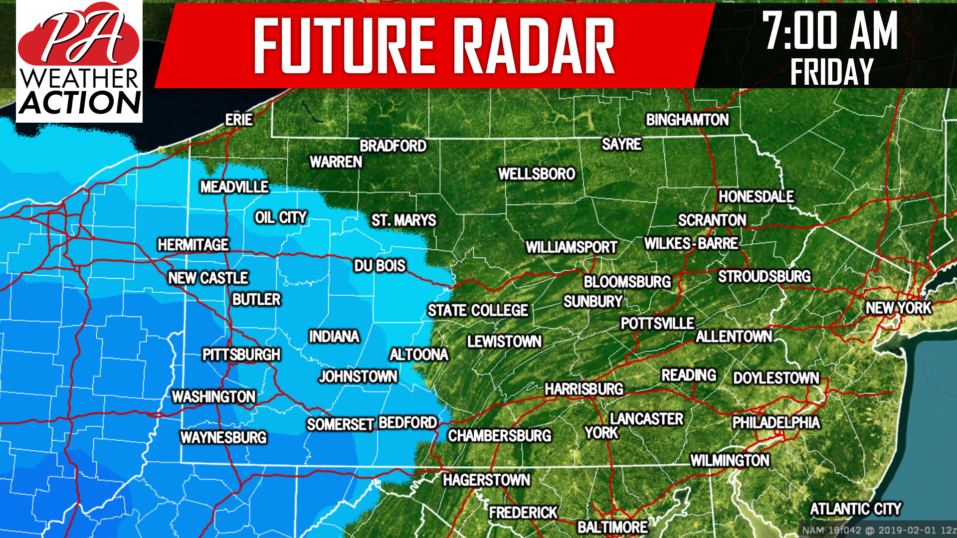
This time around, we expect higher accumulations in the southwest part of the state, with the bulls-eye being over the Laurel Highlands. Southcentral and southeastern PA will see lighter accumulations. The snow will begin to overspread Western Pennsylvania after 5:00 AM Friday. Below is a look at the future radar for 7:00 AM Friday morning:
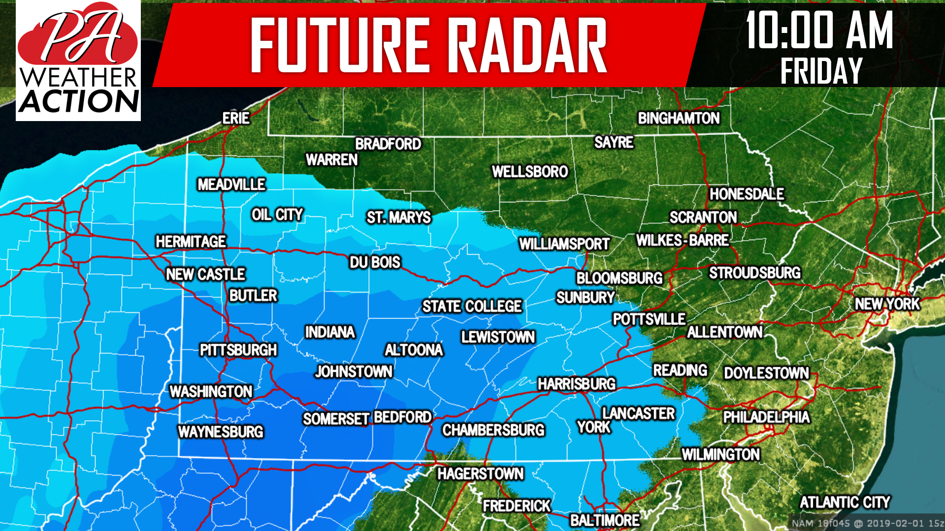
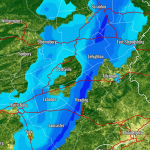
 The snow will be light to moderate at times. It will overspread Central PA by 10:00 AM:
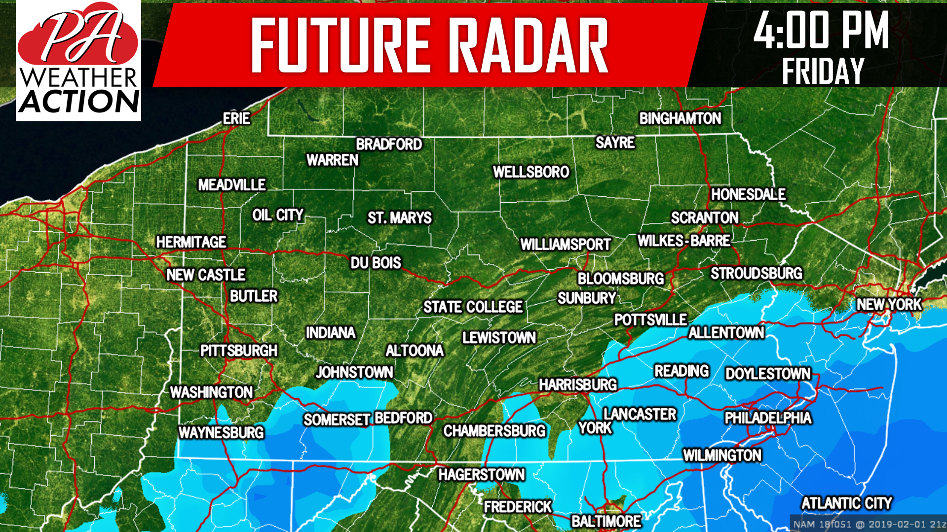
 We will have to watch Southeastern PA closely, short ranges models are beginning to suggest some coastal enhancement allowing the snow to linger around longer. If this does happen, it is likely Philadelphia and surround suburbs will see a bit more in the way of accumulations. Below is a look at 4:00 PM Friday afternoon:
FIRST CALL SNOWFALL FORECAST FOR FRIDAY:
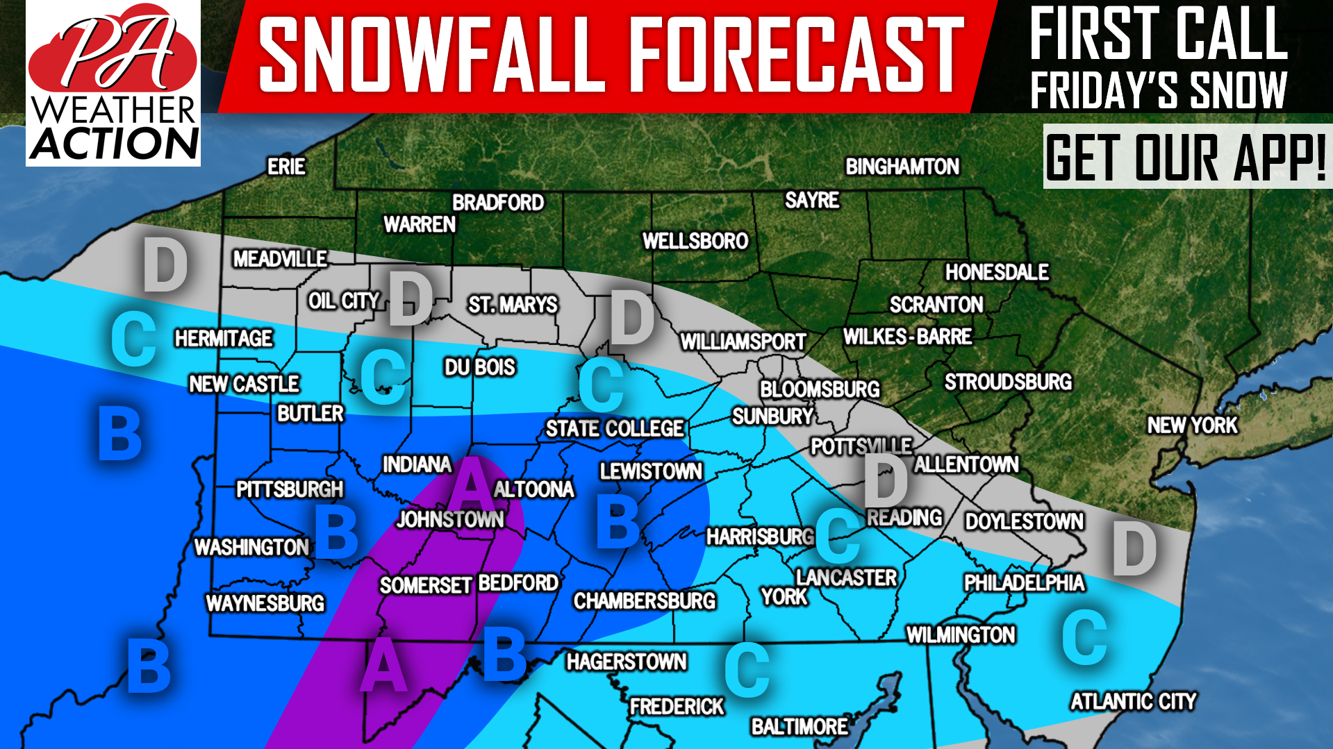
Area A: Snowfall accumulations of 3 – 6″ expected. Snow covered roads expected Friday, causing hazardous travel.
Area B: Snowfall accumulations of 2 – 3″ expected. Slippery roads expected Friday, causing hazardous travel mainly on untreated surfaces such as secondary roads.
Area C: Snowfall accumulations of 1 – 2″ expected. Use caution on slick roadways.
Area D: Snowfall accumulations of <1″ expected.
Be sure to download our free app for a notification when Thursday’s Final Call is issued, as well as your area’s forecast, alerts, and radar >>> PA Weather App Link
Don’t forget to share this first call snowfall forecast with your friends and family using the button below, stay warm!
You must be logged in to post a comment.