
The first sizable lake effect snow event of the season is expected late Sunday afternoon through mid-morning Monday as a strong cold front sweeps through. A plowable snowfall is likely for lake effect snowbelt areas from northwest PA and down through the Laurel Highlands. In addition, there will likely be some far-reaching snow squalls that give many their first snow of the season.
SNOW TIMING
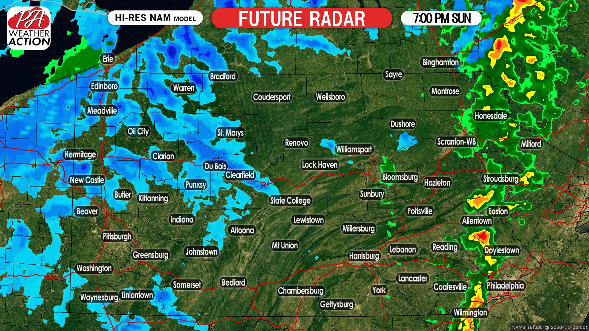
We will begin to see lake effect snow squalls form in the late afternoon, and become more widespread just after dinnertime Sunday. Temperatures will be at or below freezing when the snow starts in all areas besides the immediate lakeshore. Below is the Hi-Res NAM future radar for 7:00 PM Sunday.
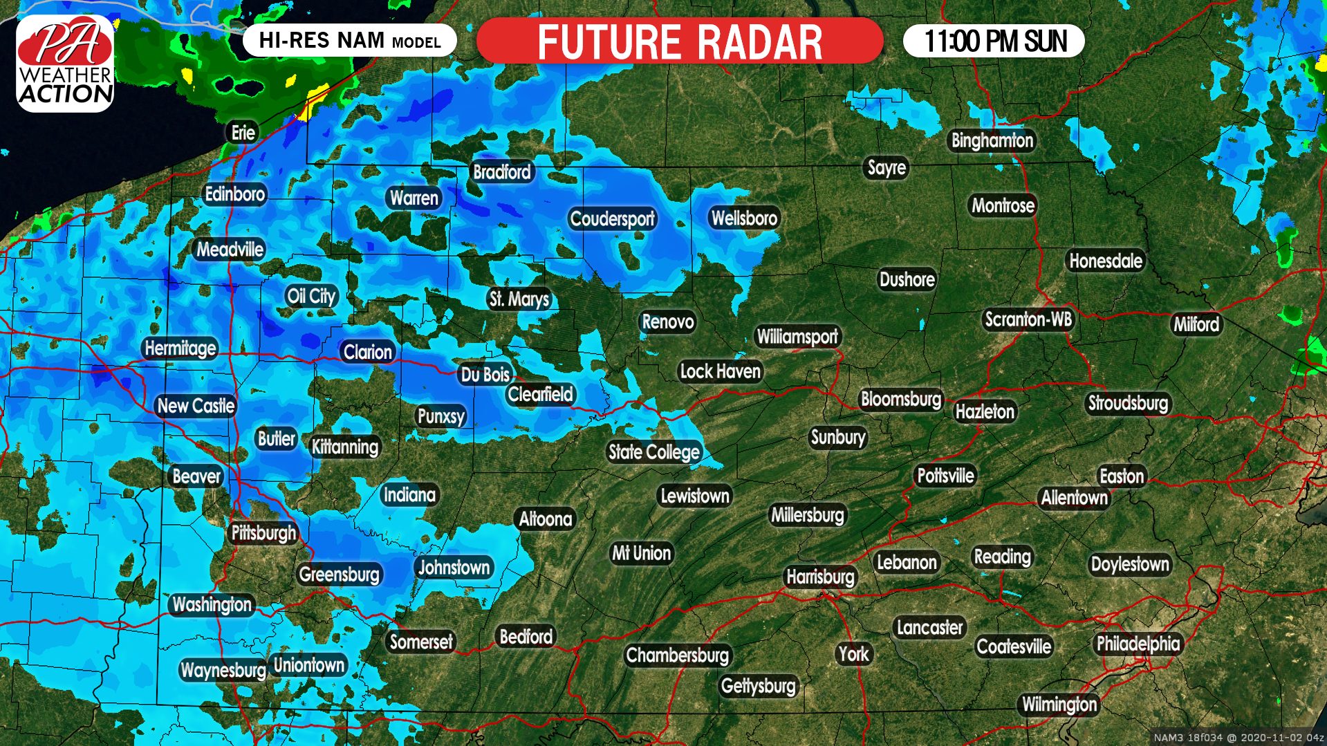
More potent snow squalls will move into areas north of Butler and west of St. Marys and Bradford by the late evening hours of Sunday. Visibility near zero and rapidly deteriorating road conditions are likely in these squalls. Here is future radar for 11:00 PM Sunday.
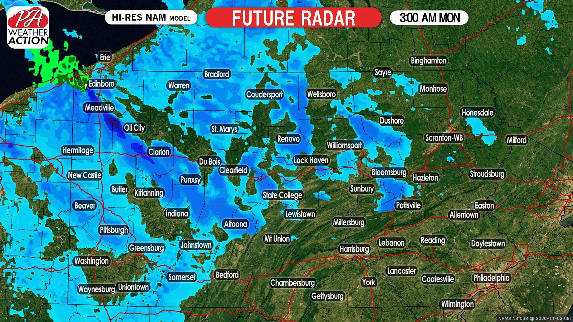
The height of the event will come just after midnight, when moderate to heavy snow bands are expected in northwest PA, and scattered snow showers will be possible near the Pittsburgh area. Below is future radar for 3:00 AM Monday.
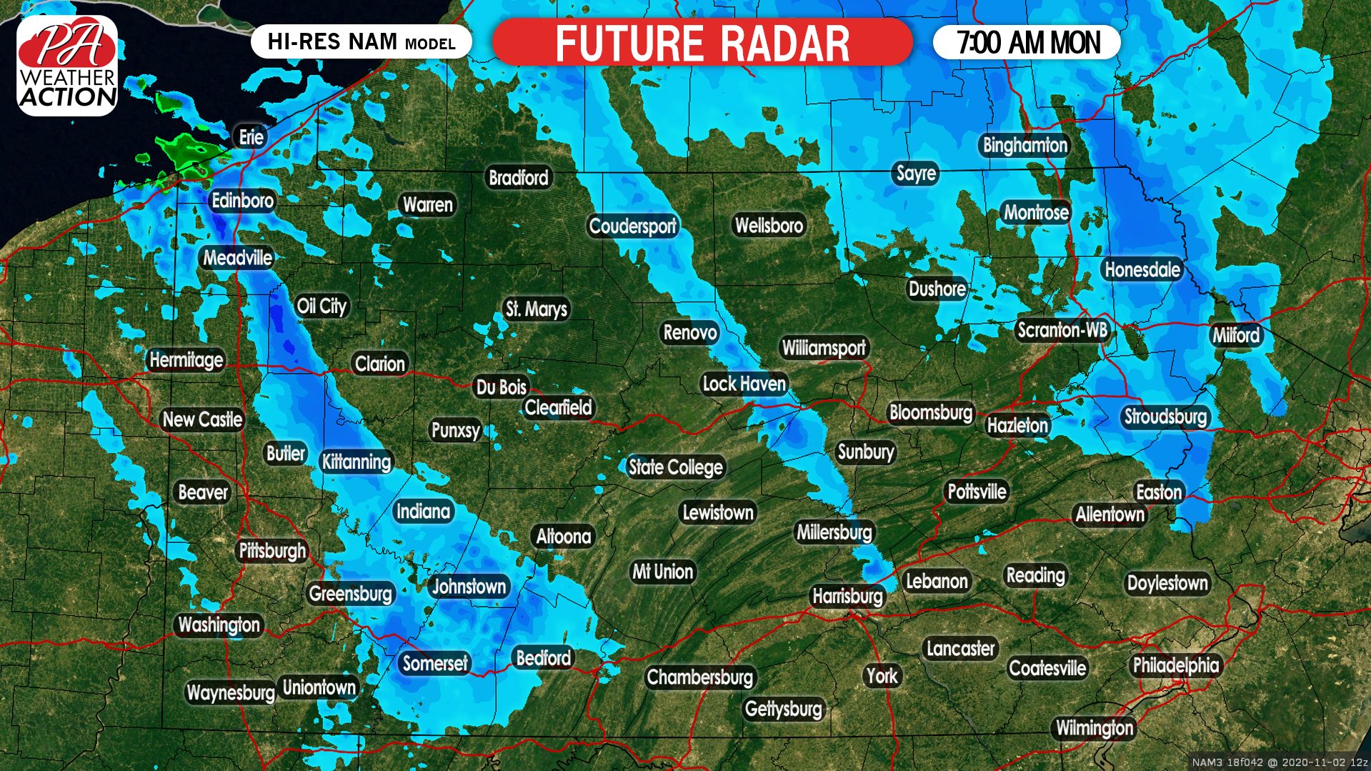
The snow squalls will become more isolated by the Monday morning commute. Even still, some light to moderate snow is anticipated especially in the Laurel Highlands and areas north of Scranton in NEPA. Here is future radar for 7:00 AM Monday.
The event is then expected to end fully by mid Monday morning.
This forecast has been updated to our final call, issued Sunday afternoon.
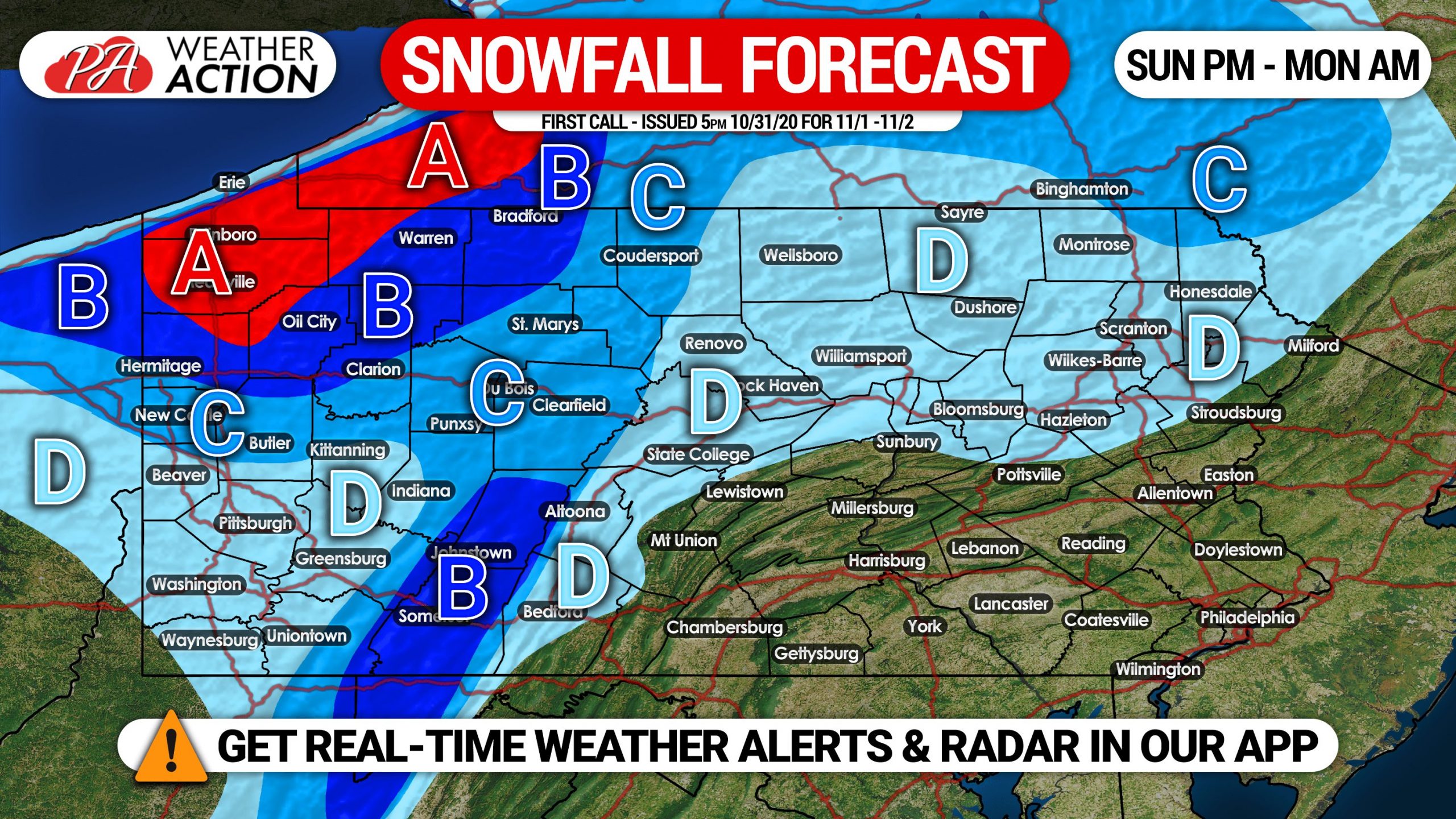
FINAL CALL LAKE EFFECT SNOWFALL FORECAST FOR SUNDAY PM – MONDAY AM
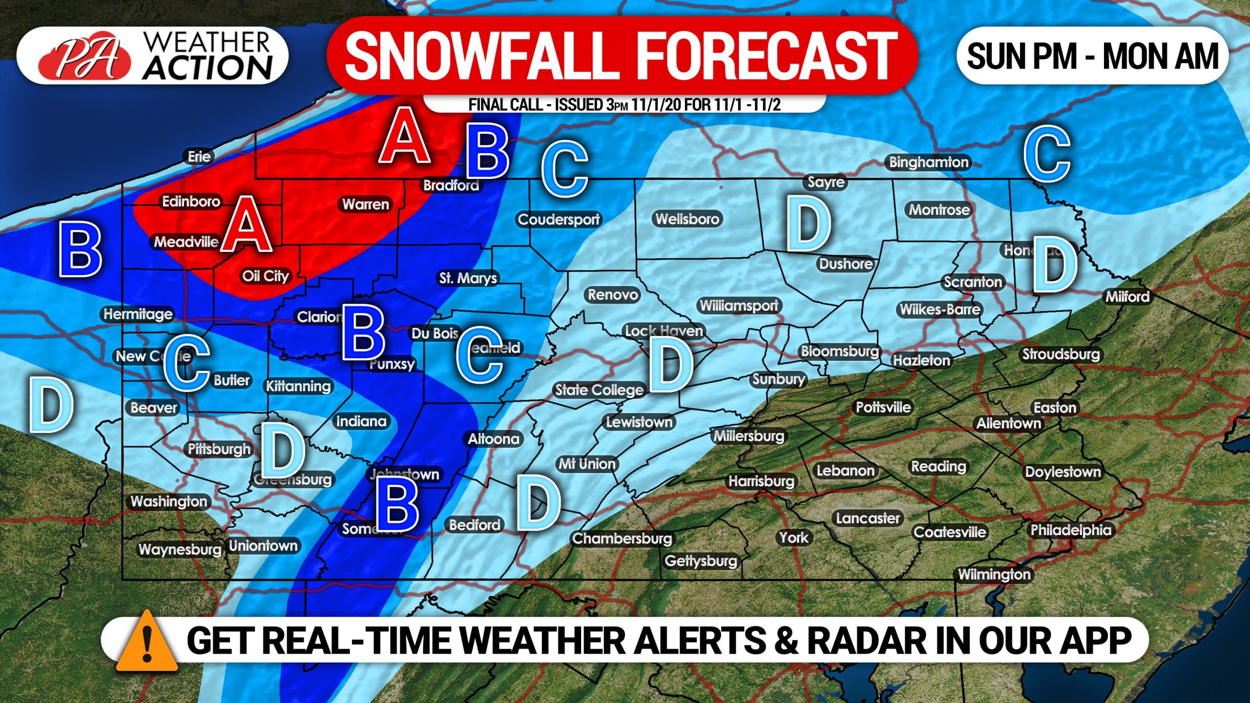
Area A: This region will most frequently see intense lake effect snow bands from Sunday evening into Monday morning. Extremely low visibility likely in snow squalls, slowly reduce speeds if caught driving in one. Snowfall accumulations of 4 – 7″ expected, locally up to 9″ possible.
Area B: Frequent light to moderate snow is expected Sunday evening through sunrise Monday, with a few breaks possible as usual with lake effect. Scattered heavy snow bands are expected. Snowfall accumulation of 2 – 4″ anticipated, locally up to 5″ possible.
Area C: Scattered light to moderate snow is likely Sunday evening through sunrise Monday. Snowfall accumulation of 1 – 2″ expected, locally up to 3″ possible.
Area D: Isolated snow showers possible Sunday evening into Monday morning. Scattered snowfall accumulation of a coating to 1″ expected. Some locations may see nothing, as the snow will not be widespread.
Don’t forget to share this forecast with family and friends in impacted areas using the blue button below!
Get the Weather Action app free by tapping on your platform!
![]()
You must be logged in to post a comment.