
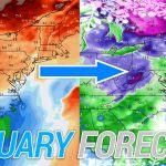
After going three weeks without any widespread winter weather to talk about in January, we are finally expecting a moderate winter storm. A weakening low pressure system coming from the Great Plains will bring a wintry mix of precipitation to the state, starting Monday evening and continuing into Tuesday for many.
Travel disruptions are expected in central and eastern PA Monday Night through early Tuesday afternoon. The Monday evening commute should be clear in all areas, but the Tuesday morning commute will be hazardous in many locations.
STORM TIMING
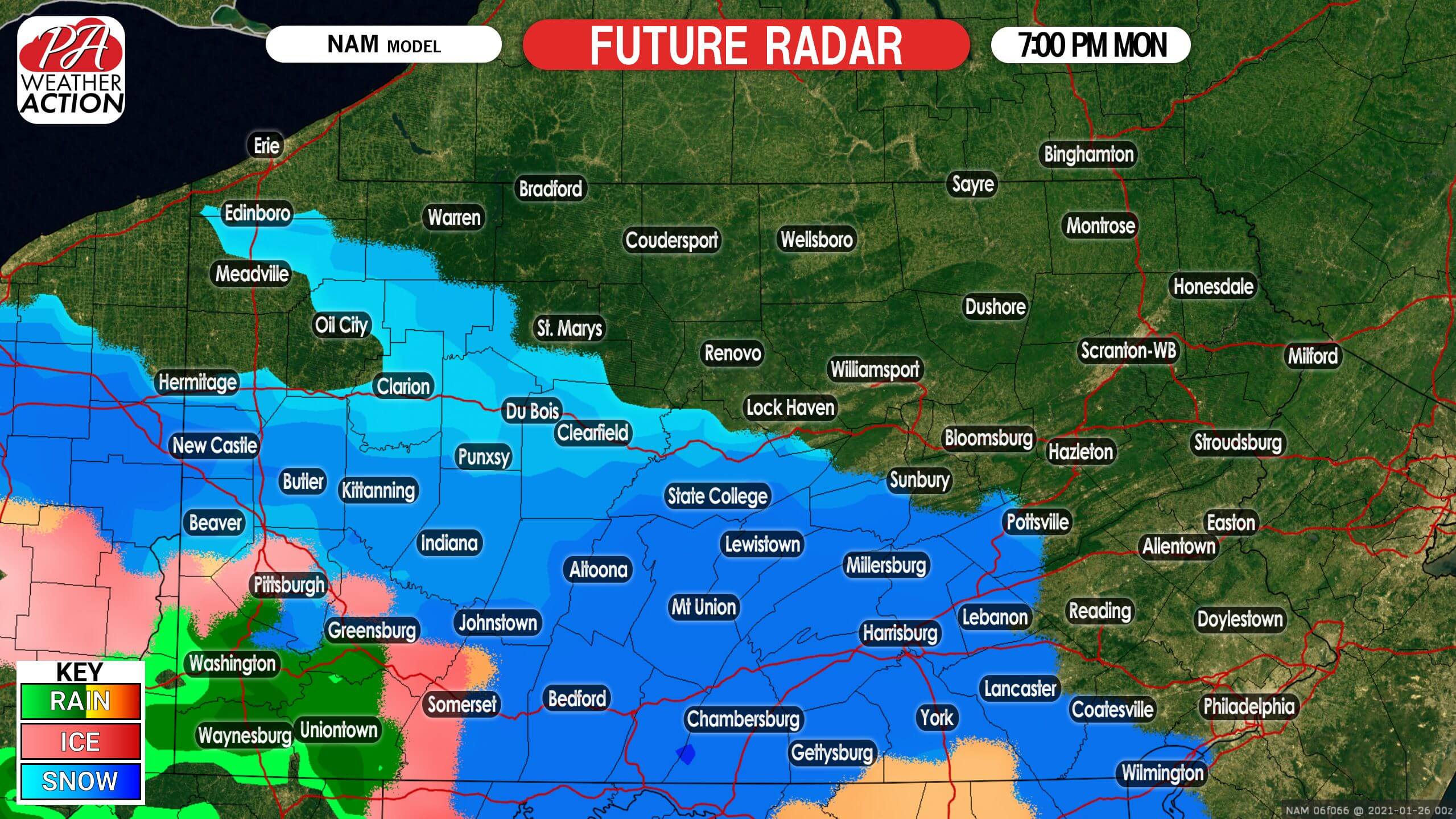
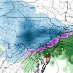
Precipitation will move into southern Pennsylvania late Monday evening. It will fall as snow in south-central PA, sleet and freezing rain in the Laurel Highlands, and plain rain west of the mountains in southwest PA. Snowfall rates of 1/2″ an hour are expected, with temperatures dropping into the lower 20s as precipitation begins. Below is the NAM model future radar for 7:00 PM Monday.
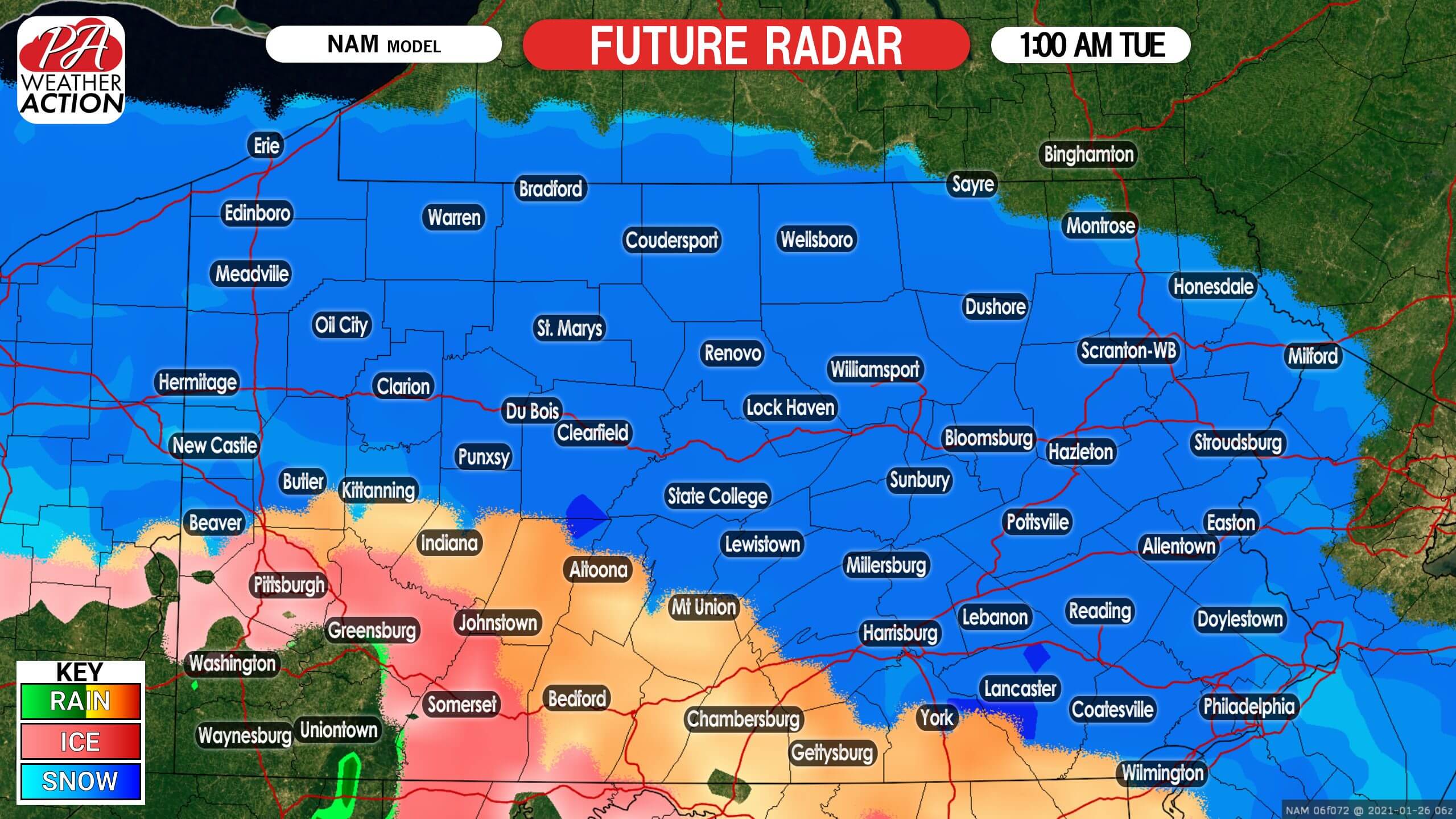
Snow will continue to push east-northeast across the state early Tuesday morning. At the same time, snow is expected to switch to a brief period of sleet and then freezing rain in our south-central counties. An extended period of freezing rain will likely lead to significant ice accumulations in the Laurels. Here is future radar for 1:00 AM Tuesday.
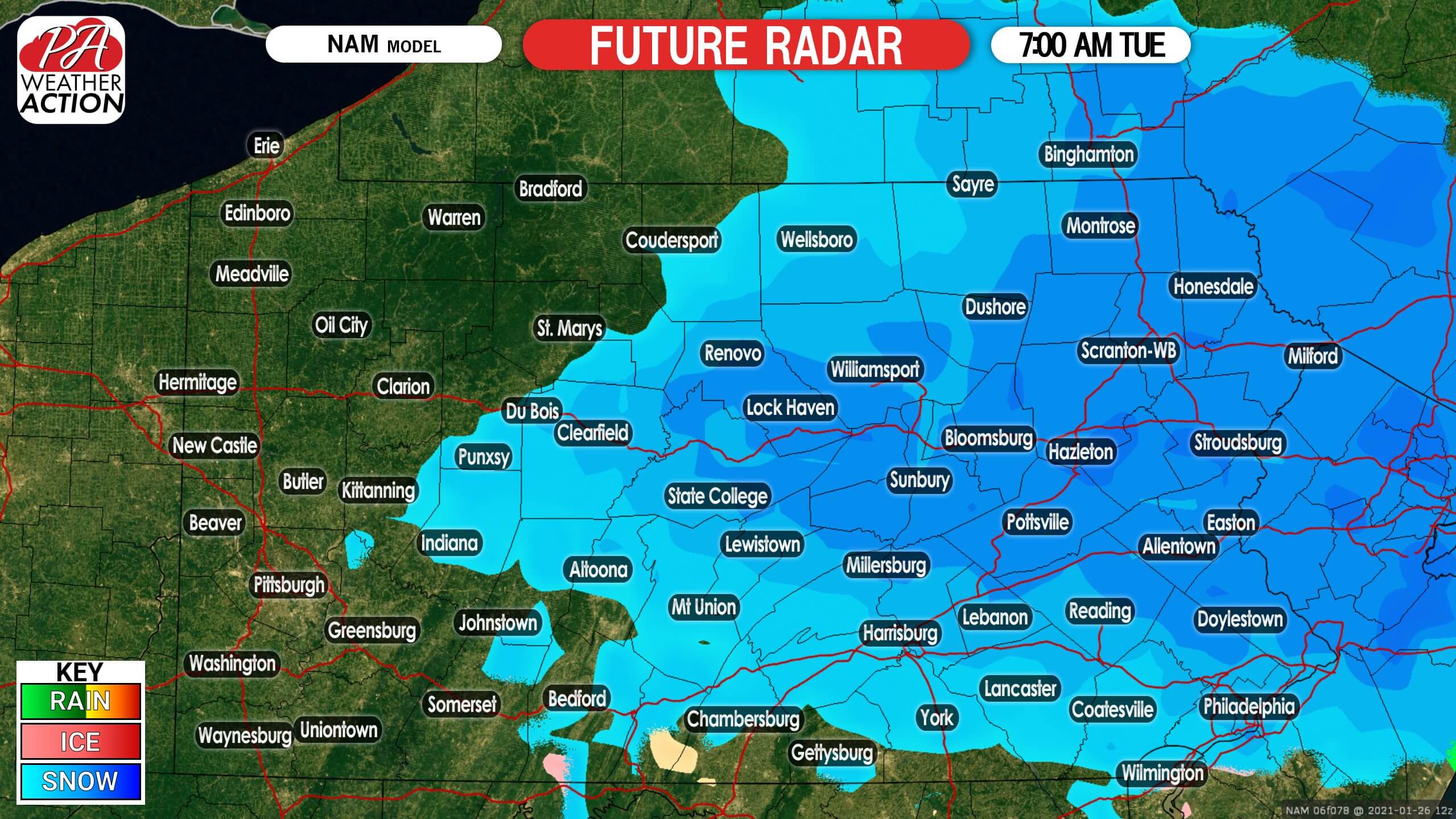
Snow will weaken Tuesday morning as it tries to move toward a high pressure setup to our northeast, leaving us with some leftover light snow showers by mid-Tuesday morning. Once again, the Tuesday morning commute does look slippery to hazardous in much of central and eastern PA. Below is future radar for 7:00 AM Tuesday.
Some snow may linger in northeast PA into Tuesday evening, but all other regions should be done.
FIRST CALL SNOWFALL FORECAST FOR MONDAY NIGHT – TUESDAY
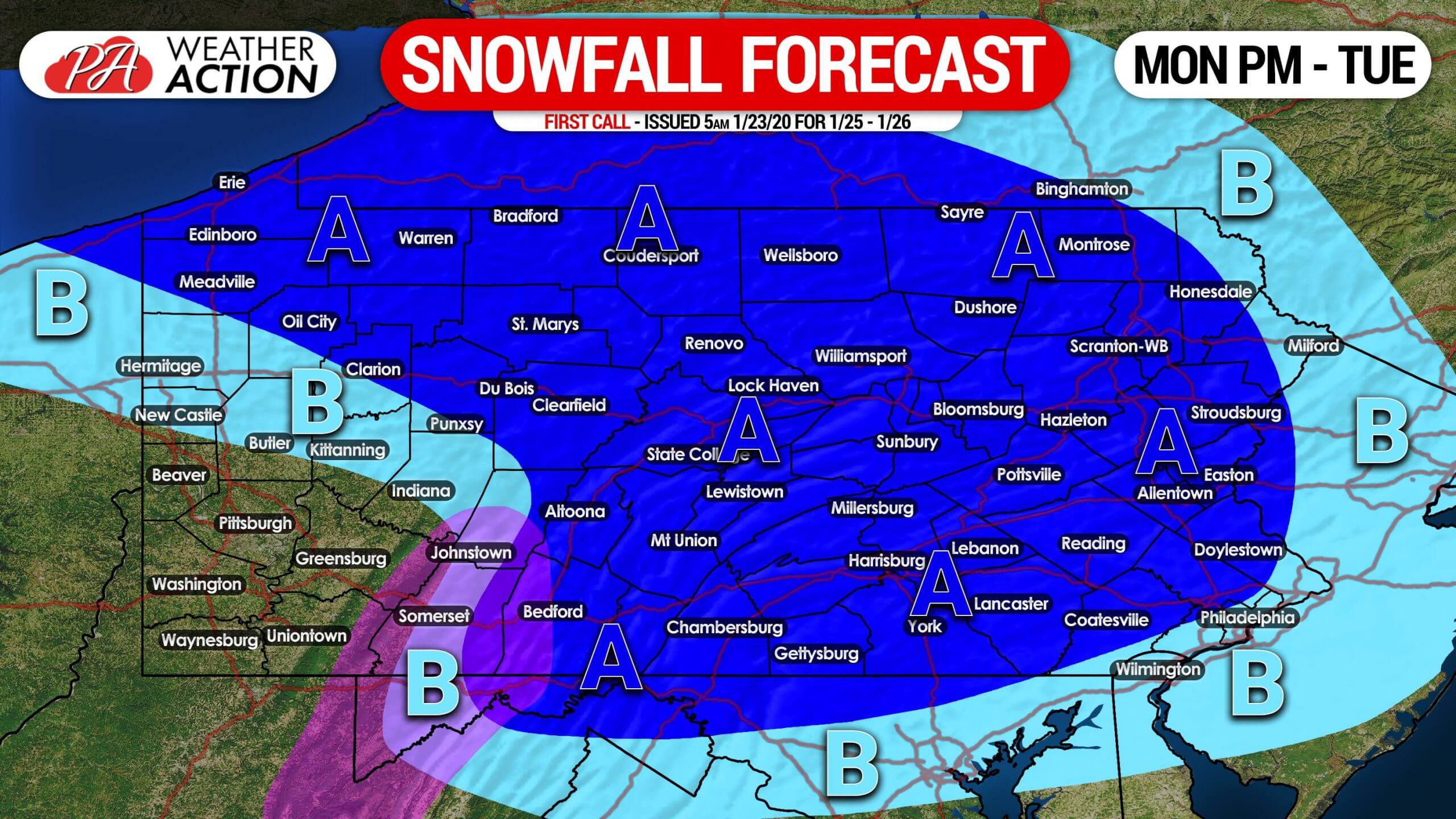
Area A: Snowfall accumulation of 2 – 5″ expected. Snow will push in from southwest to northeast. Worst travel conditions are likely late Monday evening through mid-Tuesday morning.
Area B: Snowfall accumulation of 1 – 2″ anticipated. Slippery travel possible late Monday night until just before dawn Tuesday.
Locations within the purple shaded region are also likely to receive a tenth to a quarter-inch of ice accumulation.
We are still 60 to 72 hours out from this storm (when this was posted), so be sure to stay tuned on Sunday for our Second Call for any changes that may be needed.
To get notified whenever we post new forecasts and much more, download our free app here!
Don’t forget to share the latest forecast with your family and friends who will be impacted by this storm using the blue button below, stay safe!
You must be logged in to post a comment.