
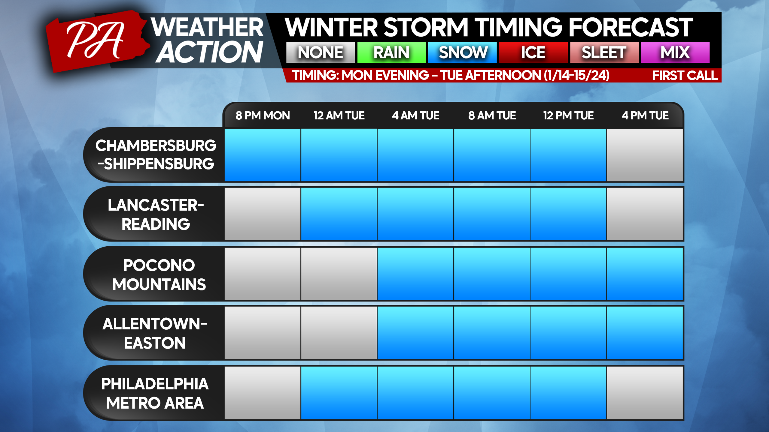
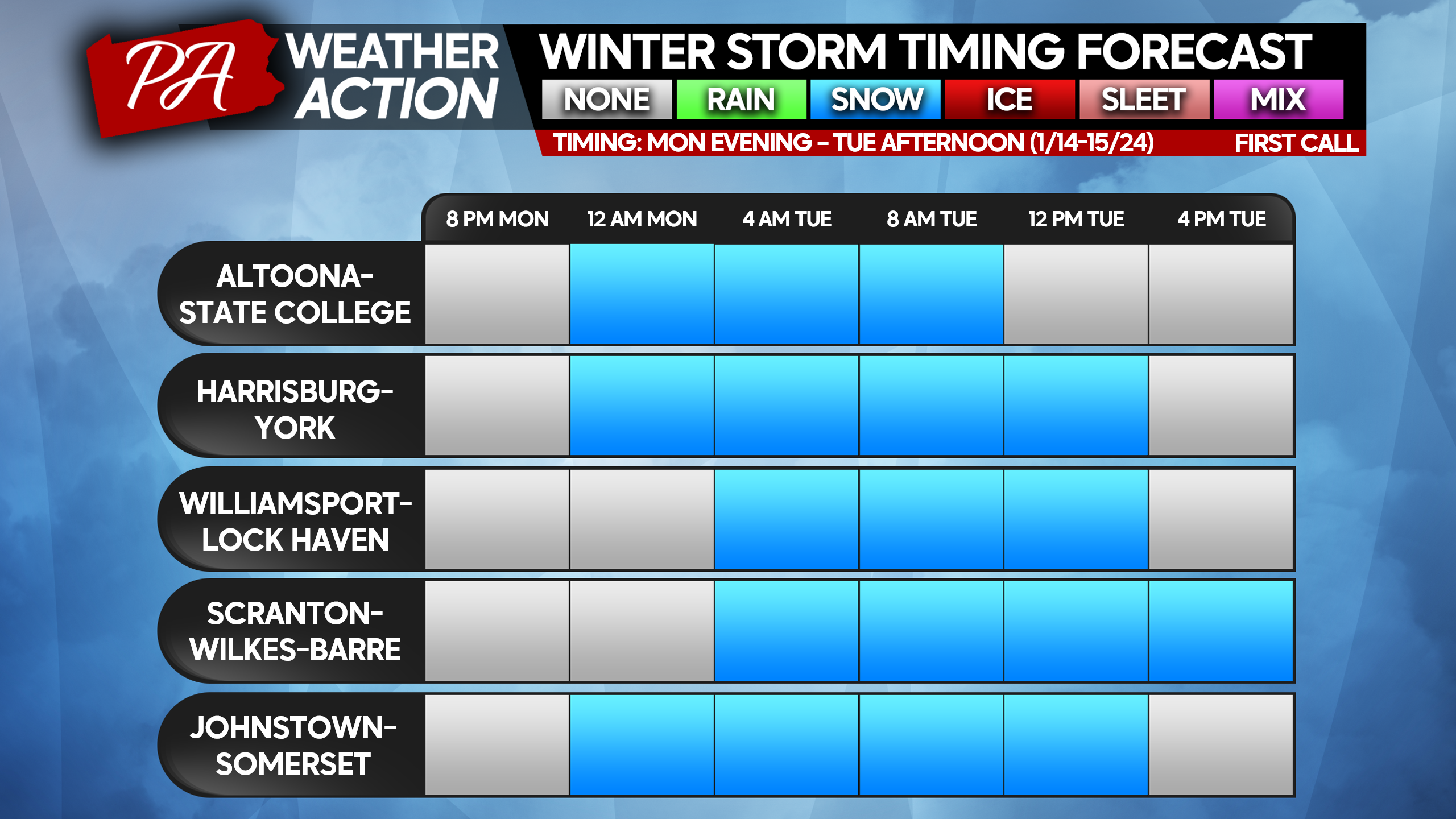
It has been a long time since the last widespread snow event with no mixing issues (sleet, freezing rain concerns) anywhere in the state! But finally, in the heart of winter during a deep cold snap, here we are. While we did write off the threat for a snowstorm back on Friday, we mentioned the possibility for light snow showers. What we are likely to get isn’t quite a storm, but more so a light snow that gradually adds up over 12-18 hours.
There is some disagreement regarding when light snow will start in Southern PA, with some guidance having flakes falling as early as dinnertime Monday. The same goes for when snow will move out, some models suggesting Tuesday morning while others suggest not until the Tuesday PM commute. The timing forecast is subject to change, and we recommend downloaded our app “PA Weather” for timing for your area.
SNOW TIMING FORECAST CHARTS

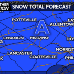
FIRST CALL SNOWFALL FORECAST FOR MON NIGHT – TUE AFTERNOON
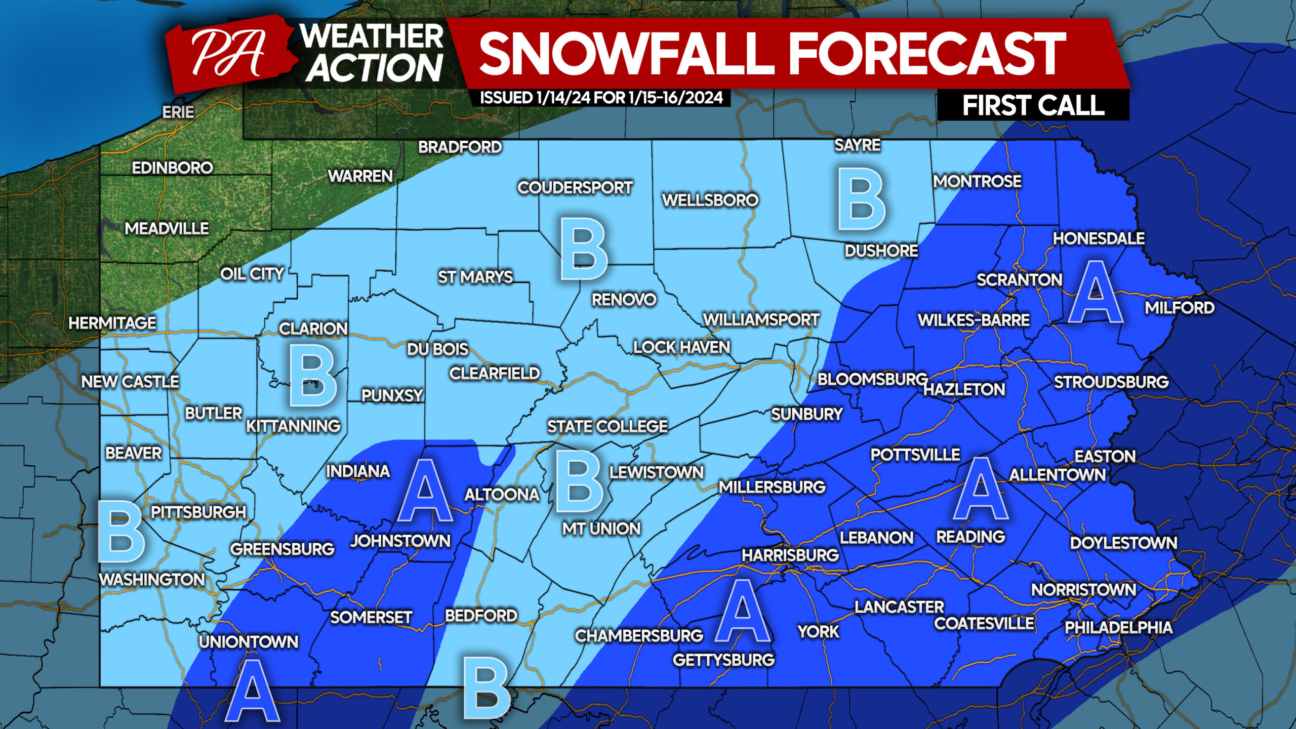
Snowfall rates will be mainly light, with occasional moderate snow in Area B.
Area A: Snowfall accumulation of 2 – 4″ expected. Snow will immediately stick to untreated surfaces, as temperatures will be in the 20s, resulting in poor travel conditions.
Area B: Snowfall accumulation of 1 – 2″ expected. Snow will immediately stick to untreated surfaces, as temperatures will be in the 20s, resulting in poor travel conditions.
Be sure to share this forecast with friends and family!
You must be logged in to post a comment.