The start of this winter season has been snowy across Northern PA, particularly in Erie, but all the way over to Scranton as well! Finally, some of that snow looks to drop south into parts of Southern PA late this weekend. A weak storm coming out of the Ohio Valley will clash with cold air damming as it reaches the Appalachians, making for a wintry mix across the heart of Pennsylvania.
Accumulations will be light to moderate, depending on your definition of those two words which tends to vary across the state. Road impacts are expected given the cold temperatures recently, but mainly in areas that hang onto wintry precipitation longer.
Winter Storm Timing
Snow will begin early Sunday afternoon near the MD line in South Central PA, and quickly push northeast. Note that this will be mainly rain in Southwest PA due to not benefiting from cold air damming. It will begin as light snow in Central PA, and then become moderate within a few hours of starting. Below is the European Model future radar for 4:00 PM Sunday.
As we push past sunset, snow will overspread much of Central and Northern PA. The sleet/rain line will begin to push into South Central PA, changing over areas south of the turnpike likely around dinnertime.
The Laurel Highlands are expected to see several hours of freezing rain, which will create significant travel hazards by Sunday evening. Here is the Euro Model future radar for 7:00 PM Sunday.
By very late Sunday evening, we expect plain rain south of the turnpike in the Lower Susquehanna Valley. But farther north, moderate snow will continue falling, with rough travel likely at this point along I-99 and I-80.
Even I-81 in Northeast PA may become slippery in the late hours of Sunday. Below is the Euro model future radar for 10:00 PM Sunday.
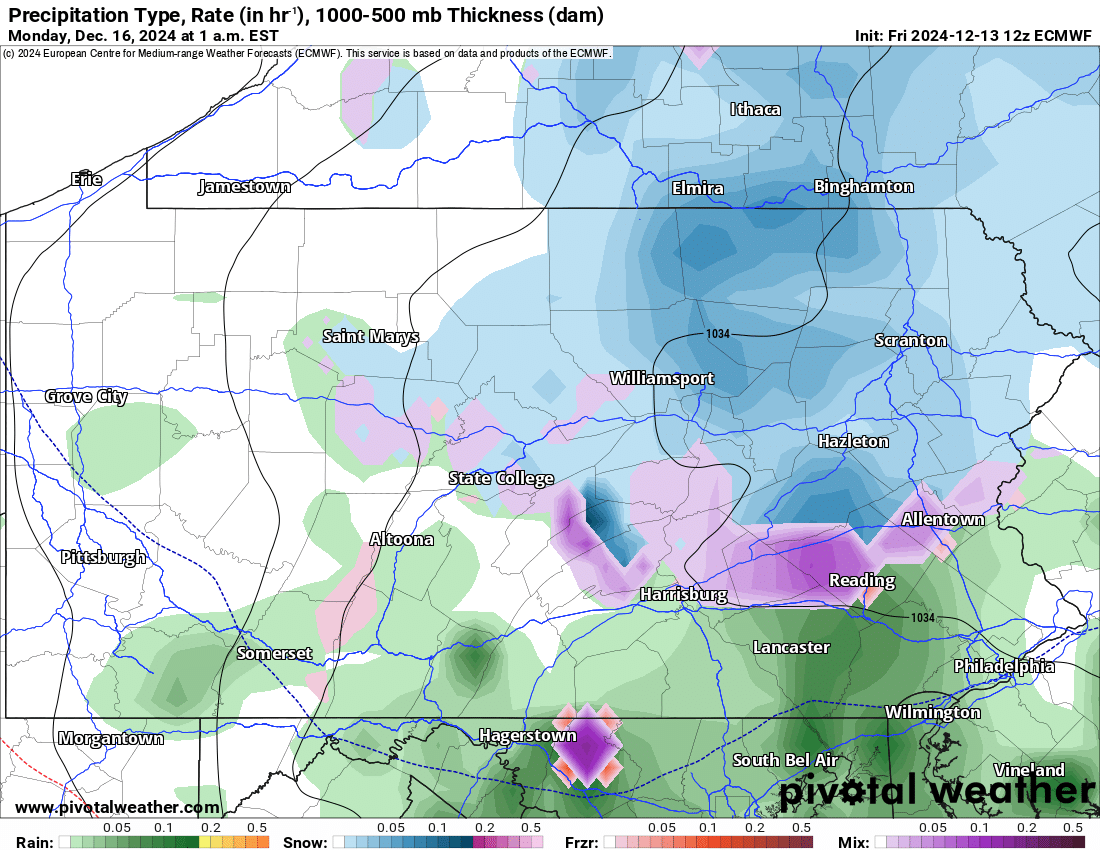
Finally as we reach the early hours of Monday, snow should be contained to the northeast quarter of Pennsylvania. However given the timing, road conditions may still be deteriorated back in Central PA at this point. After 1 AM, we anticipate precipitation to weaken and the storm to end shortly after. Here is the Euro model future radar for 1:00 AM Monday.
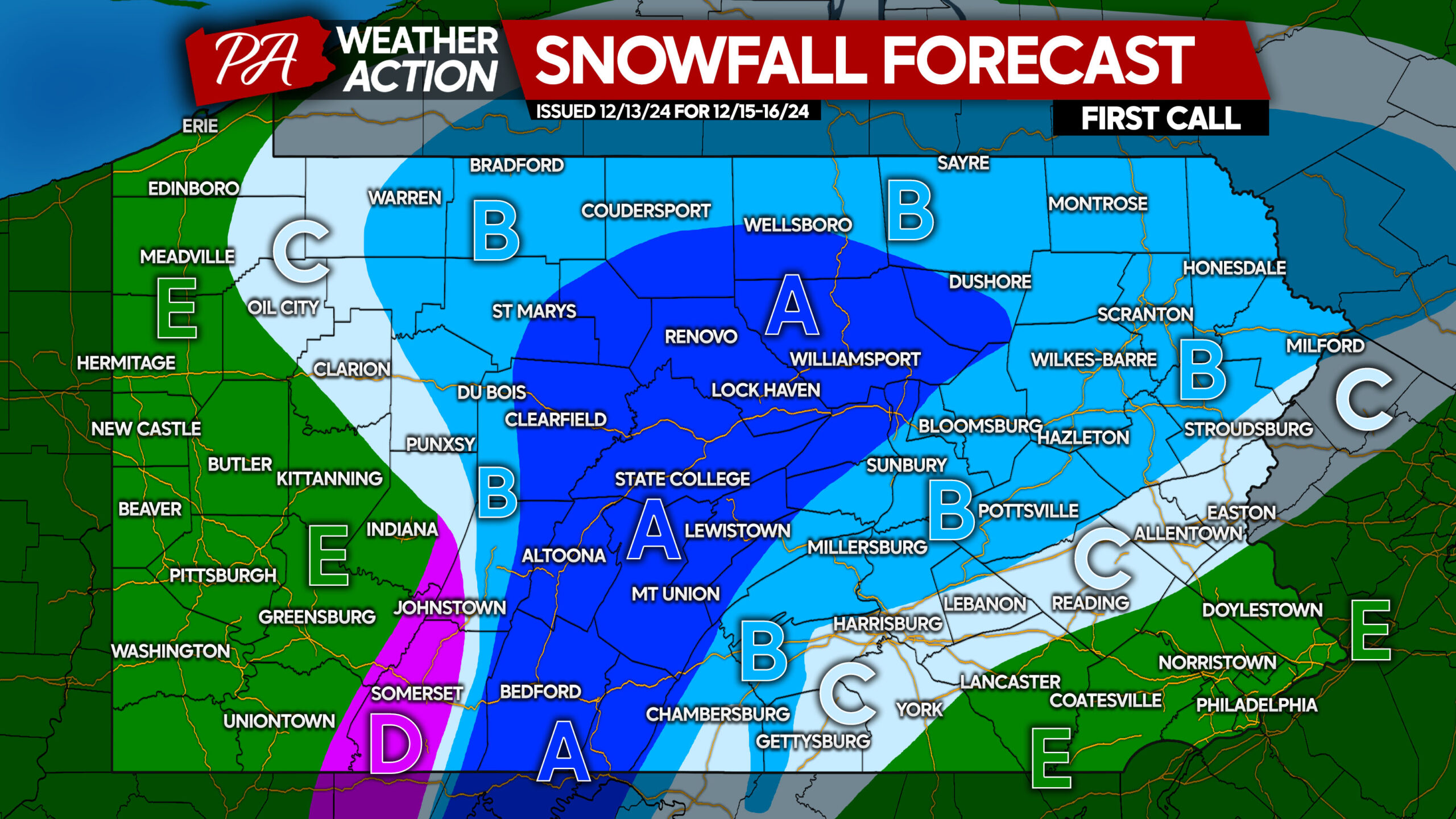
FIRST CALL SNOWFALL FORECAST FOR SUNDAY AFTERNOON – MONDAY MORNING
Area A: Snowfall accumulation of 2 – 4″ expected. Road conditions will become slushy Sunday afternoon and evening, remaining hazardous into early Monday morning.
Area B: Snowfall accumulation of 1 – 2″ anticipated. Road conditions may be slippery after snow falls for a few hours, creating poor travel conditions for those going out Sunday evening into early Monday morning.
Area C: Snowfall accumulation of less than 1″ expected. Road conditions may be slippery for a few hours as snow falls before changing to rain.
Area D: Up to a .20″ of ice accrual is anticipated, making for dangerous travel Sunday afternoon through early Monday morning.
Area E: All rain expected from start to finish.
If friends or family would find this information useful, don’t forget to share it with them!


You must be logged in to post a comment.