Thanksgiving is in just a few days, and the weather isn’t looking spectacular. Possibly by now you have heard of the Arctic air we have coming for the first half of December, but unfortunately for snow lovers, that air will not be in place for the Thanksgiving storm.
Travel conditions look good for Wednesday! By Thursday morning, precipitation will begin across the state with many areas seeing rain by sunrise.
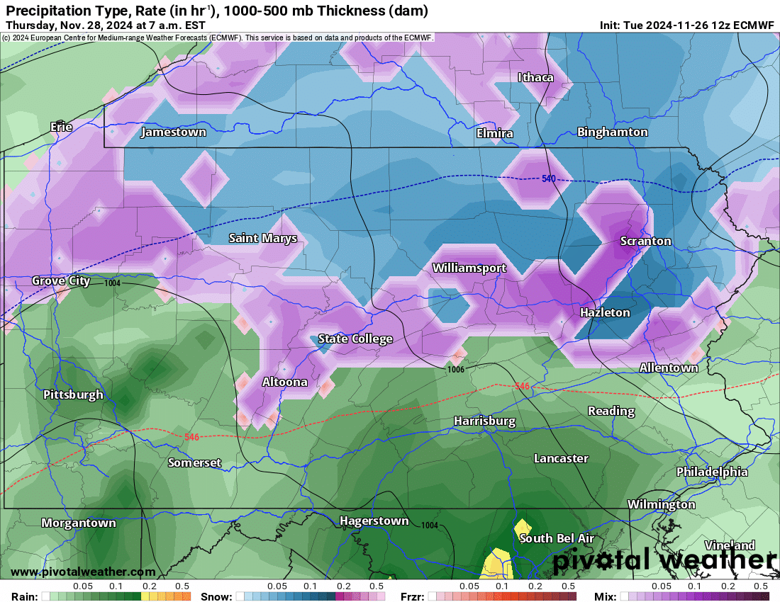
But in the Northern PA mountains, snow is expected to start around 6-7 AM Thursday. Below is European model future radar for 7:00 AM Thursday morning.
The rain/snow line will quickly begin to head northward and to the higher elevations, with locations south of I-80 expected to change to rain by 10 AM Thursday.
Meanwhile, moderate snow is expected to be falling across the northern tier. Here is Euro model future radar for 10:00 AM Thursday.
As we head into the early afternoon, snow is anticipated to continue near the NY state border, while moderate rain falls mainly across Eastern PA.
Precipitation will start to push out after lunchtime. Below is the Euro model future radar for 1:00 PM Thursday.
And just like that, the storm will be over by the time many of us are sitting down to eat Thanksgiving dinner! But after Thanksgiving, temperatures will be crashing and the lake effect snow machine will fire up!
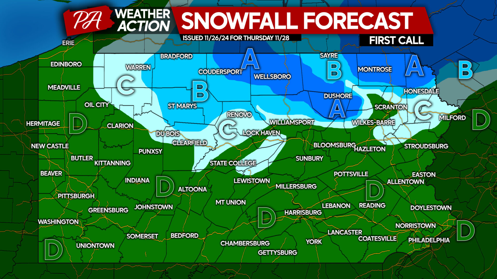
FIRST CALL SNOWFALL FORECAST FOR THANKSGIVING
Area A: Snowfall accumulation of 2 – 4″ expected. Slushy road conditions possible Thursday morning into the early afternoon.
Area B: Snowfall accumulation of 1 – 2″ anticipated. Slippery road conditions possible as snow falls.
Area C: Snowfall accumulation of less than 1″ expected.
Area D: All rain is likely from start to finish.
Don’t forget to share this forecast with friends and family in affected areas!


You must be logged in to post a comment.