Please view the article linked below for our final call forecast for this storm, which includes updated snowfall totals.
Final Call Snowfall Forecast for Thursday Evening – Friday’s Early Winter Storm in PA
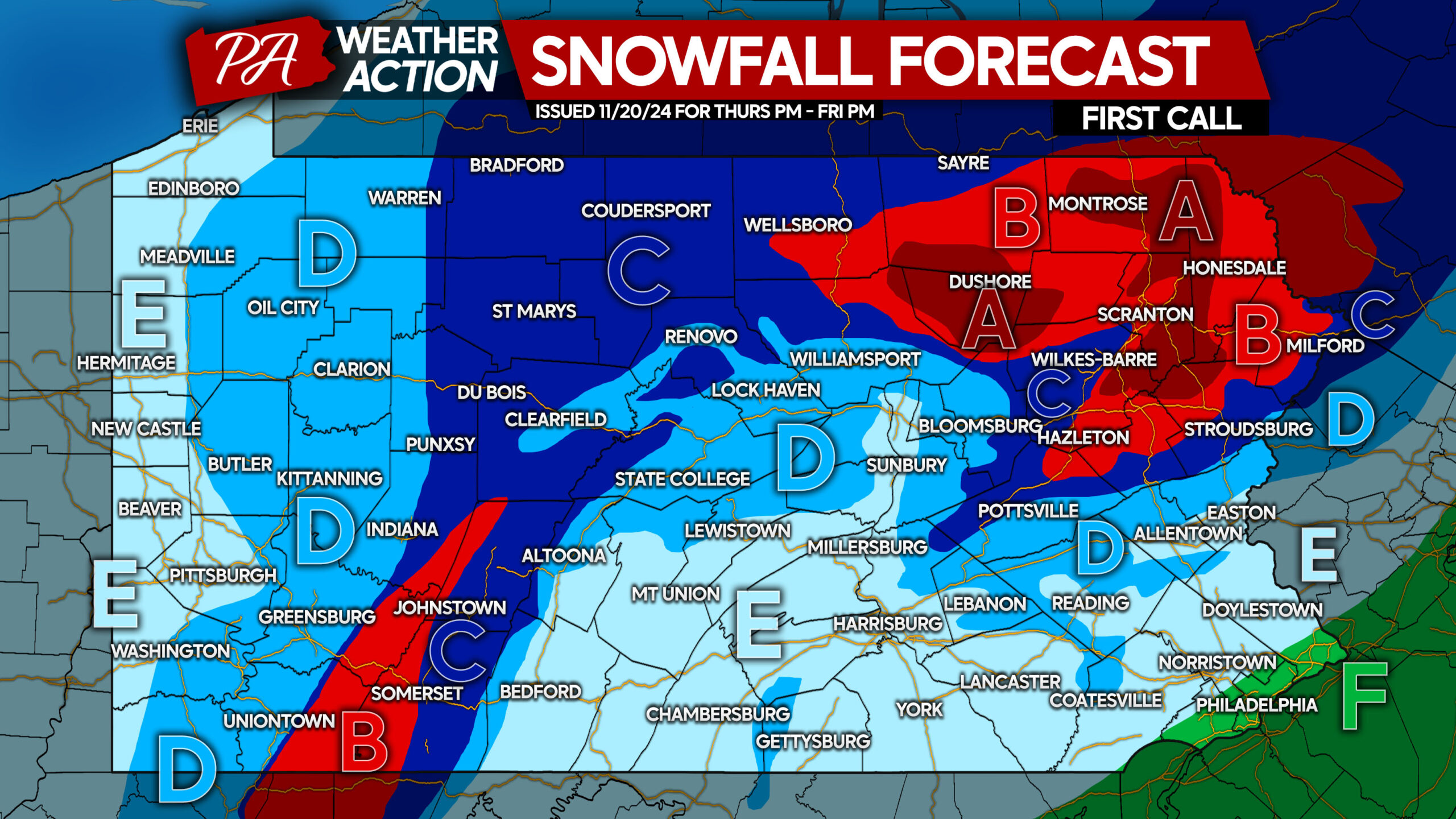
The first winter storm of the season on the East Coast will be a Pennsylvania Special, with significant snowfall now anticipated in the Poconos and Laurel Highlands. Model trends over the last 24 hours have been bullish for accumulating snow even in the valleys.
An upper level low pressure, responsible for generating the cold air and precipitation necessary for this storm, will spin back in from off the coast and push over Binghamton, then Eastern PA, before once again heading out to sea. Areas closest to the low pressure will see greatest impacts, with the exception of the Alleghenies.
Winter Storm Timing
Rain will change to snow around dinnertime Thursday in the highest elevations of Northeast PA. But the changeover will happen fast, spreading to the valleys by late Thursday evening.
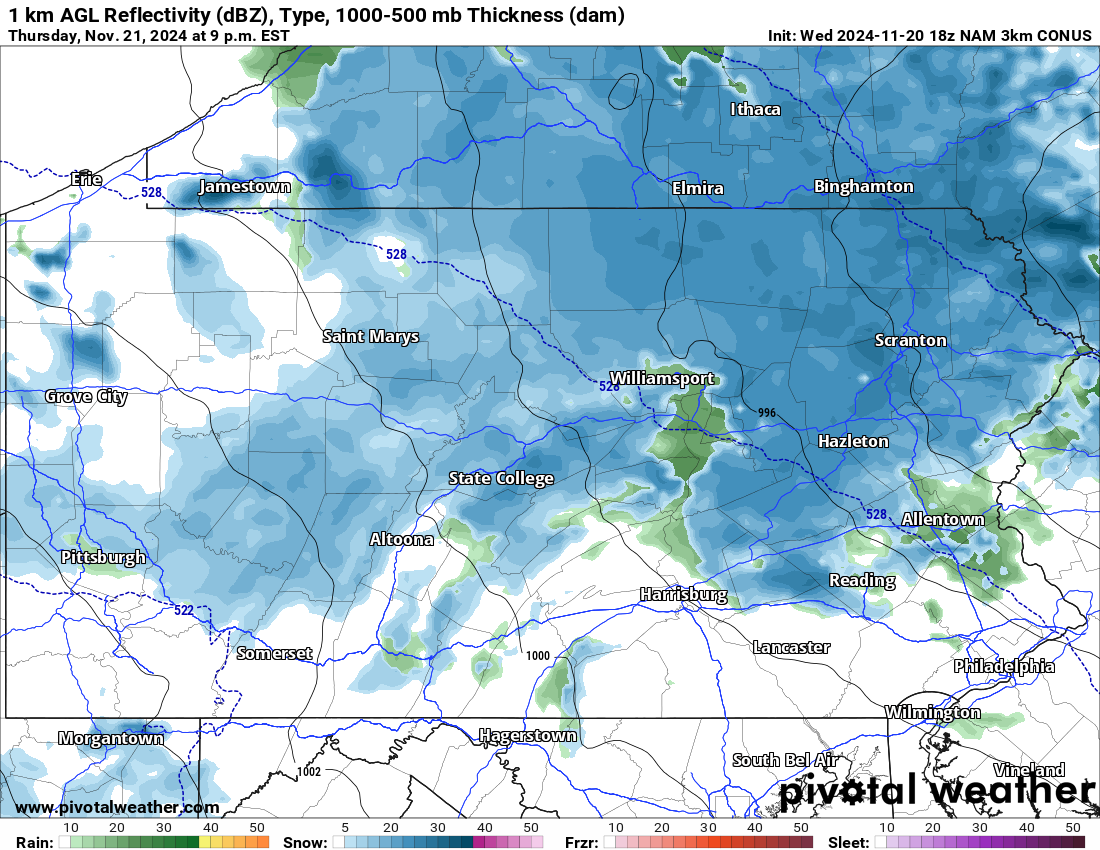
With the trend southwest with the low pressure, snow is now also expected to fall in parts of Central and Western PA by 9:00 PM Thursday evening. Below is the Hi-Res NAM model for 9:00 PM Thursday.
Moderate to locally heavy snow is expected to continue across Northern Pennsylvania into the predawn hours of Friday. Heaviest snowfall rates are expected to be in the Endless Mountains and Poconos.
Temperatures in locations below 1500′ elevation are modeled to stay just above freezing for the duration of this storm. As a result, snow will take longer to accumulate on roadways especially in the valleys of Northern PA.
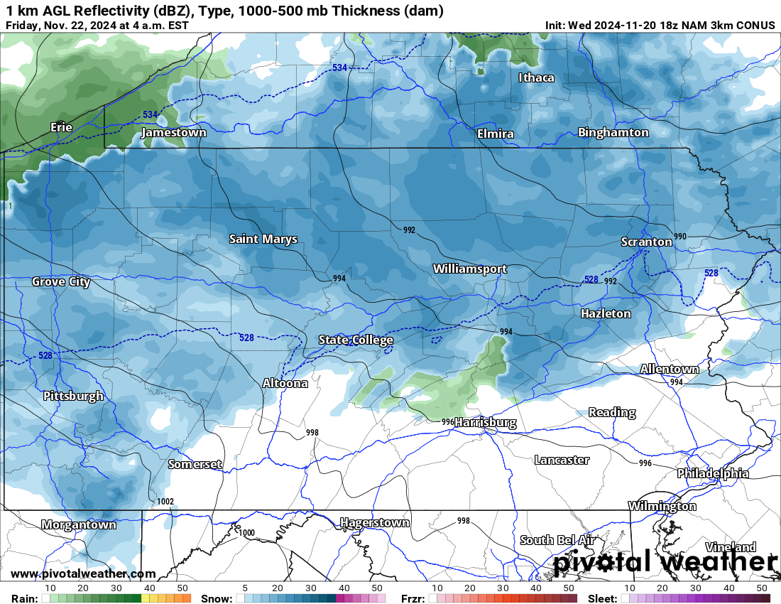
With that said, the Friday morning commute will probably be messy everywhere north of I-80, with roads likely impassible above 1500′ elevation. Here is Hi-Res NAM future radar for 4:00 AM Friday.
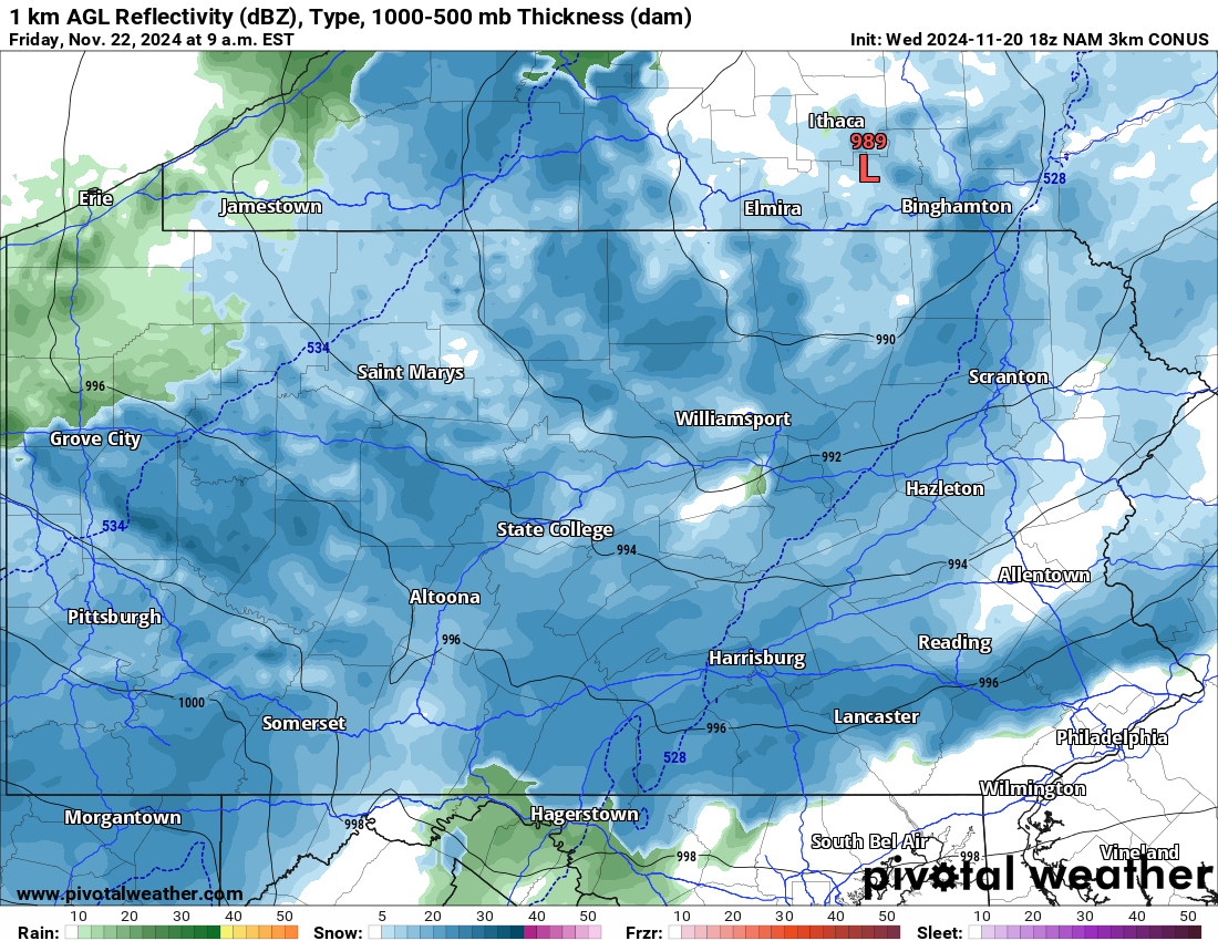
Now this is where things get a bit more questionable. The most recent model guidance has been carrying snow bands south, all the way into Southern Pennsylvania by mid-Friday morning. With temperatures a few degrees above freezing there, this would be more aesthetic snow on grass rather than impactful snow on roads.
There is the potential for an inch or two of snow especially on the ridge tops of Southern PA. But our concentration remains on the Alleghenies and the Northern PA mountains for the significant hazards. Below is future radar for 9:00 AM Friday morning.
Snow will taper off and/or change to rain by Friday afternoon, with the exception of the Laurel Highlands, where upsloping snow will continue through dinnertime Friday.
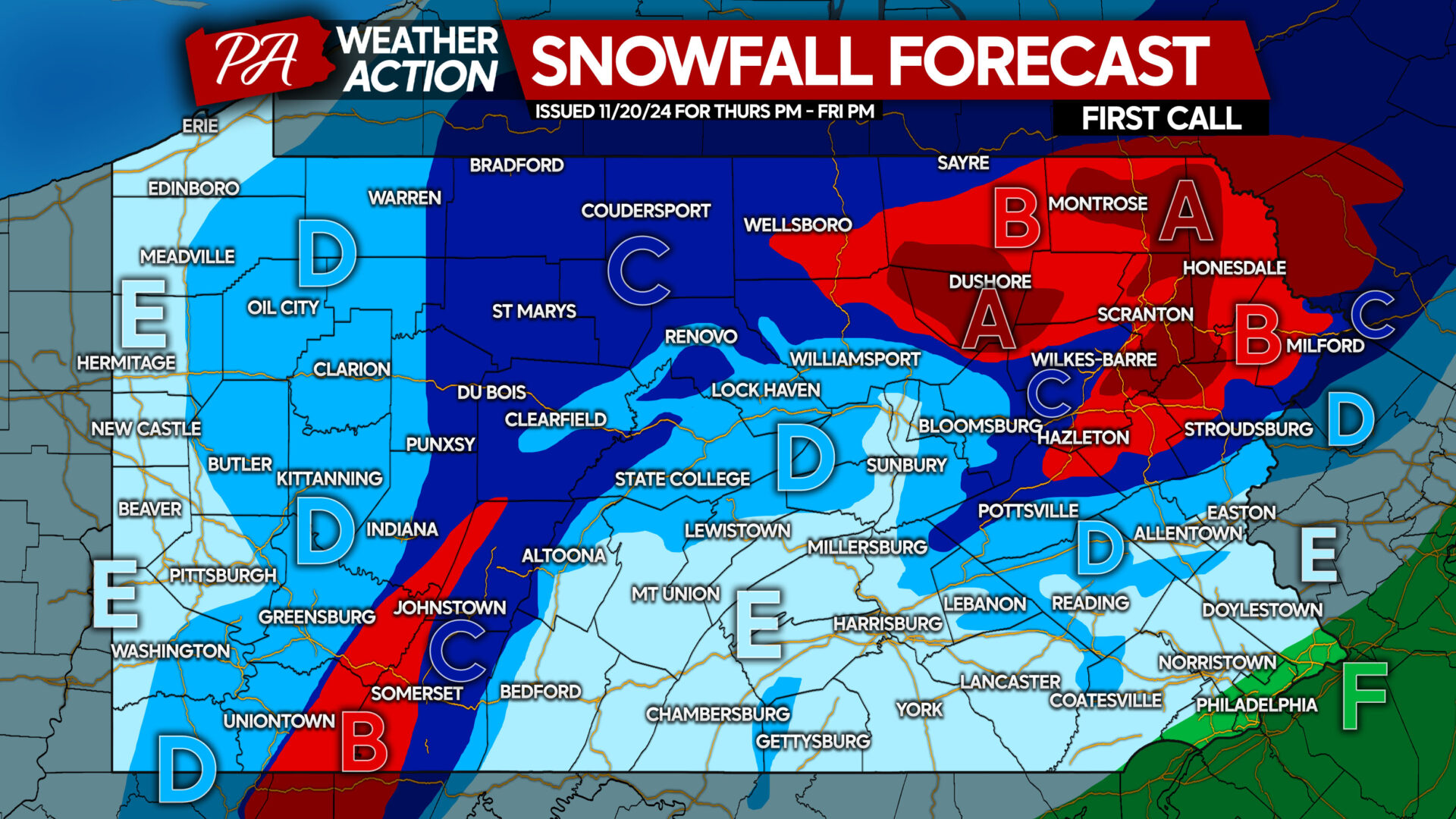
FIRST CALL SNOWFALL FORECAST FOR THURSDAY EVENING – FRIDAY
Area A: Snowfall accumulation of 8 – 12″ expected. Roads will become impassible by Friday morning, causing work and school closures. Isolated power outages are possible due to heavy snow and winds gusting to 30mph.
Area B: Snowfall accumulation of 5 – 8″ anticipated. Road conditions will become very hazardous Friday morning, likely causing work and school closures. Isolated power outages are possible.
Area C: Snowfall accumulation of 3 – 5″ expected. Roadways are likely to become snow-covered in the higher elevations, and slushy in the valleys. Work and school delays or cancellations possible.
Area D: Snowfall accumulation of 1 – 3″ anticipated. Roadways should remain mainly wet, with untreated surfaces possibly become slushy if snow is falling heavily.
Area E: Snowfall accumulation between a trace to 1″ expected on grassy surfaces only, after finally changing to snow for a period Friday morning.
Area F: Rain is expected from start to finish.
If friends or family would find this information useful, don’t forget to share it with them!

You must be logged in to post a comment.