Temperatures have crashed overnight setting the stage for the first winter storm of the season. Rain will be quickly changing to heavy wet snow for many areas beginning late this afternoon and evening. First, a look at the latest radar:
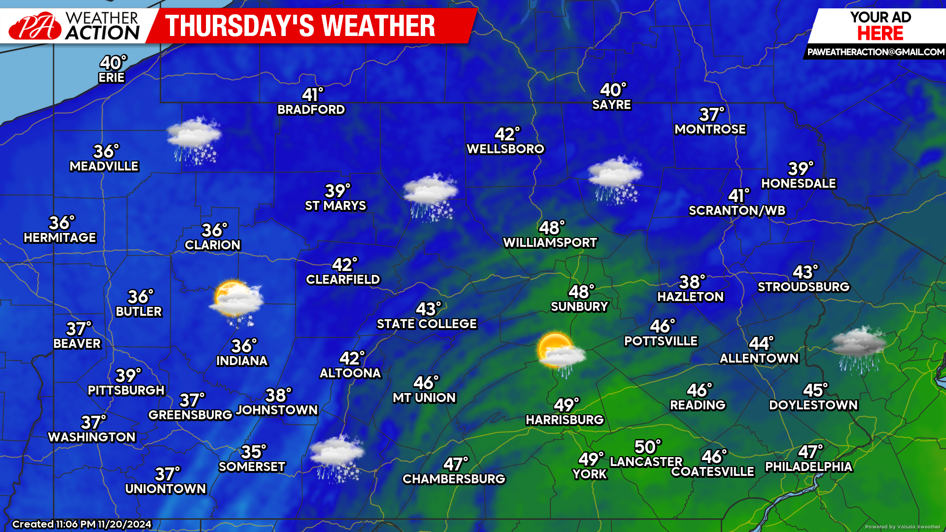
Today’s Weather Forecast: 4/10
Rain showers will change to heavy, wet snow across northeast Pennsylvania by the afternoon and evening hours. Elsewhere, a mix of rain and snow showers is possible.
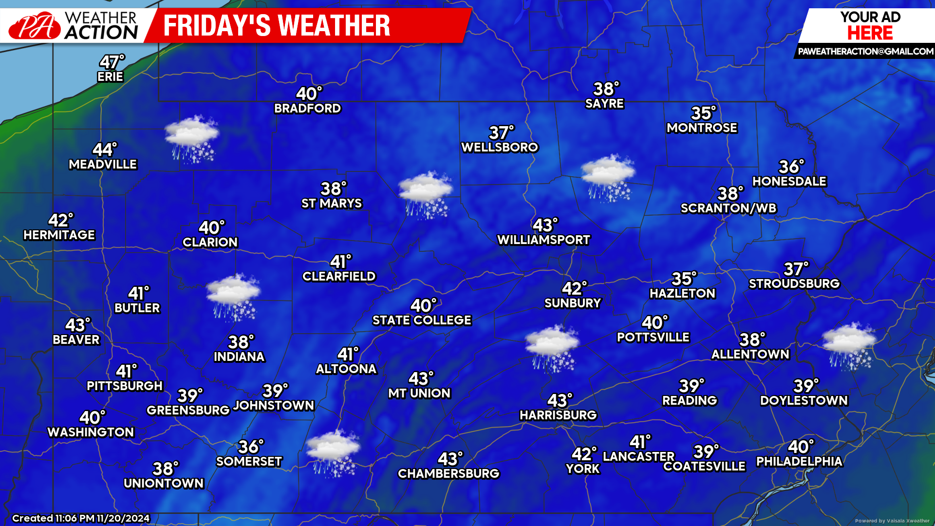
Friday’s Weather Forecast: 2/10
Widespread snow is likely for the majority of the state Friday. Accumulations will range anywhere from a coating for our lowest elevations to as much as a foot of snow for our highest elevations. Please drive with extreme caution.
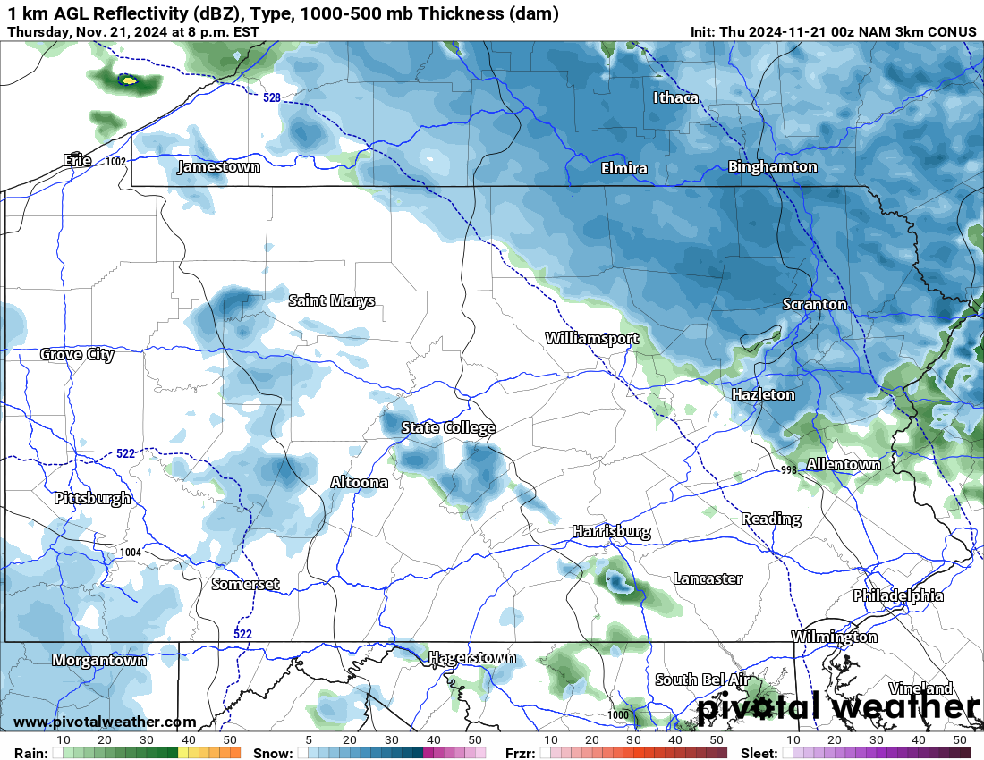
Hi-Res NAM Future Radar Valid for 8:00 PM this Evening:
Below is a look a the latest Hi-Res NAM at 8:00 PM this evening illustrating the expected snowfall to initially fall over all of northeastern Pennsylvania. These areas will see the most significant accumulations.
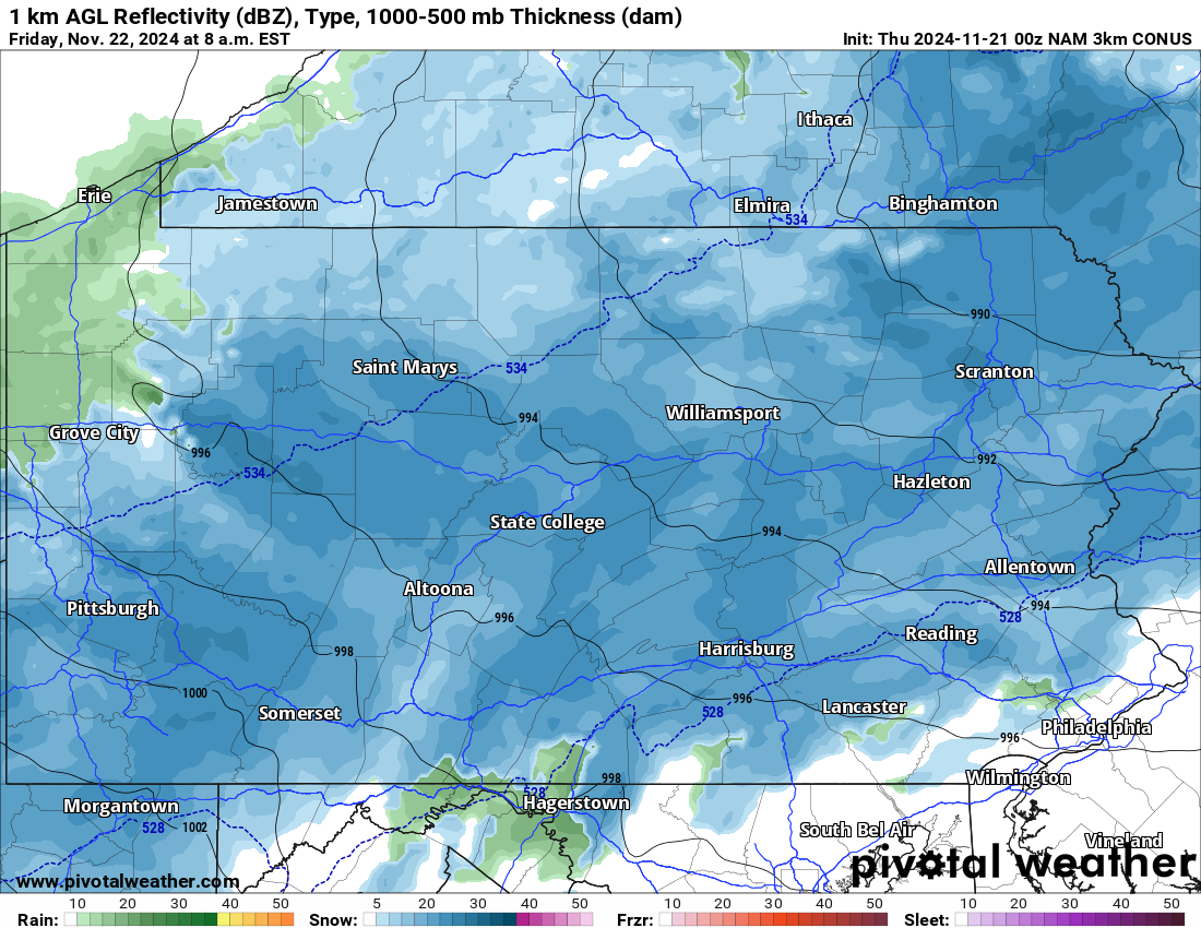
Hi-Res NAM Valid for 8:00 AM Friday:
Advancing the same future radar 12 hours shows the snow has expanded over much of the state. Friday morning is when most of the accumulations will occur. Temperatures will be marginal, therefore elevations will play a major role in just how much snow actually accumulates.
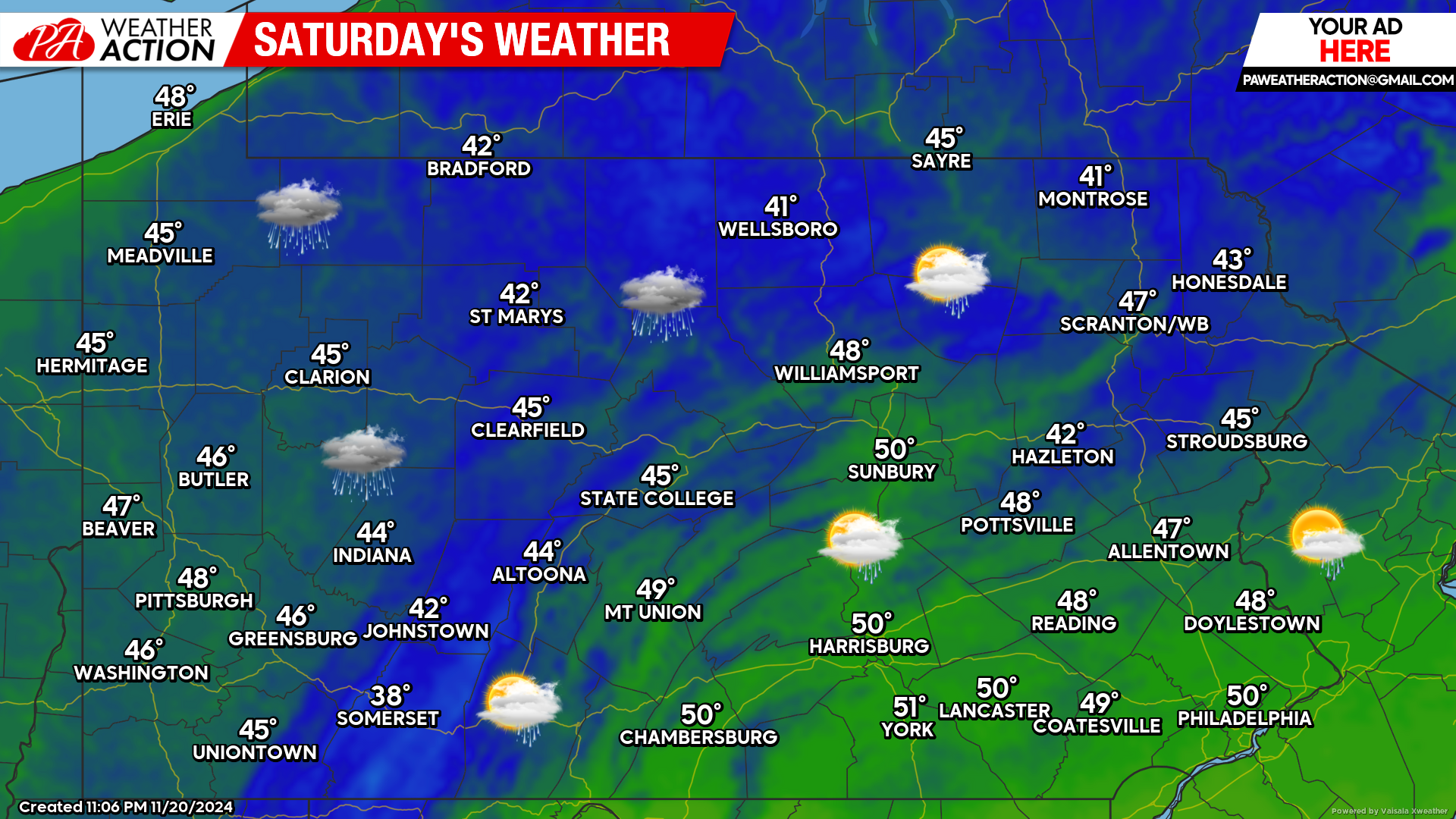
Saturday’s Weather Forecast: 7/10
A leftover drizzle and/or snow shower is possible Saturday, otherwise a mix of clouds and sunshine can be expected with temperatures in the 40s and low 50s.
If you missed our latest forecast for the first winter storm the season click the link below:
Our final call forecast will be posted later today for any last minute adjustments that is needed. Stay tuned!

You must be logged in to post a comment.