
This weekend’s snowstorm will have varying impacts around the state, with a potentially sharp cutoff in snowfall totals in parts of Southern and Eastern PA. While some may not see much in the way of travel disruptions at all, others may see hazardous travel due to snow-covered roadways. Let’s get into the specifics.
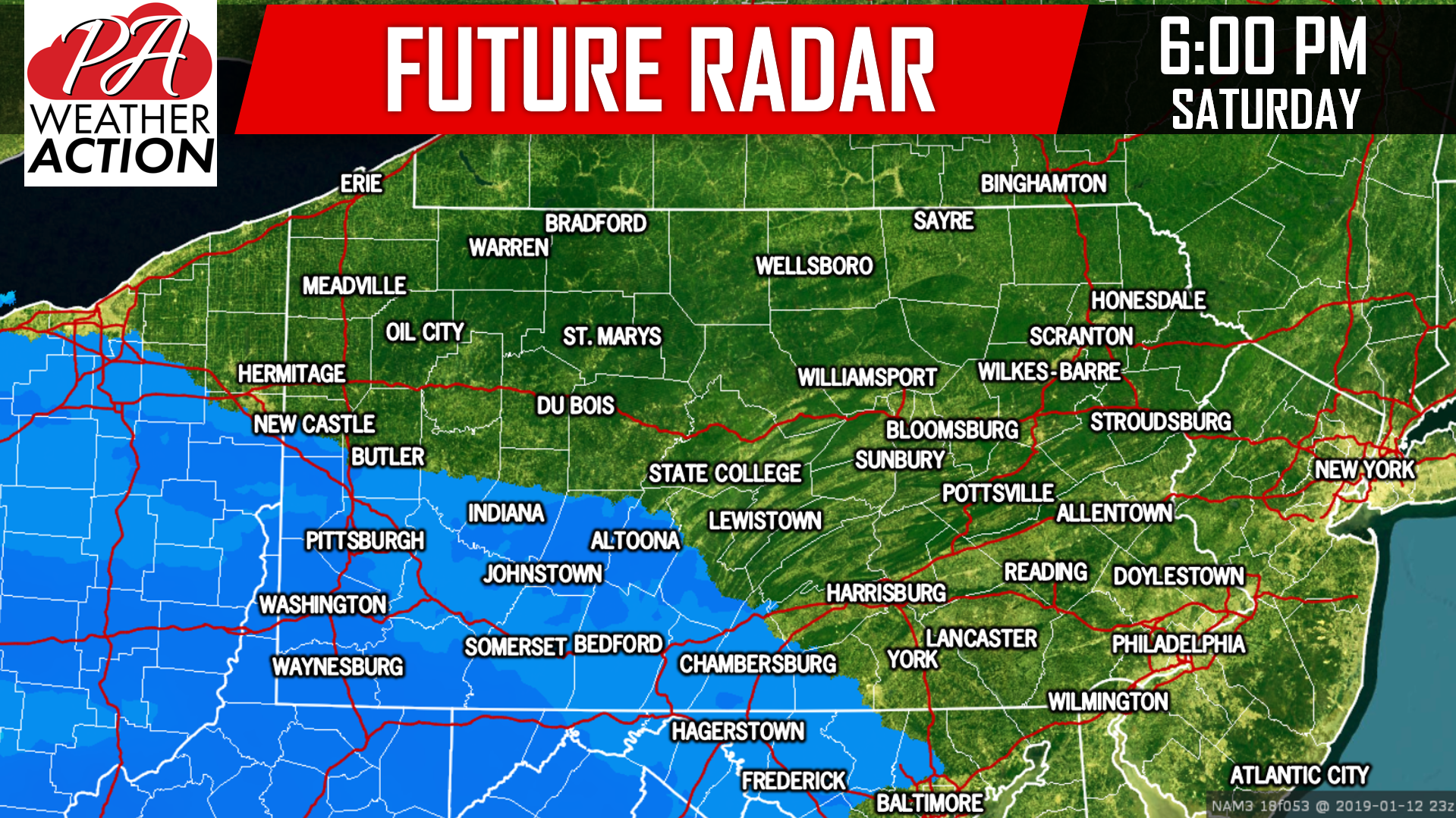
Snow will move into Western and Central PA Saturday Afternoon. Heaviest snowfall rates, around a half inch/hour, will be closest to the MD and WV borders in our southern counties. Below is the Hi-Res NAM model for 6:00 PM Saturday:
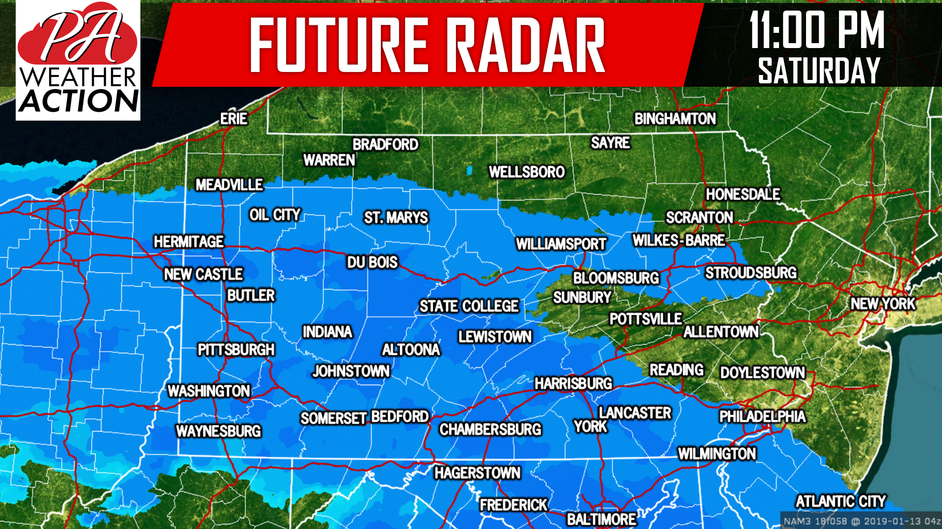
 As precipitation continues to move north and east Saturday Evening, it will run into drier air in Northern and Eastern PA. As a result, those areas will see a shorter period of snow with somewhat lower snowfall rates. By 11:00 PM, most locations south of i-80 will be experiencing light to moderate snow. Here is the future radar for 11:00 PM Saturday Evening:
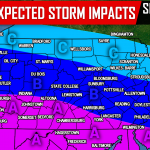
 Treacherous travel is expected south of the Butler-Lewistown-Lancaster line Saturday Evening. If unsure where those locations are, view the map above for reference. Temperatures in the mid 20s statewide will make for snowfall ratios closer to 15:1. This means we can expect a very fluffy snow, that will accumulate fast despite lacking intensity.
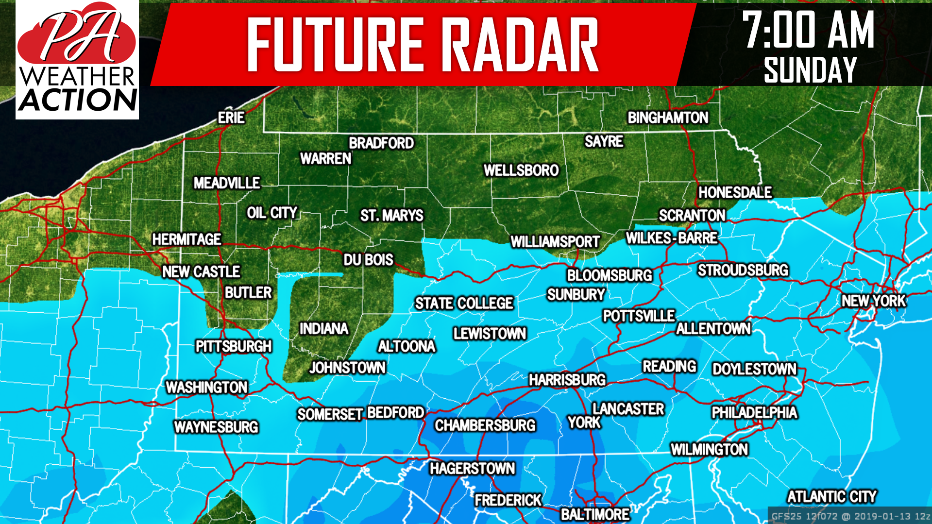
While snow may come to an end north of the PA Turnpike an hour or two before sunrise on Sunday, it is expected to continue in our southern tier counties until just before noon Sunday. View future radar for 7:00 AM Sunday Morning below:
FIRST CALL SNOWFALL FORECAST MAP
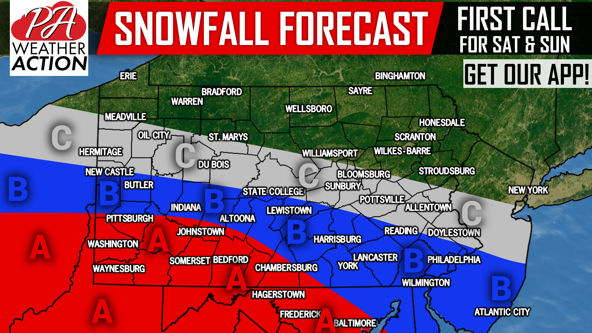 Area A: Snow accumulations of 3-5″ expected, with isolated amounts of 6″ possible. Snow-covered roadways Saturday Evening through early Sunday Afternoon will result in dangerous travel conditions. Worst conditions expected between 8 PM Saturday and 8 AM Sunday.
Area B: Snow accumulations of 1-3″ expected, with highest amounts closest to Area A. Slippery travel is anticipated Saturday Night, especially on untreated roadways. Worst conditions likely between 10 PM Saturday and 5 AM Sunday.
Area C: Snow accumulations of up to 1″ expected. Slippery travel possible Saturday Night on untreated surfaces.
Stay tuned for any forecast adjustments tomorrow or Saturday by downloading our free app >>> PA Weather App Link
Share your snowy forecast if in affected areas with friends and family using the blue button below!
You must be logged in to post a comment.