
This forecast has been updated. View our Second Call Snowfall Forecast & Timing for Monday’s Storm here >>> Updated Forecast Link
As of 5:00 PM Friday, temperatures across Pennsylvania ranged from near 80° in southeast PA to the low 40s in northwestern parts of the state. A strong cold front is making its way through the area, and will provide just enough cold air for a surprise springtime snowstorm in parts of PA Monday. As usual, model guidance split and is now in less agreement the closer we get to the storm. With nearly every potential winter storm this season, the trend among models has been to slowly lift the southern edge of the snow north. This storm looks to be no exception, and that trend was accounted for in Thursday’s Snowfall Potential map.
This will be a morning and afternoon event, meaning we will be fighting the high early spring sun angle, as well as temperatures in the 30s. This means it’s going to have to snow hard to accumulate on paved surfaces. Snow accumulation on paved surfaces will likely be about a third of what accumulates on the grass south of i80, and half of what accumulates on the grass north of i80.
STORM TIMING
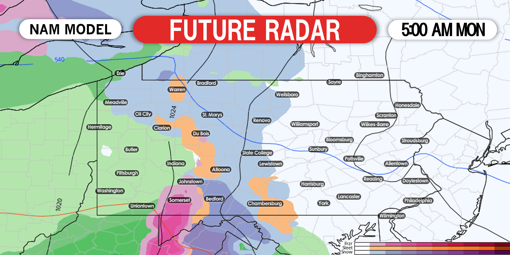
Precipitation will move into western and central PA between 2:00 AM and 5:00 AM Monday morning. It will fall as rain west of the Appalachians (west of Johnstown and Du Bois), and snow in the Appalachians. Below is future radar on the NAM model for 5:00 AM Monday morning.
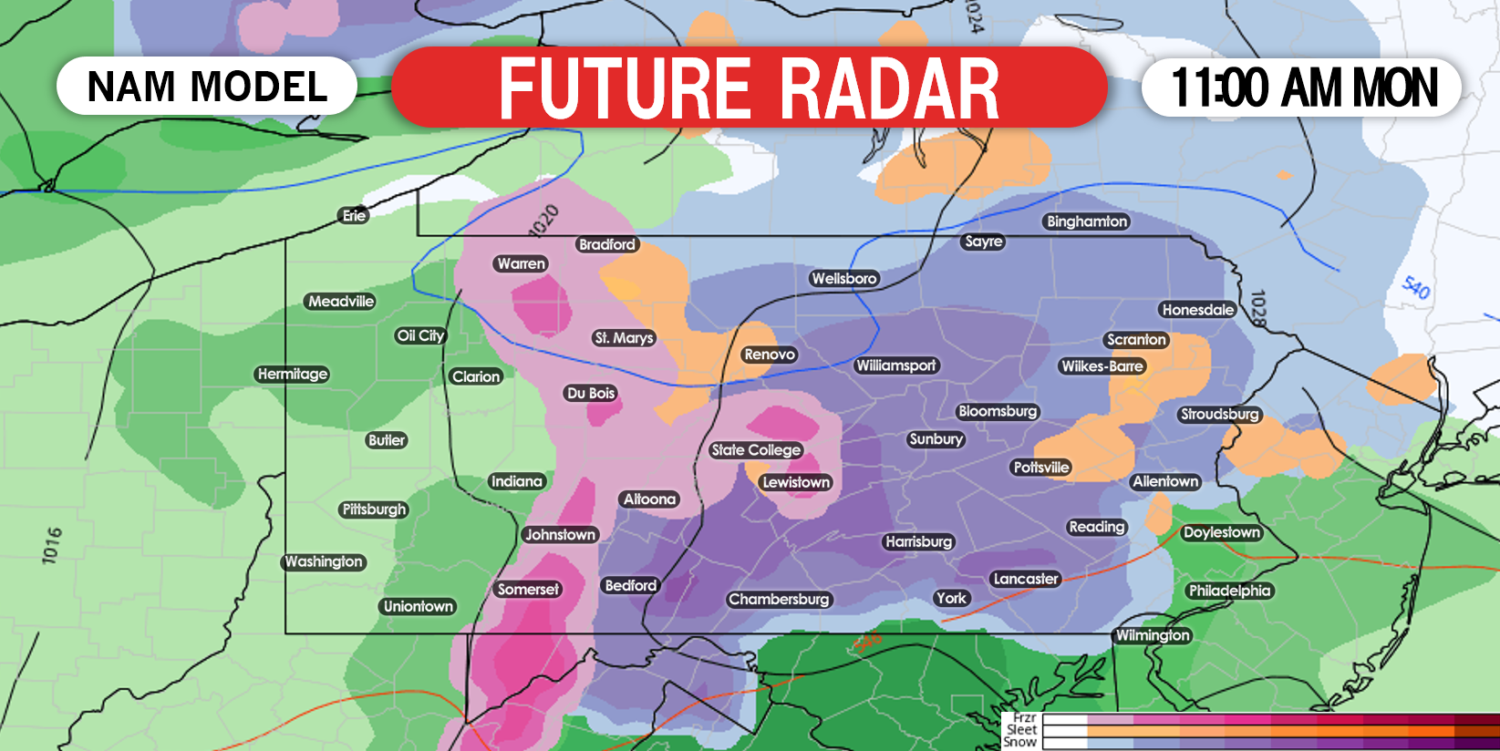
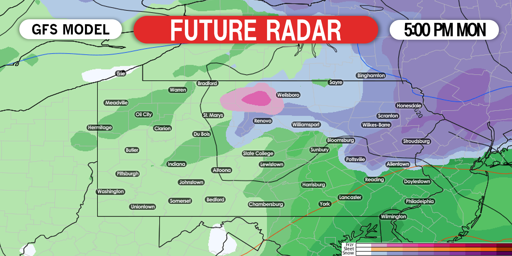
The rain/snow line will push north to about i80 (rain south of i80, snow north of i80), as temperatures begin to warm Monday afternoon. At the same time, precipitation will begin to move out of the state late Monday afternoon and early evening. Below is future radar for 5:00 PM Monday afternoon.
This storm presents no reason to stock up on extra items, as snow will begin to melt directly after it falls. However, travel will likely be slippery especially near i80 and north.
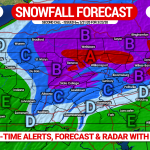
FIRST CALL SNOWFALL FORECAST FOR MONDAY
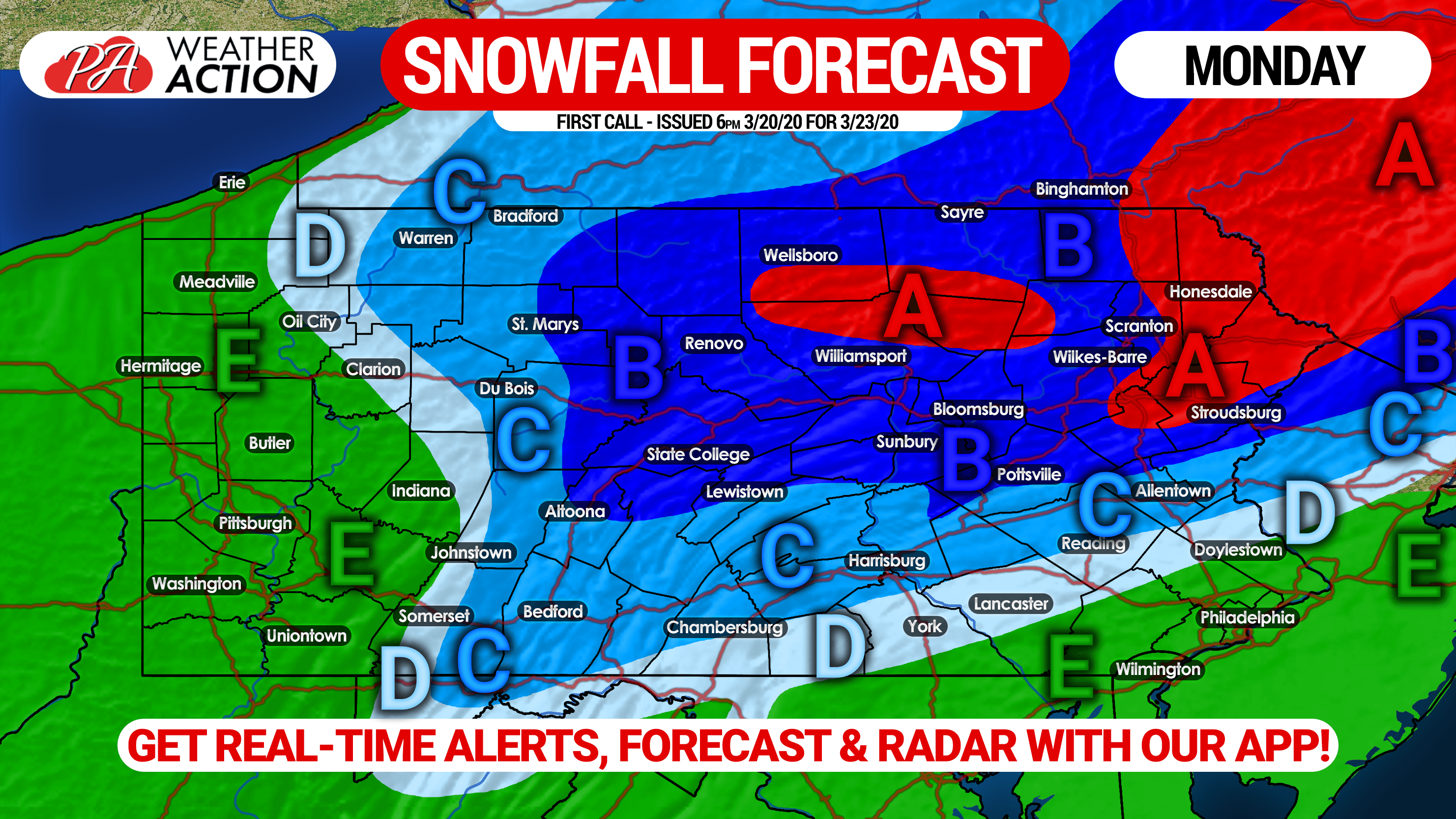
Area A: Snow accumulation of 5″ or more expected on the grass, with about 2 – 3″ on paved surfaces. Travel will be difficult, as these locations are mainly rural and roads may not be pretreated and/or plowed.
Area B: Snow accumulation of 3 – 5″ expected on the grass, with about 1 – 2″ of accumulation on paved surfaces. Travel will be slippery, especially in areas of over 1500′ elevation.
Area C: Snow accumulation of 1 – 3″ expected on the grass, with a coating to 1″ likely on paved surfaces. Roads may be slippery, especially in areas of over 1500′ elevation.
Area D: Snow accumulation of less than 1″ expected on the grass, with no accumulation anticipated on paved surfaces.
Area E: Plain rain is expected.
This forecast is still somewhat volatile, as we are still 60 hours out and models aren’t in full agreement. Check back here this weekend for the latest updates.
Track your forecast and the storm as it plays out with our newly updated app! Download it on iOS & Android here: Weather Action App Link
Don’t forget to share this forecast with your friends and family! Stay safe and stay tuned!

You must be logged in to post a comment.