
A stretched out low pressure system will rapidly intensify as it moves up the I-95 corridor. However, it won’t be a significant event for Pennsylvania because the low will just begin bomb out at our latitude. This will benefit Upstate New York, New England, and Eastern Canada much more so. For us, it’s a light event with perhaps moderate accumulations in parts of Northeast Pennsylvania.
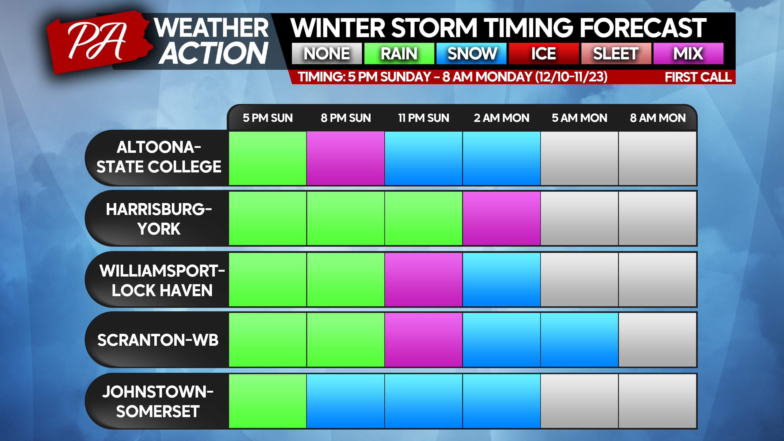
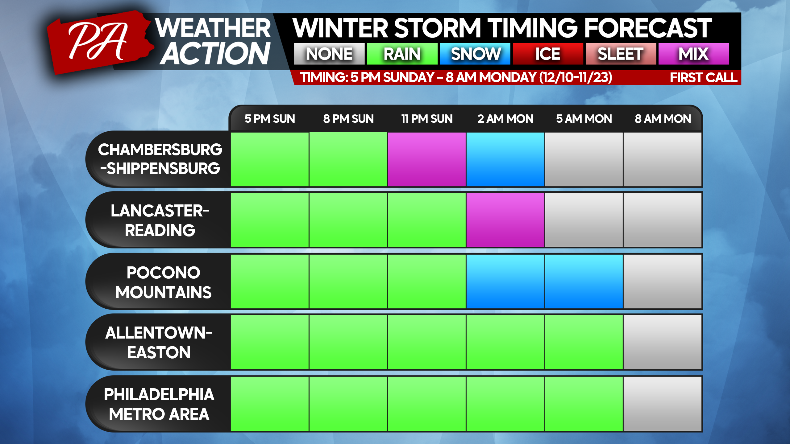
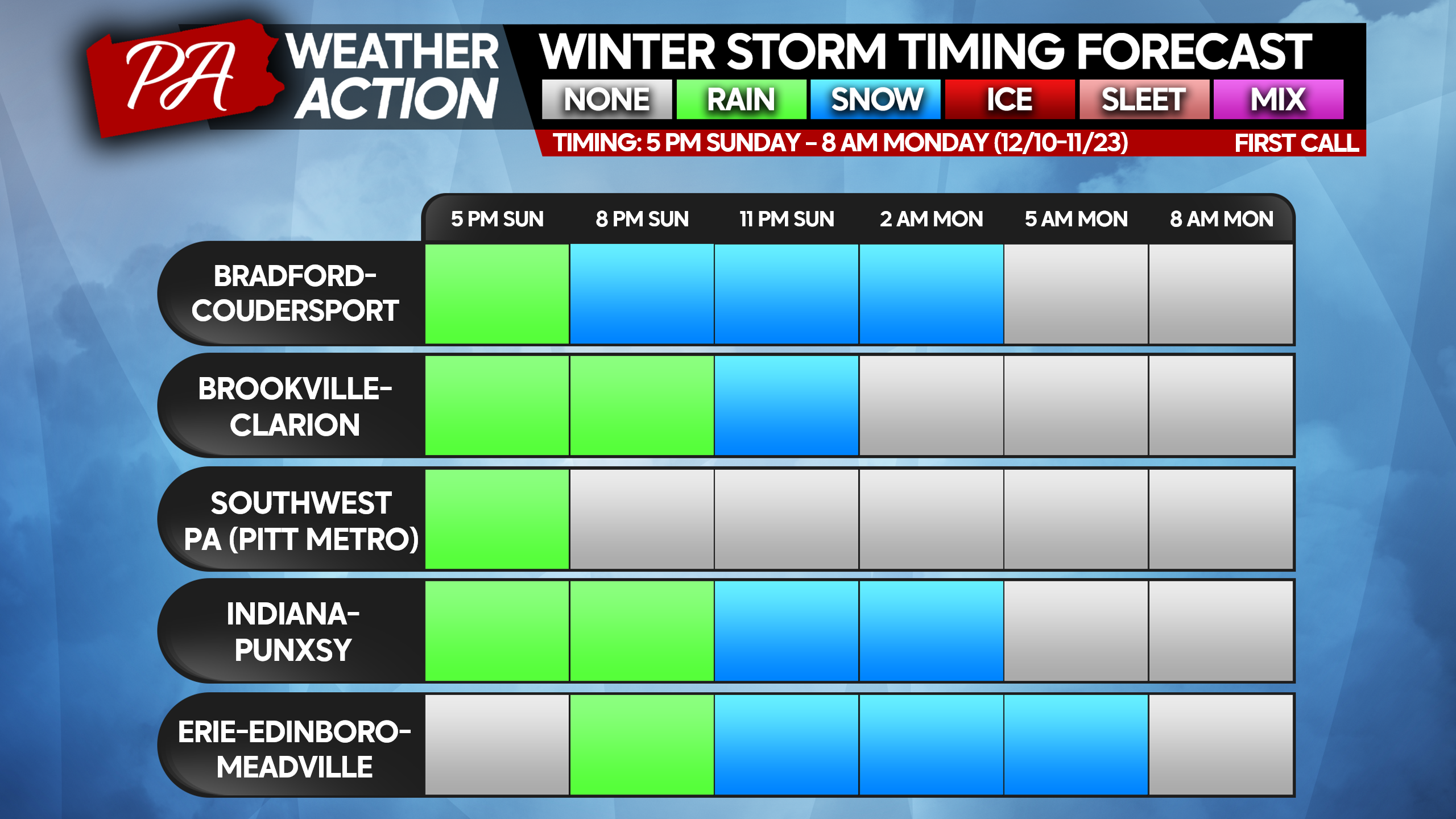
As we are still outside of mesoscale model range, which is able to pick out the fine details, it’s a bit too early for future radar. However, a new feature we will be doing are Winter Storm Timing Forecast tables. Timing is focused on when wintry precipitation is expected, and the more wintry precipitation expected in an area, the more cities from that area there will be. Find your area below!
We will be going live Saturday Evening at 8:30 PM, and you will receive an invite link through your email to join us and ask questions if you’d like!
FIRST CALL SNOWFALL FORECAST FOR SUNDAY EVENING – MONDAY MORNING
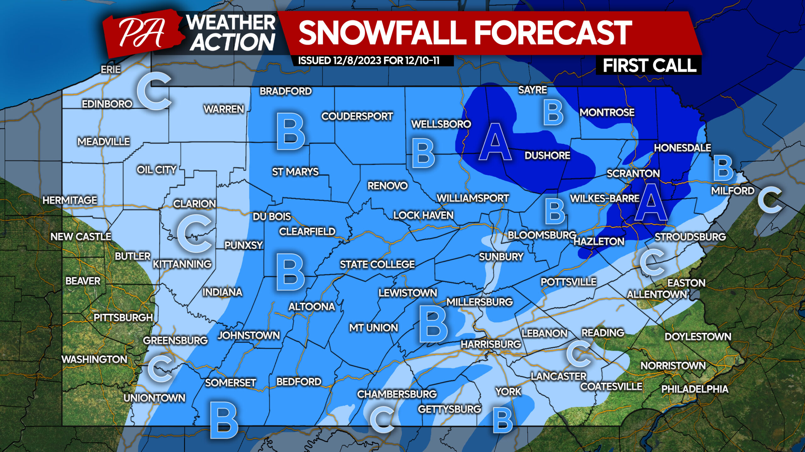
Area A: Snowfall accumulation of 3 – 6″ expected. Accumulations above 5″ will be exclusive to areas above 1800′ elevation. Snow-covered roads are expected Monday morning.
Area B: Snowfall accumulation of 1 – 3″ expected. Accumulations above 2″ will be exclusive to areas above 1200′ elevation. Snow covered roads are expected above 1200′ elevation Monday morning, with slushy road conditions possible under 1200′.
Area C: Snowfall accumulation of less than 1″ expected. Road impacts possible under moderate to heavy snow bands (if they occur), but generally not expected.

You must be logged in to post a comment.