
Good Saturday morning! A quick update here on where models are at with things.
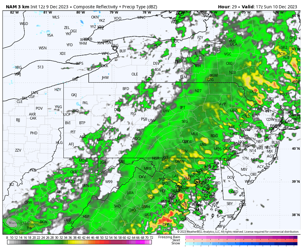
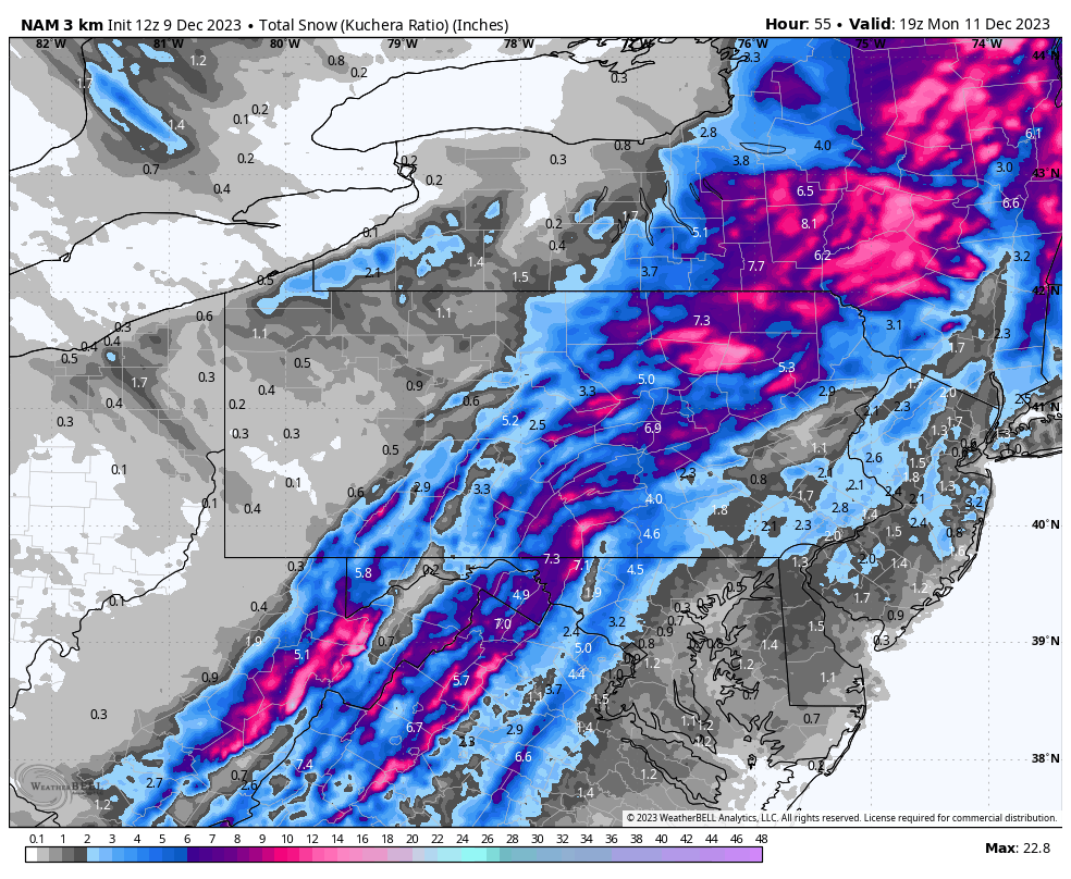
The NAM and Hi-Res NAM have been relatively consistent with sticking with a stronger, more amplified system that draws in more cold air. As a result, you get a much snowier solution. Here is the mid-morning run of the Hi-Res NAM followed by its snowfall output. As nice as it is for snow-lovers, it’s still probably a bit too exaggerated. The NAM has a tendency to overstrengthen storms.
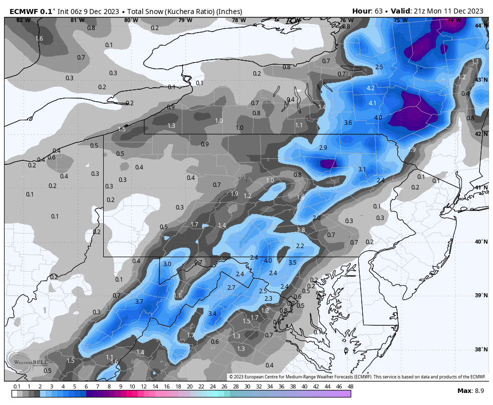
The latest European model run took a slight step towards the NAM, benefiting Southern PA more so. However, it still indicates a later changeover that’s more elevation-based and generally limits accumulations to under 6” in NEPA. Below is the latest ECMWF snowfall output.
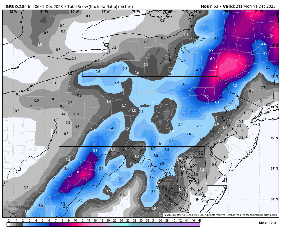
 Then comes the GFS, which has a habit of outputting wildly inaccurate solutions up until about 48 hours out and then trends towards reality. It’s important to note that global models such as the Euro, Canadian, and GFS aren’t able to project small mesoscale features and do worse with microclimates and the role elevation plays. Although the Euro does decent with elevation. Here’s the latest GFS snowfall.
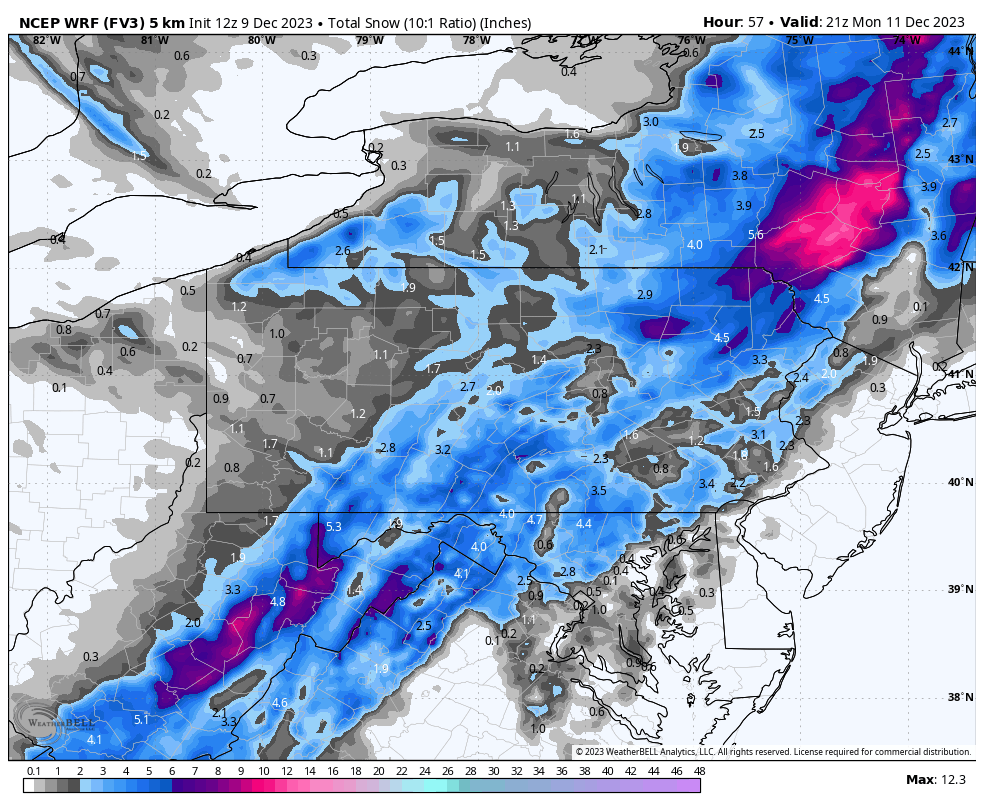
 A lesser used model is the FV3, another American short range model that isn’t spectacular but for this situation I feel probably does better than the Hi-Res NAM. Here is the FV3’s snowfall output.
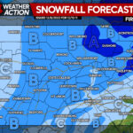
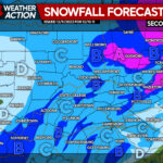
 So this is where we stand with the modeling right now. I’d say there have been trends the past 24 hours towards an earlier changeover with more precipitation left in areas within 30 miles I81 especially, on the eastern fringe. Northeast PA high elevations are looking more and more likely to see 4-8”. Stay tuned for our Second Call Snowfall Forecast later today.
You must be logged in to post a comment.