
First Call Snowfall Forecast for Tuesday’s Significant Winter Storm In Areas of Pennsylvania
As of 5:00 PM Saturday 2/10, our First Call Snowfall Forecast for Tuesday has been posted. Please tap the article above to view the latest information.
It has been a few weeks since you last heard from us, as winter took an extended hiatus. Despite temperatures today and Saturday being in the 60s in parts of Pennsylvania, we are talking snow – and potentially a significant snowstorm by Tuesday. That, combined with Super Bowl Sunday, may drown out the noise of this storm. Without further ado, let’s get into the details.
A storm will develop late Sunday down on the western gulf coast, and assemble ample gulf moisture with it as it tracks northeast into the Tennessee Valley Monday evening. From there, it will head into West Virginia before transferring to a coastal low that will form in the Chesapeake Bay early Tuesday morning. Cold air damming will not be in play much at all, meaning the rain/snow line will not head down the Appalachians as much as usual.
Temperatures will be falling as precipitation moves in, and will be in the mid 40s initially in Southern PA, meaning those areas will begin as rain. Closer to I-80, precipitation is more probable to start as snow and end as snow. Elevation will play a small role as well, but ultimately it comes down to temperatures a few thousand feet above our head as to when rain changes to snow. So this will not be a situation where the ridges are snowing for hours while nearby valleys are raining.
What will keep this storm in the significant category rather than major will be the lack of Greenland Blocking that would help to slow the storm down. The duration of only 10-12 hours of moderate to heavy snow even for the jackpot zones will be a limiting factor.
POTENTIAL TIMING FOR TUESDAY’S WINTER STORM
I would not recommend taking the rain/snow line on this model at each hour verbatim. It will shift in either direction with every run over the coming days. With that said, we do not expect any more than a 50 mile shift south or north. But that will make all the difference for many of us!
Precipitation will move in from south to north late Monday evening, beginning as rain for everywhere generally south of I-80. Below is Future Simulated Radar from the ECMWF (European Model) for 10:00 PM Monday.
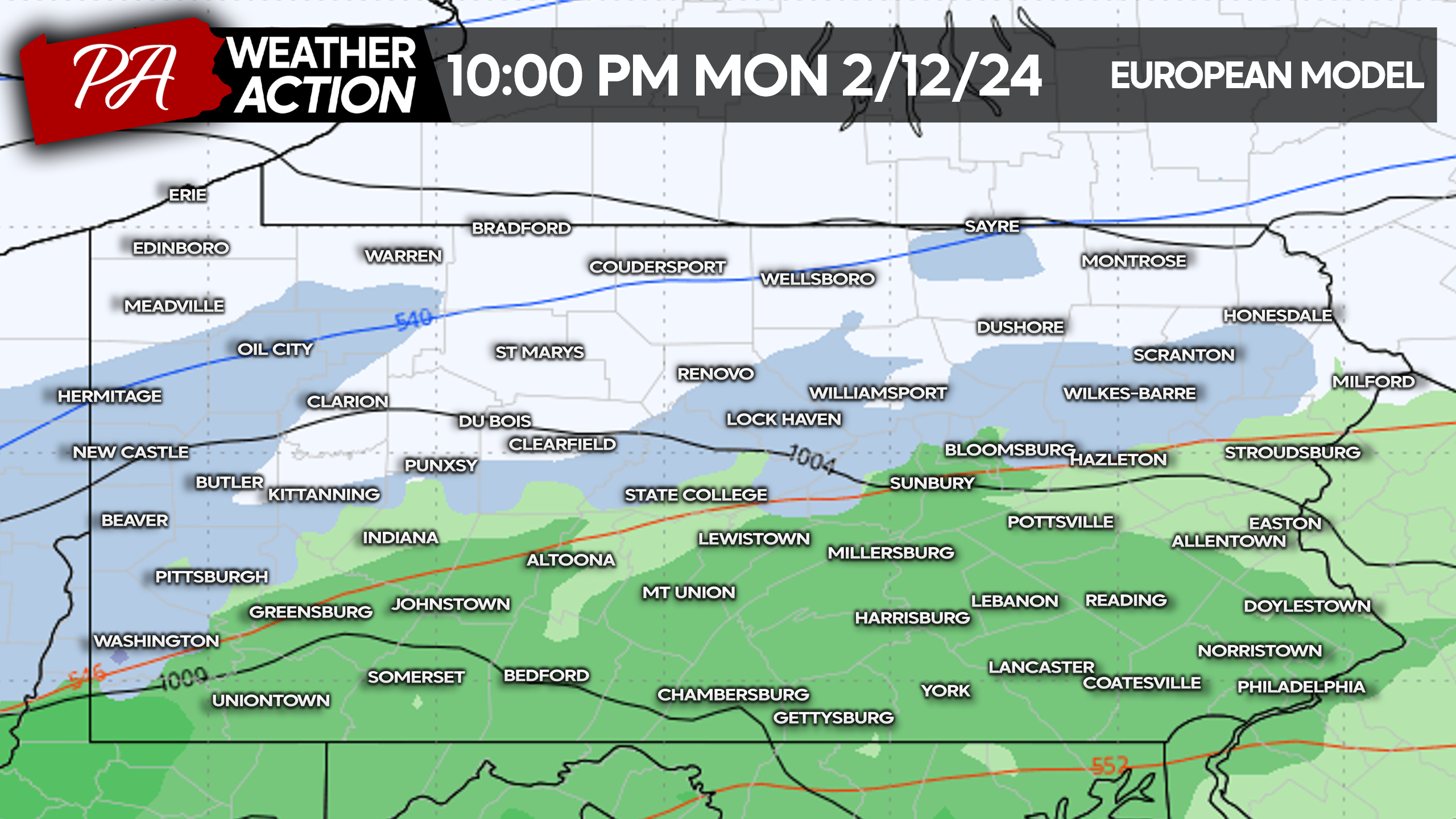
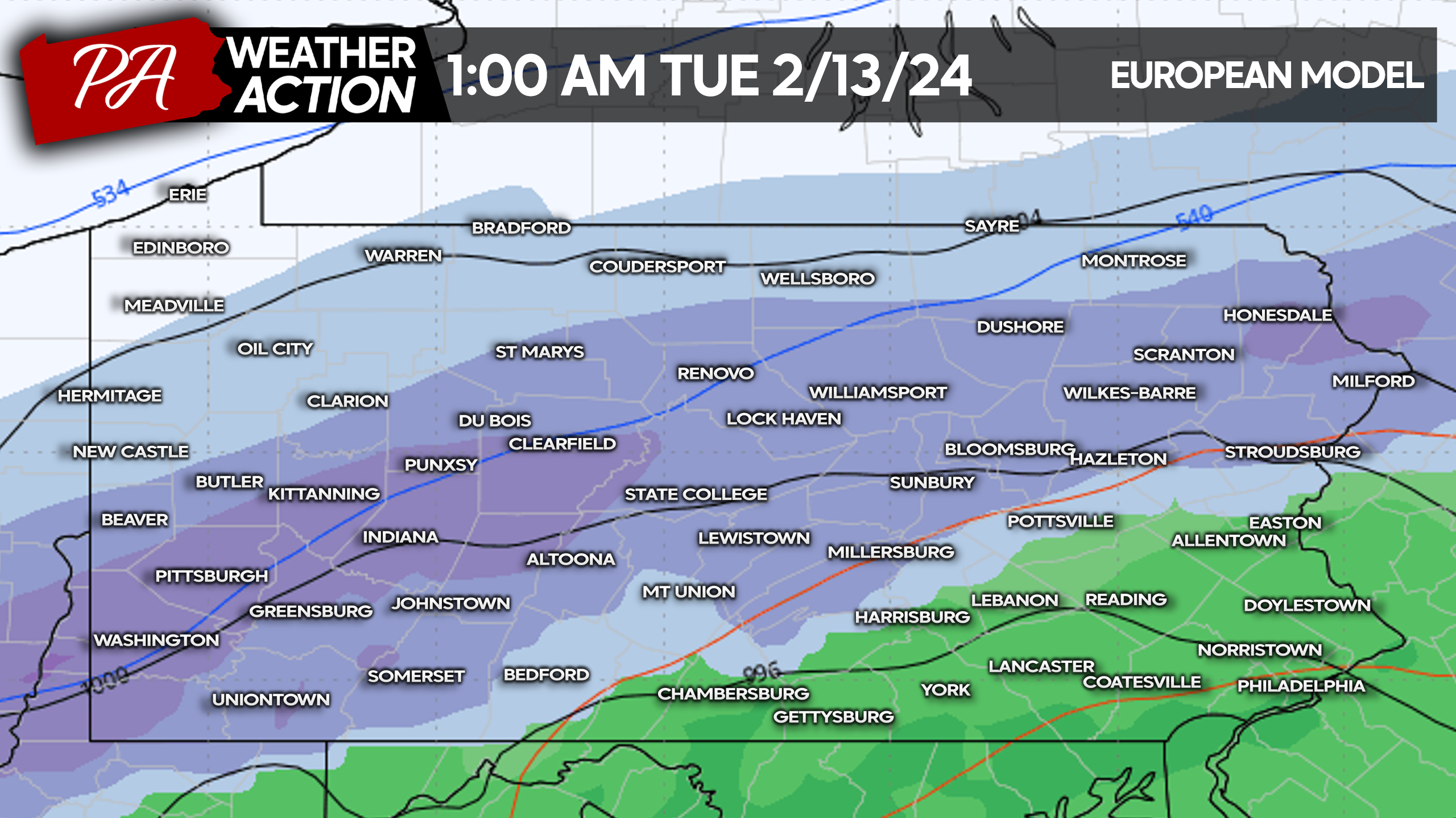
As precipitation rates begin to increase, dynamic cooling will take place from north to south. That will quickly change rain to heavy snow near and just south of I-80 by early Tuesday morning, around 1:00 AM Tuesday.
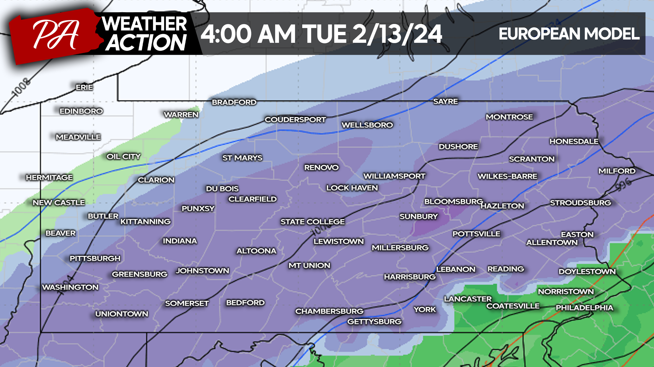
Road conditions may begin to deteriorate by the pre-dawn hours of Tuesday in much of the state north of I-78 in Eastern PA and I-76 in Central and Western PA. Below is European Model Future Radar for 4:00 AM Tuesday.
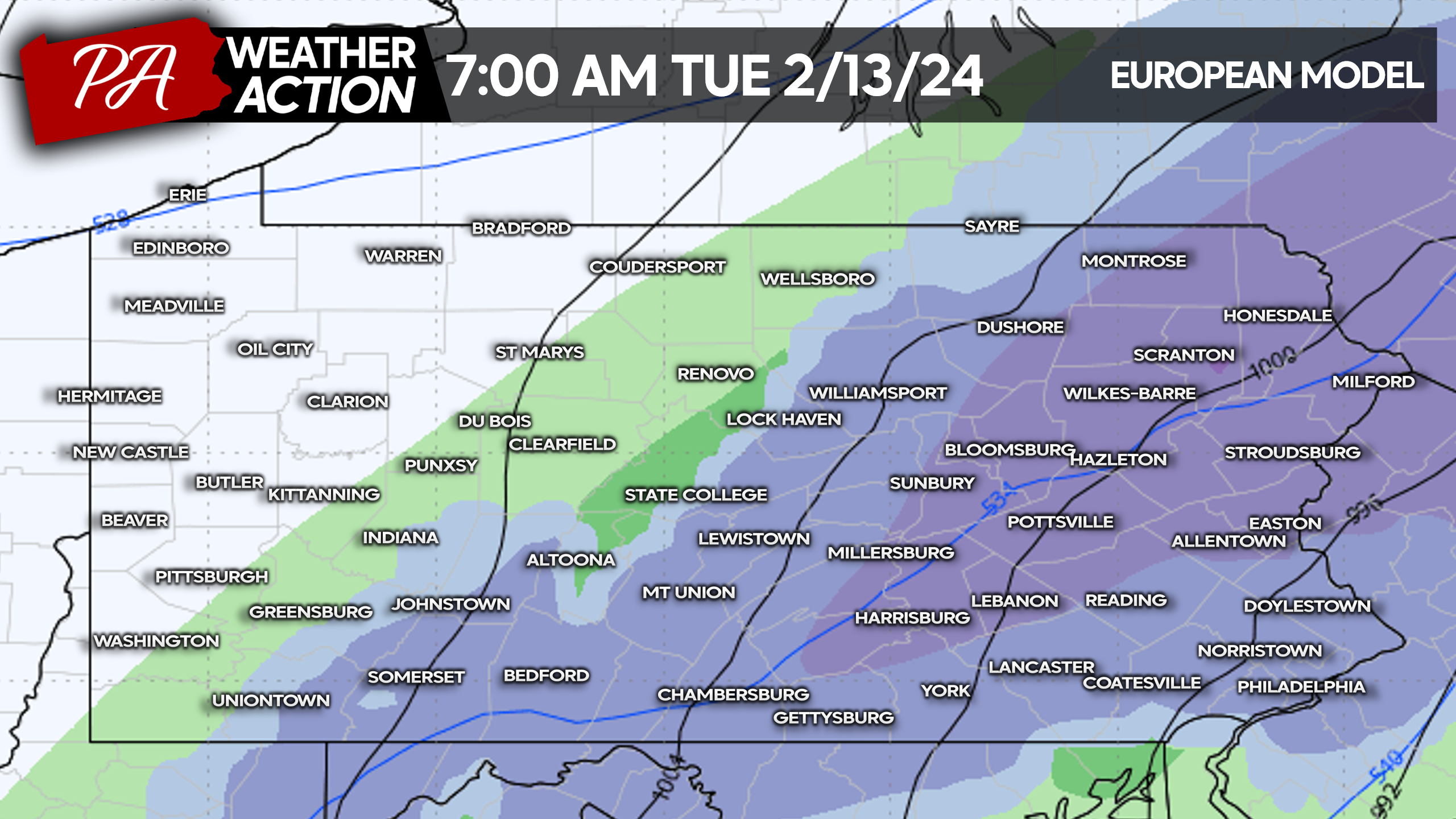
Safe to say if reality works out the way models are projecting and the way we are feeling it will, the Tuesday morning commute will not be happening in much of the state due to heavy snow and snow-blanketed roads. Tuesday morning will be the height of this storm. Here’s a look at 7:00 AM Tuesday Future Radar.
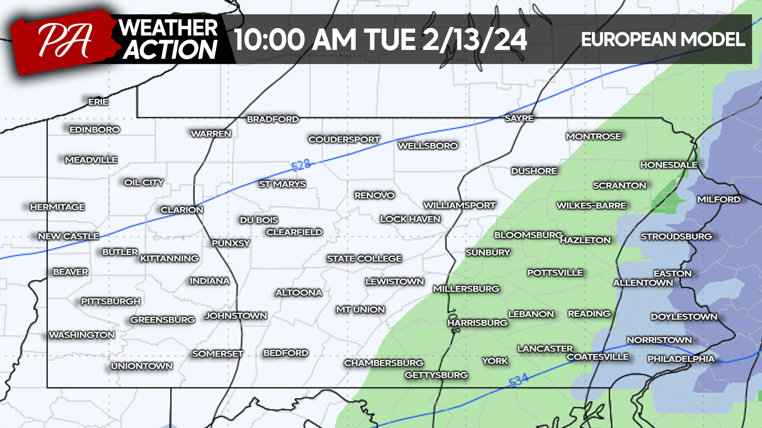
And by 10:00 AM Tuesday, the storm should be on its way out of Eastern PA as shown below.
FIRST LOOK AT TUESDAY’S SIGNIFICANT SNOWFALL POTENTIAL (2/13/24)
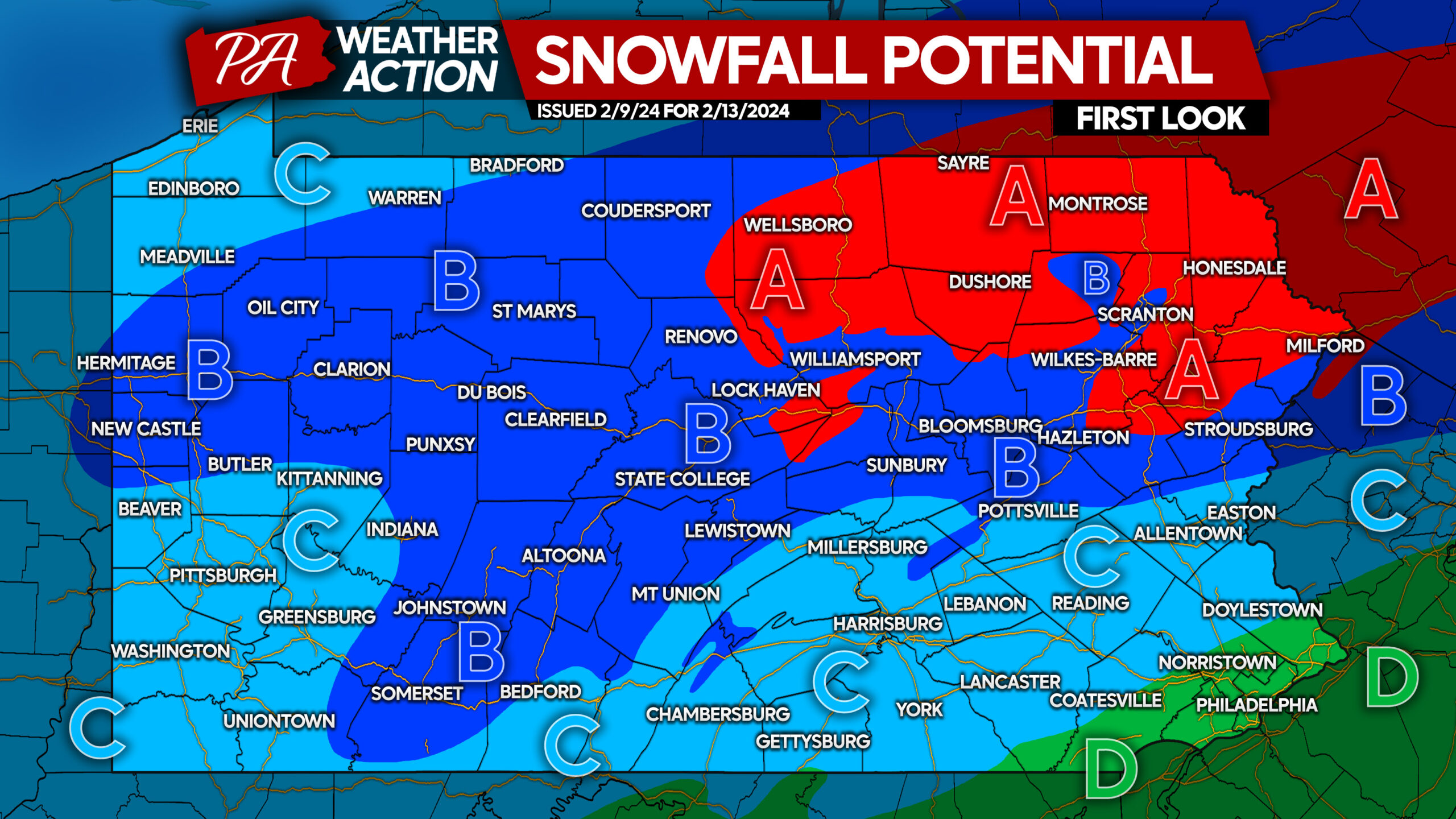
Area A: Potential snowfall accumulation of 8″+. Near-impossible commute possible Tuesday morning, although too early to make decisions.
Area B: Potential snowfall accumulation of 4″+. Treacherous conditions possible Tuesday morning, although too early to make decisions.
Area C: Potential snowfall accumulation of 2″+. Slushy roadways possible Tuesday morning, although too early to make decisions.
Area D: All rain expected, no travel impacts.
While it is early, it’s a good idea to share this post with friends and family, as the potential exists for this to be the largest storm of the season to date.
Don’t forget to download the PA Weather Action App here ~> PWA App Link
Finally, the majority of you reading our articles don’t follow us on Facebook! We only post worthwhile info, so consider following us below!

You must be logged in to post a comment.