
After Phil avoided seeing his shadow and made the prediction for early Spring, much-above-normal temperatures along with the rare appearance of blue skies offered a welcomed reprieve from the constant onslaught of moisture we’ve experienced since Thanksgiving. Much-above-normal temperatures will continue through this weekend, but winter will attempt to return next week.
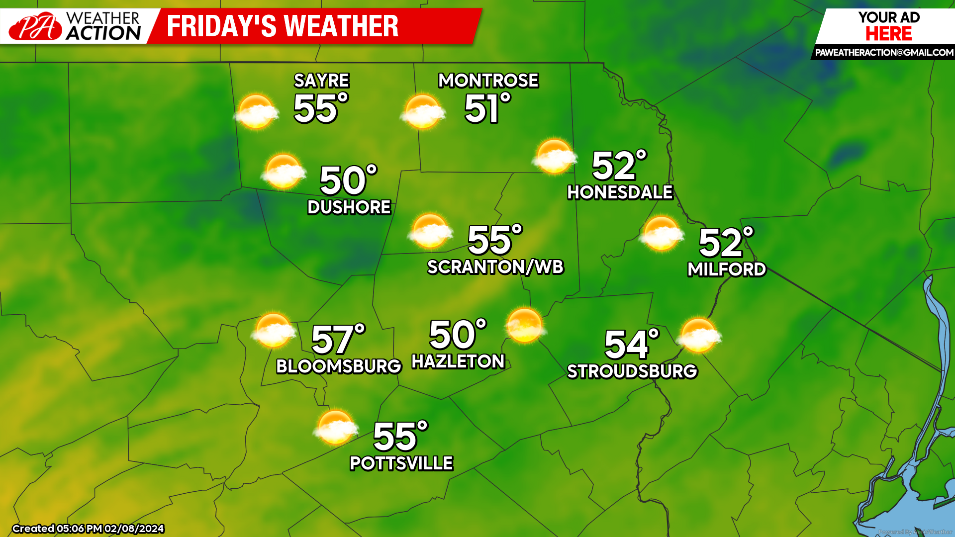
FRIDAY
A weak front will cross our area from west to east early Friday, possibly generating isolated sprinkles through midday. Otherwise expect partly cloudy skies with much above normal temperatures.
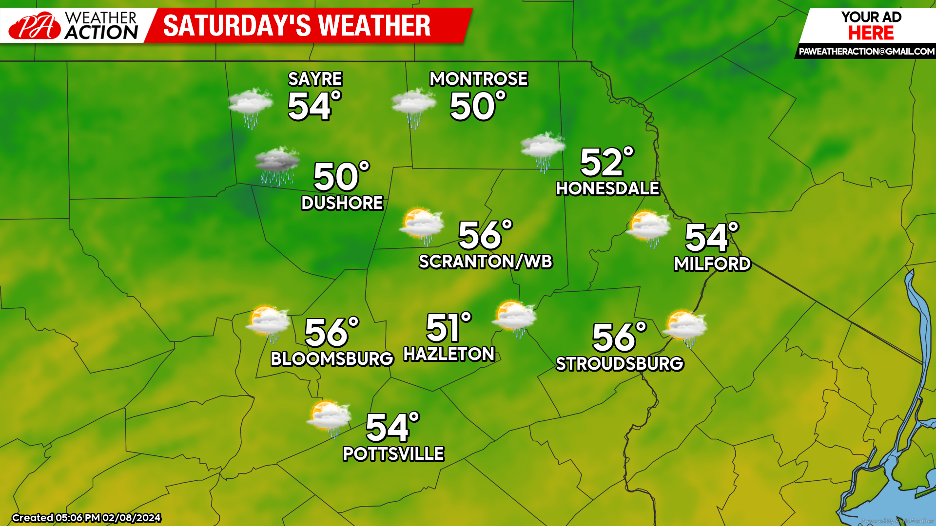
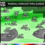
SATURDAY
A disturbance will race by our area and bring some showers across our area. Rainfall amounts will generally be between a tenth and a quarter inch. Temperatures will continue to be much above normal.
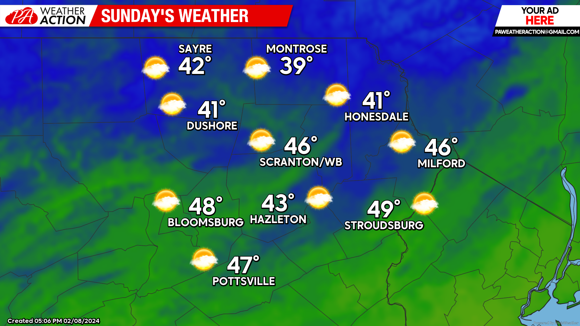
Sunday
A cold front will cross Saturday night to bring clearing skies and cooler, albeit still above-normal, temperatures for Sunday.
BEYOND SUNDAY
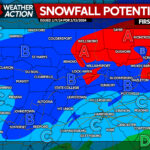
A disturbance will tease us with snow on Tuesday as it tracks along the Mid-Atlantic coast. As usual, the track five days in advance remains controversial. With the track expected to be south of our area, our area should at least remain mostly snow, so measurable accumulations are possible. Mix or rain is also possible at the start, especially in the valleys of the southern part of our area (which might remain slightly too warm for accumulations). Another disturbance could deliver wintry precipitation to the area later in the week. While more-wintry than this week, temperatures next week will likely average slightly above normal, with no arctic air expected.
You must be logged in to post a comment.