
UPDATE: FIRST CALL SNOWFALL FORECAST POSTED (WED 5:10 PM)
First Call Snowfall & Timing Forecast for Friday’s Snow in Pennsylvania
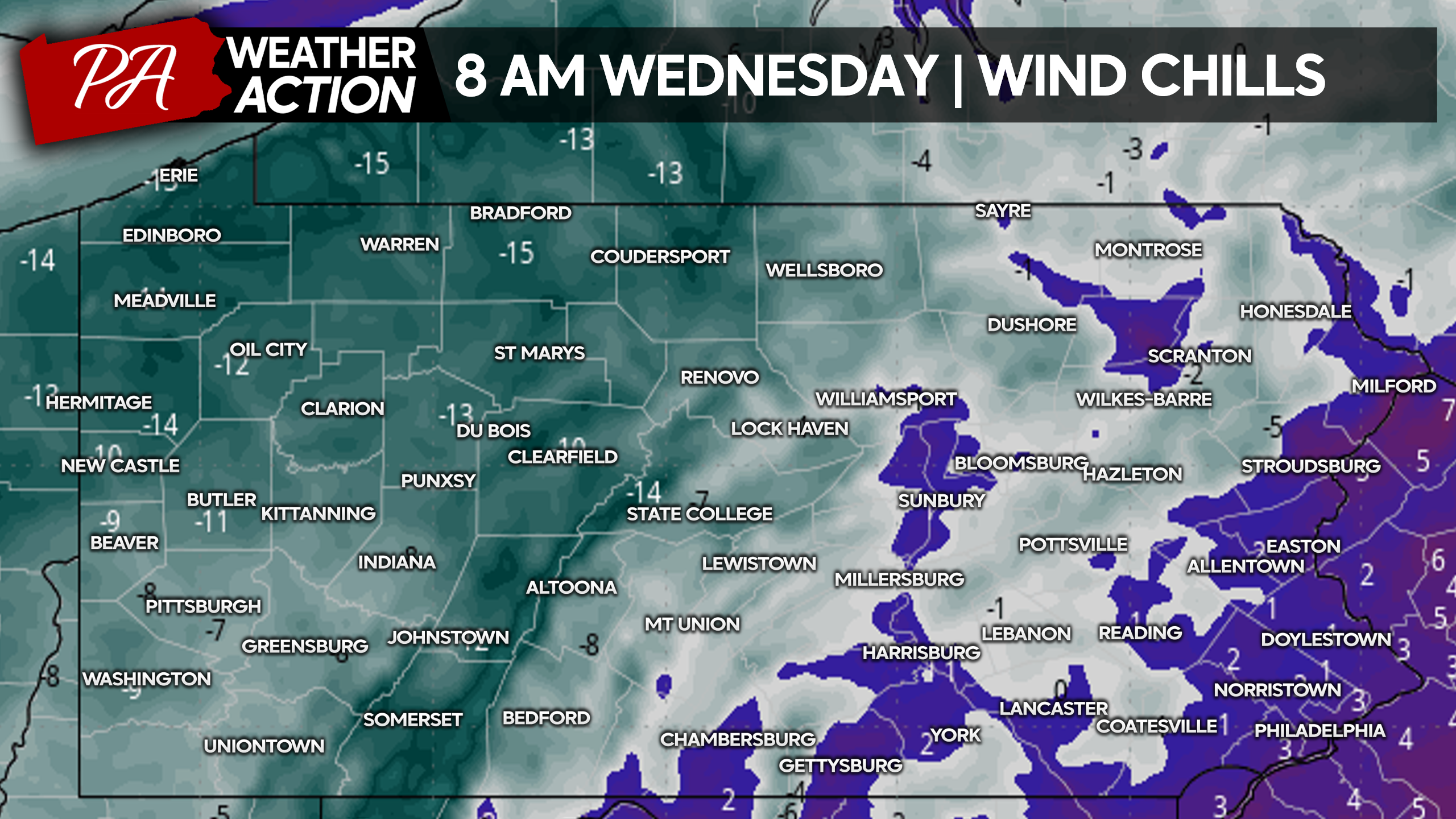
After 2-5″ of snow fell Monday into Tuesday Morning around Pennsylvania, we now face bitterly cold temperatures with wind chills of -20 to low single digits Wednesday morning. And they won’t improve much, only to either side of 0 during the daytime Wednesday. Here is a look at expected wind chills as you’re walking out the door Wednesday morning.
Temperatures will fail to reach above freezing on Thursday everywhere except along the Mason-Dixon Line in the valleys, meaning we don’t expect the current snow cover to melt before our next round of snow comes in. Now that is something we have not seen since February 2021, snow on snow!
That means when measuring snow on Friday, be sure to do in on a previously cleaned surfaces such as untreated paved surfaces. Temperatures will be well below freezing when snow is falling, meaning it will immediately stick to all untreated and even treated surfaces. As we saw with this recent snow, most treated surfaces still become snow covered very easily.
POTENTIAL SNOW TIMING
Snow looks to start in the early hours of Friday morning from west to east, continuing through the morning. It’s then expected to diminish from west to east late Friday afternoon through mid evening. If current model guidance holds, we will likely be looking at school and potentially business cancellations on Friday.
FIRST LOOK AT FRIDAY (1/19) POTENTIAL SNOWFALL
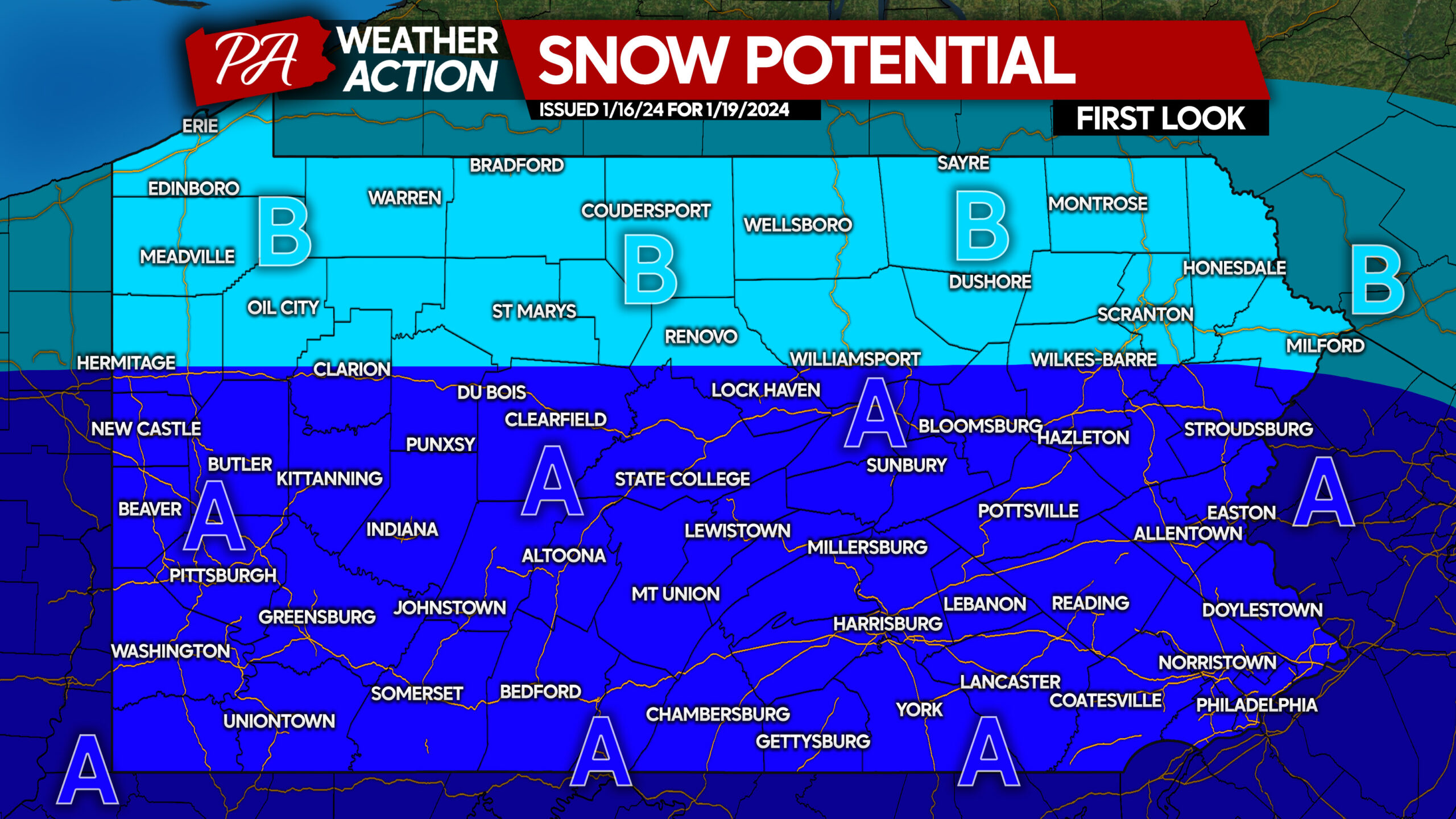
Area A: Potential for moderate snowfall accumulation Friday. Temperatures will be in the mid to high 20s, meaning snow-covered roadways are likely if snow falls.
Area B: Potential for light snowfall accumulation Friday. Temperatures will be in the low 20s, meaning snow-covered roadways are certain if snow falls.
We are three days away from this potential, so it’s not a guarantee. We will have a First Call Snowfall Forecast posted on Wednesday.
Don’t forget to share this forecast with friends and family, as more cancellations are possible Friday!
You must be logged in to post a comment.