
We have been spoiled, there is no other way to put it. The amount of perfect weather we’ve experienced since August has been unfathomable in Pennsylvania. To the point it feels like as winter approaches, we have to get used to caring about the weather again. We developed an expectation for great weather the last few months.
Not to rain (or snow) on your parade, but that’s all coming to an end as we descend into another winter. While this upcoming cold snap will be short lived and we will return to November normals shortly after, the pattern may be loading up for December.
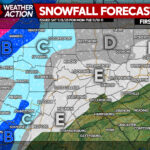
Yesterday, we posted an article about the first snow potential in parts of PA. That can be found here.
In today’s article, we will be highlighting the bitter cold temperatures that will grip the region for a few days. Blustery winter conditions are inbound!
Temperatures on Sunday night will crash as a cold front moves through after the low pressure that will give Ontario an early season snowstorm departs. High temperatures on Monday will be in the 30s and 40s in PA, with the coldest anomalies in Western PA.
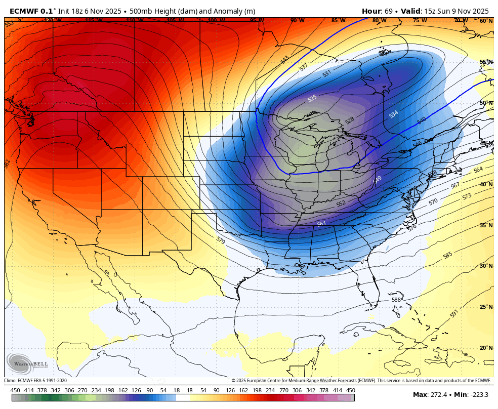
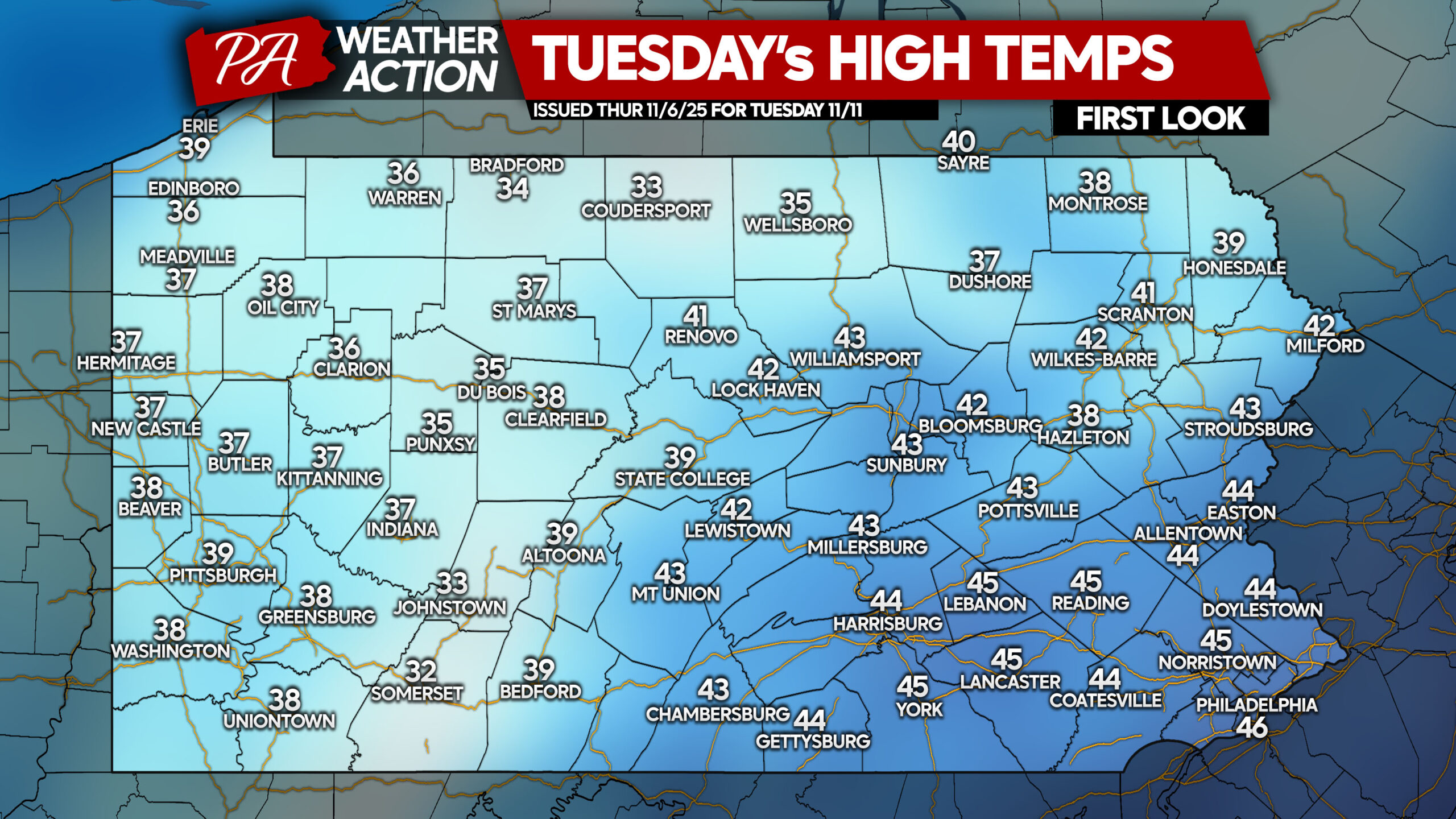
By Tuesday, the heart of the trough will be centered overhead with west winds of 15-20mph and gusts of 30-40mph. Below are the highest temperatures we will reach on Tuesday.
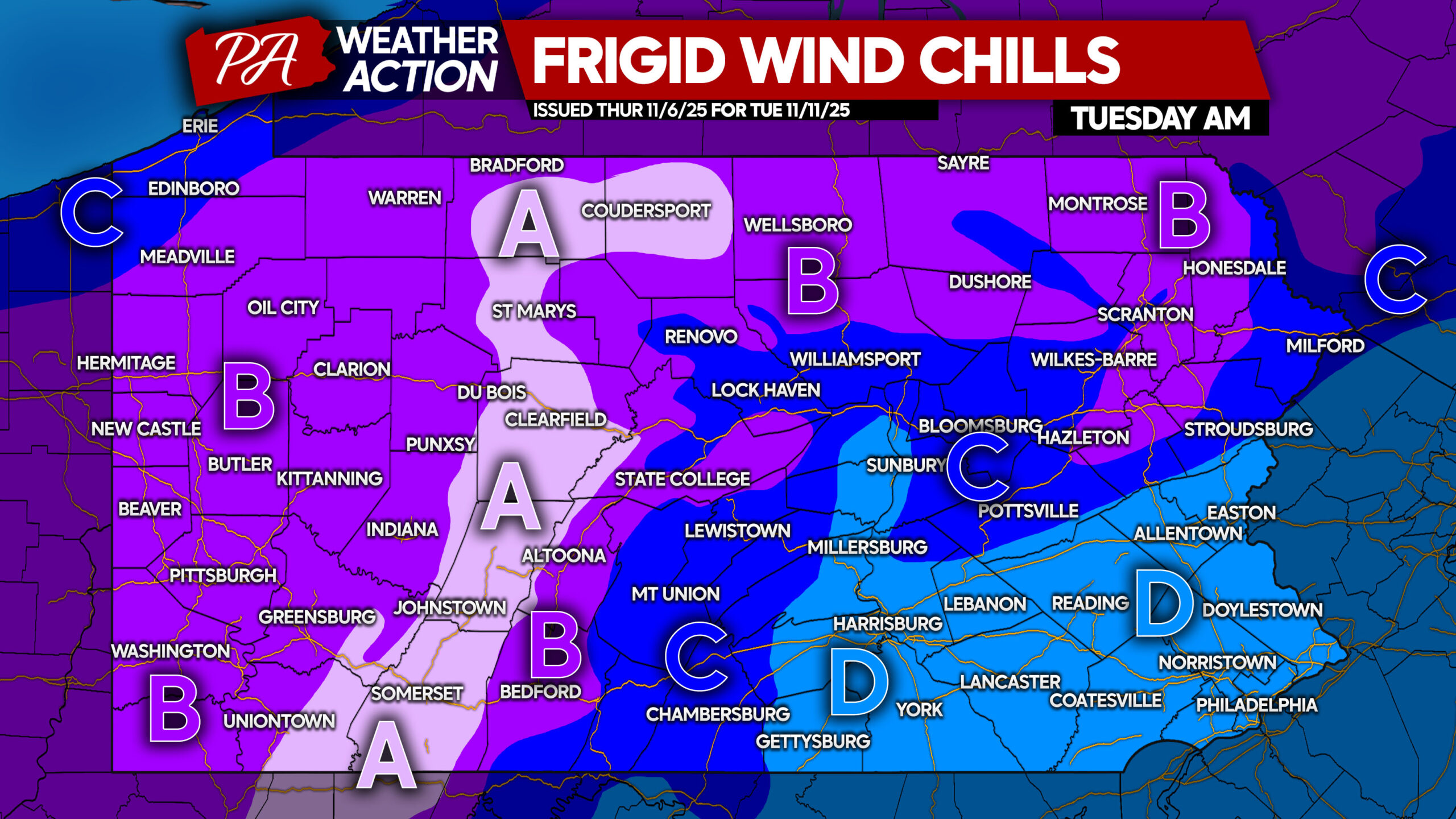
Now if that doesn’t look to bad for us hearty Pennsylvanians, which it’s not, well unfortunely it gets worse. Wind chills Tuesday will be much colder, with high elevations in the single digits!
FIRST LOOK WIND CHILLS FOR TUESDAY MORNING IN PA
Be sure to turn the water off in any uninsulated/unheated buildings to avoid frozen and broken pipes!
Area A: Wind chills of 5-10° are expected Tuesday morning.
Area B: Wind chills of 10-15° are expected Tuesday morning.
Area C: Wind chills of 15-20° are expected Tuesday morning.
Area D: Wind chills of 20-25° are expected Tuesday morning.
You must be logged in to post a comment.