
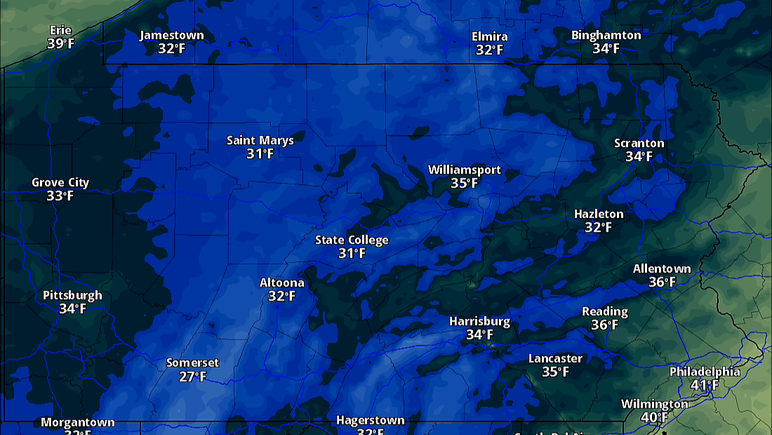
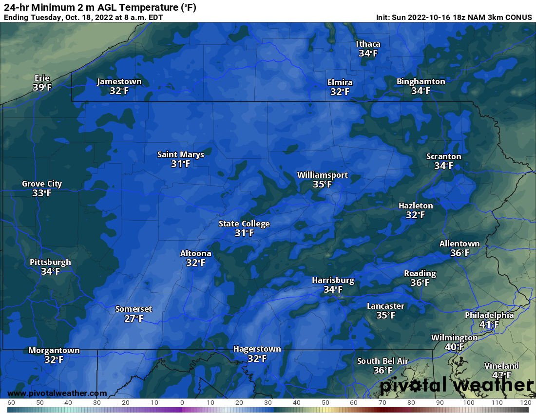
The growing season will come to a close in many areas this week, as widespread freezing temperatures will occur Tuesday morning. Wednesday morning and Thursday morning will also be very cold. Below are lows for Tuesday morning.
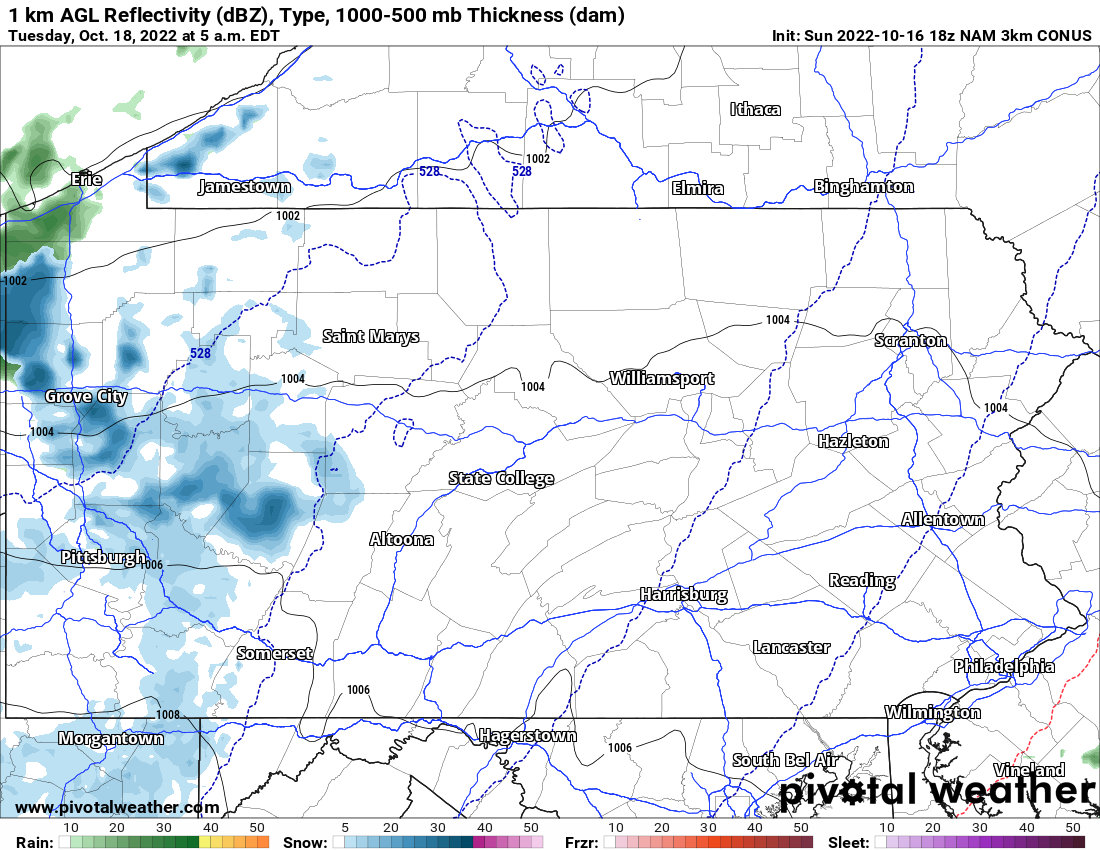
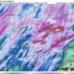
The more exciting aspect of this deep cold front will be first snow for much of Western PA. First flakes will occur Monday Night in the form of lake effect snow showers. Here is future radar for 5:00 AM Tuesday.
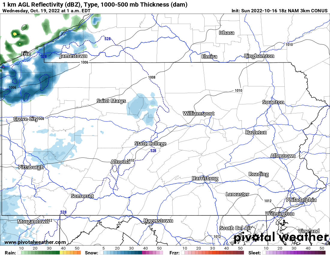
Flurries are then expected across the western half of PA Tuesday, before heavier snow showers are again possible late Tuesday evening and early Wednesday morning. Below is future radar for 1:00 AM Wednesday.
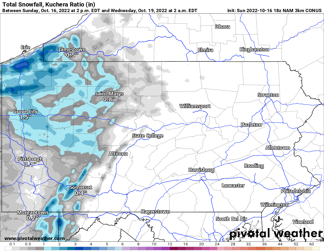
Since the snow will be falling at night, a coating is possible in all of Western Pennsylvania. In the lake effect snowbelts of Erie, Crawford, and Warren County, 1-3″ of snow is expected. Below is a look at totals through Wednesday.
Colder than normal temperatures will continue through Friday before we enjoy a nice stretch of warmer temperatures until Halloween.
Don’t forget to share this article with someone who may be interested in the first snow of the season!
[social_warfare]
You must be logged in to post a comment.