
AN UPDATE TO THE FORECAST HAS BEEN POSTED. VISIT THE ARTICLE BELOW.
The first snow of the season is always long anticipated by many, and dreaded by some. No matter where you stand, it’s coming very soon in parts of PA. It’s not so much the snow, but the frigid air that is a very humbling experience every Fall knowing we’re headed into another long Pennsylvania winter.
Windy conditions will give way to a cooler end of the week, though Saturday will be a stellar day to head outdoors and enjoy the leftovers of the nice part of Fall. By early next week, temperatures will nosedive. We’re talking high temperatures in the 30s and 40s with bitter wind chills.
The first winter storm of the season is possible for areas to our north in Michigan and Ontario Sunday, but it’s the strong northwest winds blowing over a very warm Lake Erie that will bring our snow shortly after. The lake effect snow machine will be awoken from its slumber. By Monday morning, all latest model guidance suggests snow will be falling in parts of Western PA, especially the lake effect belts.

Lake effect snow showers will likely continue through Monday and into Tuesday morning, unless the currently modeled low pressure drastically changes path. As you can see below, models are suggesting moderate to heavy lake effect snow in Northwest PA. As always, it will be on and off as the streamers come in.
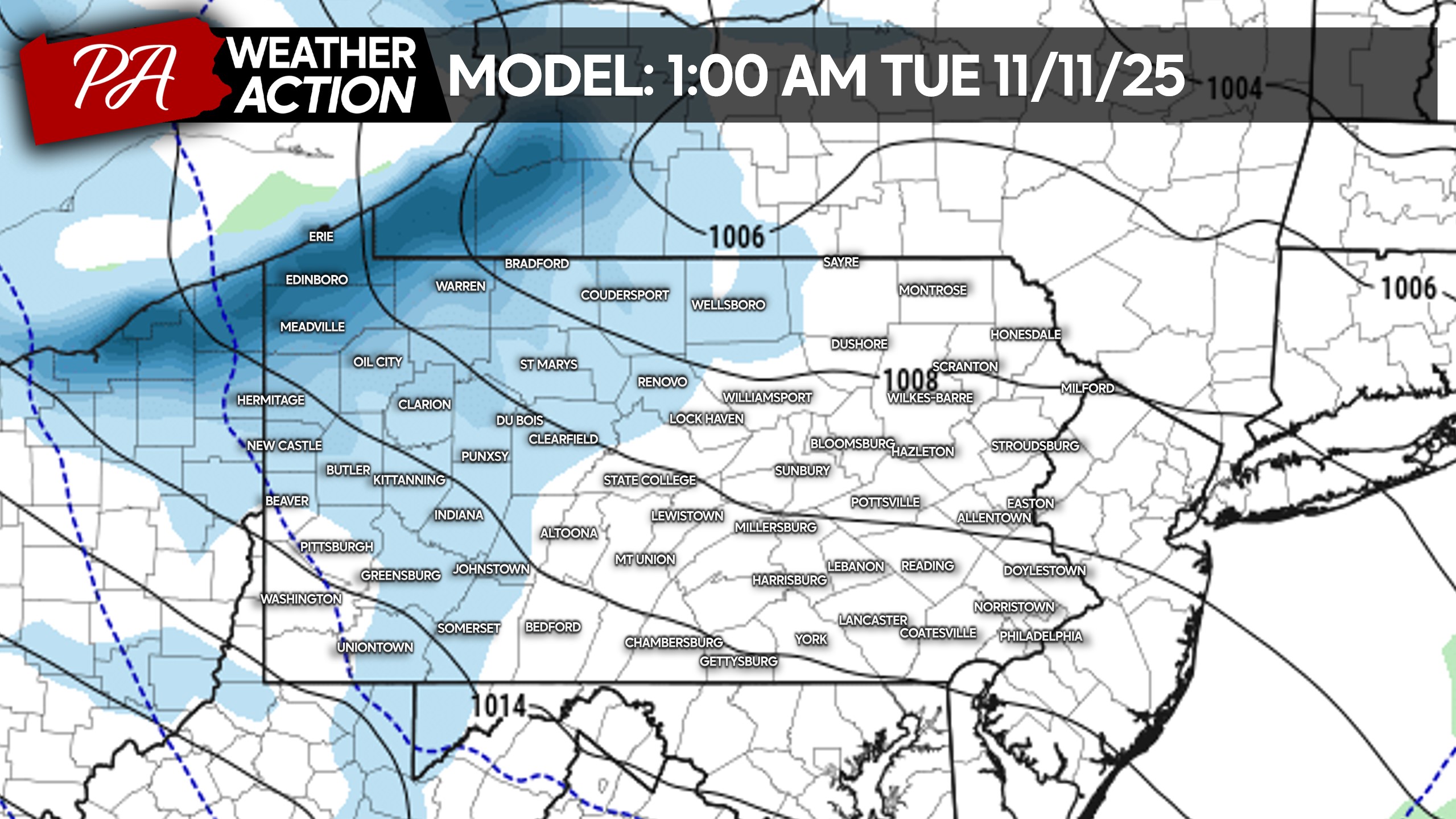
Often this early in the season, immediate lakeshore towns like Erie and North East are warmer and see less snow. But due to the strength of this cold air intrusion, that will not be the case.
The map below is not meant to represent particular snowfall numbers this early on, but rather give an idea of the potential early next week.
Another Must Read: Northern Lights May Be Visible in PA Thursday Night as G3 Space Storm Hits
FALL’S FIRST SNOWFALL POTENTIAL IN PARTS OF PA
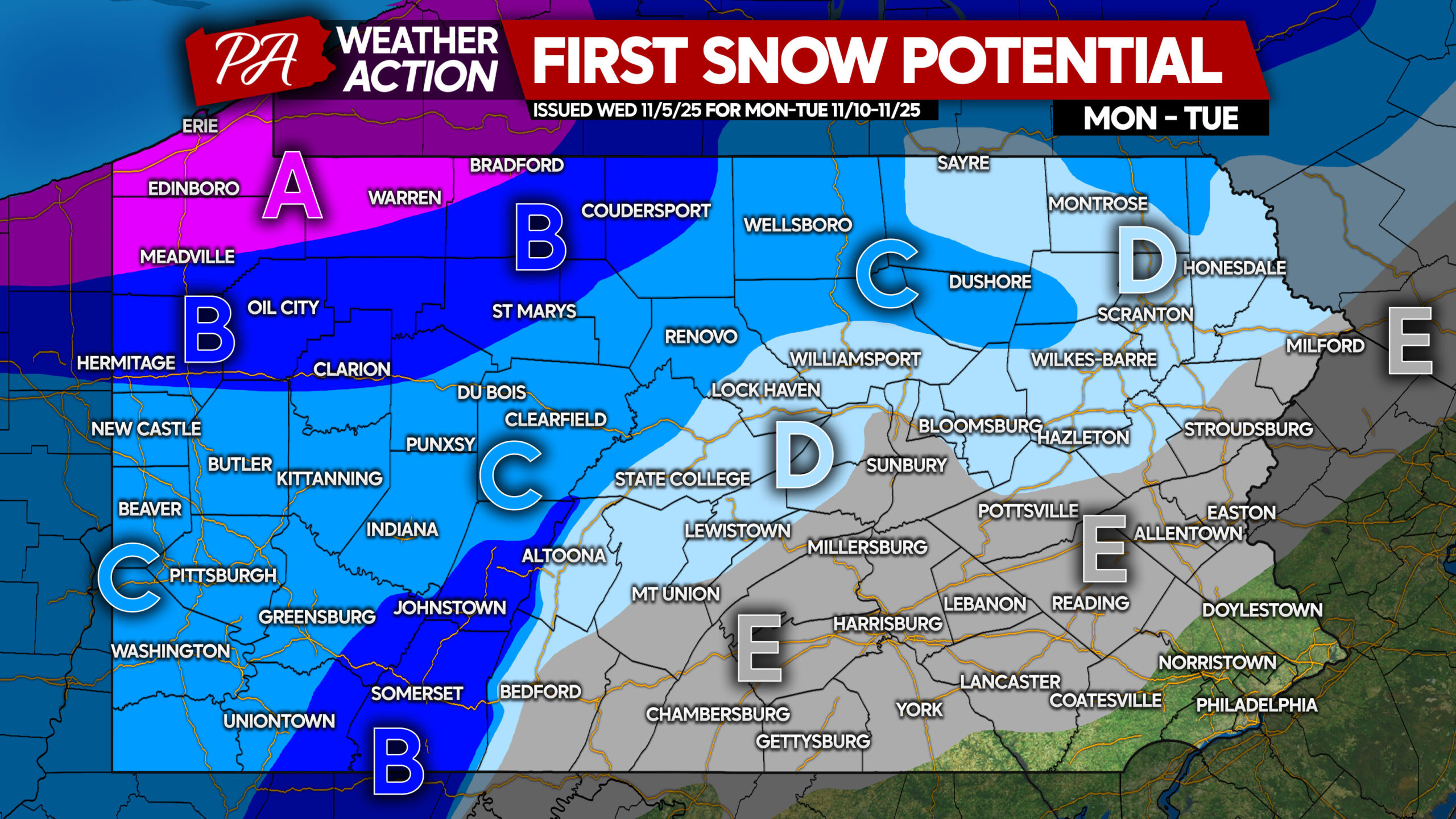
Area A: Significant lake effect snowfall accumulation possible Monday into Tuesday. Check on your snow blowers and winter weather kit before the season begins!
Area B: Light to moderate snowfall accumulation is possible Monday into Tuesday. Assure your snow blower is in working order beforehand. Whether it’s needed or not, still a good idea!
Area C: The first snow showers of the season are likely, with light snowfall accumulation a possibility.
Area D: The first snow showers of the season are likely, with widespread accumulation unlikely.
Area E: The first snow showers of the season are possible.
We will have more updates in the coming days.
Don’t forget to share this article with friends and family!

You must be logged in to post a comment.