
Say goodbye to the 70s and 80s this week, as by the weekend snow showers will possibly be in the air for some areas throughout Pennsylvania. A strong cold front will be pushing through the region on Friday, delivering with it plenty of rain as we stated in yesterday’s article. This cold front will then transfer its energy off to the coast, where a coastal low will form and head north. As it heads north, wraparound winds from the northwest, will lead to Lake Effect Rain and Snow Showers during the Afternoon and into the Night on Saturday.
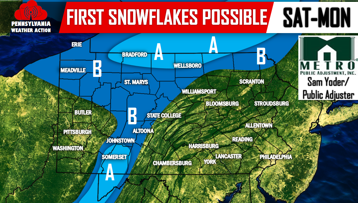
A second piece of energy, an Alberta Clipper, will be dropping out of Canada and will lead to rain and snow showers for the extreme northern parts of Pennsylvania and into New York. So these locations actually have two shots at seeing their first snowflakes of the season, late Saturday and again late Monday. Everywhere else, the best chance will be Saturday.
Neither of these systems are expected to produce accumulating snow for anywhere in PA, however, a dusting on car roof tops is possible. Enough to give us a friendly reminder Winter is just around the corner.
Make sure you have us liked on Facebook as our Winter Forecast and our Ahead of the Action Text Alert service will be released November 1st! Click here>>>>PA Weather Action on Facebook!
Area A – Best chance for snow showers. Up in North Central PA there are two opportunities for snow showers. Saturday Evening and again late Monday. No accumulation is expected other than a dusting on car roof tops.
Area B – There is some chance for snow showers. Temperatures may be a bit too warm in these areas to get the rain showers to turn into snow showers. But there is definitely some chance.
You must be logged in to post a comment.