
December 9, 2022 Morning Update
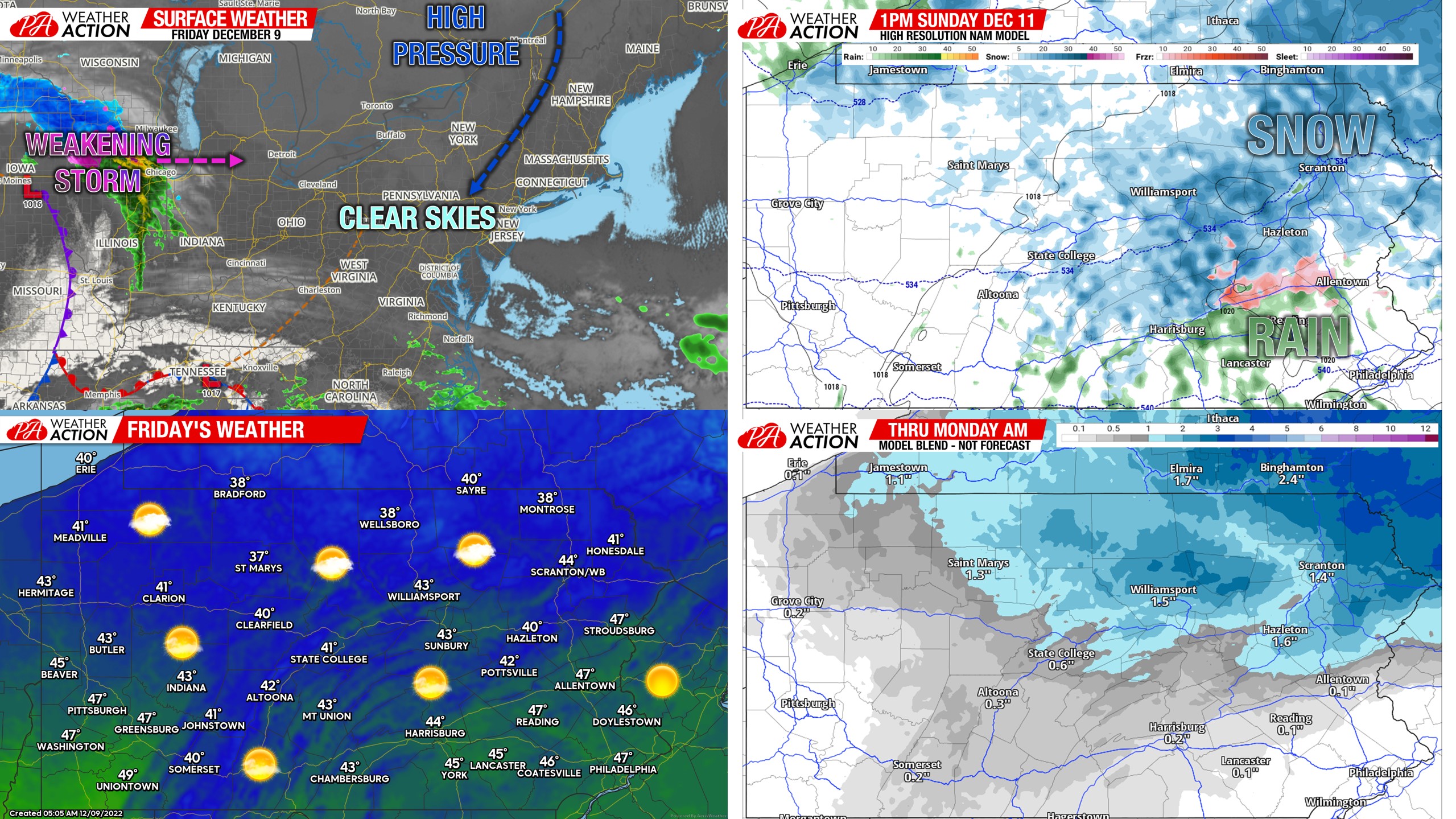
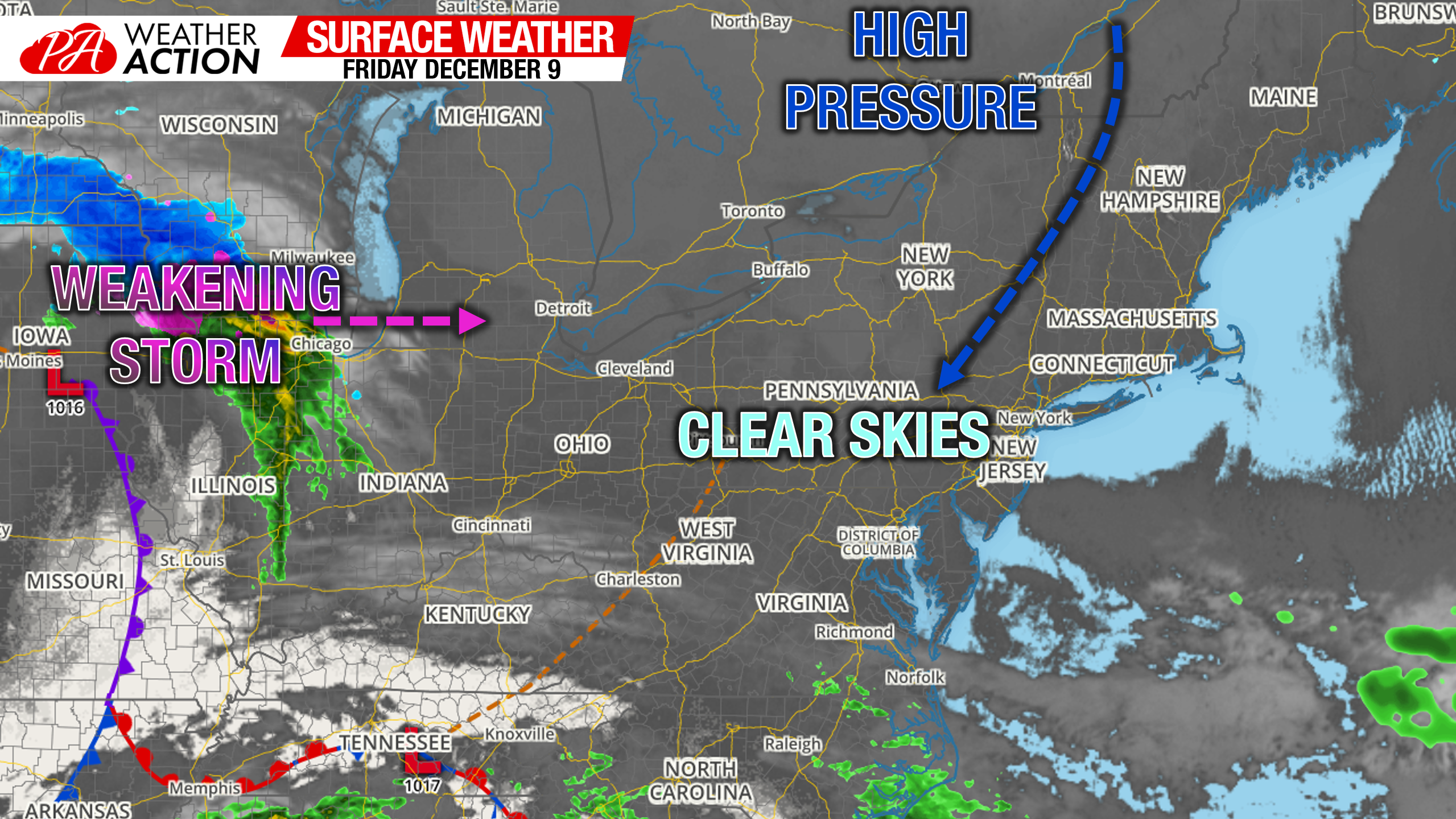
Morning Surface Weather Map
Good morning. Today’s surface weather map includes a small winter storm out by Chicago and Milwaukee that will weaken completely over Michigan. That’s due to the massive high pressure to our north that will be impenetrable, and also our cold air source. You will notice heading out that it’s a bit chillier this morning, but sunny skies are the tradeoff.
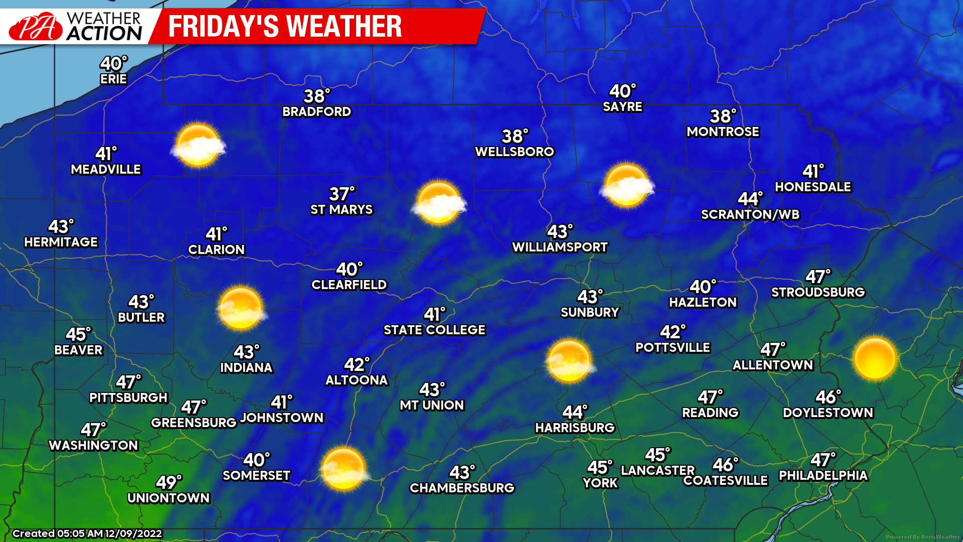
Friday’s Weather Map
Just about all of us will be seeing bright blue skies today, with maybe some cloudiness by Route 6. Temperatures will be right around average in the eastern two thirds of the state, and a few degrees above normal in Western PA. Overall highs in the upper 30s to upper 40s, not bad!
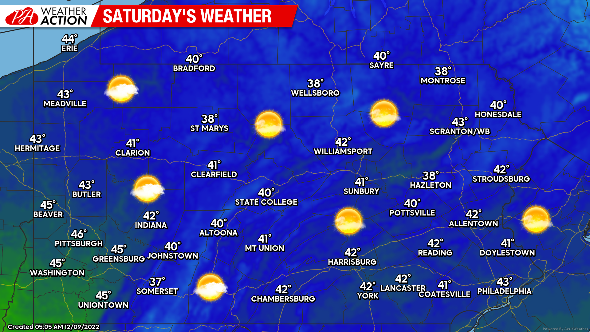
Saturday’s Weather Map
Saturday morning’s snow showers have officially evaporated…basically. Suppression from the high pressure will just be too strong. So Saturday will be an excellent day to go shopping or visit some Christmas light shows. Most ski resorts aren’t open just yet, otherwise it would be great skiing conditions as well.
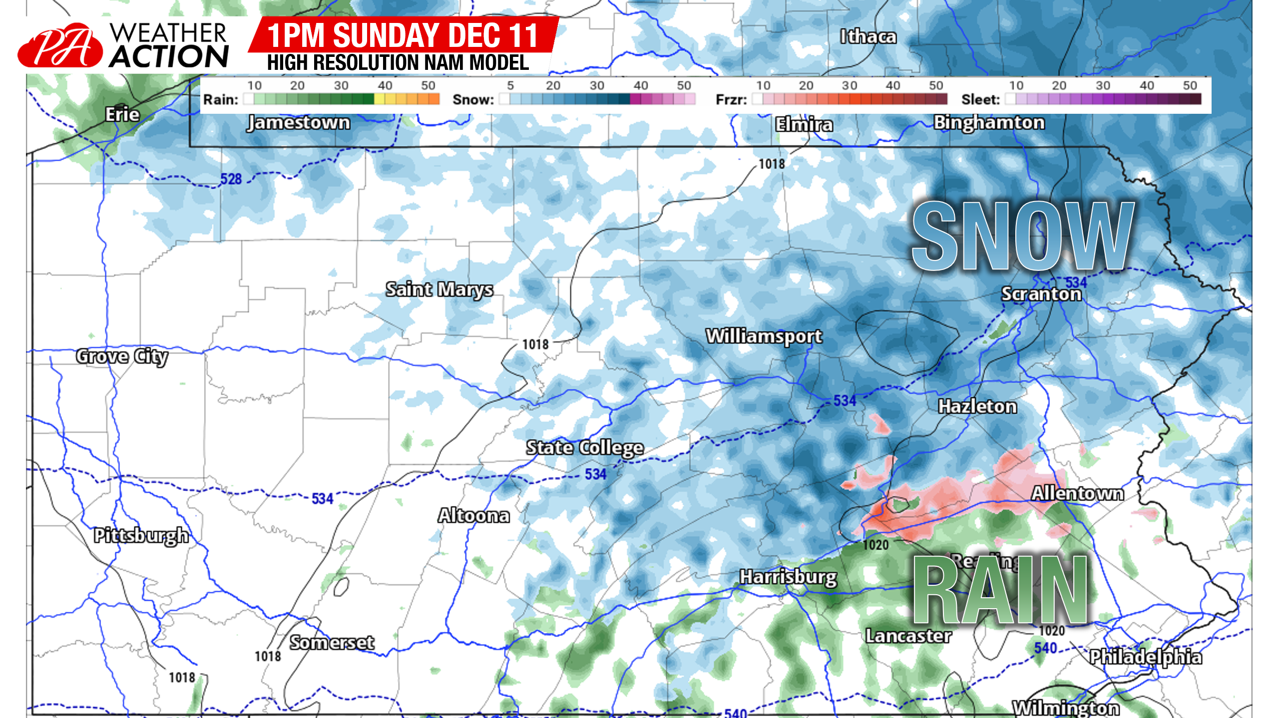
Sunday’s Rain & Snow
Now for what I assume the majority of you came here for. A light snowfall is expected in Northern, and now more so Northeast PA, late Sunday morning through the late evening. Although models are still split when it comes to precipitation placement, I’m leaning more towards the European model still. I expect snow to be falling in 90% of areas east of Williamsport and north of Hazleton by 1:00 pm Saturday. Here is the Hi-Res NAM for that time, I think precipitation will be about 30 miles north of what it shows.
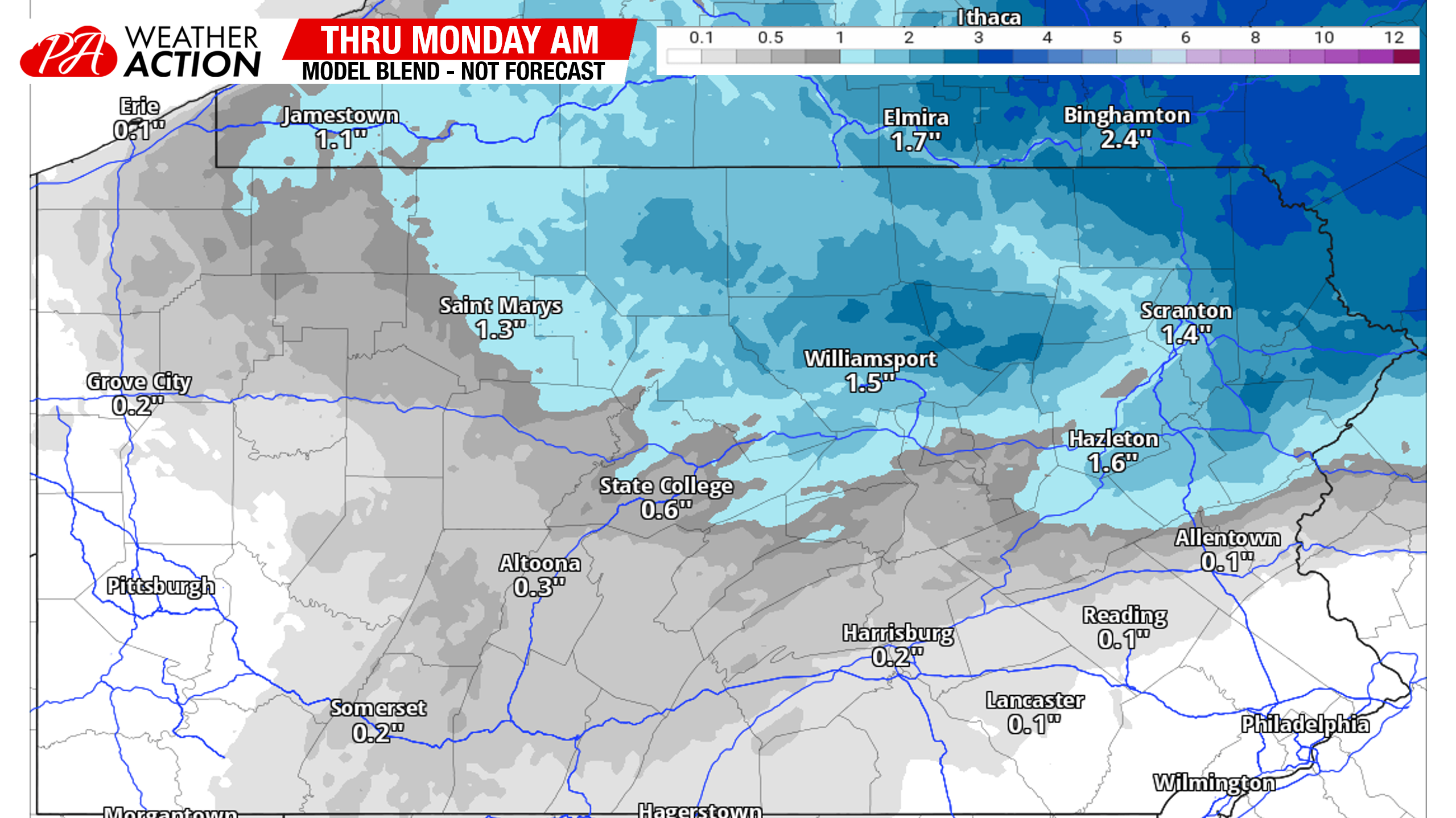
We will have the first call out this evening, and for most this won’t be much to get excited about. I’d say the areas that have the best chance of seeing 2″+ are the Northern Poconos, like Wayne County. Besides that, probably lots of 1″ reports by Sunday evening. Here is the model mean (average of many models) through Monday morning.
Pattern Change & Storm Potential Next Thursday – Friday
First of all, everyone stay calm and proceed with your weekend. There’s no need to lose time with friends and family over a storm 6 days out. We have a pattern change coming next Thursday and Friday as the PNA finally goes neutral. The EPO, AO, and NAO will all be negative, which are favorable phases for cold air and potential storminess. And with a pattern change often comes a storm, which is on the models.
The setup looks to be a low pressure cutting into the Northern Plains on Tuesday, creating a whole mess for them. Then the storm hits the big blocking high we have in Canada and weakens. However, at the base of the trough, another low pressure develops in the Southeast US and pushes northeast over the Carolinas and then things become unclear when it goes. The most important player in this game will be how strong the high pressure is to our north, and how dug in the cold air damming is.
The European model has a weaker high pressure parked several hundred miles to our north, and the system drives right into Eastern PA. There’s two issues here. The big one being the high pressure is way too far north, causing little CAD (cold air damming), and mostly rain in Southern PA with mixing in Northern PA. Also, regardless of how much CAD there is, a low over Philly would mean rain to Lancaster and Allentown hypothetically.
The Canadian model is a mix of the Euro and American (GFS) model, and gives us quite the ice storm because only the surface is cold enough, with the upper levels a few degrees above freezing.
And then there’s the GFS model, which you may see floating around today. Please realize that the model has already changed from the scenario that it had last night, so you’re seeing an old run. However, the concept that run and the following supported was a seriously dug-in cold air damming situation with a low pressure right on the coast. If you know PA meteorology, you know that equals a big snowstorm.
All these models will continue to wobble around a lot. But I will say, this storm is coming at a time that strongly supports a big winter storm. Knowing the area well, my probably premature guess is that the I-81 corridor has the highest possibility of seeing impacts from this type of setup. But we are still 6 days out, and this storm could be gone from models by tomorrow. So keep calm and carry on!
You must be logged in to post a comment.