
Summary
A weak system moving across the Southern Great Lakes will bring a period of snow to mainly Northern Pennsylvania Sunday. Temperatures will be near freezing in the valleys and in the upper 20s in higher elevations, so it’s a given that this will be somewhat of an elevation-dependent event. Generally highest totals will be in the Northern Poconos, with as much as 4″, and lowest totals for those who see snow will be in the deep valleys where about in inch is expected.
Road Impacts
Road impacts will be very minimal on Sunday in the valleys, but slick travel is expected about 1000′ elevation in Northern PA.
Timing
Light to localized moderate snow will push in to Central PA by 6-9am Sunday and Eastern PA by 9am-12pm. Light freezing rain is possible in the Laurel Highlands from 5-10am Sunday as well. The back end of the snow will come through North Central PA by 11am – 1pm, and Northeast PA by 3pm in Luzerne and Sullivan Counties to as late as 9pm in Wayne County. This is why Wayne County will receive highest snow totals.
Below is latest future radar this Friday evening from the High Resolution NAM model. I think it does a decent job but is a but too far south with the extent of snowfall in Eastern PA.
First Call Snowfall Forecast for Sunday (12/11)
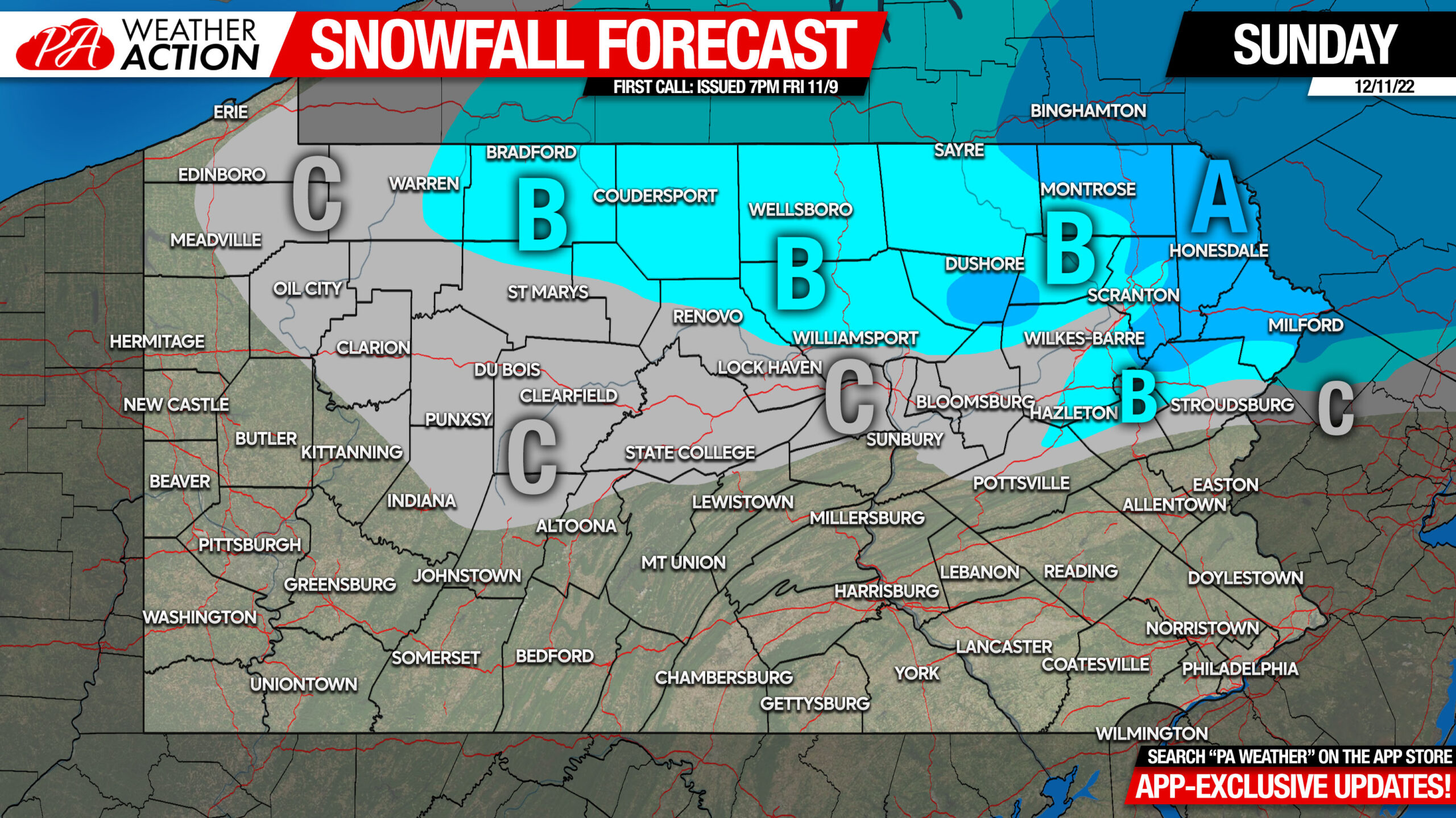
Area A: Snowfall accumulation of 2 – 4″ expected. Roads will be slushy, take it slow Sunday afternoon and evening.
Area B: Snowfall accumulation of 1 – 2″ expected. Roads may be slick especially in higher elevations.
Area C: Snowfall accumulation of less than 1″ expected.
Beyond this forecast, we are watching late next week for a potential winter storm. Download our app for exclusive model updates and your local NWS forecast, along with these updates! Get it here: PA Weather Action App
Have a good weekend and take it easy in Northeast PA Sunday!
[social_warfare]


You must be logged in to post a comment.