
A surface high provided blazing sunshine today, albeit with gusty wind and some blowing snow this morning. That surface high will maintain dry weather through Wednesday.
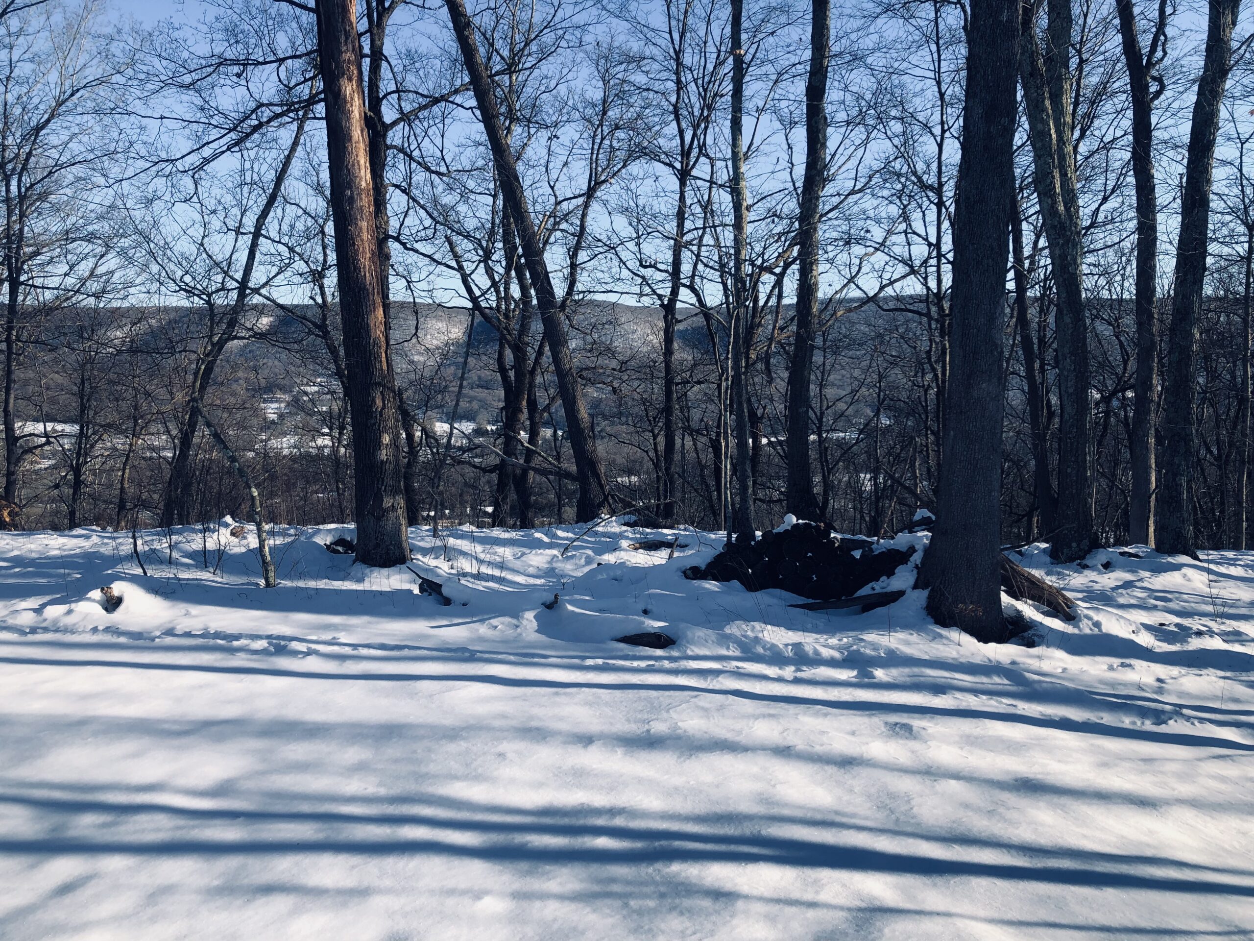
Tonight will feature clear moonlit skies, calm wind, and crisp conditions. Temperatures will fall into the teens, and possibly even the single digits in some of the colder spots! I recommend spending some quality time outside to feel the icy crunch of the snow and true winter conditions, as the Spring Equinox is rapidly approaching.
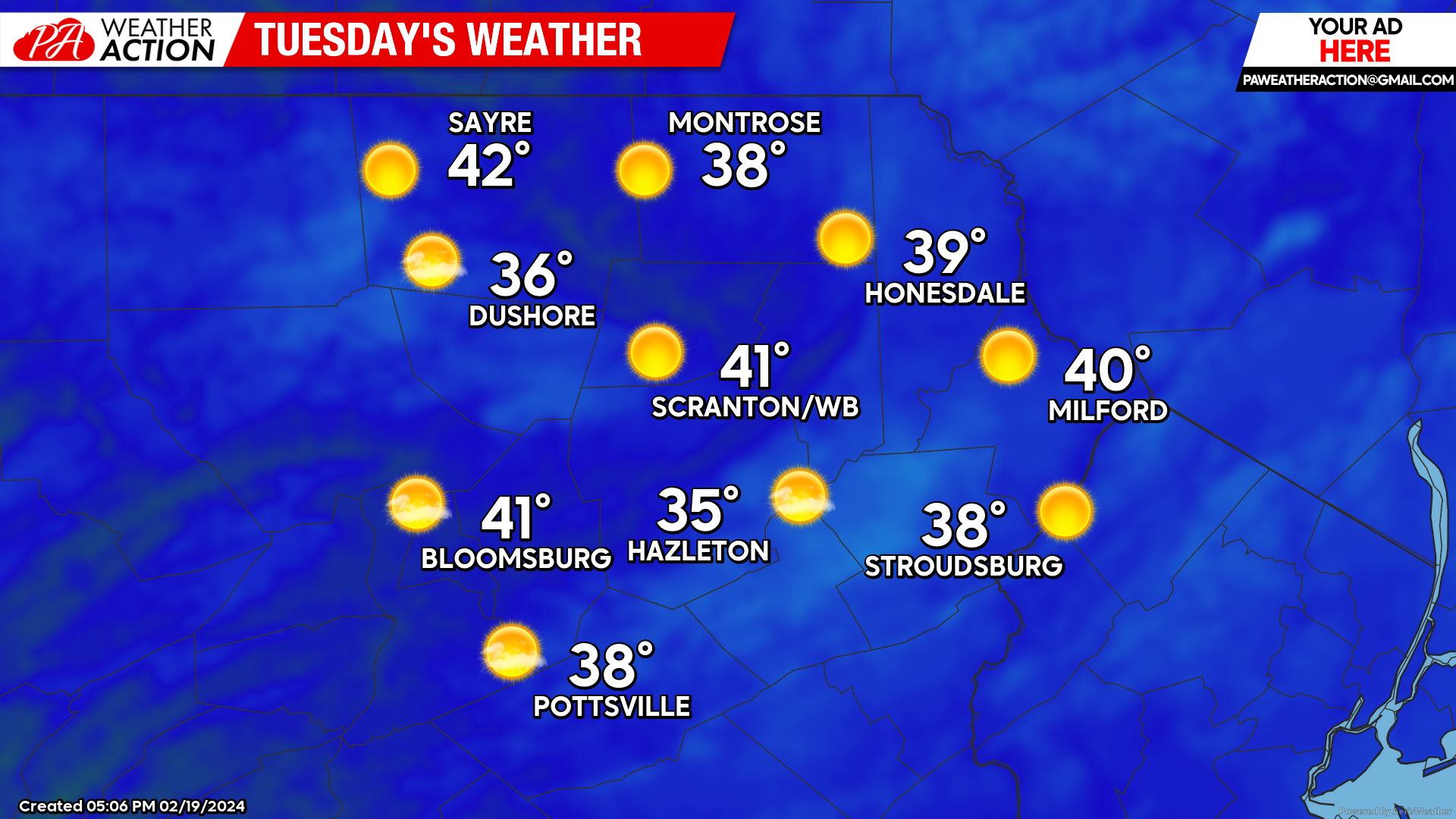
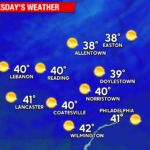
TUESDAY:
After a crisp start with temperatures in the teens and perhaps single digits in some spots, blazing sunshine and light wind will boost temperatures to near 40 for all but the higher elevations.
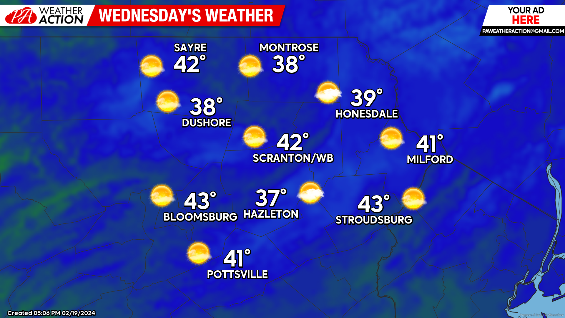
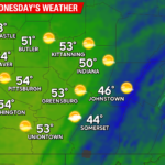
WEDNESDAY:
The surface high will slide to our east, with increasing southerly wind and some high clouds, along with milder, warmer-than-normal temperatures.
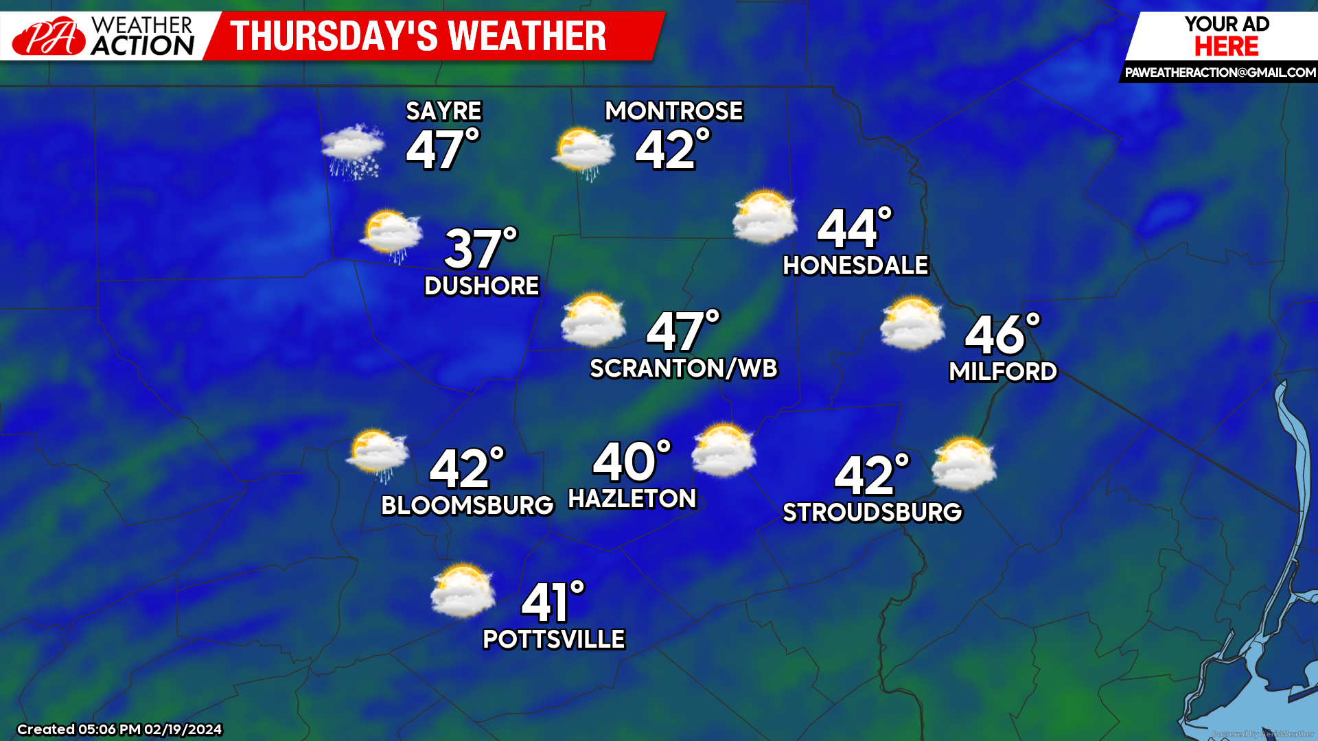
THURSDAY:
An approaching disturbance will bring increasing clouds, with precipitation arriving around sunset, likely in the form of snow that will change to rain. There could be light accumulation before the changeover.
You must be logged in to post a comment.