
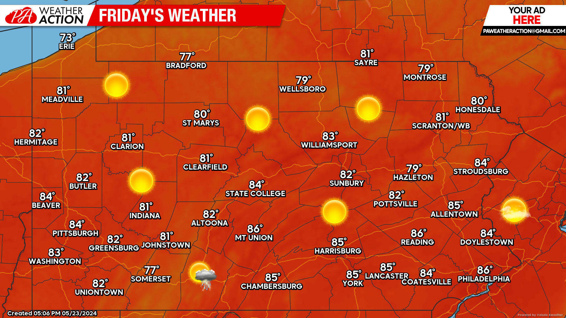
Mother Nature will be treating us very well with an absolutely gorgeous day today. Starting off looking at this morning’s satellite imagery, any thunderstorm activity we saw overnight is completely wrapped up. Skies are clearing out:

Today’s Weather Forecast: 10/10
No doubt about it, today will be a perfect day to be outside. Not a bad idea to start Memorial Day weekend plans a little early.
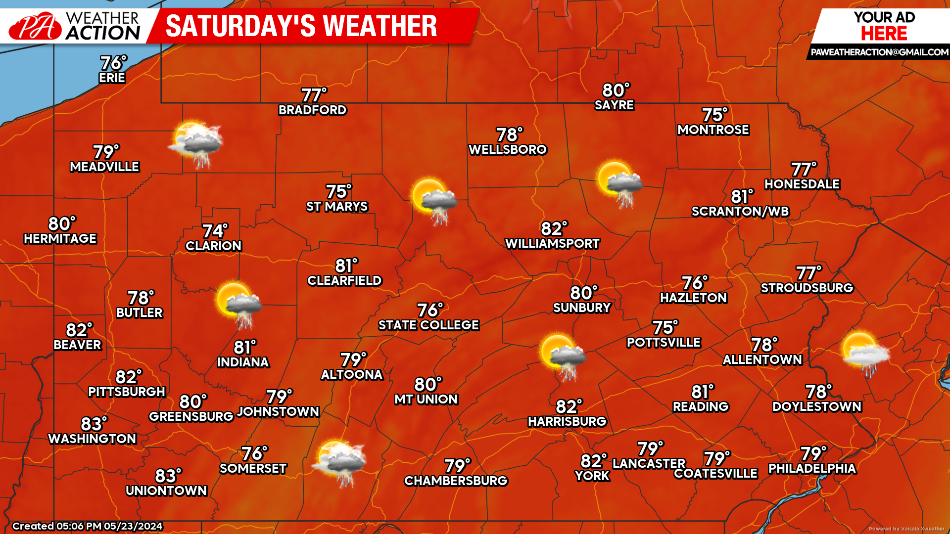
Saturday’s Weather Forecast: 8/10
What a difference a couple days make. Saturday continues to trend more dry. The best chance for showers and thunderstorms will occur in the evening over the western half of the state. Most us will escape the daytime hours dry.
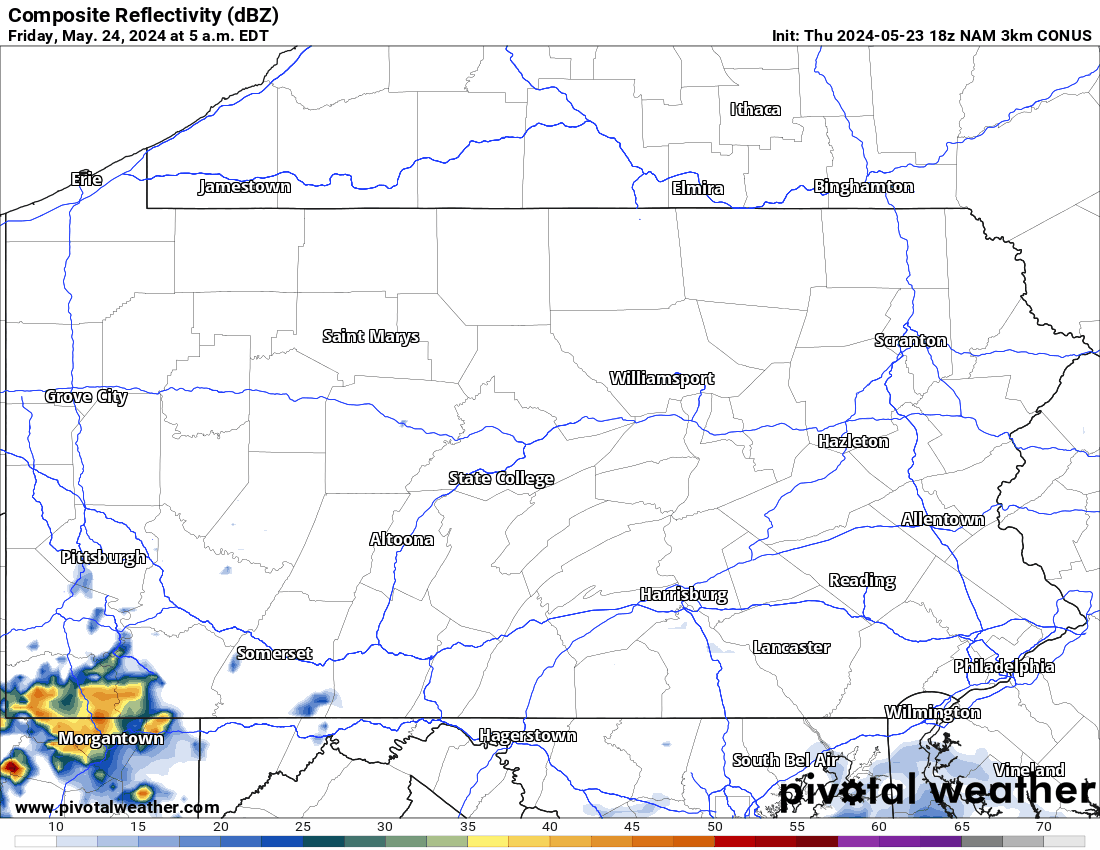
Hi-Res NAM Future Radar Valid Through Early Sun AM:
Taking a look at the future Hi-Res NAM radar below, we can see that many of will escape any thunderstorm activity until at least Saturday evening. Top left of the graph shows the timestamp for reference. It appears that the best time-frame for thunderstorm activity Saturday will be anywhere from 4:00 PM to 10:00 PM.
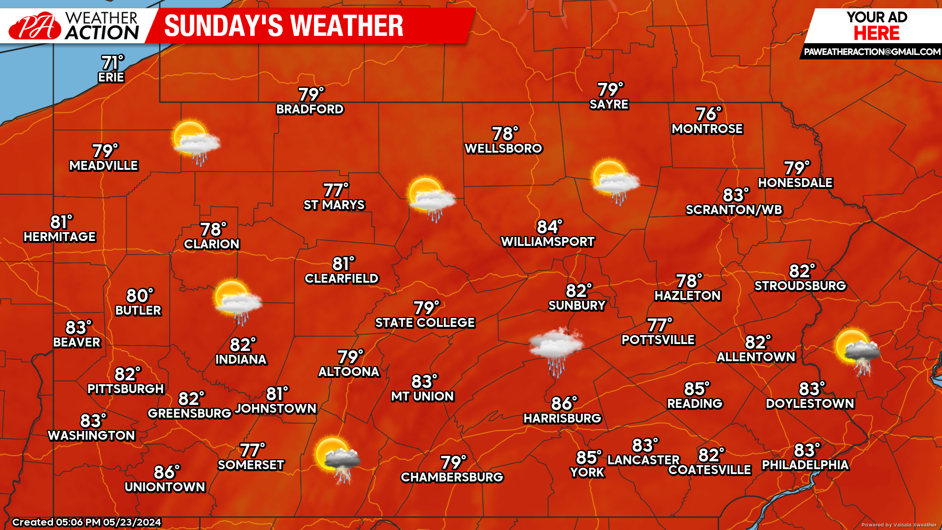
Sunday’s Weather Forecast: 8/10
Sunday continues to look mainly dry across the state. An isolated shower or storm is possible. Strongly encourage any outdoor Memorial Day plans to happen by Sunday before rain moves in by Monday.
Memorial Day Forecast: 5/10
A storm system will be cutting through the Great Lakes region during the latter part of the weekend, leading to widespread showers and thunderstorms likely on Memorial Day. Again, we encourage outdoor activities to take place Saturday or Sunday.
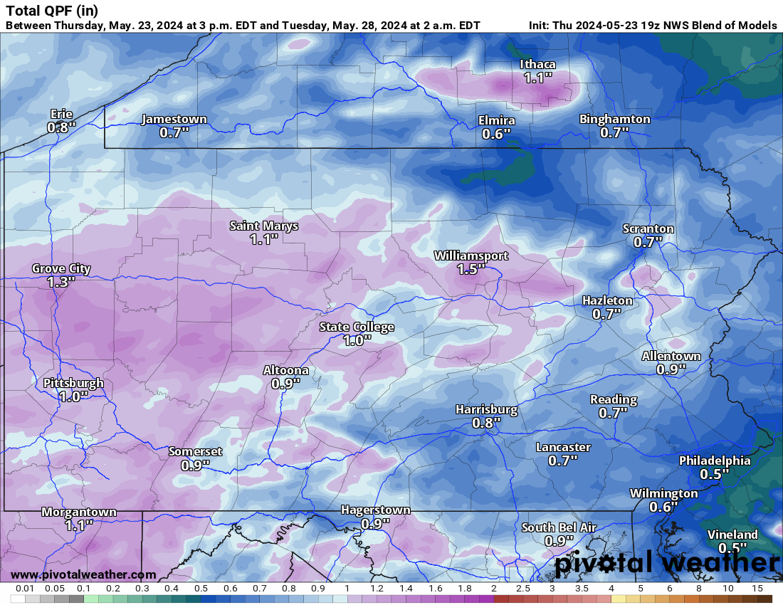
Rainfall Totals Through Monday Night:
Taking a blend of all model guidance, you can see that the heavier amounts of rain will be targeted over the western and central counties. Please note that most of the rain you see in the image below falls on Monday.

You must be logged in to post a comment.