
The passage of a cold front will bring chances for showers and thunderstorms along with windy conditions. A drop in temperatures will bring the chances for snow showers and wintery mix by the middle of the week.
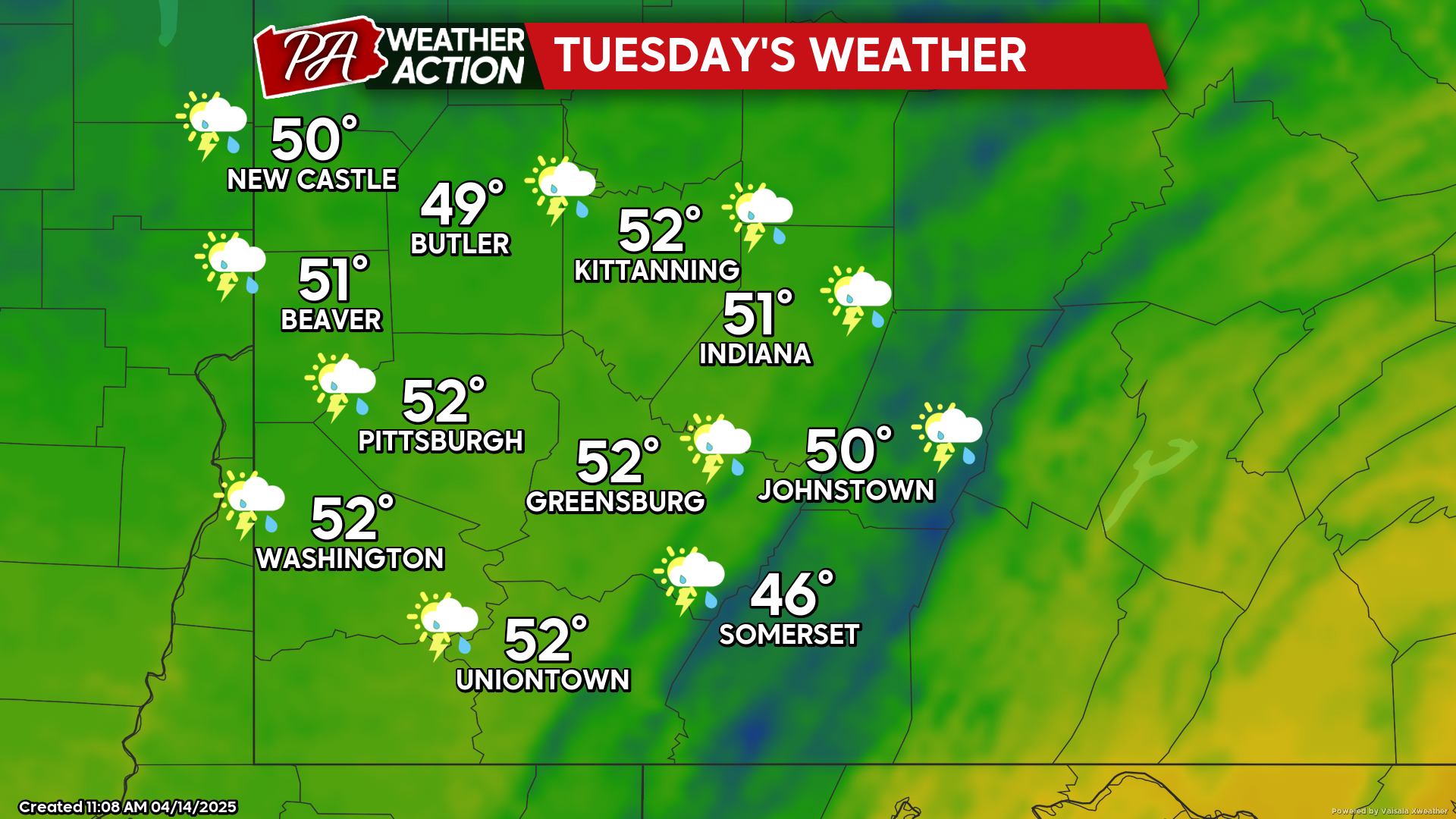
Tuesday
Showers and breezy conditions are expected throughout the day, a wintery mix is possible in the evening and overnight hours. Highs will be in the low 50s to mid 40s, lows will be in the mid to low 30s. Winds will be out of the West at 15-25 mph, wind gusts could approach 50 mph in some areas, especially in the higher altitudes.
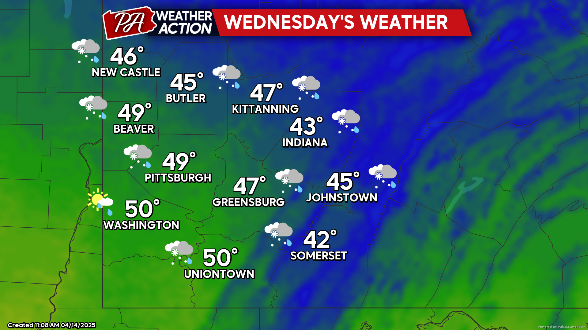
Wednesday
Chances for morning snow showers will transition to partly cloudy skies and breezy conditions. Highs will range in the low 50s to low 40s, lows will be in the low 30s to upper 20s. Winds will be out of the West at 15-25 mph, wind gusts ranging between 25-45 mph are possible.
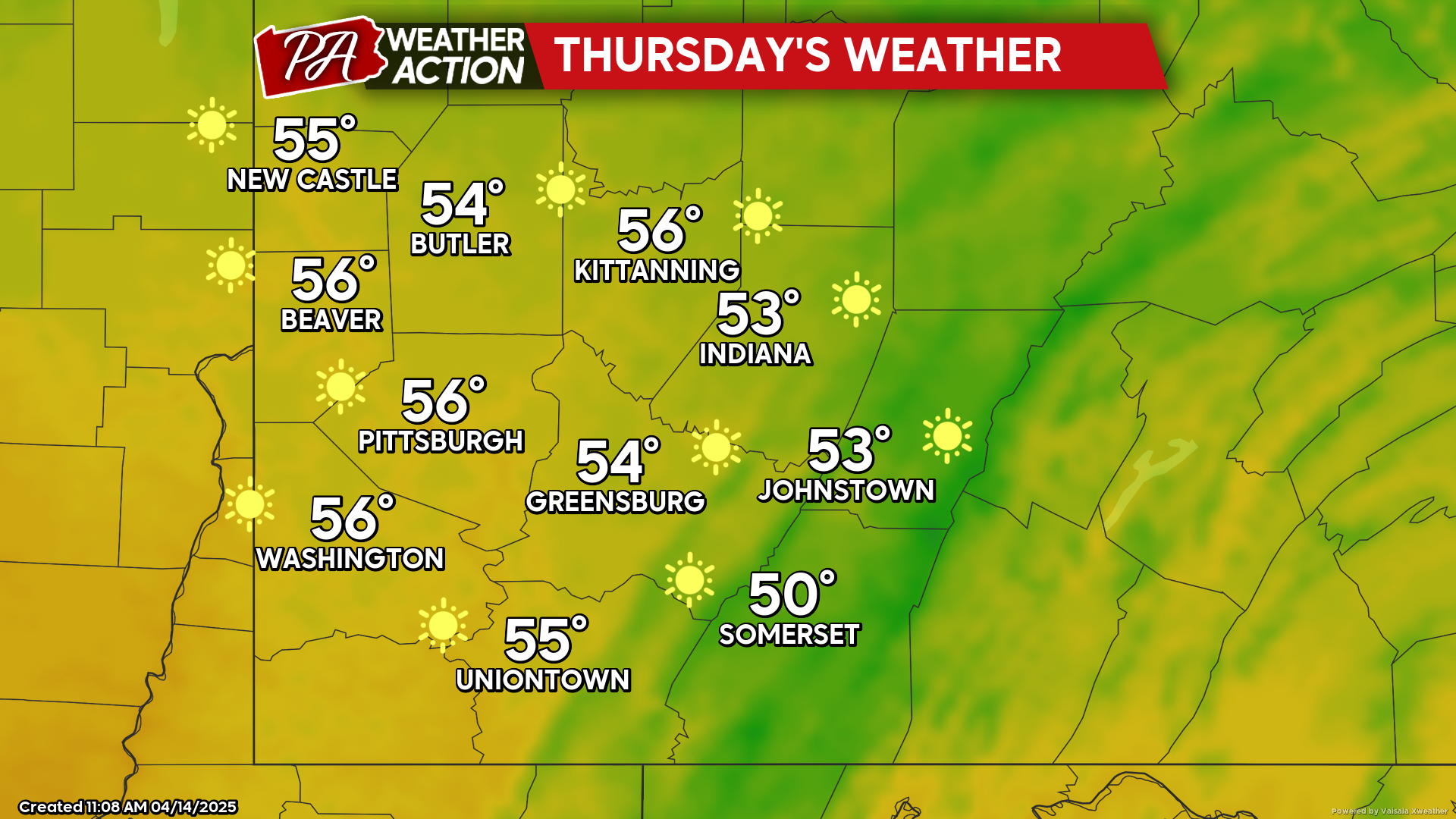
Thursday
Sunny conditions with warmer conditions. Highs will be in the mid to low 50s, lows will be in the low 40s to mid 30s.
Rain chances return to end the work week and continue into the weekend. Be sure to follow PA Weather Action for more forecasts.


You must be logged in to post a comment.