
A low pressure system developing in the Ohio Valley today will strengthen as it transfers east, heading up the eastern spine of the Appalachians right into Pennsylvania by Thursday. Moderate to heavy rain is likely at times, with gusty winds up to around 35 MPH expected.
We recently posted that Halloween-Eve would likely be rained out, and it was clear many people were surprised that some areas actually do trick-or-treat on days other than Halloween. This is especially true when Halloween falls on a Friday or Saturday.
Hopefully areas that had trick-or-treat scheduled for Thursday took our advice. The forecast for Thursday evening doesn’t look much better, and lawns will also be very soggy/muddy. The few locations that have trick-or-treat scheduled for this evening should be good, aside from some light showers in Southern PA after sunset.
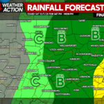
FUTURE RADAR TIMING
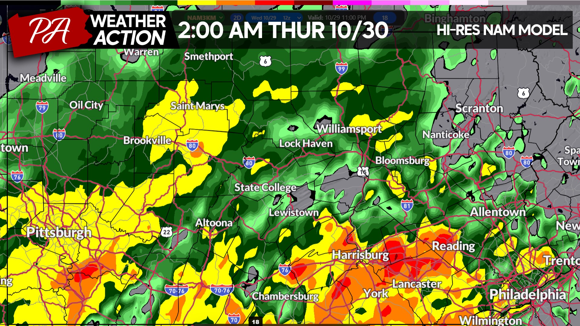
Rain will begin to move in late this evening into early Thursday morning. Light rain will change to moderate rain with heavier pockets in Southern PA by 2:00 AM Thursday as shown below.
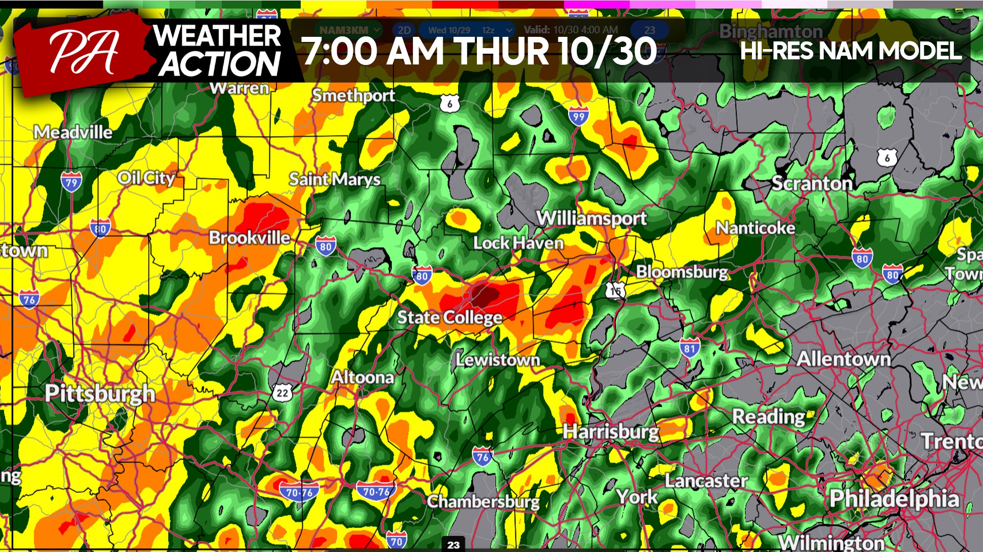
The Thursday morning commute looks very wet everywhere in the state. This model has some dry pockets in Eastern PA but most other models show a slug of moderate rain there Thursday morning.
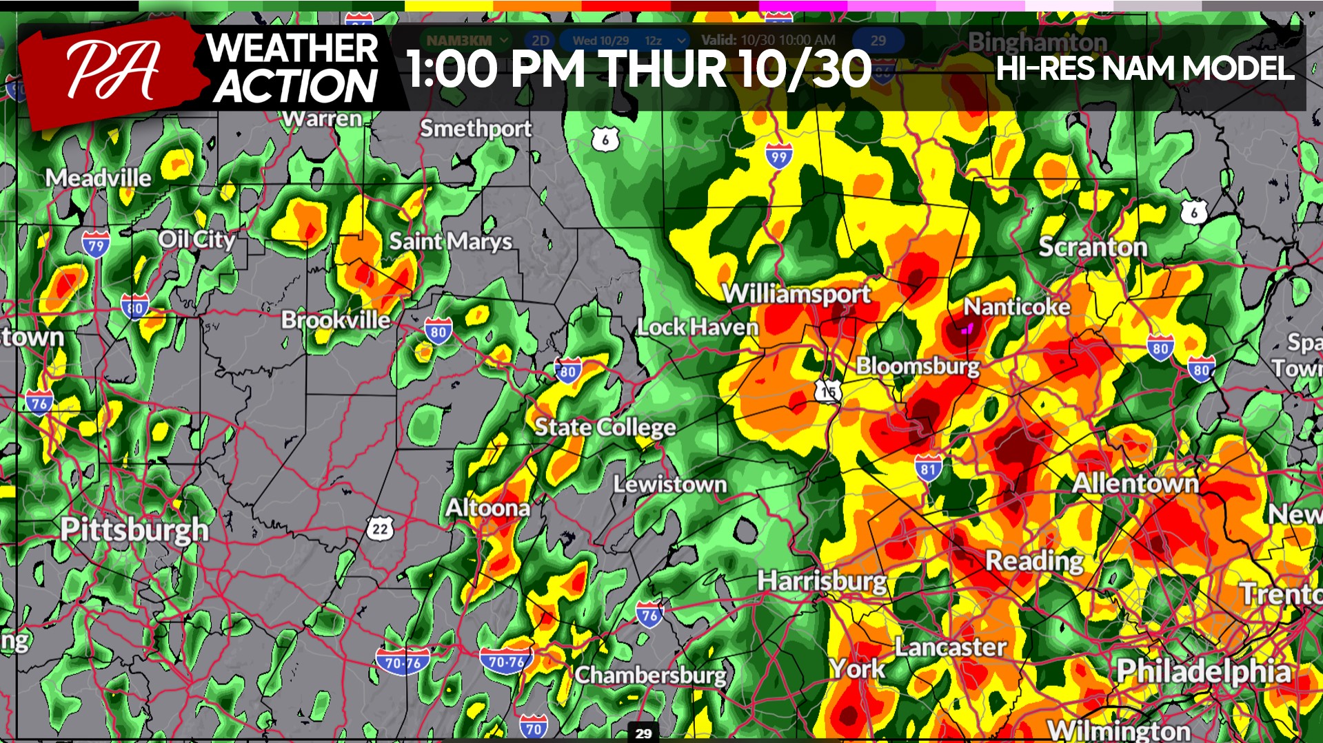
By early Thursday afternoon, rain will become more sporadic across the western half of Pennsylvania. Heavy rain will begin lifting out of Eastern PA by the middle afternoon. Below is future radar for 1:00 PM Thursday.
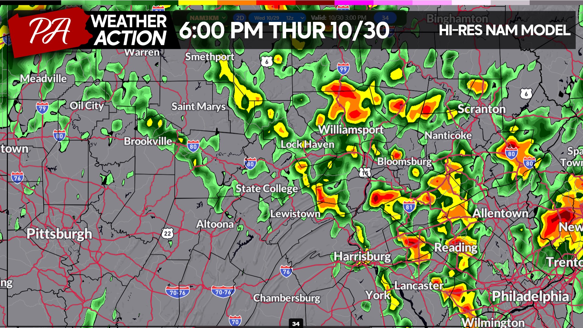
And finally by dinnertime Thursday, scattered showers will remain across Northern and Eastern PA as the low pressure lifts out to our northeast.
FINAL CALL RAINFALL FORECAST FOR WEDNESDAY – THURSDAY IN PA
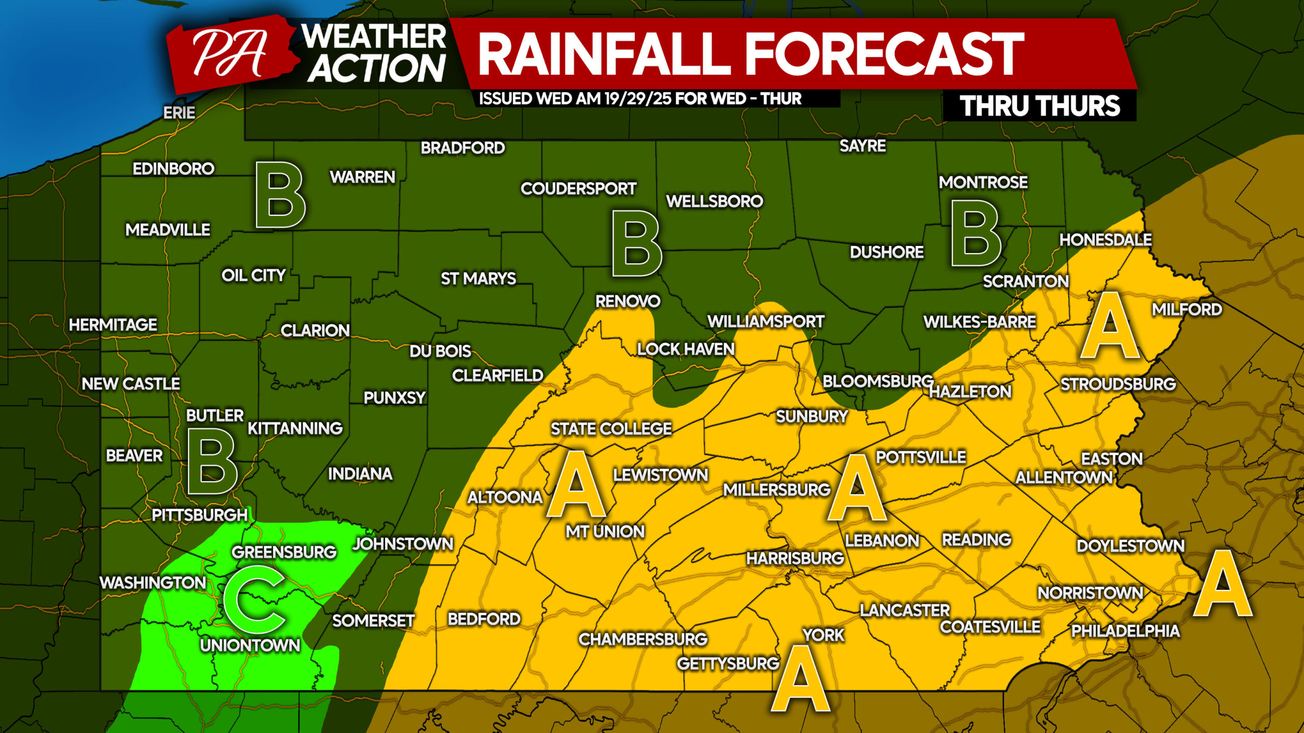
Important Points: Wet leaves on roadways can cause your car to spin out. Also, drainage may be clogged by fallen leaves.
Area A: Rainfall accumulation of 1.5 – 2.0″ expected. Localized flooding in areas with poor drainage possible. Winds may blow some leaves off the trees as many of these locations hit peak Fall foliage.
Area B: Rainfall accumulation of 1.0 – 1.5″ anticipated. Localized flooding possible in usual areas with poor drainage.
Area C: Rainfall accumulation of 0.5 – 1.0″ expected.
Trick-or-treat looks good for Friday evening aside from some sprinkles in Western and Northern PA. Temperatures will be in the upper 30s to mid 40s so definitely have multiple layers on!
Be sure to share this forecast with friends and family!
You must be logged in to post a comment.