
Today we experienced a taste of what’s to come in the next week, and possibly beyond. Temperatures in the 90s to near 100 degrees combined with dew points in the 70s will push the heat index into the 100s for many populated areas across the state.
Originally we thought the worst of the heat would be Sunday. While this remains true, the days following will not be much cooler. If you work outside we recommend stocking up on water bottles, the heat unfortunately isn’t going anywhere fast. Latest model trends extend the heat wave through the week and into next weekend.
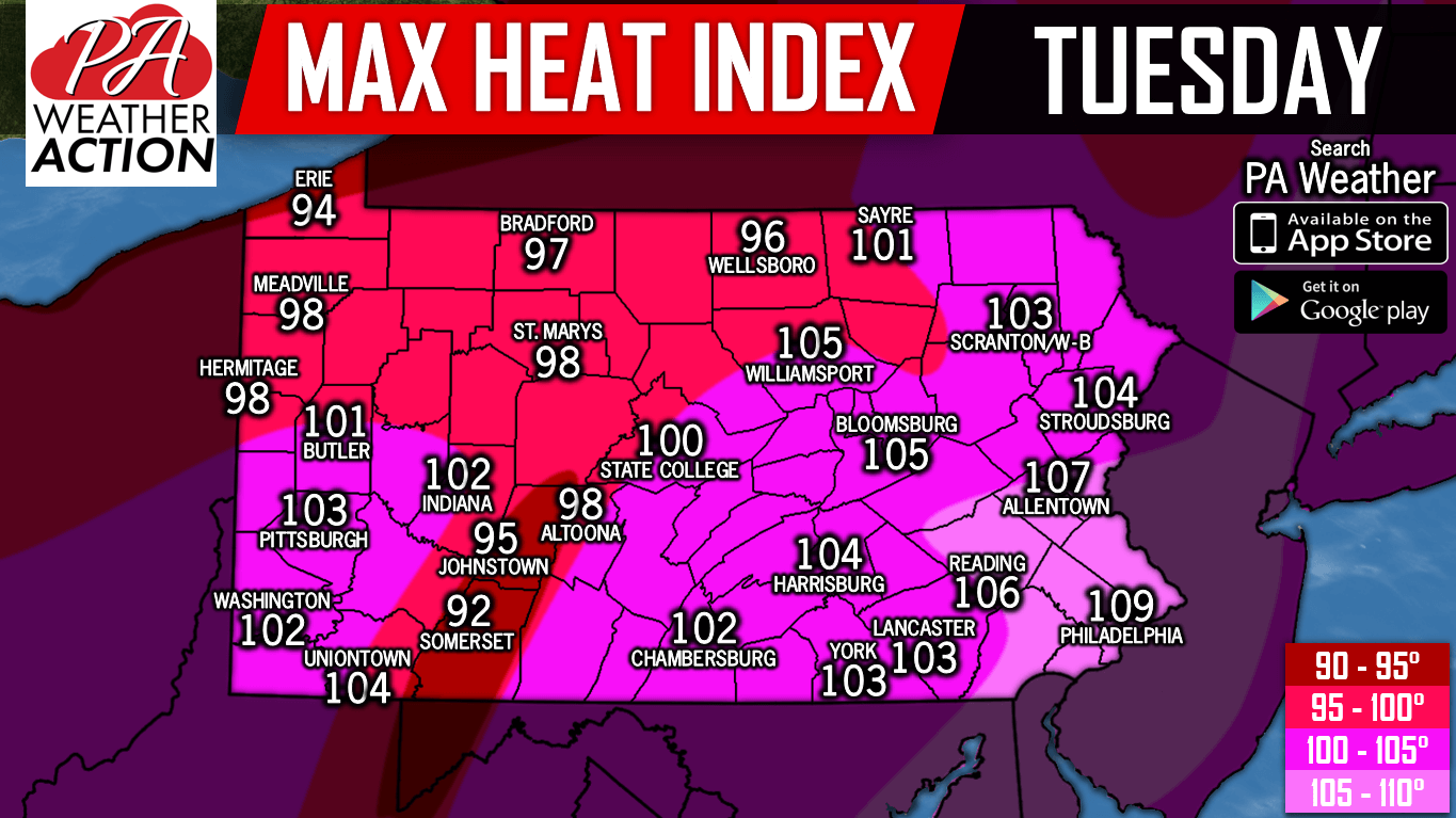
Below are maximum heat index graphics for Monday and Tuesday.
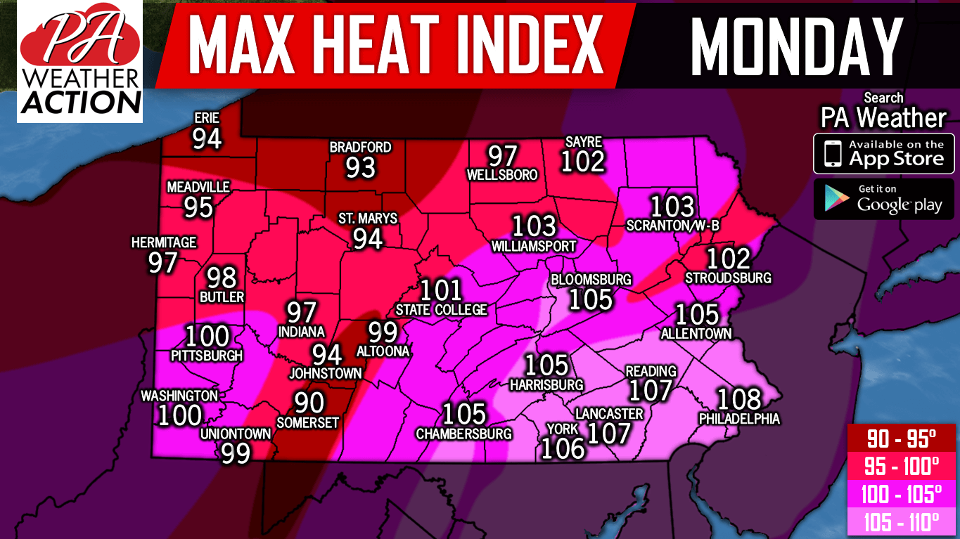
The maximum heat index forecast doesn’t reflect what it will feel like the entire day, but at the day’s hottest point.
The moral of the story is drink lots of water. Let’s all hope our air conditioner can make it through the next week or two!
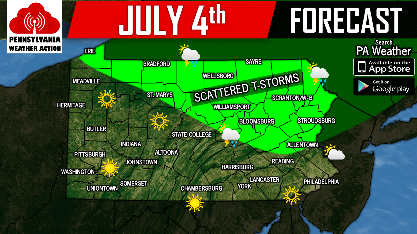
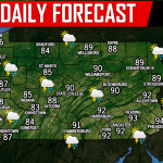
Now it’s time for the July 4th forecast. Since PA residents can now buy serious fireworks unlike previous years, this forecast is a little more important than before. Most of the state will be dry on Wednesday, however there is the chance of scattered thunderstorms in Northern PA.
If you appreciate our work, please consider supporting us on Patreon >>> Our Patreon Page!
Share this update with your friends and family by tapping the blue button below. Stay hydrated!
You must be logged in to post a comment.