A storm system will track through the Great lakes and into eastern Canada tonight into Tuesday. The system will swing a cold front eastward through our area after midnight tonight, delivering some showers. Between a tenth and a quarter inch is expected. Temperatures will only fall into the upper 40s and lower 50s.
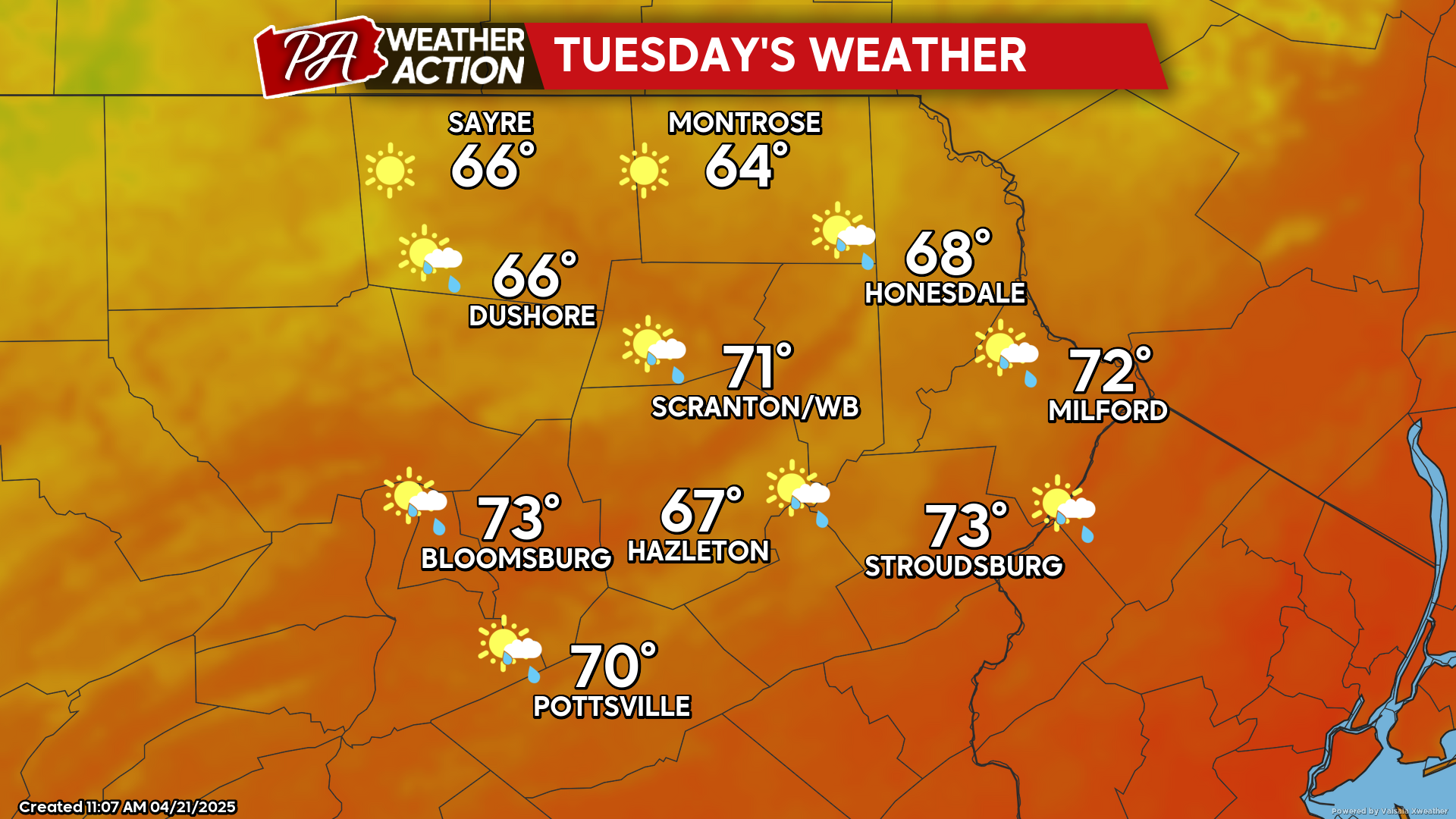
TUESDAY
There could be a few leftover clouds and perhaps a shower around sunrise in the eastern counties, but otherwise it will be a sunny day with wind from the west gusting to 25 mph. Unfortunately this could exasperate the ongoing brush fire near Jim Thorpe in Carbon County, which has already consumed several hundred acres.
The breezy conditions will subside after sunset. This will allow temperatures to fall into the low-mid 40s, with 30s in the higher elevations and normally-colder locations.
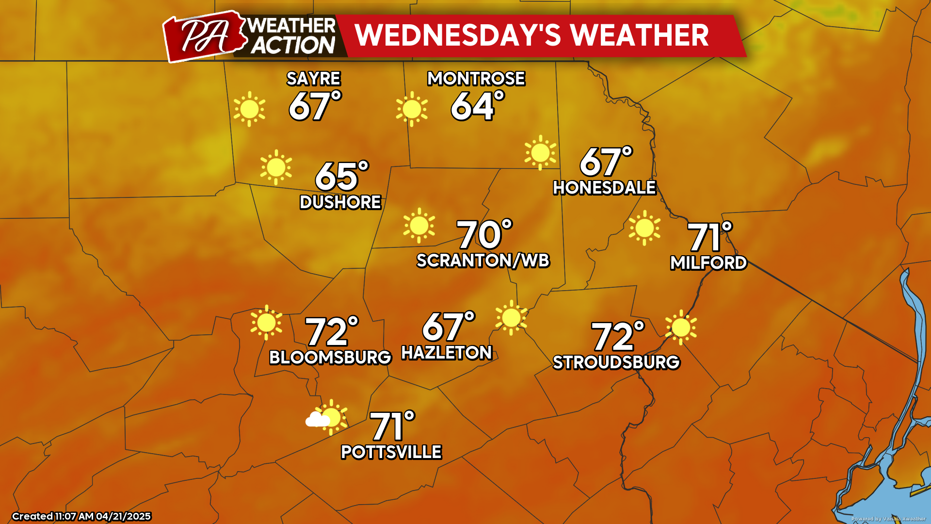
WEDNESDAY
High pressure will provide blazing sunshine, mild temperatures, and light wind.
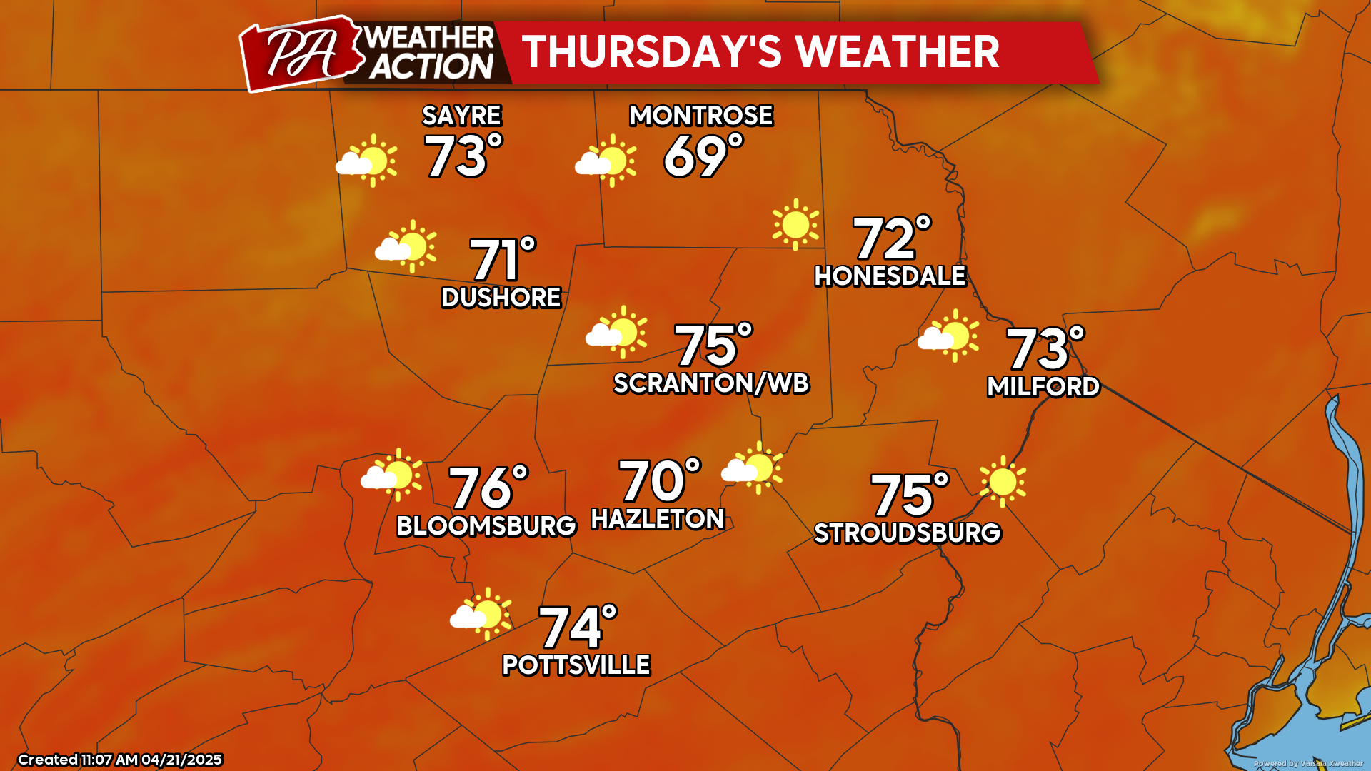
THURSDAY
High pressure will continue to dominate our weather as it slides just to our east. South wind on the west side of that high will draw much-above-normal temperatures northward into our area along with sunshine. Enjoy!