
A cold front pushed through our area this afternoon igniting thunderstorms, some of which were quite strong. This front will herald low humidity, cool overnights, sunny daytime warmth, and comfortably summer skies for the holiday weekend.
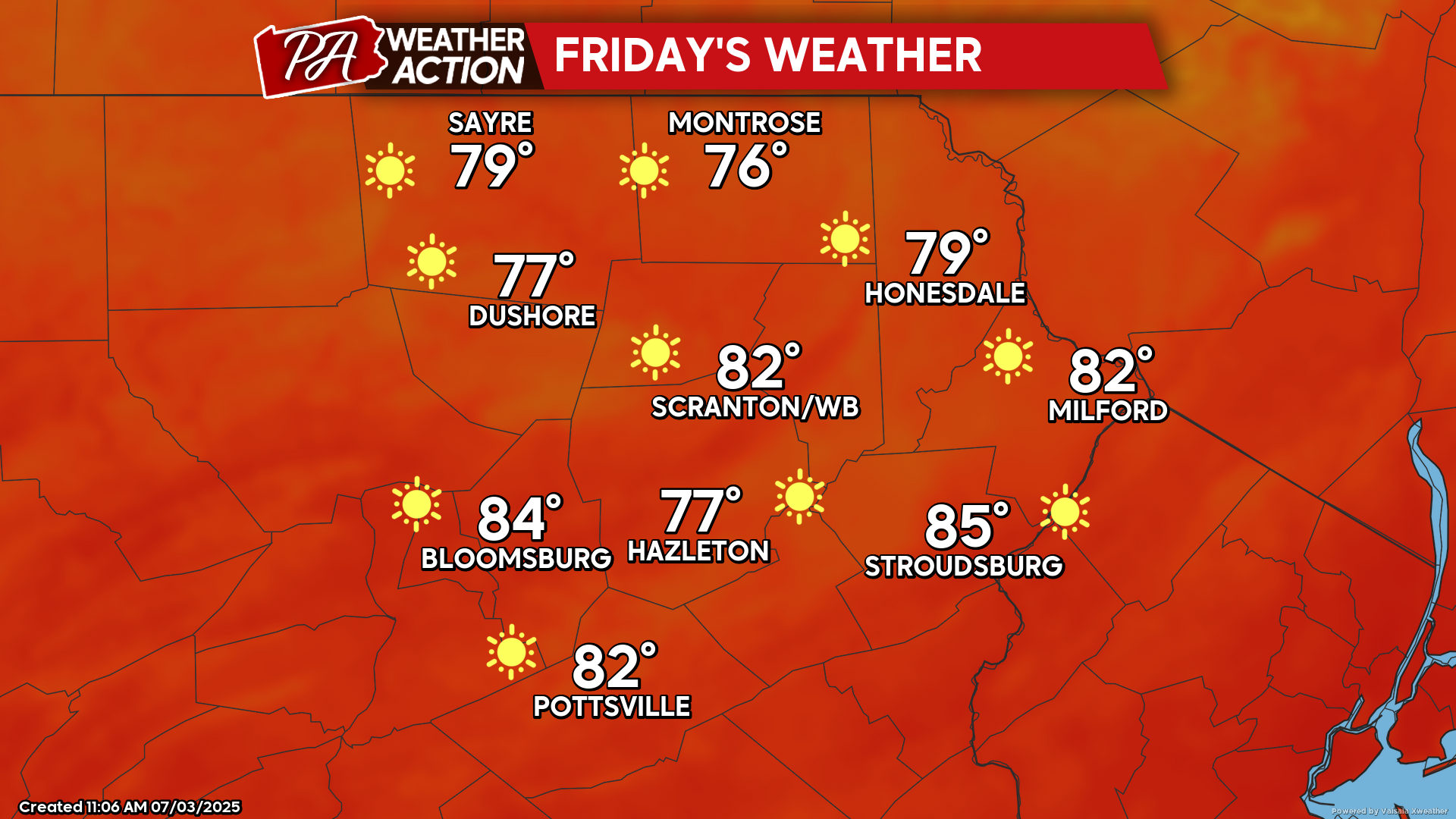
FRIDAY
The morning will be cool with widespread 50s. The day will feature strong sunshine and low humidity with temperatures climbing through the 70s and into the 80s in the valleys. Enjoy! With another cool Friday night into Saturday, it might be a good opportunity to open windows and enjoy fresh air.
SATURDAY
That refreshing surface high will be overtop our area. This will bring another day of low humidity and azure blue skies. Temperatures should get into the 80s with comfortable humidity.

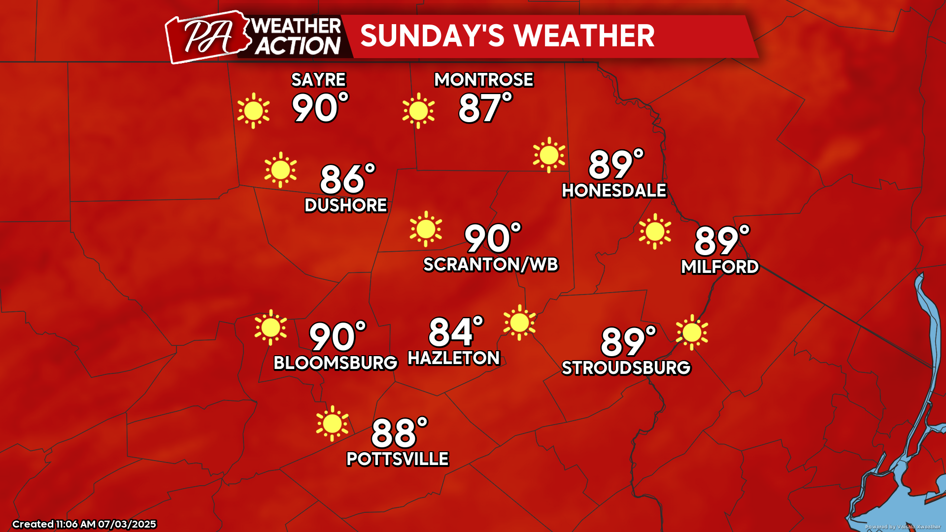
SUNDAY
The surface high responsible for the refreshing weekend weather will move offshore Sunday. This will induce a flow of hotter and increasingly humid air from the south into our area. Temperatures Saturday night into Sunday morning will be in the upper 50s into the 60s. High temperatures on Sunday will soar to above-normal levels, with widespread 80s and even some 90s likely. Very sunny and dry weather will prevail.

You must be logged in to post a comment.