
Heat advisories have been issued for portions of the region on Tuesday, as hot and humid conditions are expected. The passage of a cold front will bring the chances for showers and thunderstorms, along with cooler conditions following frontal passage after mid-week.
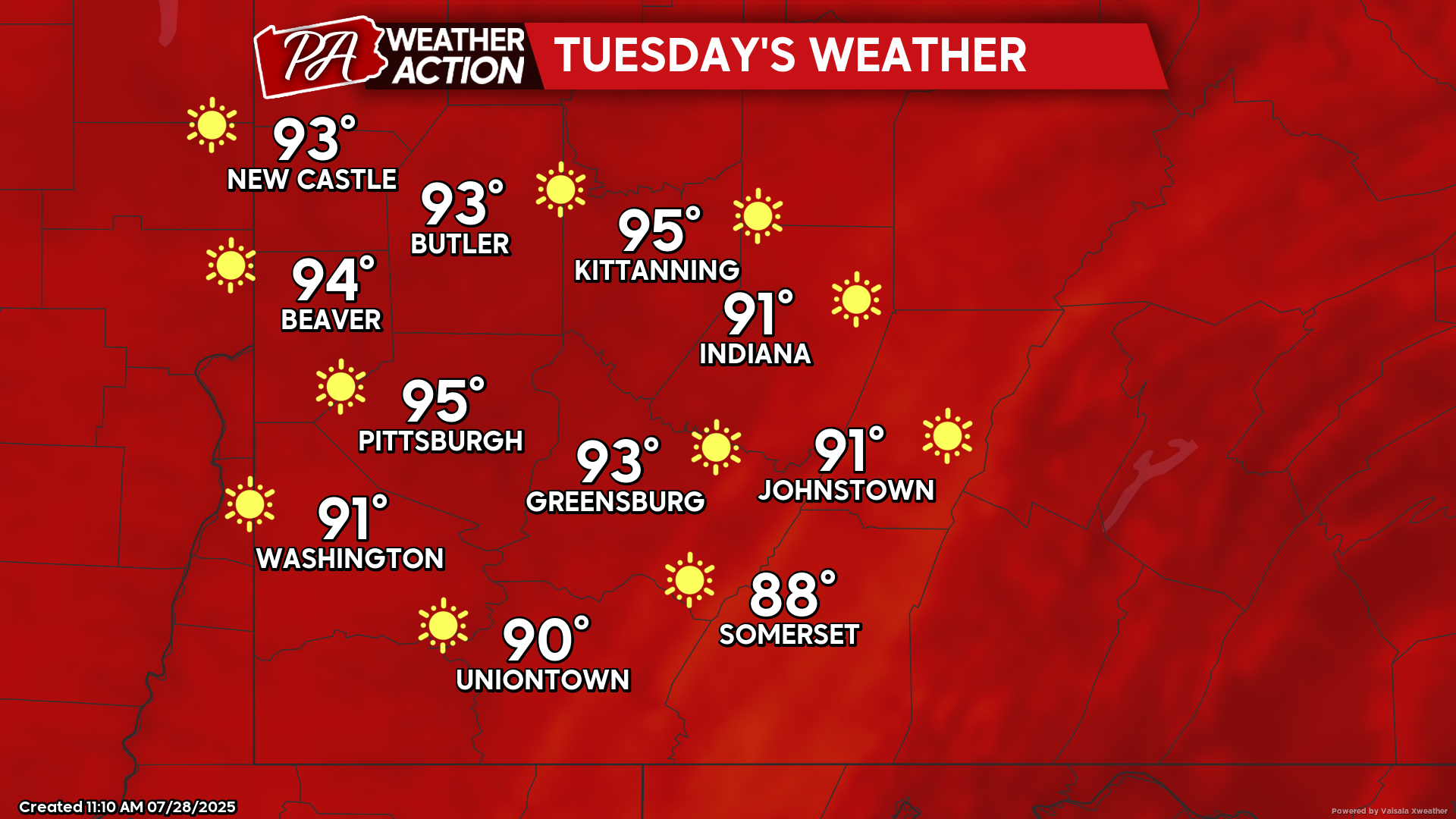
Tuesday
Sunny skies with hot and humid conditions. Heat advisories will be in effect for the western portion of the region. Highs will be in the mid 90s to upper 80s, heat index values could approach 100+ degrees in some areas, lows will be in the mid 70s to upper 80s. Winds will be calm.
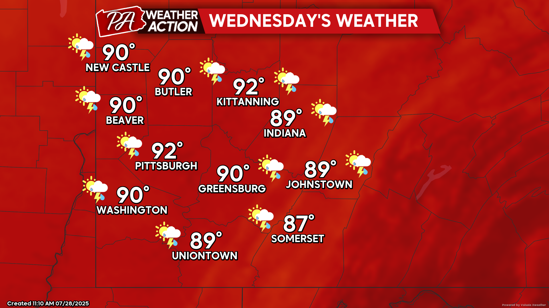
Wednesday
Mostly sunny and hot, with chances for afternoon and evening showers and thunderstorms. Highs will be in the low 90s to upper 80s, heat index values again could approach 100+ degrees in some areas, lows will be in the low 70s to mid 60s. Calm winds will transition to winds out of the west around 5 mph with the passage of a cold front.
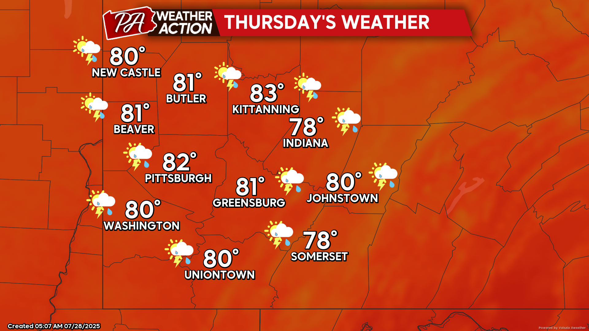
Thursday
Mostly cloudy with chances for showers and thunderstorms, cooler temperatures are also expected. Highs will be in the low 80s to upper 80s, lows will be in the low 60s to upper 50s. Winds will be out of the north at 5-15 mph, with wind gusts approaching 20 mph.
Clear and cooler conditions are expected to end the week. Be sure to follow PA Weather Action for more details and forecasts.

You must be logged in to post a comment.