
Above average temperatures with chances for severe weather and flooding potential through mid-week.
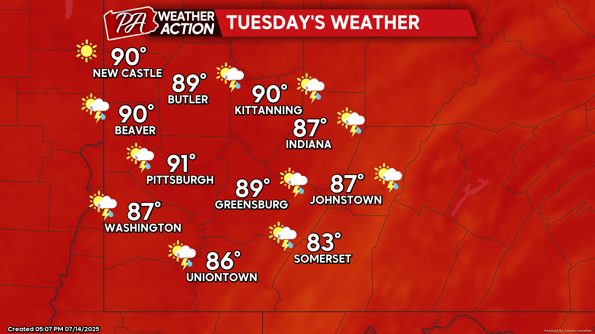
Tuesday
Mostly sunny and hot, with a slight chance for rain, especially in the southern portions of the region. Highs will be in the low 90s to upper 80s, lows will be in the low 70s to upper 60s. Winds will be calm.
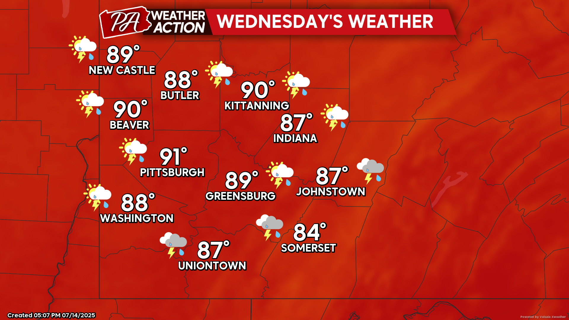
Wednesday
Mostly cloudy with chances for showers and thunderstorms beginning in the afternoon and continuing overnight. Some storms could be severe and could bring the potential for flooding. Highs will be in the low 90s to mid 80s, lows will be in the low 70s to mid 60s. Winds will be out of the south-southwest at 5-7 mph.
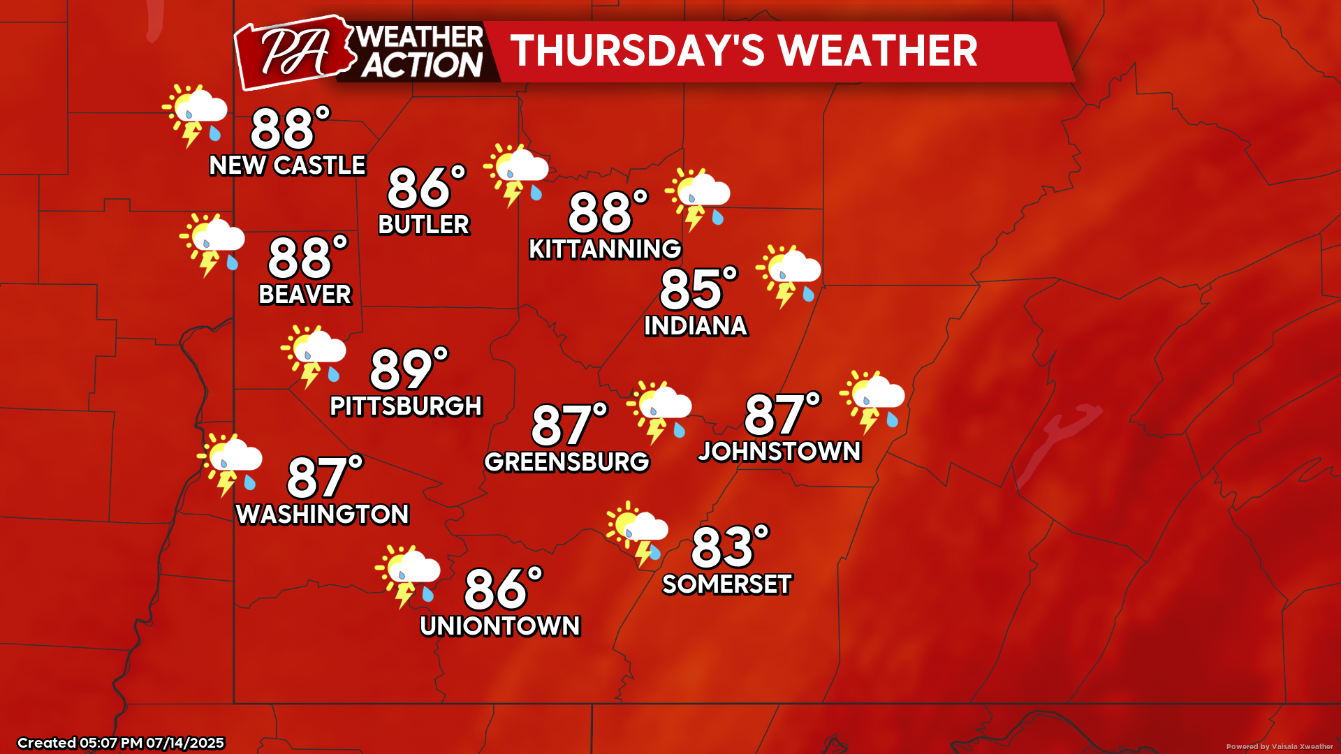
Thursday
Mostly cloudy with ongoing chances for showers and thunderstorms throughout the day. Some storms could be severe and bring the potential for flooding. Highs will range in the 80s, lows will be in the low 70s to upper 60s. Winds will be out of the southwest at 5-10 mph
Slightly cooler temperatures with an ongoing chance for showers to end the week. Be sure to follow PA Weather Action for more information and forecasts.

You must be logged in to post a comment.