
Winter Storm Watches are up in parts of the state ahead of an ice storm that will impact us on Friday, New Year’s Day. The good news is that the storm will not begin until Friday afternoon, meaning there should be no issues traveling in the morning. Travel is discouraged in nearly all of central and eastern PA Friday afternoon and evening.
FUTURE RADAR TIMING
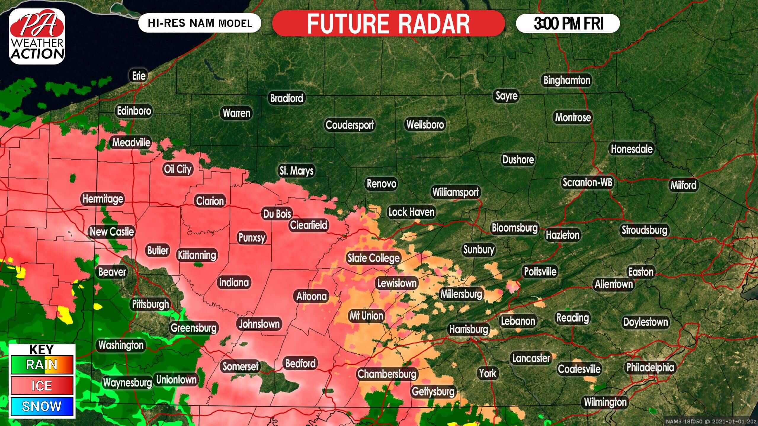
Freezing rain is expected to begin in much of central PA by mid Friday afternoon. Temperatures will be right around freezing in many areas, but with ground temperatures several degrees above freezing, it may take an hour or two for non-elevated surfaces to get slippery. Below is Hi-Res NAM future radar for 3:00 PM Friday.
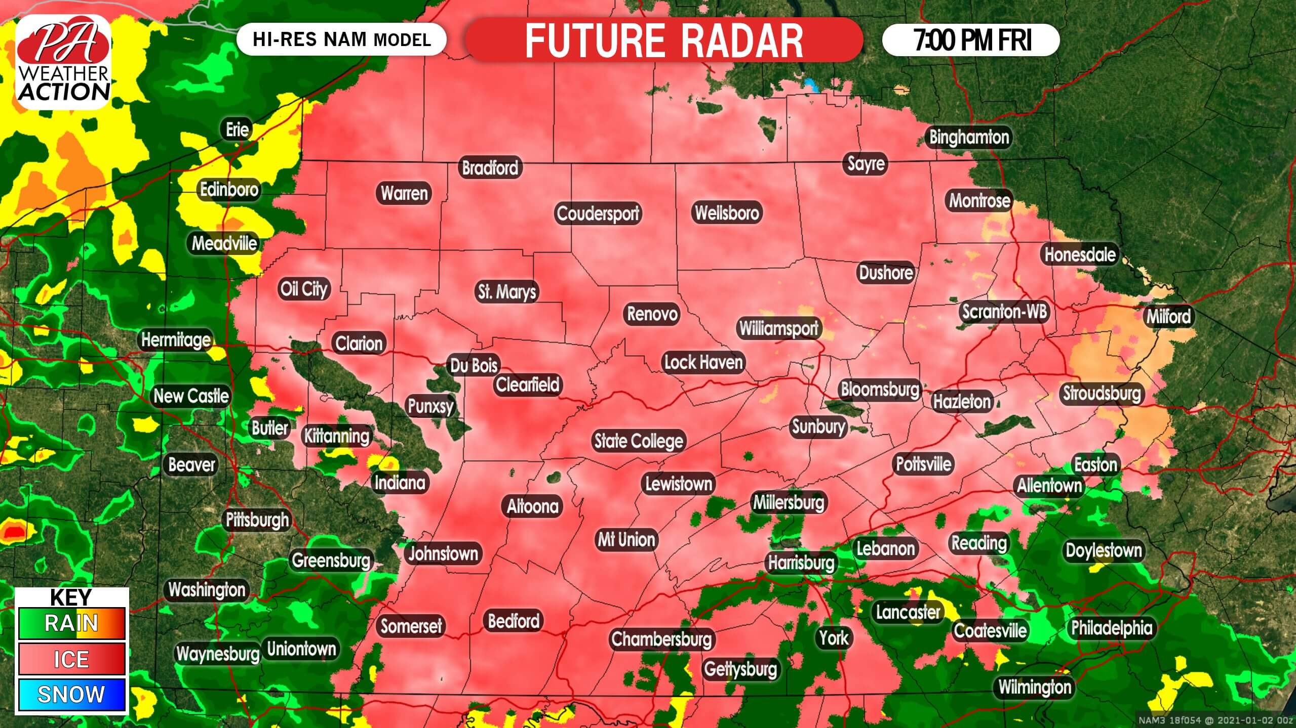
As we head into Friday evening, conditions will deteriorate for many of us. Freezing rain will continue as temperatures hold around the 32 degree mark, and roads will become hazardous by dinnertime. Make no mistake, freezing rain is more dangerous than snow, especially since it doesn’t happen nearly as much and we aren’t used to driving in it. Here is future radar for 7:00 PM Friday.
By very late Thursday evening, most of the state should be above freezing with the exception of the Poconos. Sometimes the cold air hangs on several hours longer than what the models show, so travel conditions may still be hazardous early Saturday morning. Below is future radar for 11:00 PM Friday.

Untreated surfaces may still be slippery until about 7-8 AM Saturday, before temperatures warm into the 40s.
SECOND CALL ICE FORECAST FOR FRIDAY (NEW YEAR’S DAY)
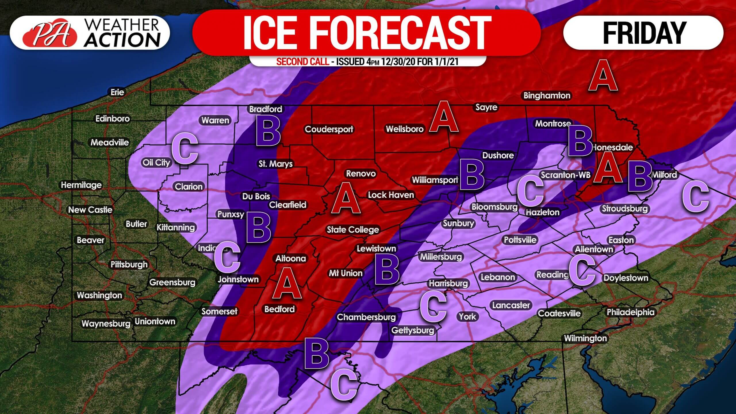
Area A: Ice accumulation of around a quarter-inch (.25″) expected. Very hazardous travel conditions are likely Friday afternoon and evening. If you must travel, drive at reduced speeds especially over bridges. Isolated power outages also possible.
Area B: Ice accumulation of around a tenth-inch (.10″) anticipated. Hazardous travel conditions are likely Friday afternoon into the evening. If you must travel, drive at reduced speeds especially over bridges.
Area C: Ice accumulation of up to a twentieth-inch (.05″) expected. Slippery travel conditions are possible Friday afternoon.
For updates on this storm and the rest of the winter, get our free app! Download it here on Apple & Android >>> Weather Action App Link
Be sure to share this forecast with family and friends who may be traveling on New Year’s Day using the blue button. Stay safe!

You must be logged in to post a comment.