
Isolated showers and thunderstorms are possible in the eastern portions and the higher elevations of the region. Sunny conditions will be experienced for most with increasing cloud cover towards the east. Widespread rain is expected by mid-week for the entire region.
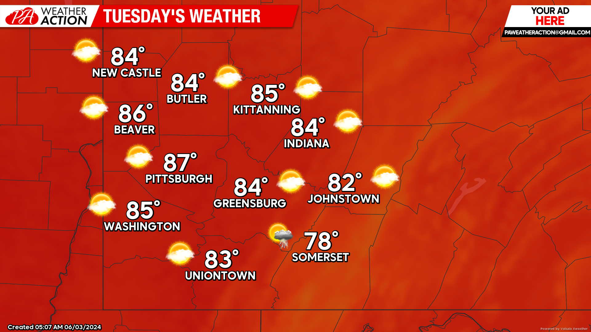
Tuesday
Areas of dense fog are expected in the eastern portions and higher elevations to start the day on Tuesday, followed by mostly sunny conditions. Highs will be in the high to mid 80s, lows will be in the mid to low 60s.
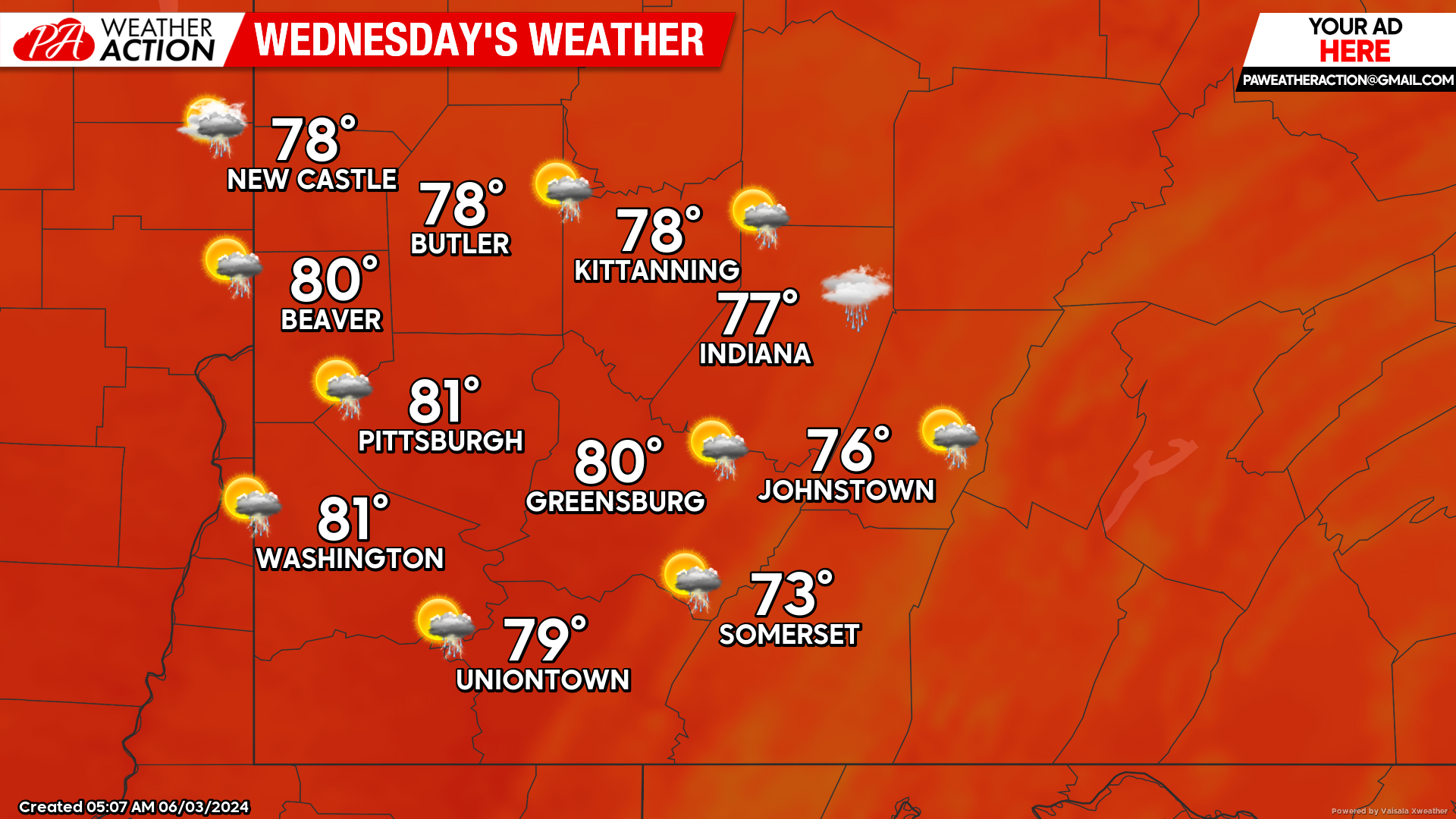
Wednesday
Showers and thunderstorms are likely to impact the entire region starting in the early afternoon and continuing into the evening and overnight hours. Highs will be in the low 80s to mid 70s, lows will be in the mid to low 60s. Winds will be out of the south at 5 to 10 mph. Rainfall totals are expected to be around a quarter and a half an inch, high totals are possible in any thunderstorms that occur.
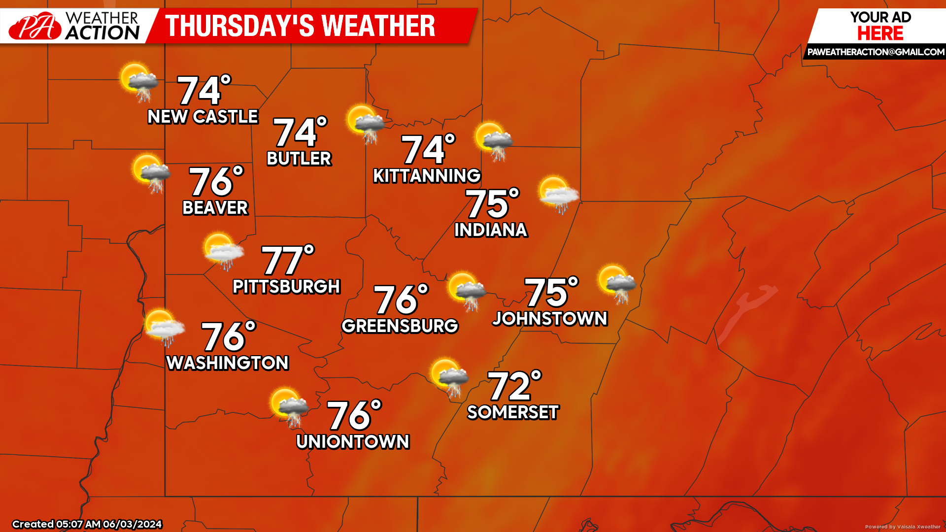
Thursday
Chances for showers and thunderstorms continue into Thursday. Highs will be in the mid to low 70s, lows will be in the low 60s to mid 50s.
Chances for showers and thunderstorms continue throughout the week and into the weekend. Be sure to follow PA Weather Action for more regional forecasts.

You must be logged in to post a comment.