
Today
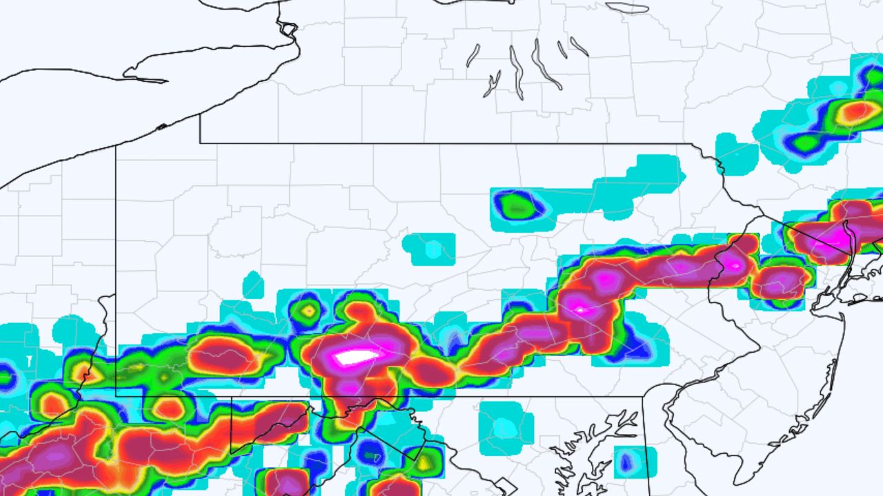
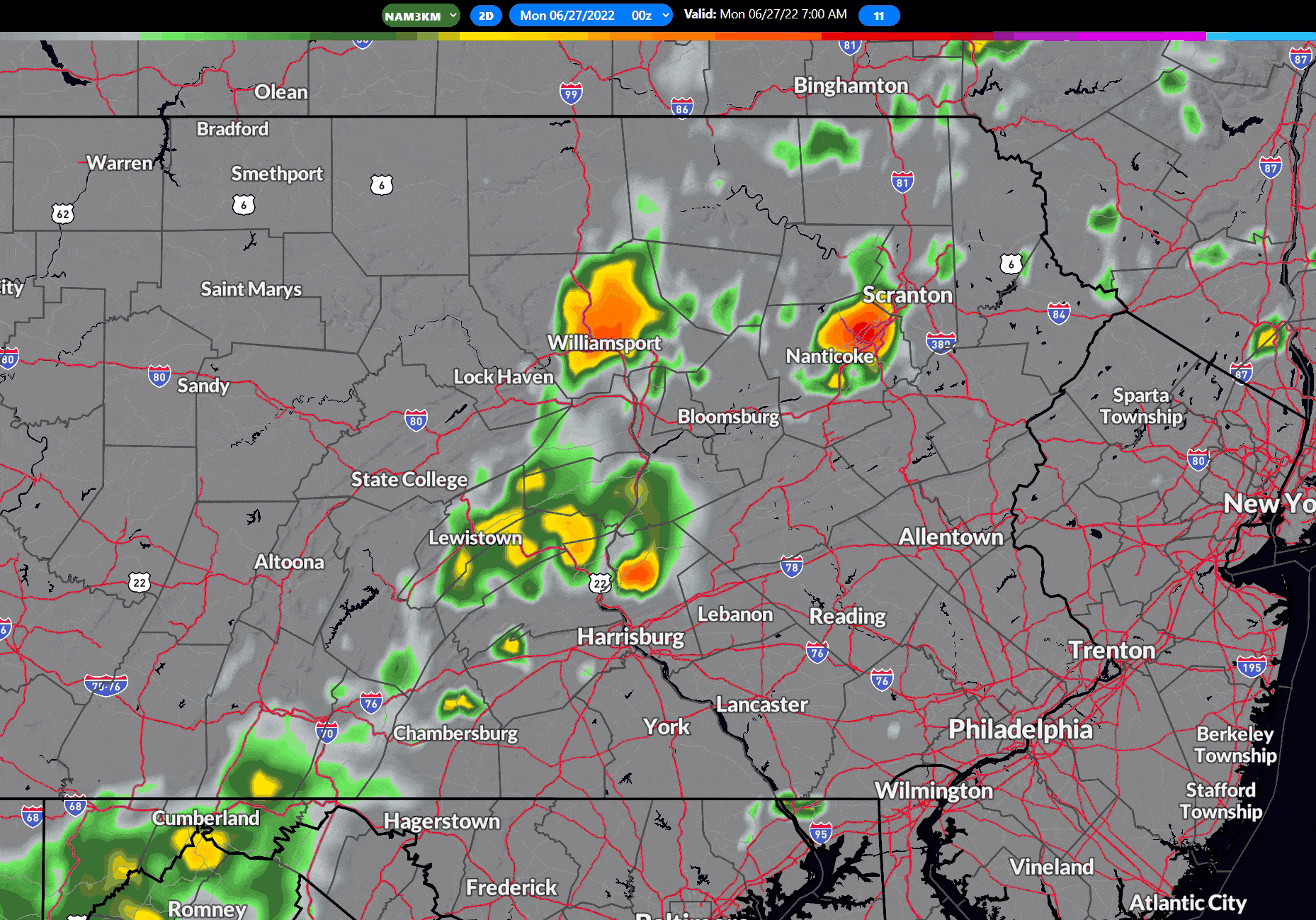
It’s the start of a new workweek, and a start of a very brief cooler period of weather. Some leftover showers and even a rumble of thunder are possible this morning, mainly across Eastern PA. By the evening, we expect mostly sunny skies and comfortable temperatures with a decent breeze. Here is future radar for those showers exiting.
Tuesday
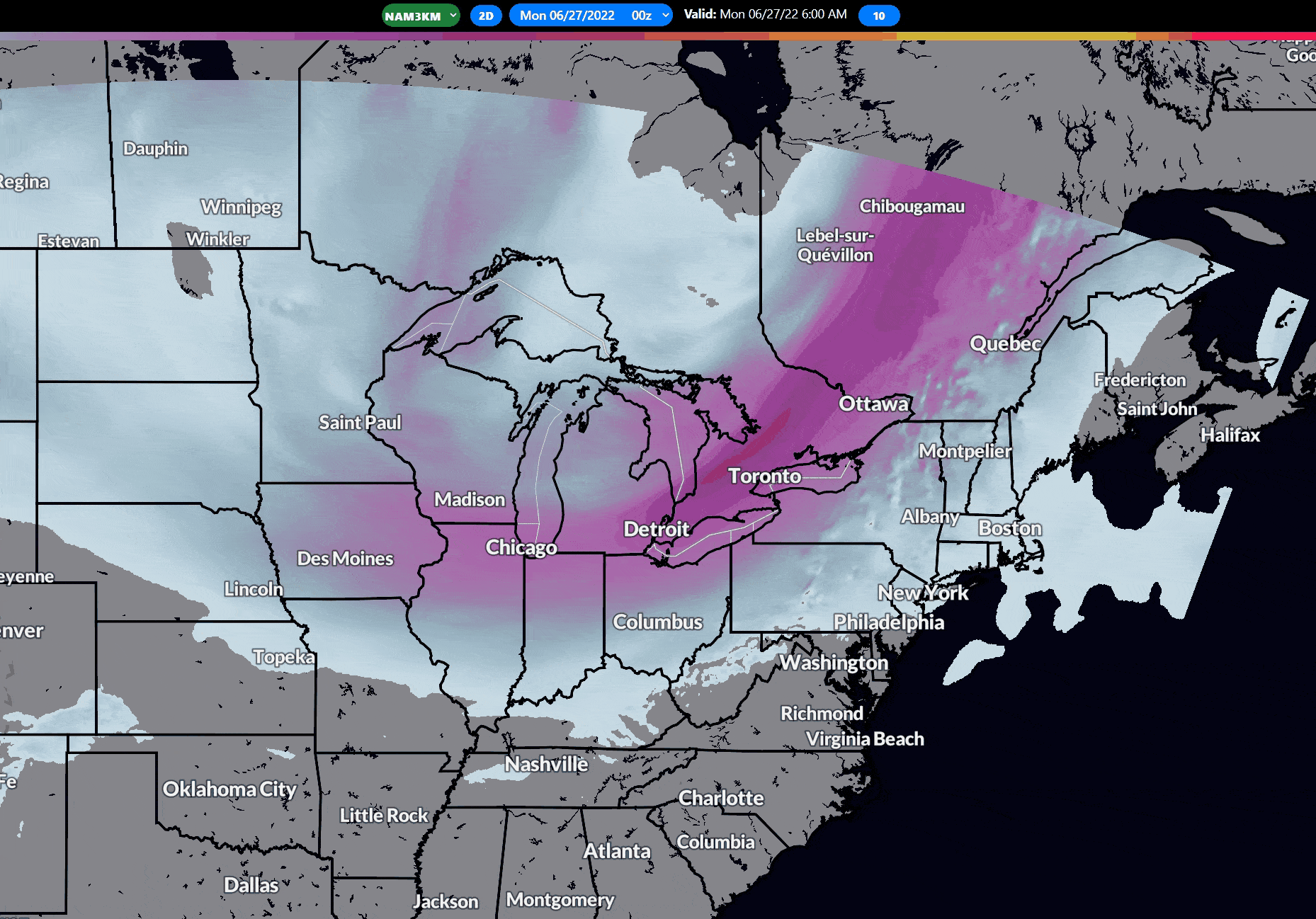
Morning temperatures will be pretty chilly for late June standards, generally in the 40s in Northern PA and 50s in Southern PA. However, it won’t warm up too much thanks to the trough that’ll be lifting out, as shown below. It’ll be a bright, sunny day with high pressure overhead.
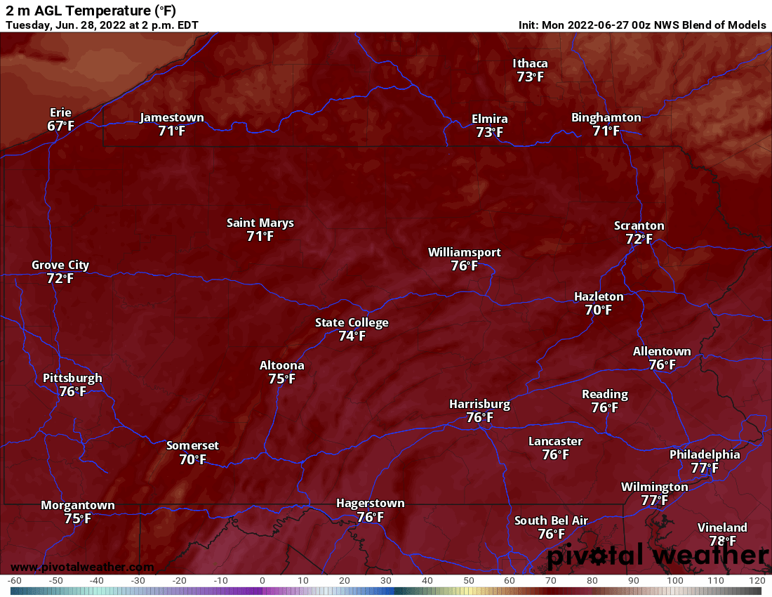
Highs Tuesday will be in 70s, which is more than acceptable for the third to last day of June.
Wednesday
Wednesday continues the mostly sunny skies, with the best chance for some clouds over the northern mountains. We will begin the gradual uptrend in temperatures on Wednesday, with highs in the 70s in the mountains and 80s everywhere else.
Thursday
For all intensive purposes, Thursday will be a copy of Wednesday and the last day before we heat up just in time for the holiday weekend. Another dry day with normal temperatures.
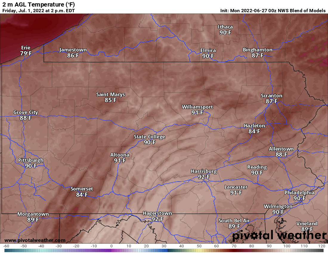
Friday
The heat turns up a notch on Friday as the ridge builds in, pushing high temperatures into the 90s for most of us. Clouds will build in later in the day in northern and western PA, but we should stay dry with the cold front not yet reaching the area. Highs for Friday aren’t pretty unless it’s a pool day.
Weekend
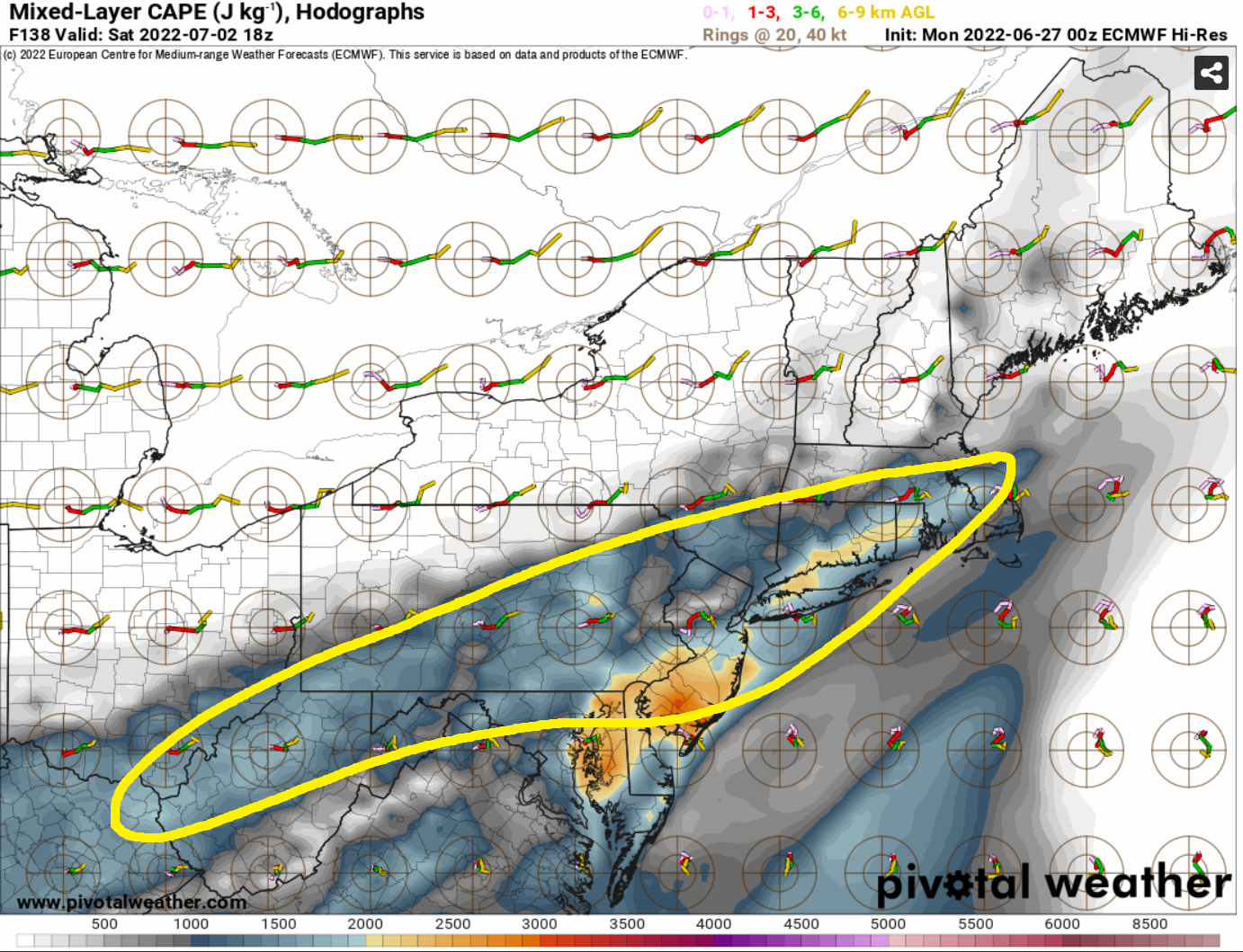
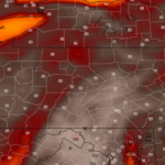
Thunderstorms will be possible Saturday as a strong cold front pushes through from northwest to southeast, which will likely be the direction of these storms. Modeling is showing signs of a severe risk potential for Saturday, so we’ll definitely keep an eye on it. Below is the area right now where the severe risk looks highest for Saturday, but it’ll be a few days before we have details.
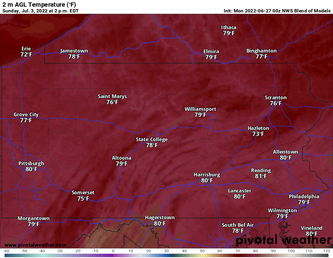
Sunday and Monday right now look mostly dry after the front passes, with very comfortable temperatures for this time of year. Here are highs for Sunday, not bad at all!
Monday (July 4th) looks very similar to Sunday, with highs about 5 degrees below average. Skies right now are projected to be mostly sunny, which is great news for firework shows either Sunday or Monday evening!
That’s all for this morning’s update. Remember you can find our local hourly and daily forecast graphics in our app, along with so much more. Thanks for reading!

You must be logged in to post a comment.