
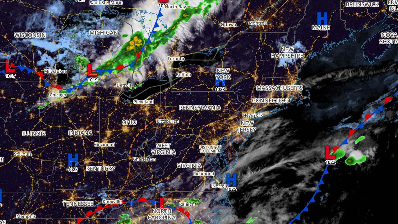
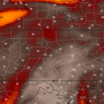
Good morning, it’s Wednesday, June 29th, 2022. Below is a current view of satellite & radar, and surface analysis.

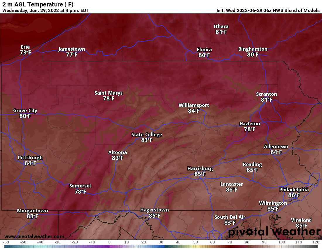
Today
Today begins the warming trend, with highs in the upper 70s to mid 80s. High pressure will continue to keeps skies mostly sunny. A light southwest breeze is expected, with occasional gusts up to 15mph.
Thursday
Highs tomorrow will generally be in the 80s, with a few 90s in the hotter valleys of Southern PA. And after some morning patchy clouds move out, the sunshine continues. There’s not much else to say, just a great summer day.
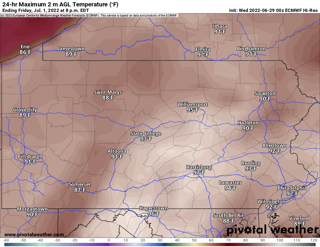
Friday
Unfortunately Friday will give us a taste of what much of the country has been dealing with in the past few weeks – temperatures near 100 degrees. While almost everyone should stay in the 90s, it’s possible a few places reach the triple digits. There may be isolated showers and storms in Western PA, but nothing severe. If you’re starting the holiday weekend early with outdoor activities, drink plenty of water and don’t forget the sunscreen. Here’s highs for Friday.
Saturday
A weak cold front will drop in Saturday, bringing some showers and thunderstorms in the afternoon and evening moving from northwest to southeast in Central & Eastern Pennsylvania. Models aren’t as enthused about the severe threat as they previously were, so perhaps we could be looking at a slight risk but probably nothing more. Either way, we’ll keep you informed on how it’s looking but there will definitely be some rain in the eastern two-thirds of the state Saturday. Highs in the 80s.
Sunday
We have some good news for Sunday, as models have backed away from the idea of showers/storms in Southern PA. It’s looking nice and dry with highs in the upper 70s to mid 80s.
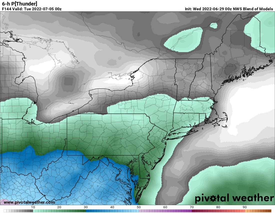
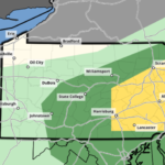
Monday
There is now some model disagreement for Monday, with the European model wanting to fire off some thunderstorms in Western PA Monday evening. However, basically everything else disagrees strongly and gives us mostly sunny skies with no precipitation even close to the state. I don’t think we will have to deal with any rain. With that said, be sure to check back for new forecasts. Below is a graphic displaying probabilities of thunder, and as you can see there is a low probability mainly in Southern PA Monday evening.
Tuesday
Scattered showers and thunderstorms are possible Tuesday, with highs in the upper 70s across Northern PA to the mid 80s in the southern tier.
Be sure to check back each morning for our daily updates! You can always get them in our app, which can be downloaded on your phone’s app store by tapping the image below.

You must be logged in to post a comment.