

The severe storm threat has moved east today as the upper level low that has been responsible for all the rain lately has moved north. With it now over the Eastern Great Lakes, an unstable southerly flow will increase the threat of potent thunderstorms in the eastern half of Pennsylvania.
High lapse rates will mean a rogue supercell or two may contain large hail, with the threat of damaging wind relatively low. Flash flooding is a rising concern with several inches of rain now having fallen in recent days.
FUTURE RADAR STORM TIMING
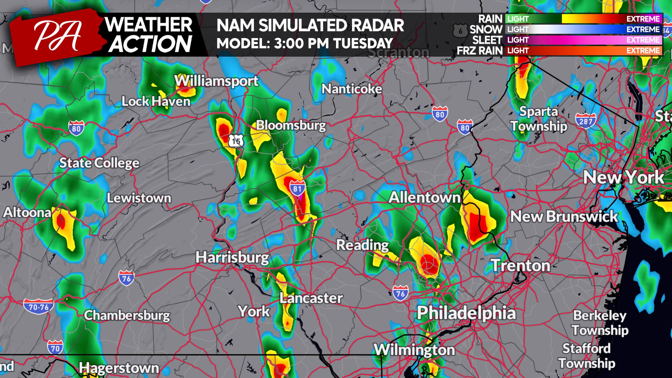
Scattered thunderstorms will develop in Eastern PA mid-afternoon, with a few of these having the possibility of going severe. The main threats will be hail and an isolated tornado.
Below is the Hi-Res NAM model for 3:00 PM Tuesday.
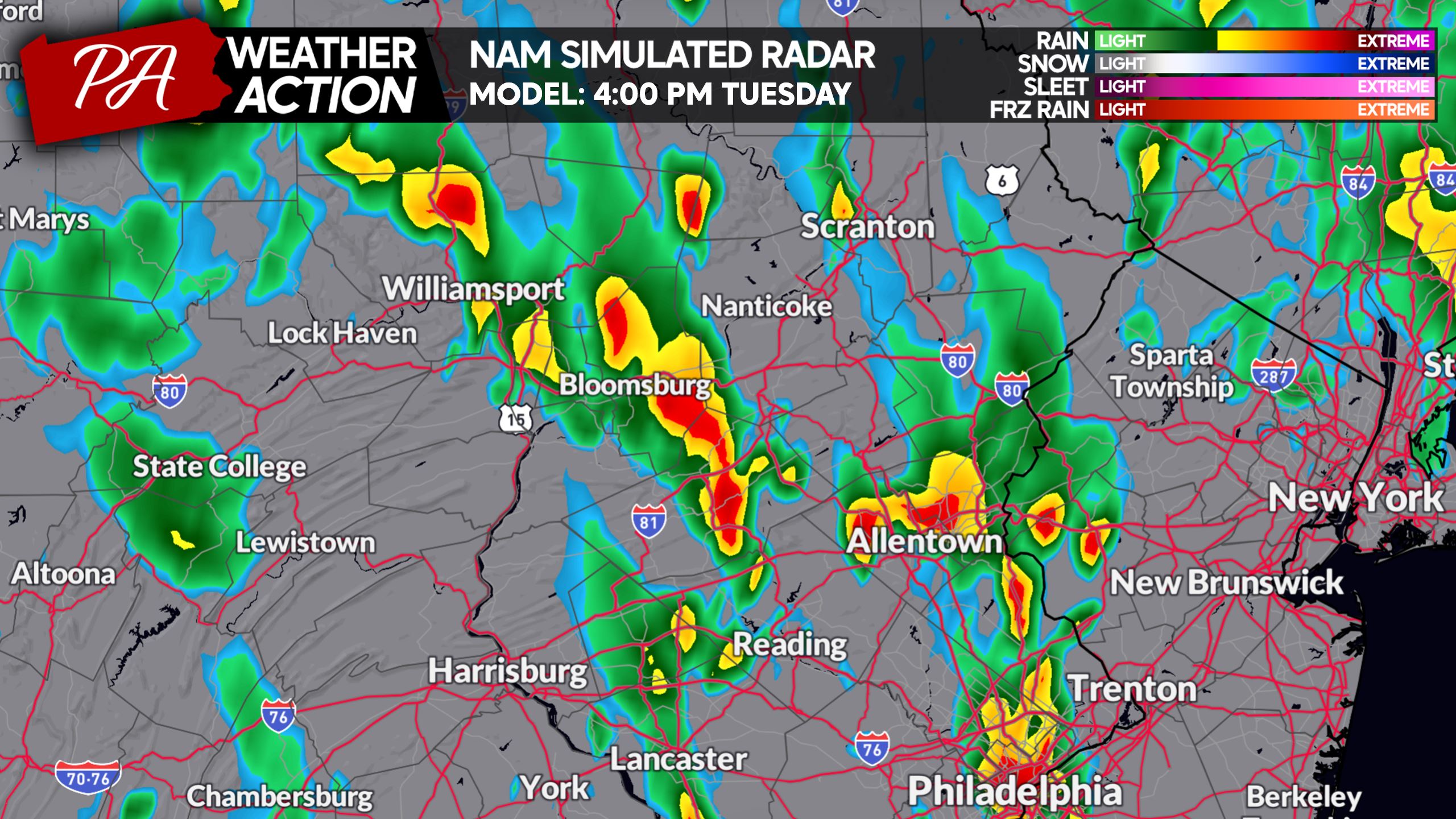
These storms will be pushing northeast into the Lehigh Valley and Northeast PA by afternoon commute, with a continued risk of severe weather. Here is future radar for 4:00 PM.
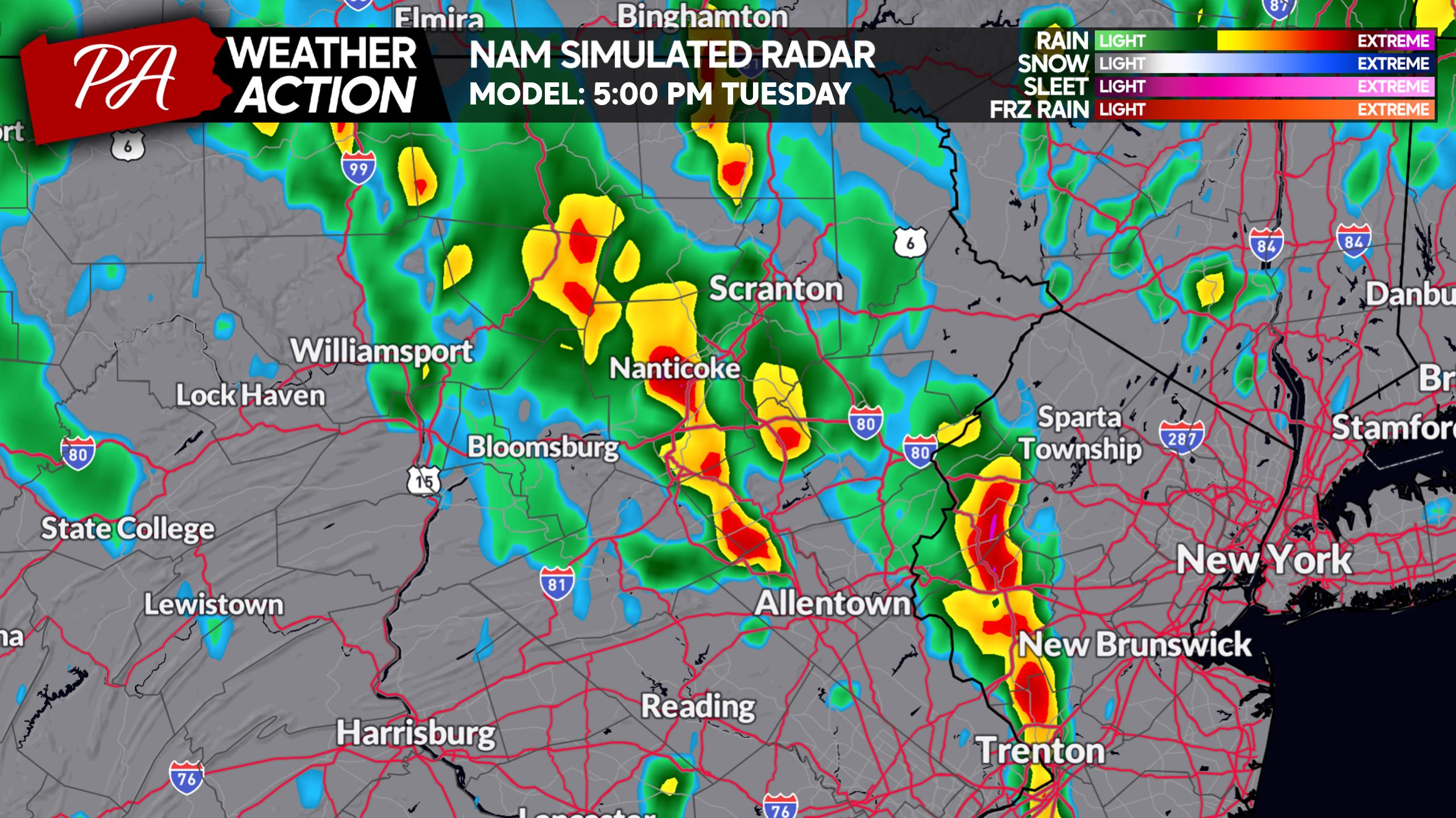
As we approach dinnertime, Hi-Res NAM Future Radar suggests most of the strong to severe storms will be near the Delaware River in Eastern PA and up to NEPA.
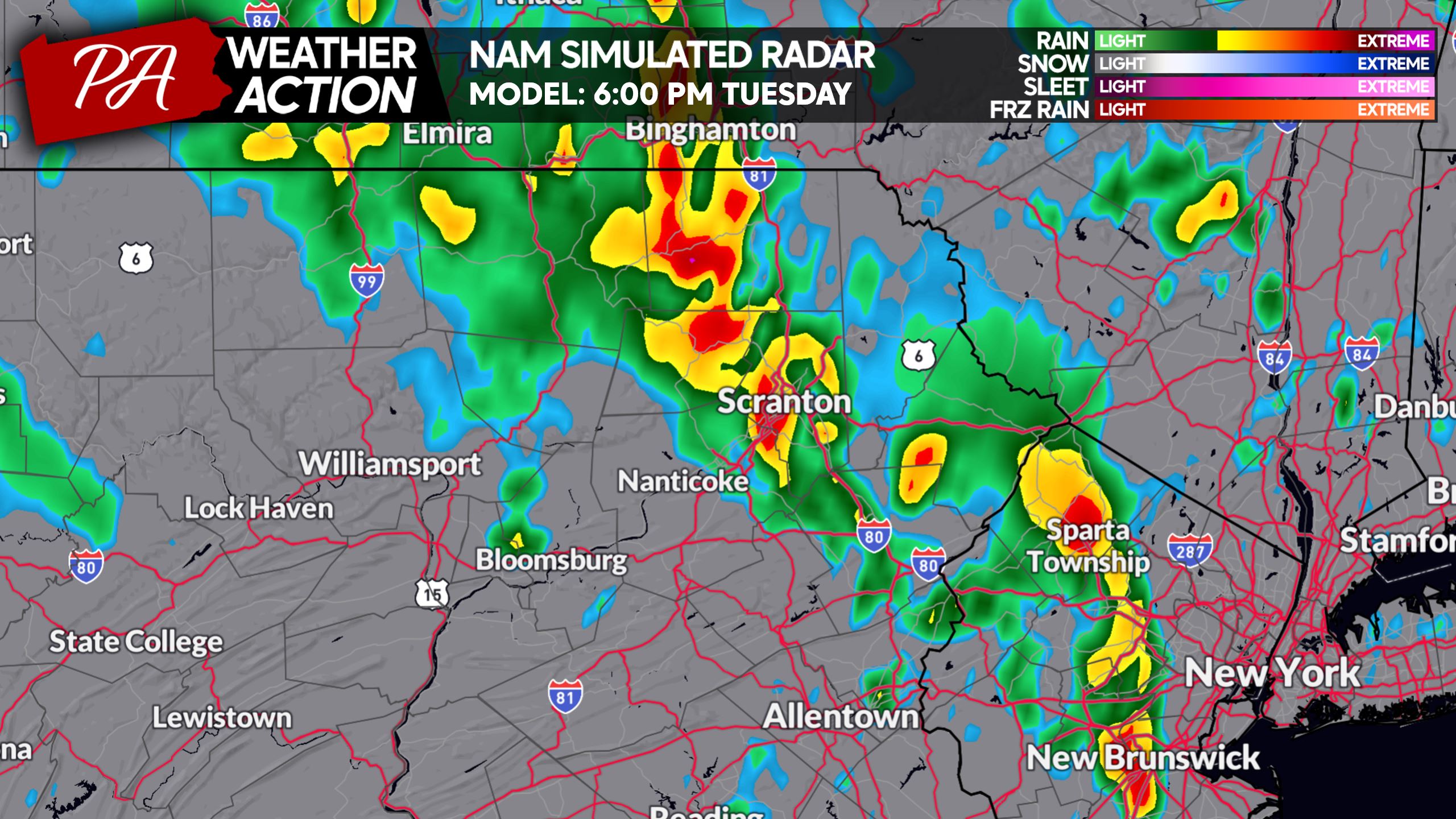
And finally by 6:00 PM, storms are expected across the Northern Poconos and Endless Mountains.
TUESDAY’S SEVERE THUNDERSTOM THREAT FORECAST
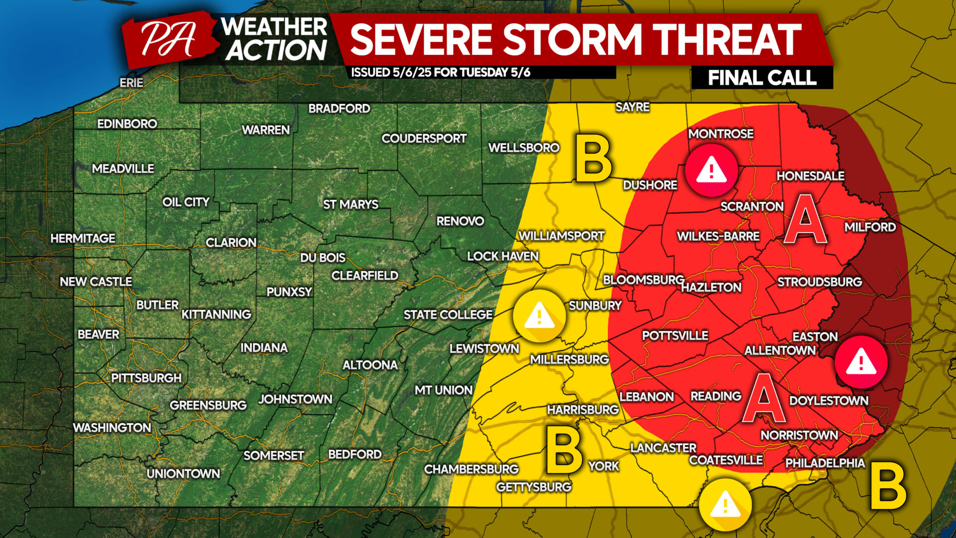
Area A: Large hail is possible within the strongest storms, with scattered strong to severe storms expected. Flash flooding may be a concern in areas with poor drainage, along with a very isolated tornado.
Area B: Isolated strong to severe thunderstorms are possible, with a rogue cell or two producing hail. A very isolated tornado is possible.
Be sure to share this article with family and friends in affected areas!
You must be logged in to post a comment.