
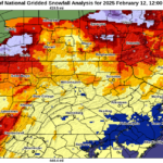
A large-scale, strong low-pressure system is forecasted to impact the region Saturday into Sunday bringing a wintery mix of precipitation and large amounts of rainfall in some areas, resulting in flood watches being issued.
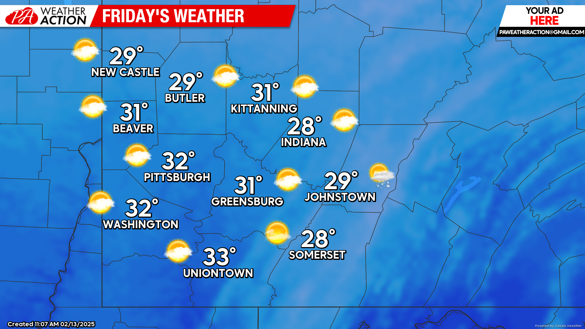
Friday
Scattered morning snow showers will make way for mostly sunny skies on Friday. Highs will be in the low 30s to upper 20s, lows will be in the low 20s to upper teens. Breezy conditions will remain with winds out of the West at 5 to 18 mph, wind gusts could approach 30 mph resulting in wind chill values approaching -5 in some areas.
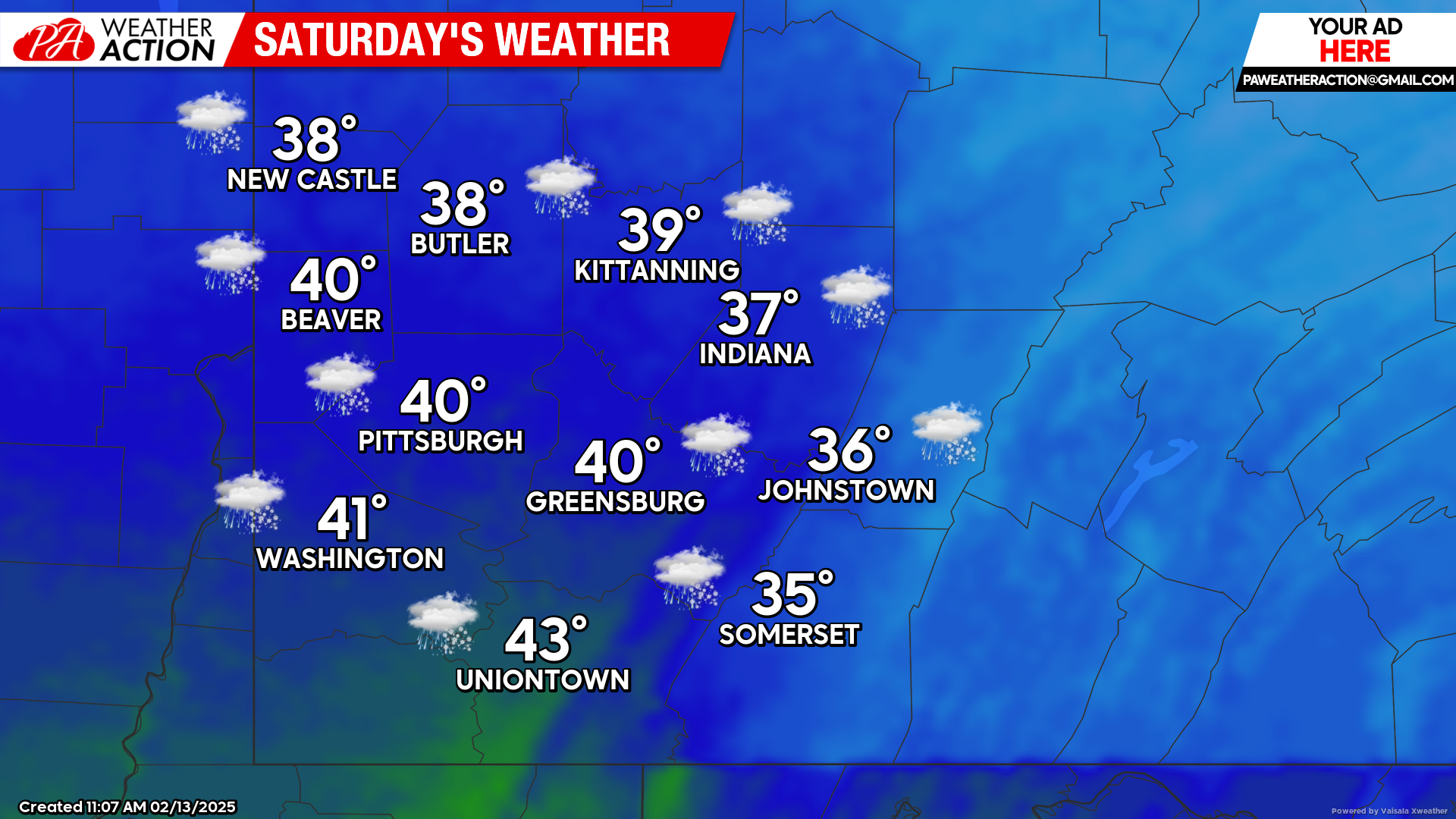
Saturday
Snow showers are expected to begin after midnight continuing in the early morning hours before transitioning to a wintery mix, including areas of freezing rain, before finally transitioning to mostly rain showers in the afternoon hours. Highs will be in the low 40s to mid 30s, lows will be in the upper to mid 30s. Winds will be out of the Southeast at 5-10 mph.
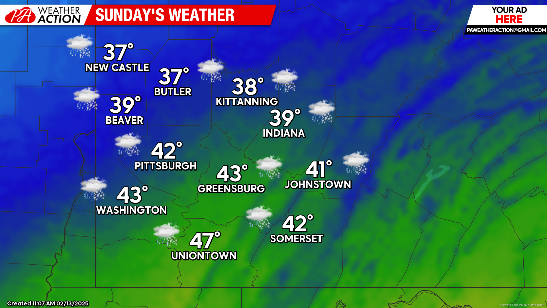
Sunday
Rain to start the day will transition to snow showers as the temperature begins to significantly drop. Highs will be in the low 40s to upper 30s, lows will be in the mid-teens to upper single digits. Breezy conditions are expected with winds out of the West at 7 to 18 mph, with gusts approaching the 35+ mph.
Cold temperatures are expected to continue into next week with another chance for snowfall by mid-week. Be sure to follow PA Weather Action for more forecasts and statewide forecasts providing details on potential snowfall totals.
You must be logged in to post a comment.