
Widespread wind gusts of 40-50 mph disrupted power for thousands of people this morning. The wind has calmed down this afternoon ahead of the next system.
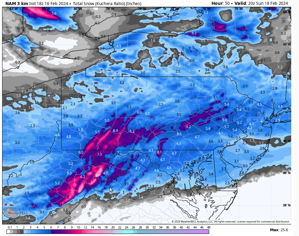
That system is currently over Kentucky Friday afternoon and will track ENE to off the southern New Jersey coast by Saturday morning. This system will spread snow across our area by 8pm tonight in the western counties, and the rest of the area by midnight. The snow will last into Saturday morning, deposing a low-density snow to usher in the biggest ski weekend of the year. The general model trend has been farther north, so most places should see 1-3″, with possibly 3-5″ over the southern counties.
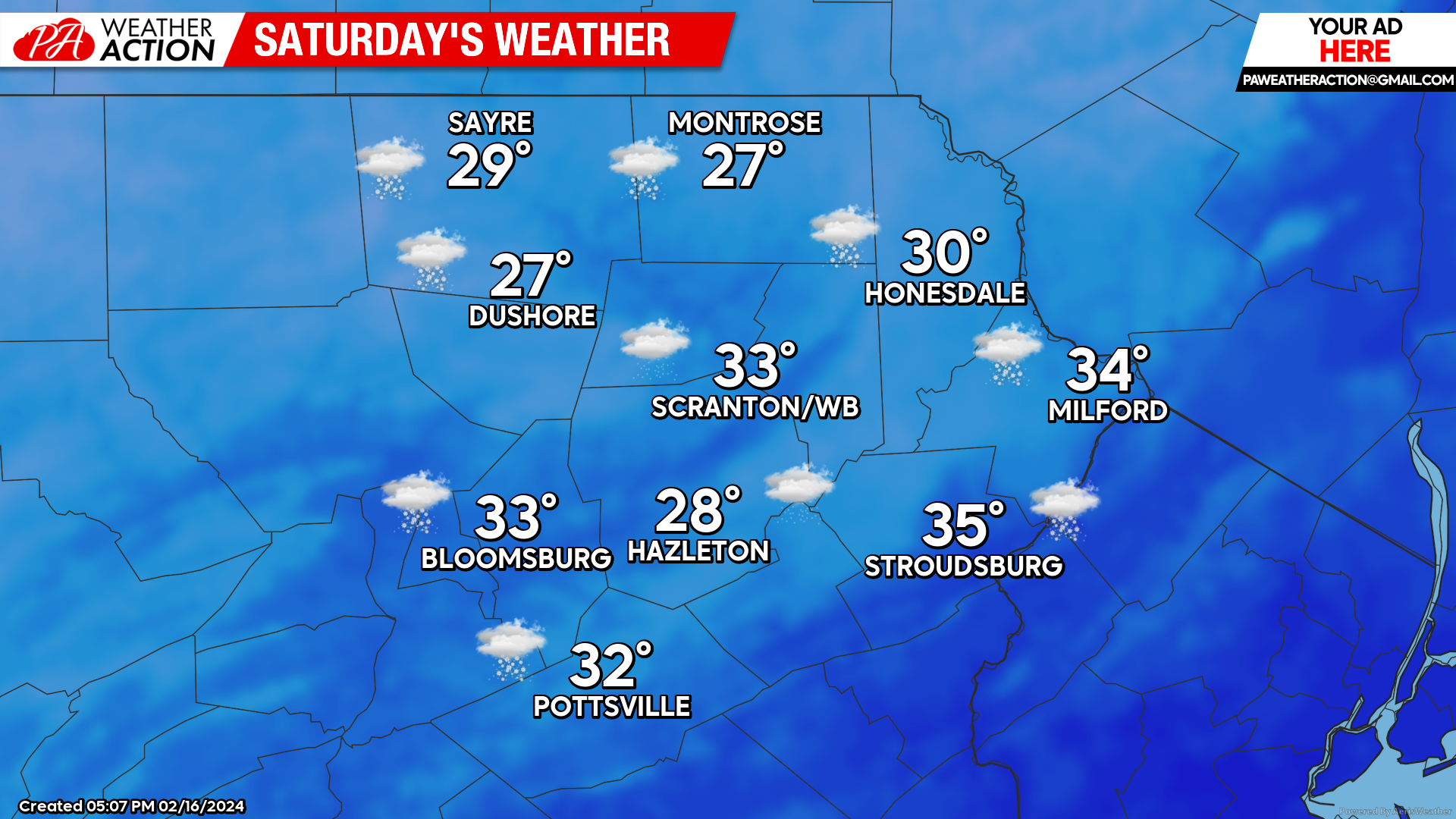
SATURDAY
Snow from that departing system will linger until slightly after sunrise, especially for the eastern counties. Colder air will move into our area behind that system, generating some heavy snow squalls throughout Saturday which could deposit a quick coating to an inch of snow. Gusty wind will drive temperatures down into the mid-upper teens Saturday night.
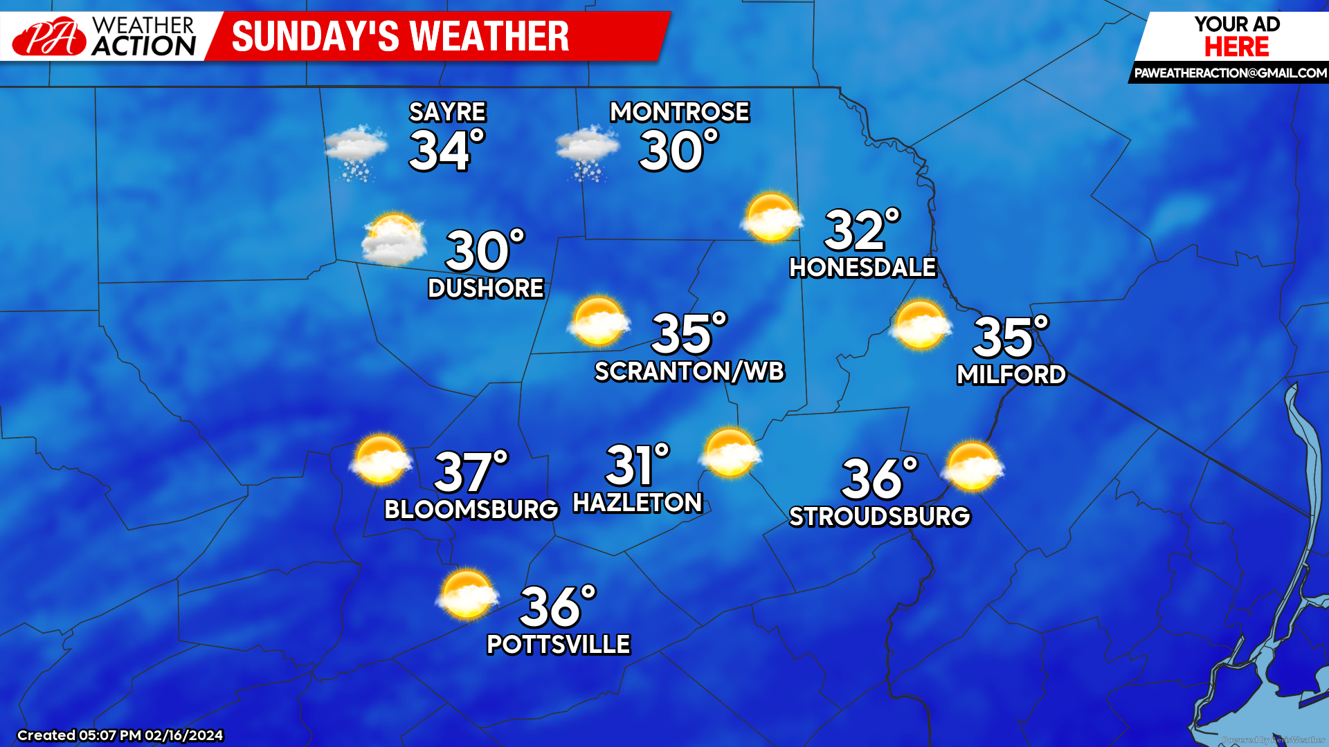
SUNDAY
Sunday will feature blustery wind and partly cloudy skies, with slightly below-normal temperatures.
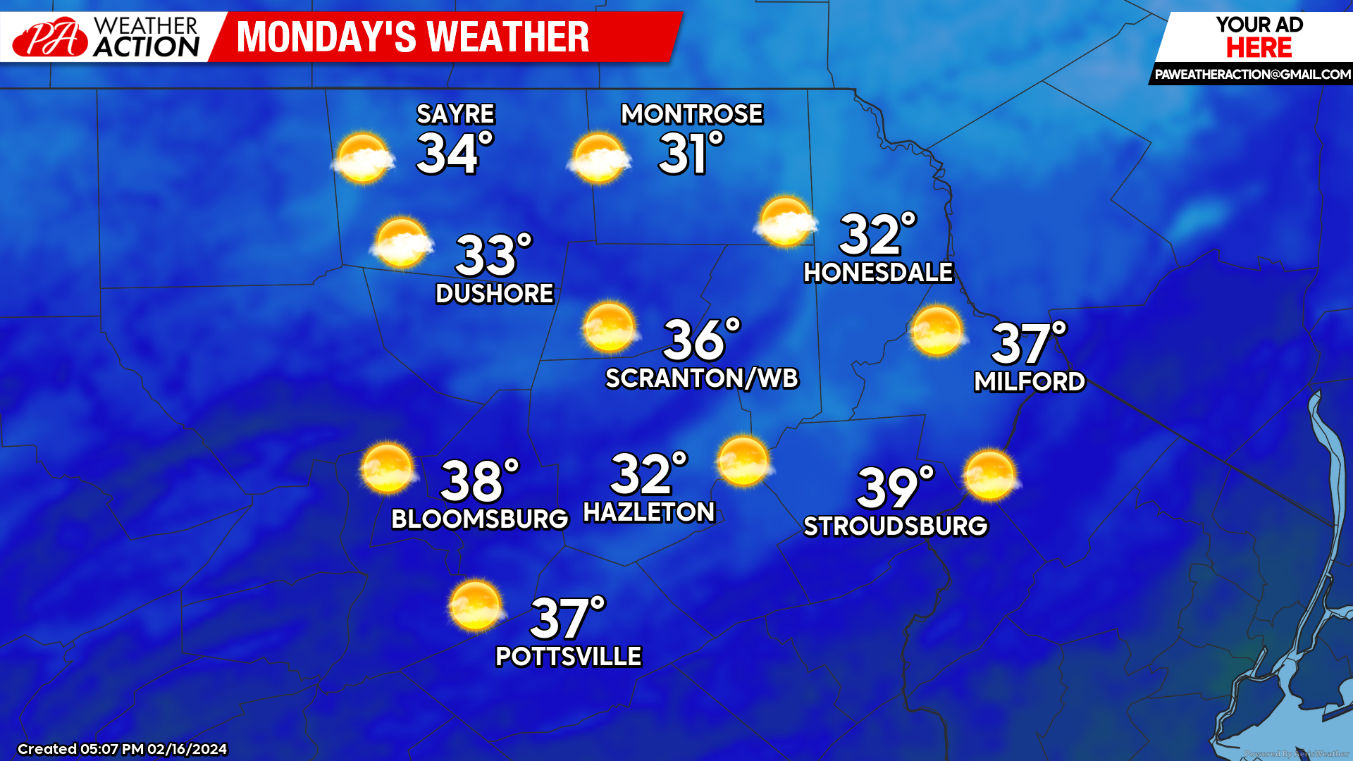
PRESIDENTS DAY
Monday will be sunny and milder across the region, with temperatures near to slightly above normal.

You must be logged in to post a comment.