
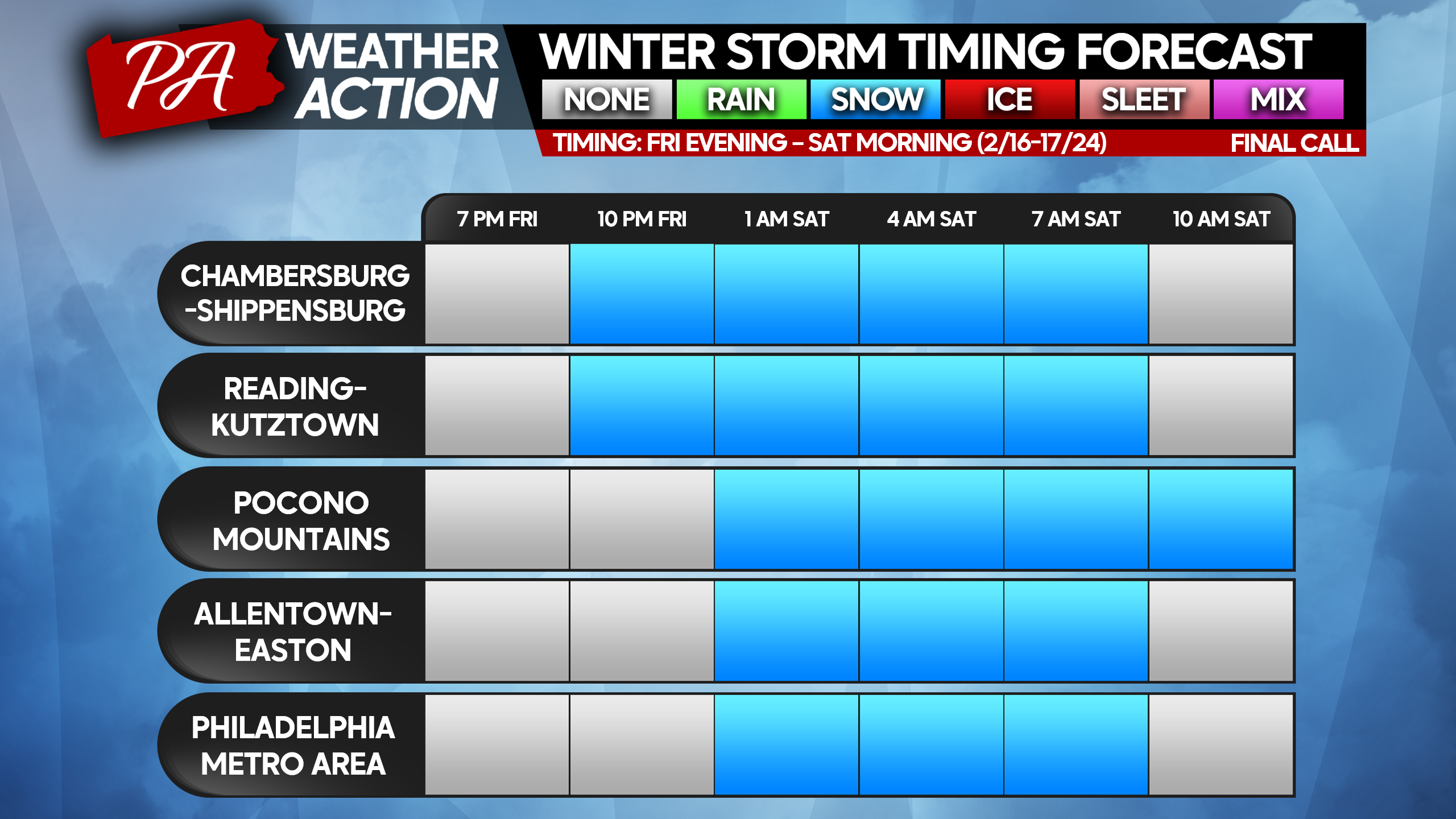
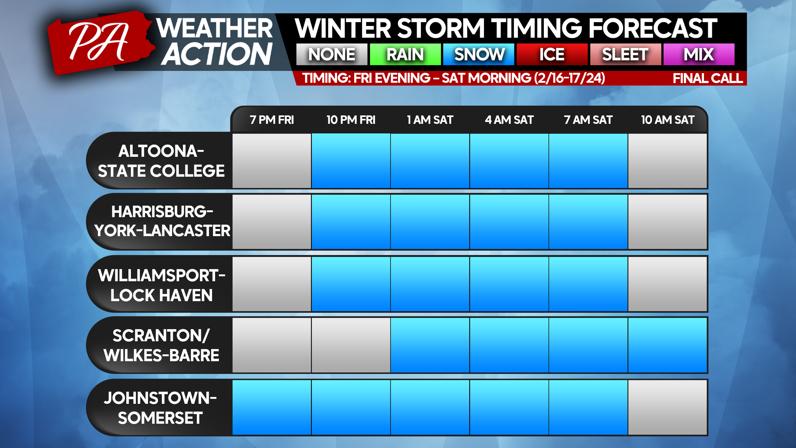
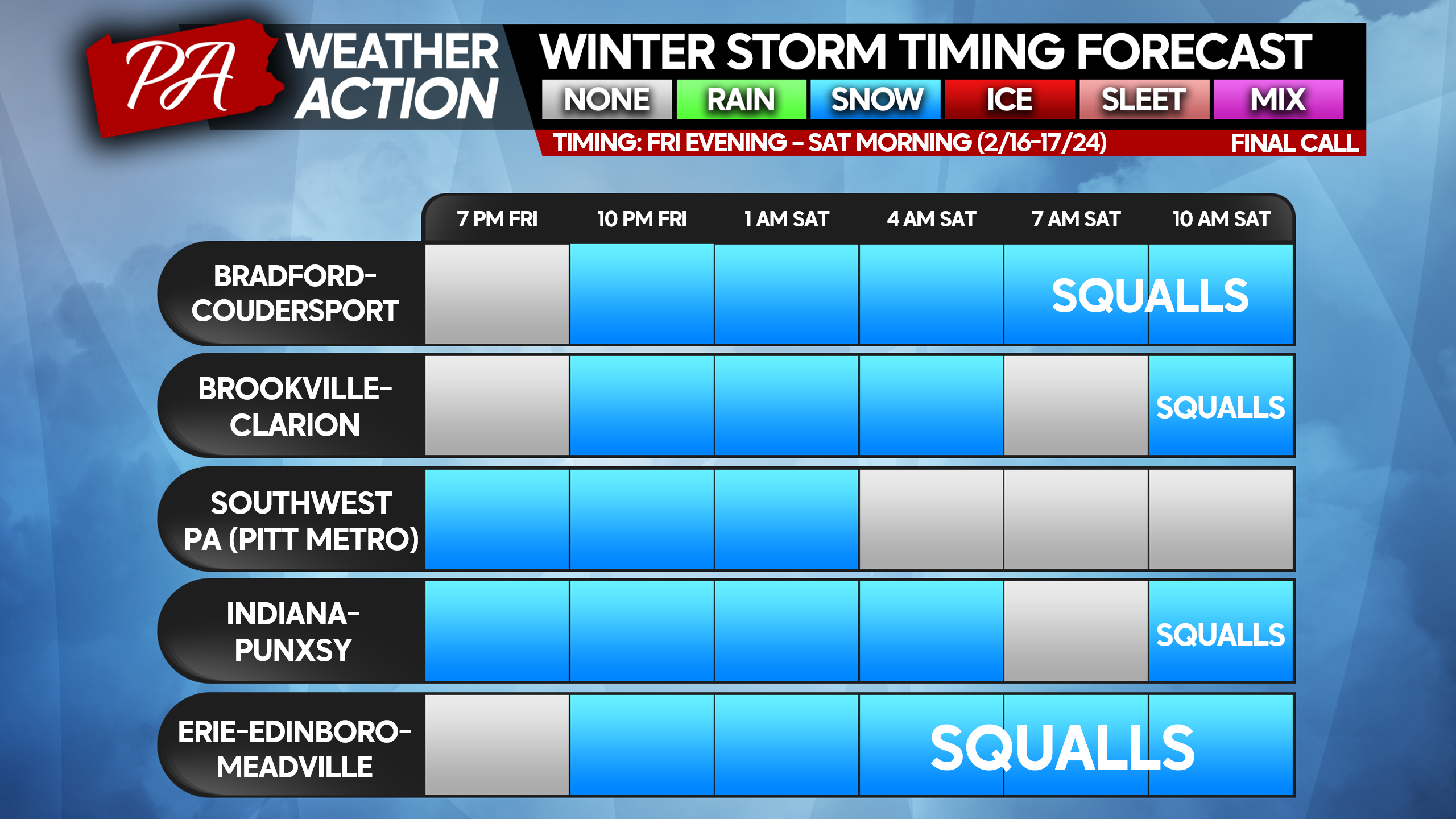
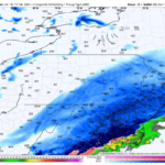
On theme with what we have already experienced this week, more snowfall is now expected across a greater portion of Pennsylvania tonight. Ironically, this time the trend is north which is what we always expect! And it’s why the massive south shift with the storm to start this week caught everyone off guard!
Snowfall rates will generally be a half-inch to an inch per hour tonight, however areas south of I-76 may exceed an inch per hour in the early morning hours of Saturday. No concerns of mixing with rain with this one, and snow will by fluffier than Monday. However, roads will still be a mess Saturday morning as they become covered.
SNOWSTORM TIMIMG TABLES
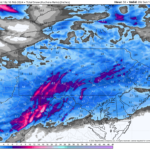
FINAL CALL SNOWFALL FORECAST FOR FRI NIGHT – SAT MORNING SNOWSTORM
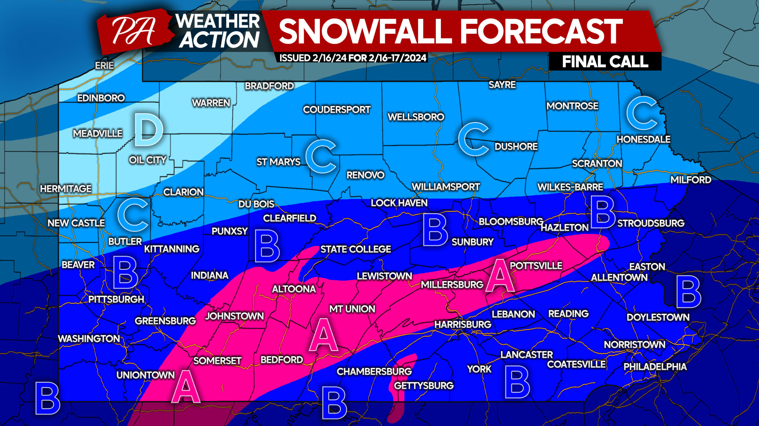
Area A: Snowfall accumulation of 5 – 8” expected. Snowfall rates of 0.5″ to 1.5″ per hour, heaviest early Saturday morning. Travel will be extremely difficult after midnight until sunrise or when roads are cleared.
Area B: Snowfall accumulation of 3 – 5” expected. Snowfall rates of 0.5″ to 1.5″ per hour are likely, heaviest early Saturday morning. Travel will be extremely difficult after midnight until sunrise or when roads are cleared.
Area C: Snowfall accumulation of 2 – 3″ expected. Snowfall rates of 0.3″ to 0.6″ per hour are likely. Difficult travel anticipated during snowfall.
Area D: Snowfall accumulation of 1 – 2″ expected, with light snow for a period Friday night and scattered squalls on Saturday.
Share this significant forecast update with friends and family below, and take it slow in the snow!
Don’t follow us on Facebook? It would be great to have you there! Like PA Weather Action below.
You must be logged in to post a comment.