
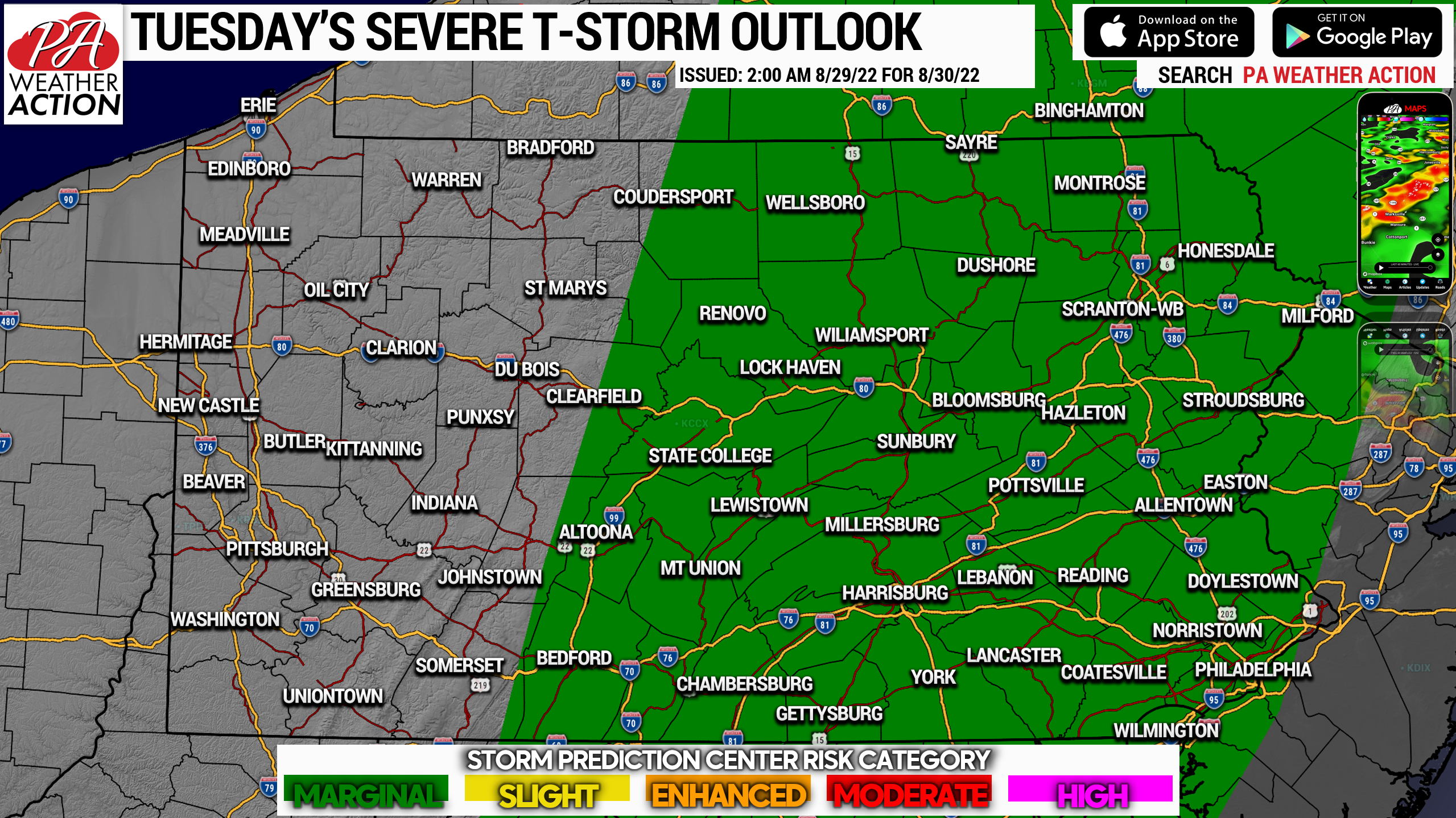
A relatively light severe weather season is coming to an end, but not before some thunderstorms roll through parts of Pennsylvania on Tuesday. The Storm Prediction Center has placed the eastern two-thirds of the state under a Marginal Risk for damaging winds as a result of these storms tomorrow. Below is the risk map.
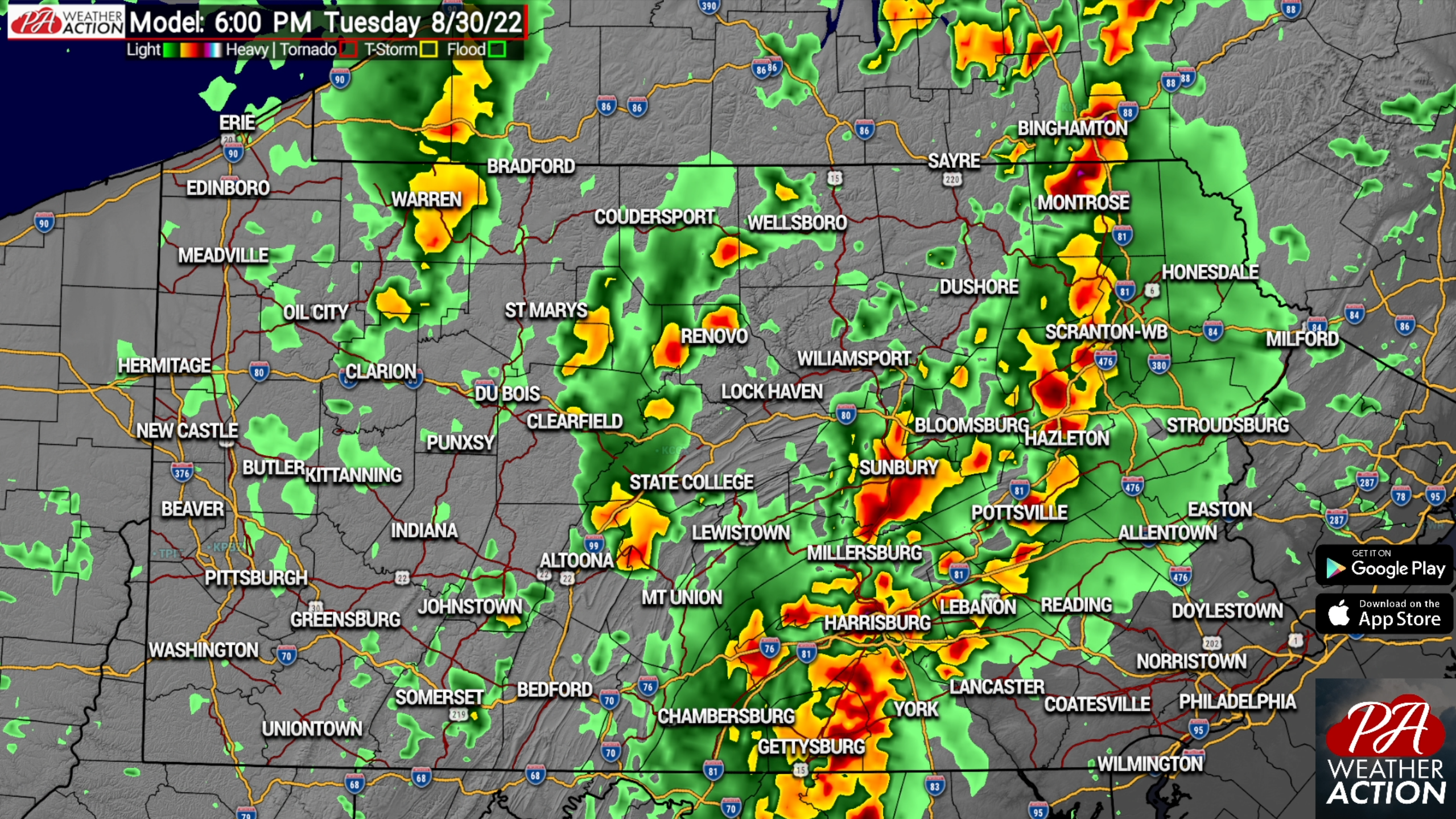
Storms are expected to develop over the mountains of Central PA around 3-4 PM Tuesday and push east-northeast. This means much of the Susquehanna Valley may experience these storms during the evening commute, so be aware of the potential for rapidly-changing conditions.
As we near sunset Tuesday, storms will begin to weaken as they march east in Eastern PA, specifically as they impact areas on a line from Scranton to Jim Thorpe to Reading. The Lehigh Valley and even the Philadelphia Area may still hear rumbles of thunder, but it will be a weakening line of heavy rain and isolated gusty winds by the time it reaches those locations around 8:30-10pm.
Below is Future Radar from the Hi-Res NAM model for Tuesday’s storms.
After this cold front sweeps through, temperatures and humidity will briefly drop before we warm up again by the end of the week. The next two weeks after these storms look to bring ample sunshine and minimal rainfall, which will likely worsen the drought present across Northern PA.
This is all the time of year we should be cheering for rain if we are hoping for a vibrant fall foliage season!
We are days away from a new home screen on our app that has been advertised since last fall, and a feature that will get our followers involved in the latest model trends this hurricane season and more so this winter. Tap the banner below to get our app!

You must be logged in to post a comment.