
FINAL CALL POSTED:
After one of the most shocking reversals on the weather models in years, we have gone from expecting a low-impact event this weekend to a full scale major to perhaps historic East Coast snowstorm. The storm will hit the coast hardest, however snow amounts have been drastically increased in much of Pennsylvania.
This is still a developing situation and a volatile forecast. This forecast is being done with anticipation that current trends will continue to meet the American model where it is at, as has been the case recently. Now is the time to prepare in the eastern half of the state.
WINTER STORM TIMING
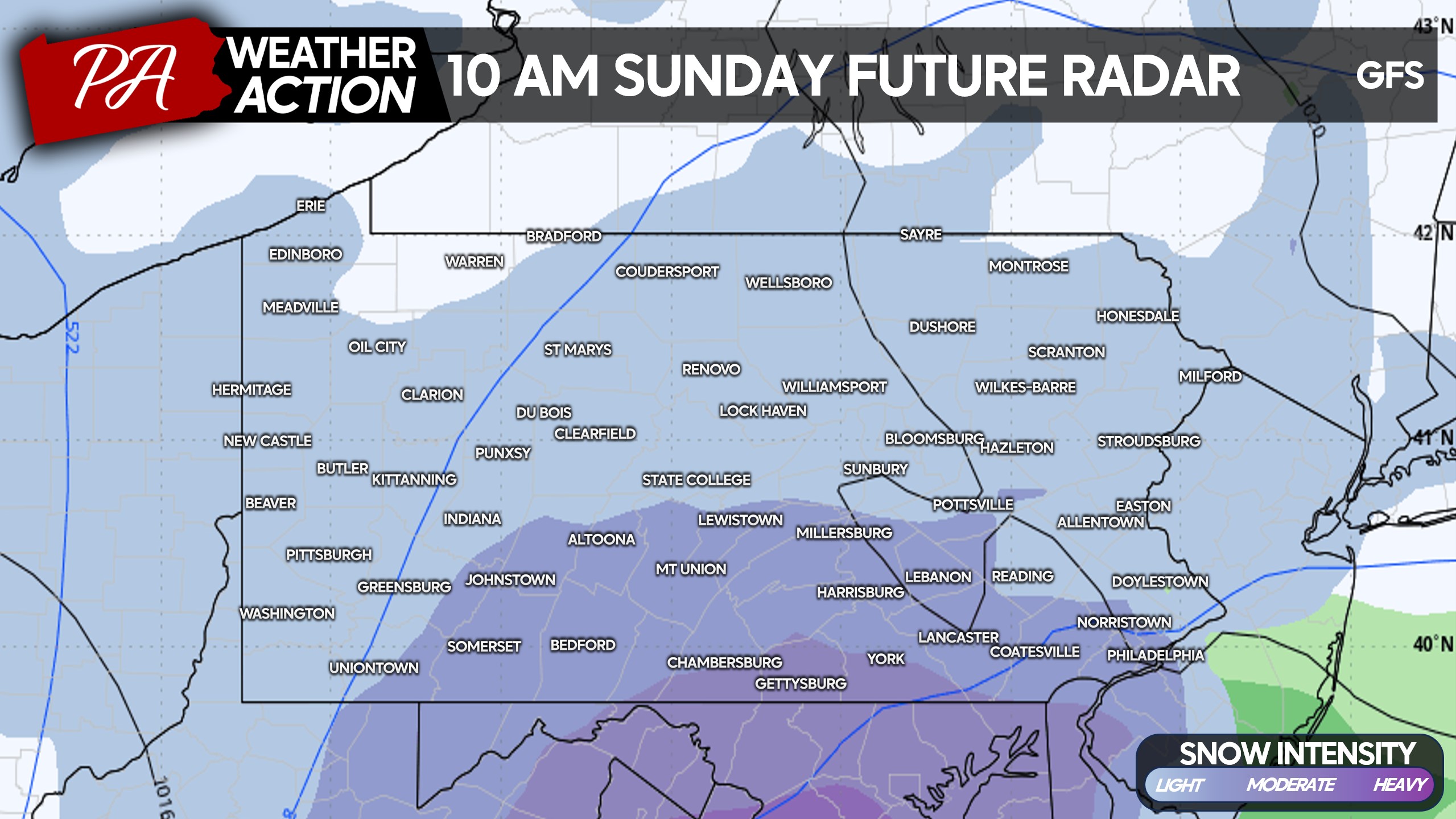
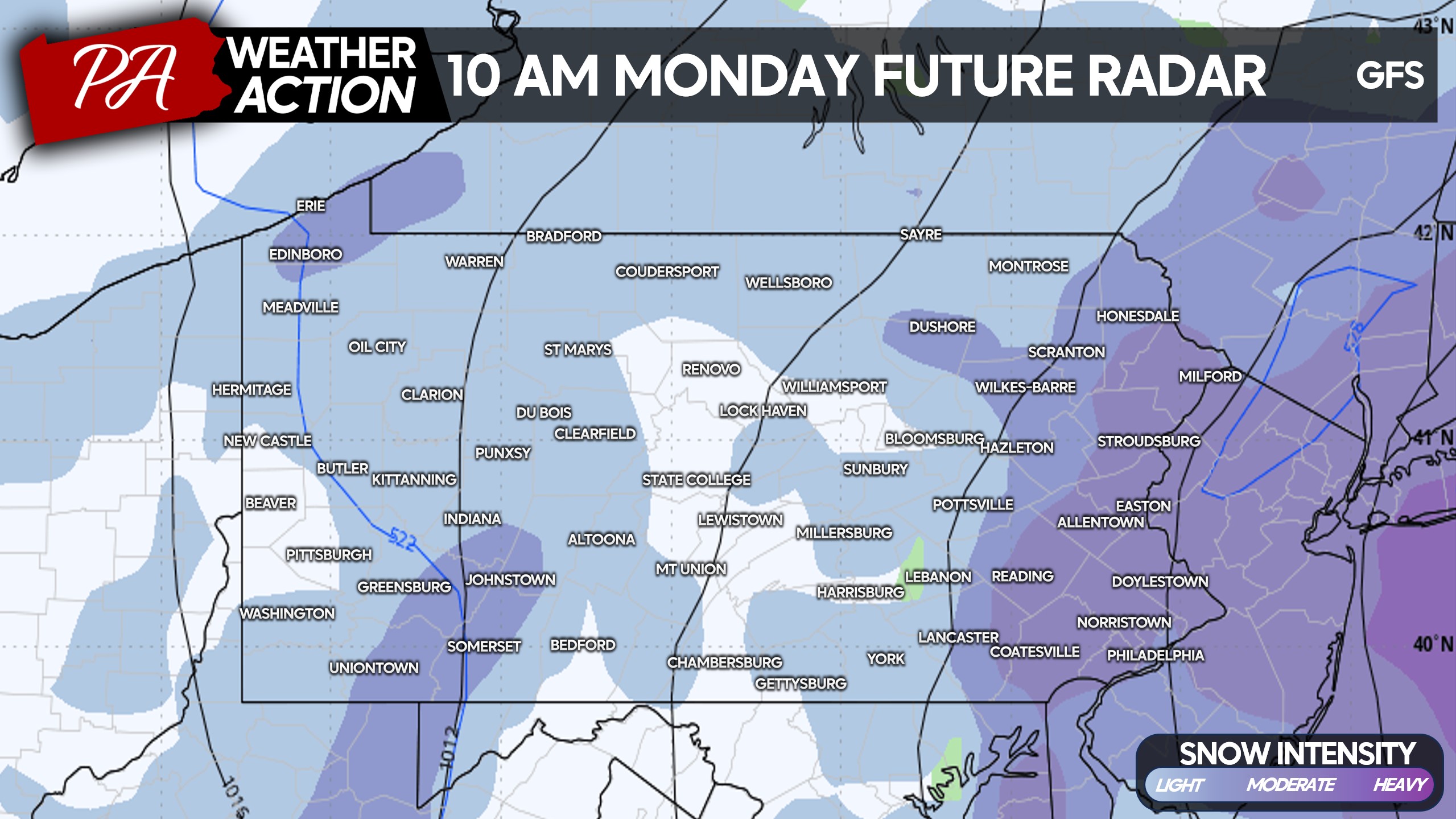
Light to moderate snow will overspread Southern PA from south to north around sunrise Sunday morning with temperatures on either side of freezing. This snow will accumulate on all surfaces due to heavier rates now expected, and will be wet and heavy. Below is the American model for 10:00 AM Sunday.
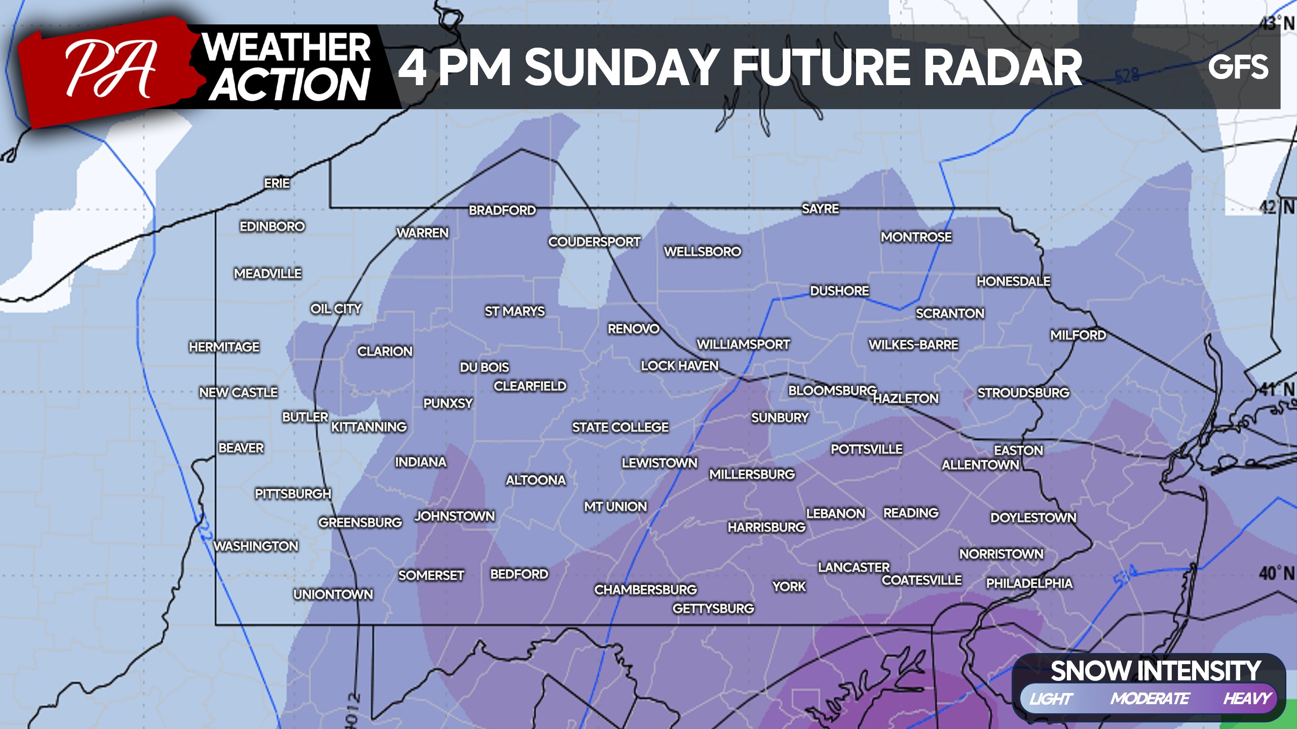
Moderate to heavy snow will push in across the southeast quarter of the state early Sunday afternoon as the coastal low pressure starts to rapidly intensify. Temperatures will begin to drop as cold air flows into the system, pushing temperatures below freezing mostly everywhere by 4-5 PM Sunday.
Sunday evening into early Monday morning will be intense across Eastern PA, with heavy snow accumulating 2-3″ per hour with wind gusts up to 40mph. Do not travel unless it’s an absolute emergency, you will be risking your safety and the safety of EMS responders who may have to come get you if stranded.
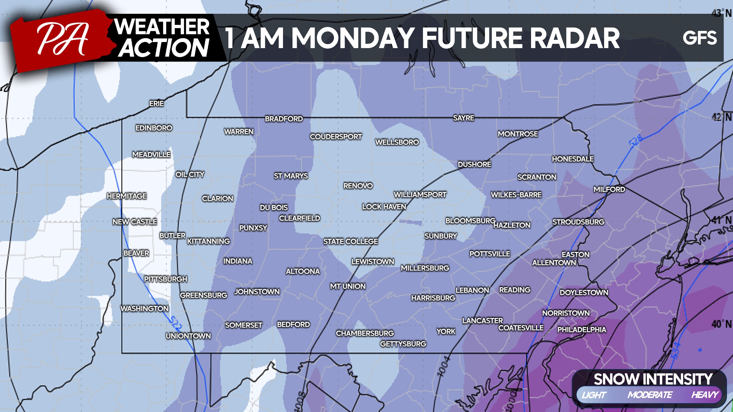
Moderate snow will continue through Monday morning as the snow slowly moves up the coast and away from the area. It looks like around a lunchtime Monday end time in Eastern PA.
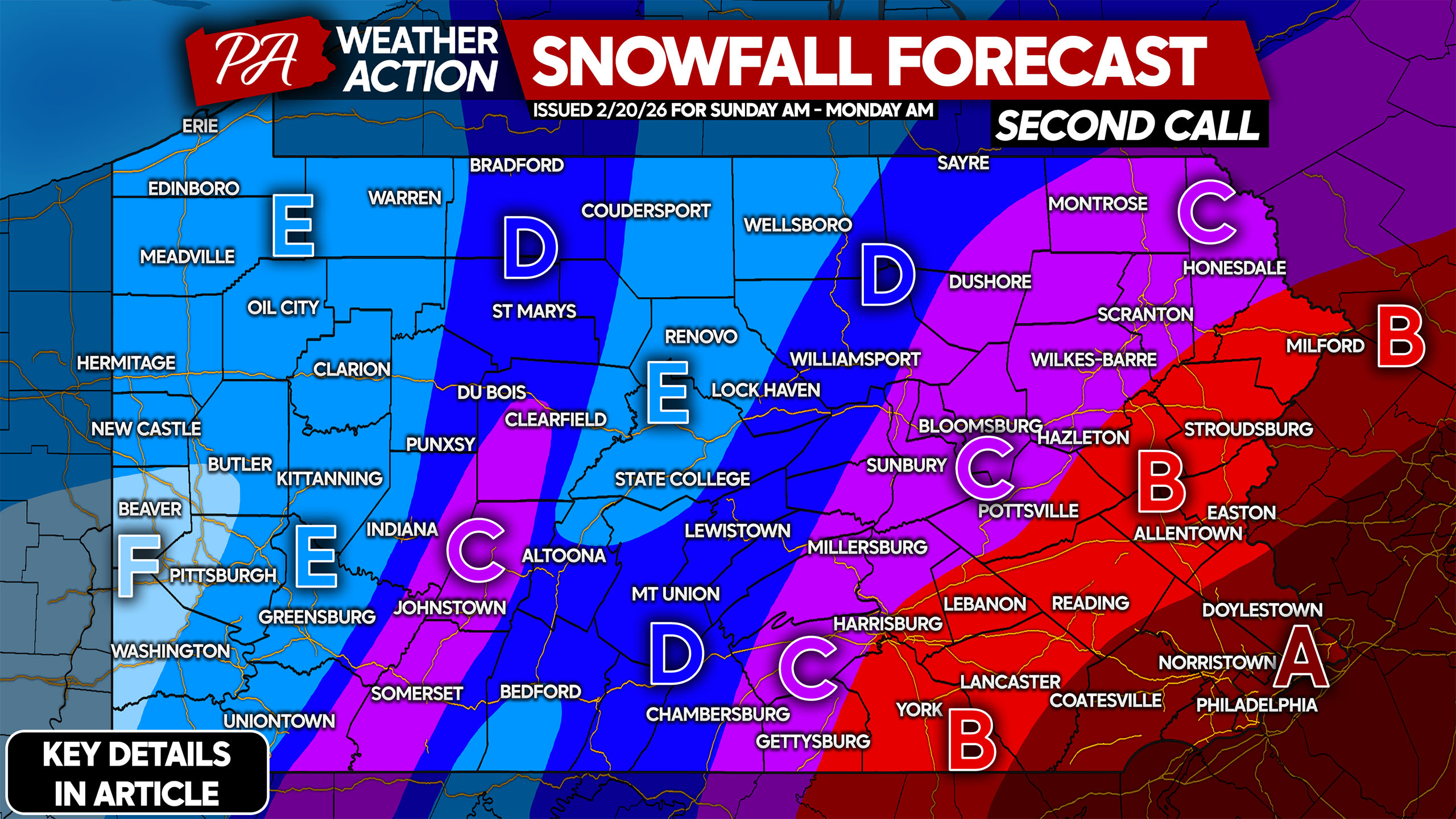
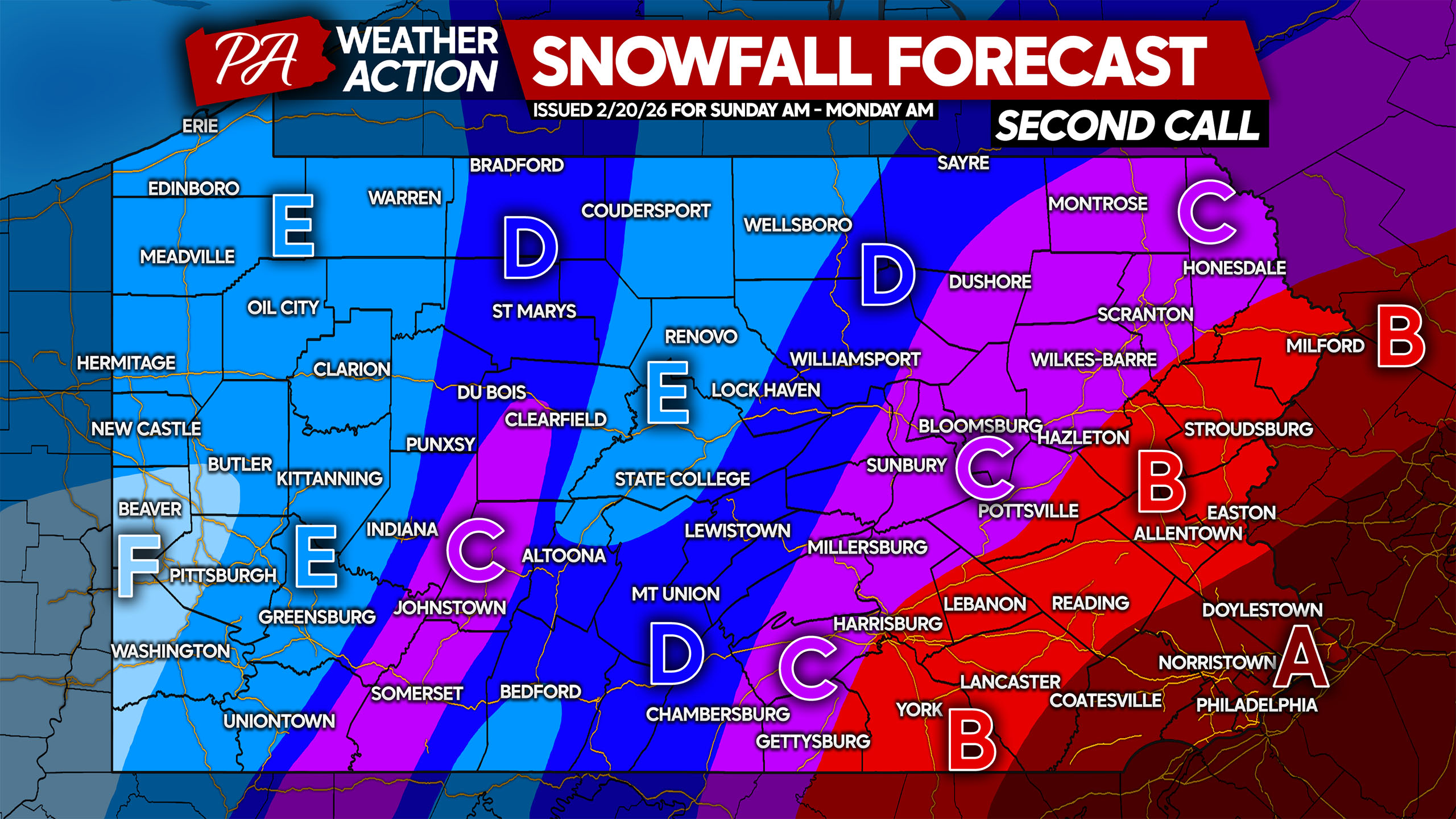
SECOND CALL SNOWFALL FORECAST FOR SUNDAY – MONDAY
Please take many breaks when shoveling and stay hydrated. Help out senior citizens who could use assistance, they are at much higher risk of experiencing medical emergencies when shoveling this much snow.
Area A: Snowfall accumulation of 12 – 20″ expected. Prepare now and do not travel in heavy snow unless in an emergency. Expect several days of school closures.
Area B: Snowfall accumulation of 8 – 12″ anticipated. Prepare now and do not travel in heavy snow unless in an emergency. Expect a few days of school closures.
Area C: Snowfall accumulation of 6 – 8″ expected. Avoid traveling during heavy snow unless you absolutely must! Expect school closures for a day or two.
Area D: Snowfall accumulation of 4 – 6″ anticipated.
Area E: Snowfall accumulation of 2 – 4″ expected.
Area F: Snowfall accumulation of 1 – 2″ anticipated.
Don’t forget to share this important forecast with friends and family below!
You must be logged in to post a comment.