

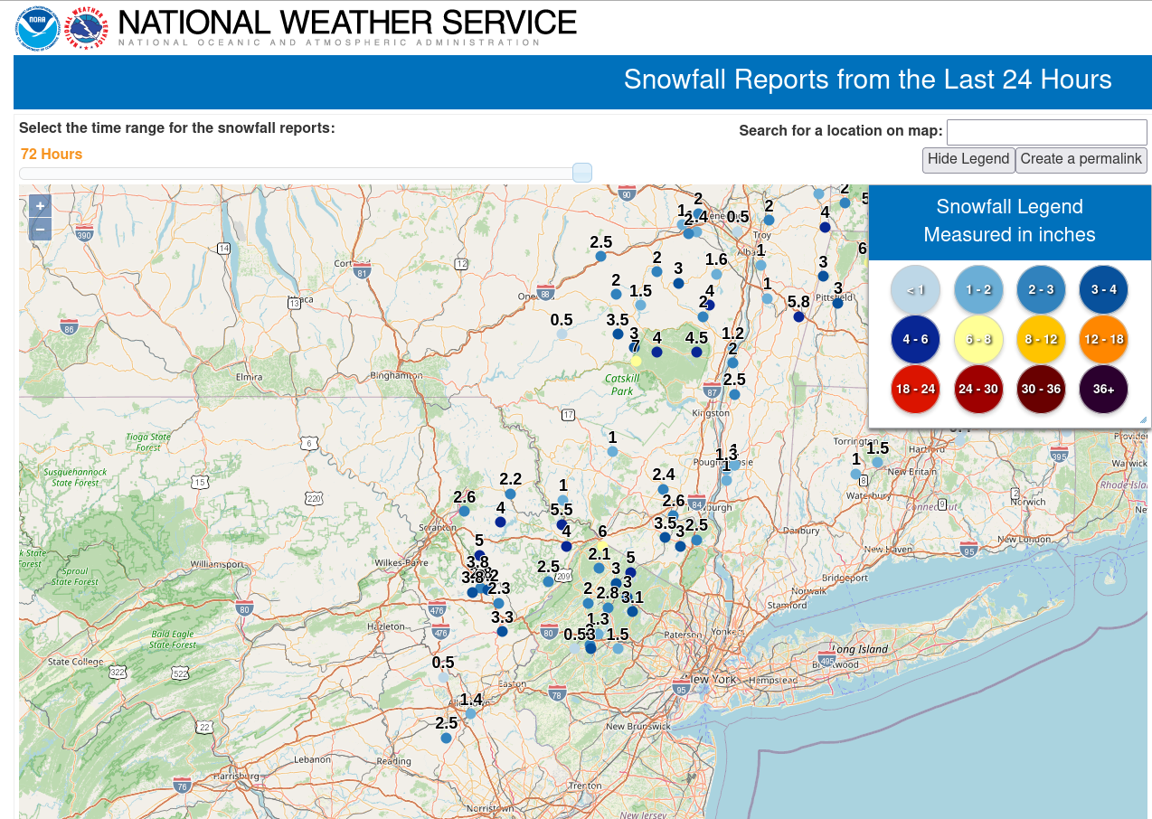
Saturday morning’s coastal storm dumped 2″-6″ of snow on parts of Monroe and Pike counties, as winter wanted one last gasp. After a mild day today, a storm system moving from the Great Lakes into eastern Canada will drag a cold front across our area, which will bring some showers. The following image was taken at ~1500 ft elevation between Stroudsburg and Bangor at the southern border of Monroe County, where more than 6″ accumulated:

Here is a map of snowfall reports received by the National Weather Service:
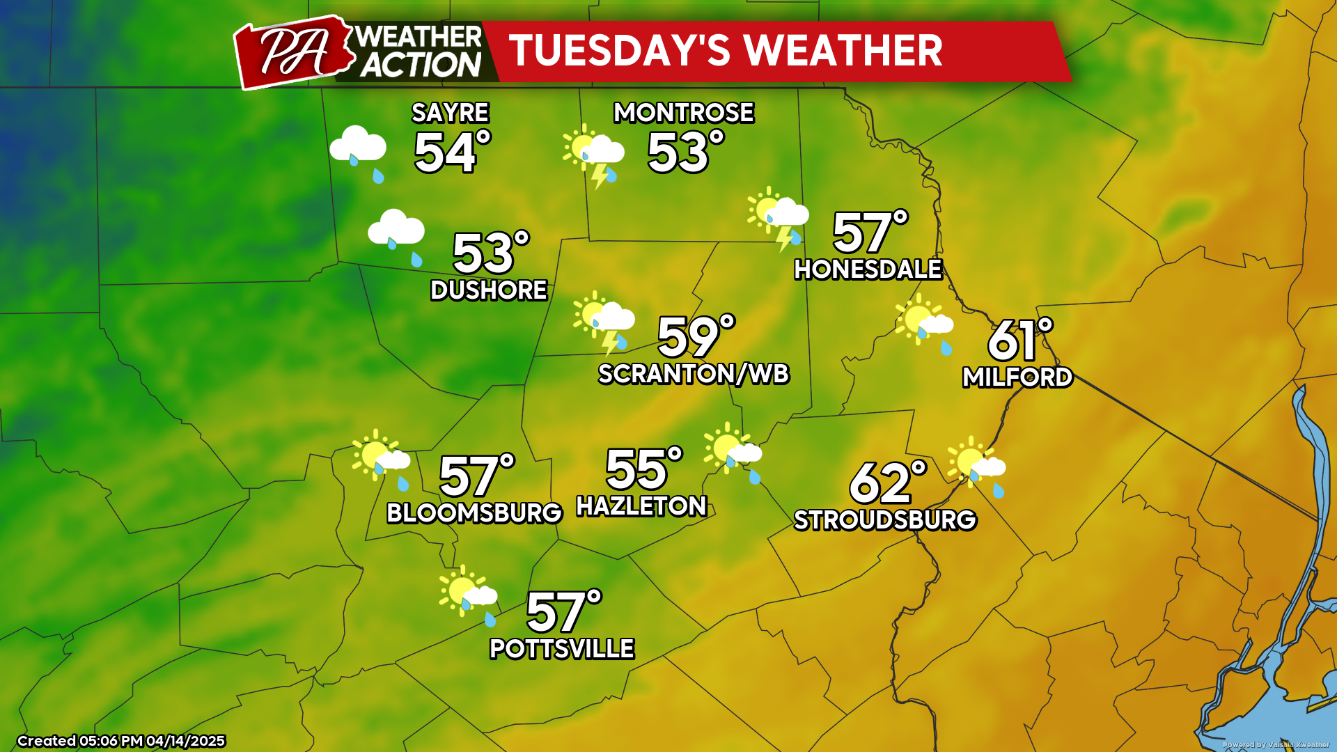
TUESDAY
Tuesday will feature post-frontal wind gusts of 30-40 mph. As a cold upper-level low moves over our area, scattered showers and thunderstorms will also develop, along with some peeks of sun. Windy conditions will continue Tuesday night with temperatures dropping into the upper 20s and low 30s regionwide.
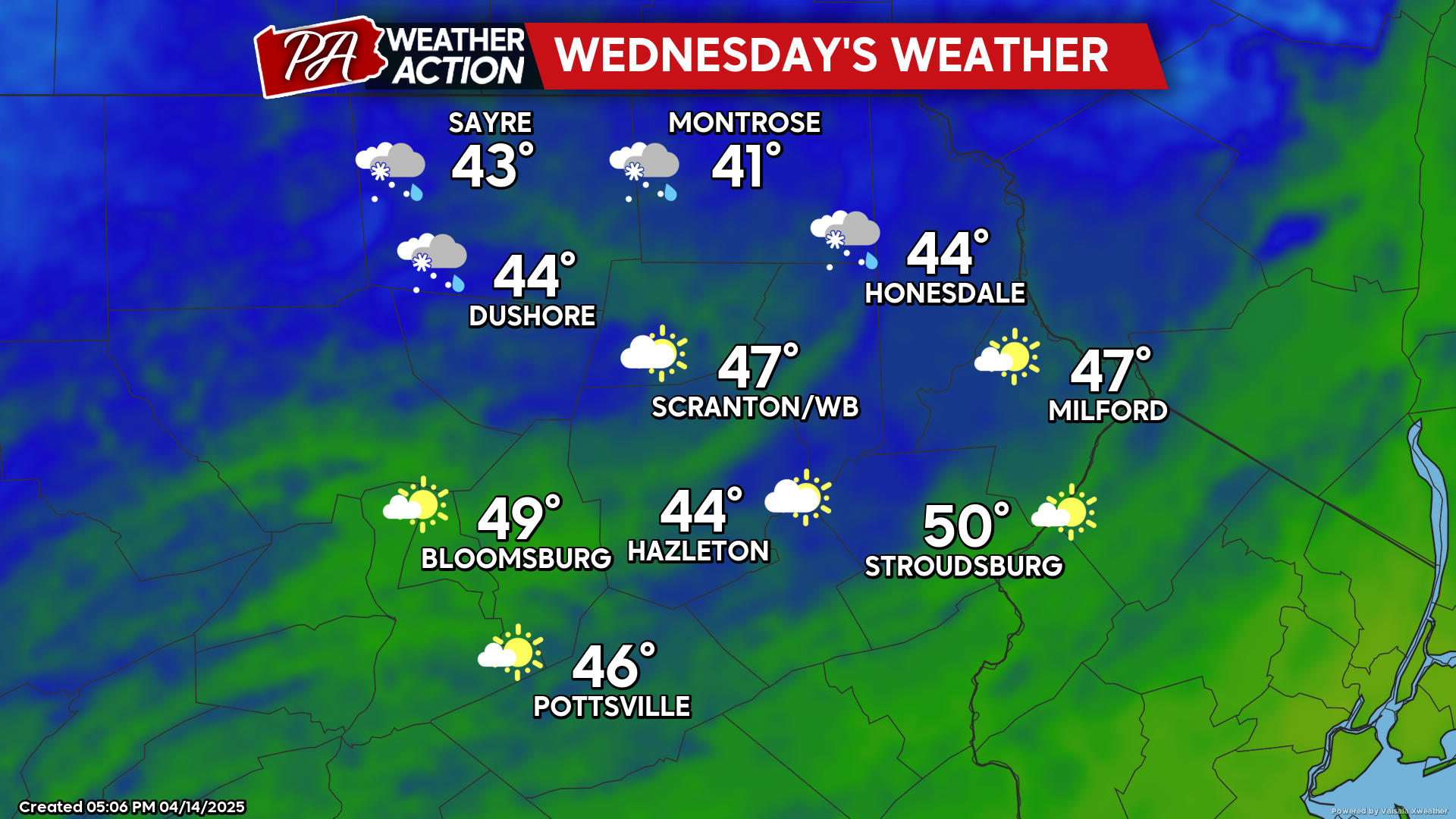
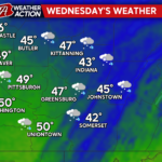
WEDNESDAY
High pressure will move into our area. Colder than normal temperatures and breezy conditions will continue, with some rain and snow showers possible in the northern counties. The southern areas will enjoy more sunshine but also could get a shower.
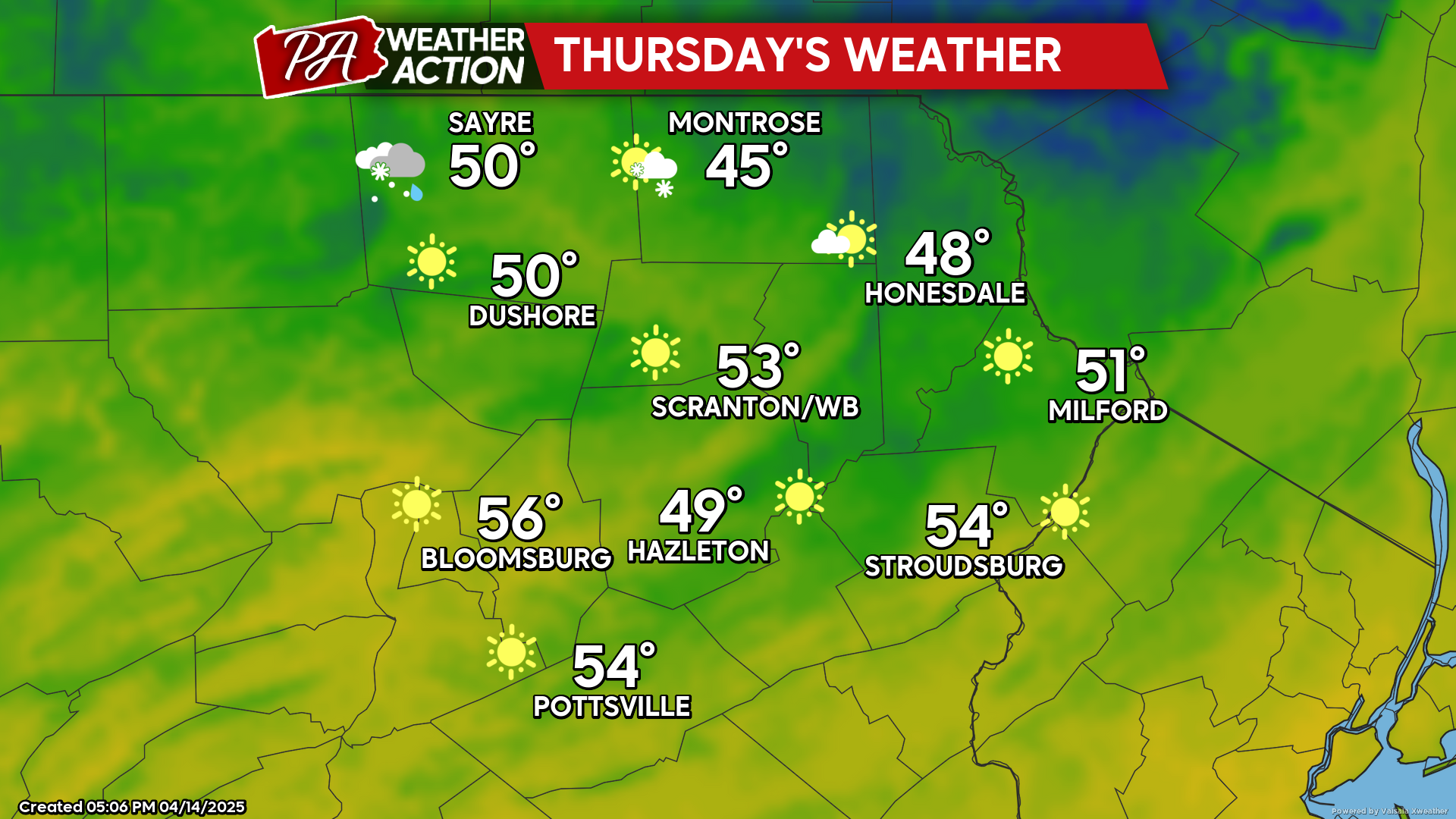
THURSDAY
Thursday will feature more sunshine and less wind, along with temperatures closer to normal. Enjoy!

You must be logged in to post a comment.