
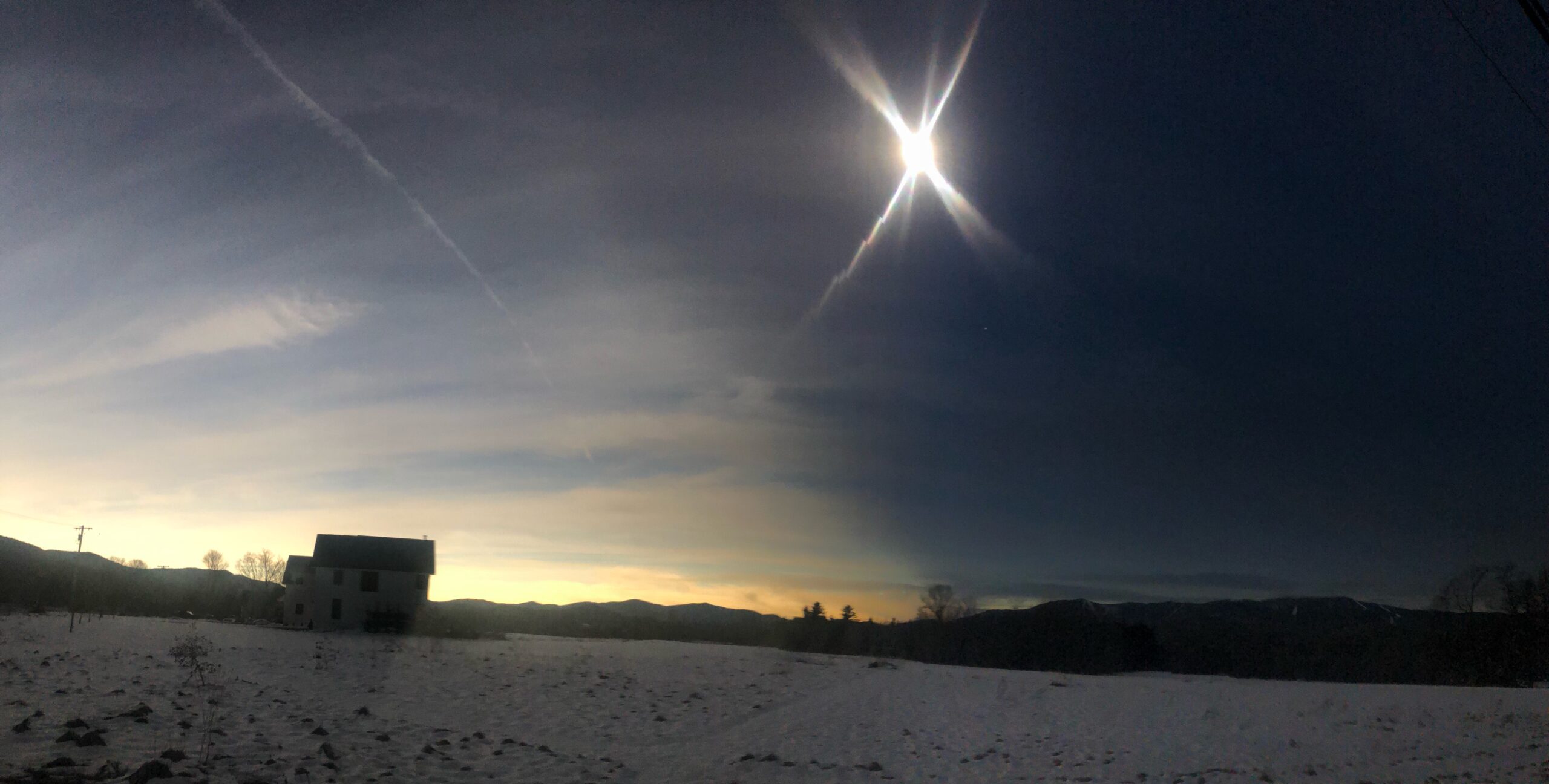
I hope some of you were fortunate-enough to journey to totality on Monday. I ventured to northern Vermont, where a thin layer of high cirrus clouds provided a striking, almost ominous visual of the approaching shadow of the moon. I tried to capture that moment with a quick panoramic from my phone. Those rays in the image are NOT the corona but are lens flares from the camera on my phone.
Today through Saturday we will get our weekly dose of heavy rain, strong wind, and snow. Enjoy!
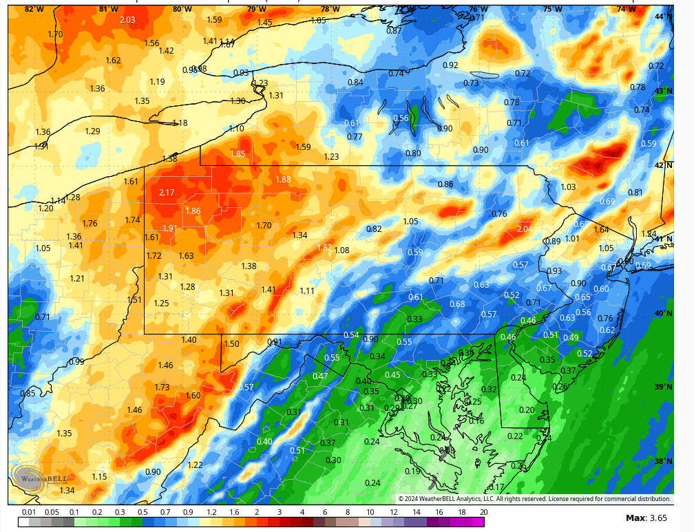
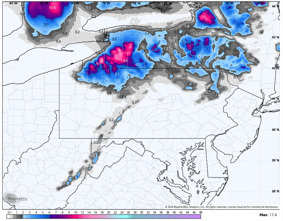
A strong storm moving northward though the eastern Great Lakes tonight will spread rounds of heavy rain across our area tonight into Friday morning. There will also be a strong wind blowing from the south a few thousand feet above our heads that will result in strong surface gusts exceeding 40 mph tonight into Friday morning, especially across the higher elevations. There could also be some thunderstorms. Widespread 1-2″ of rain will fall, with locally higher amounts.
Anticipated rainfall Thursday night through Saturday evening:
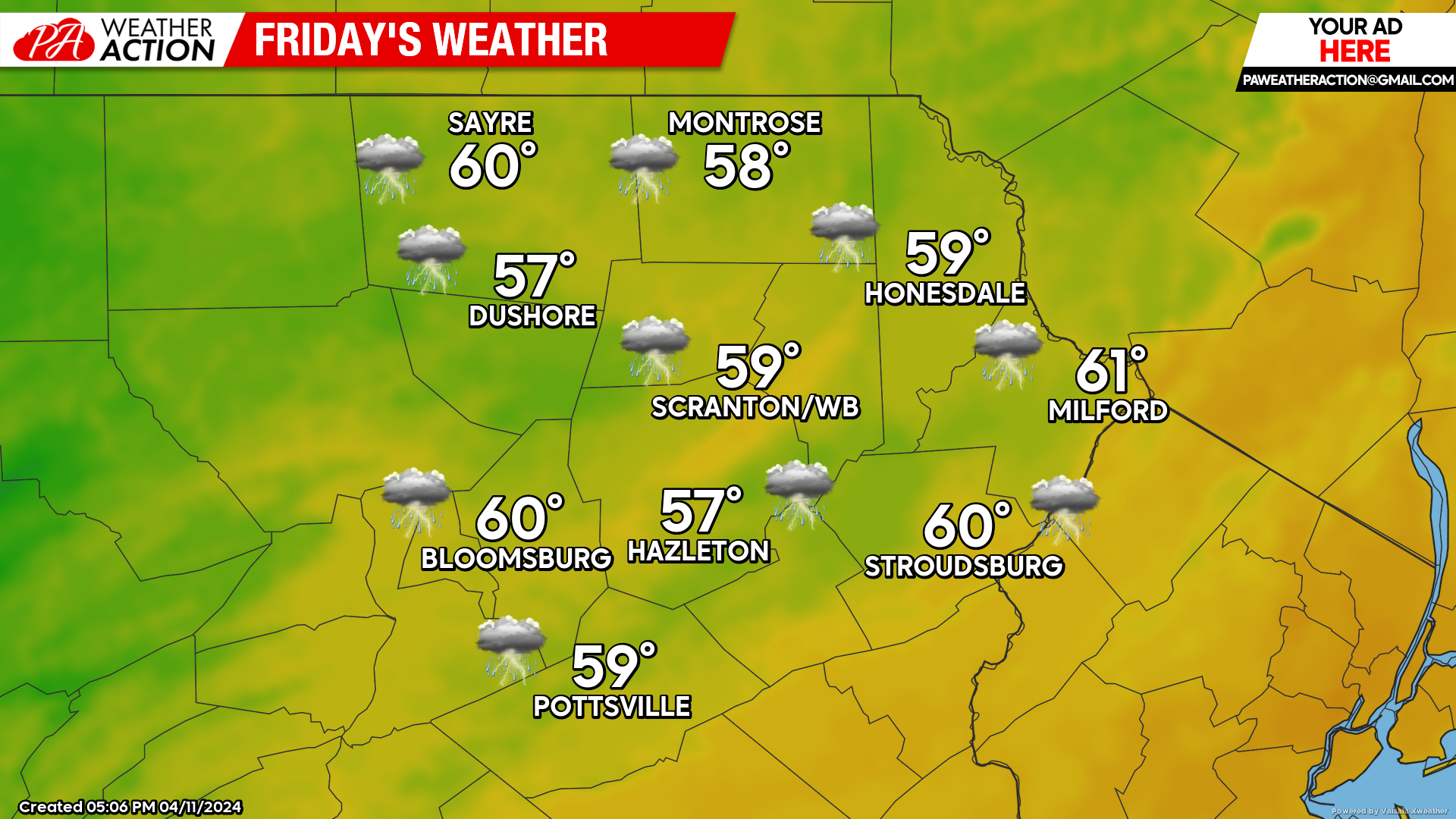
FRIDAY
The aforementioned system will continue moving northward into Southeastern Canada, swinging a cold front through our area mid-late morning. Showers and thunderstorms with locally heavy rain will continue until that frontal passage, followed by more-scattered showers during the afternoon. Ahead of the front, wind gusts could exceed 40 mph. Behind the front, there will be a wind from the southwest gusting to 30 mph. Temperatures could start the day in the low 60s ahead of that front, but will generally be in the mid 50s for most of the day behind the front. Steadier light rain and chilly temperatures will advance into our area from the west after sunset Friday night as moisture wraps around the departing storm.
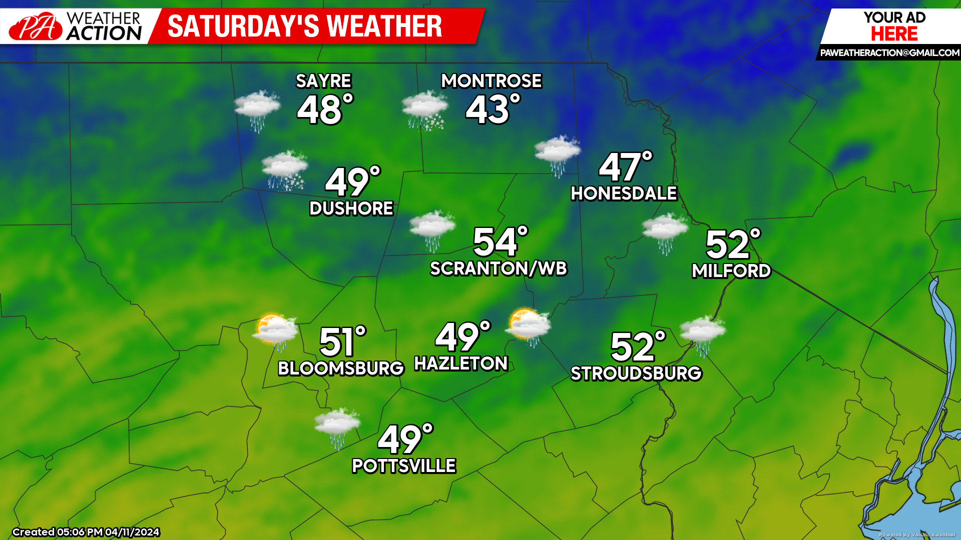
SATURDAY
The steady cold rain could change to snow in the higher elevations just before sunrise Saturday morning, with minor accumulations possible in the highest elevations! Windy conditions will continue with gusts from the WNW reaching 40 mph.
For the hopeful dreamers of April snow, here is the maximum potential snowfall for Saturday morning in inches:
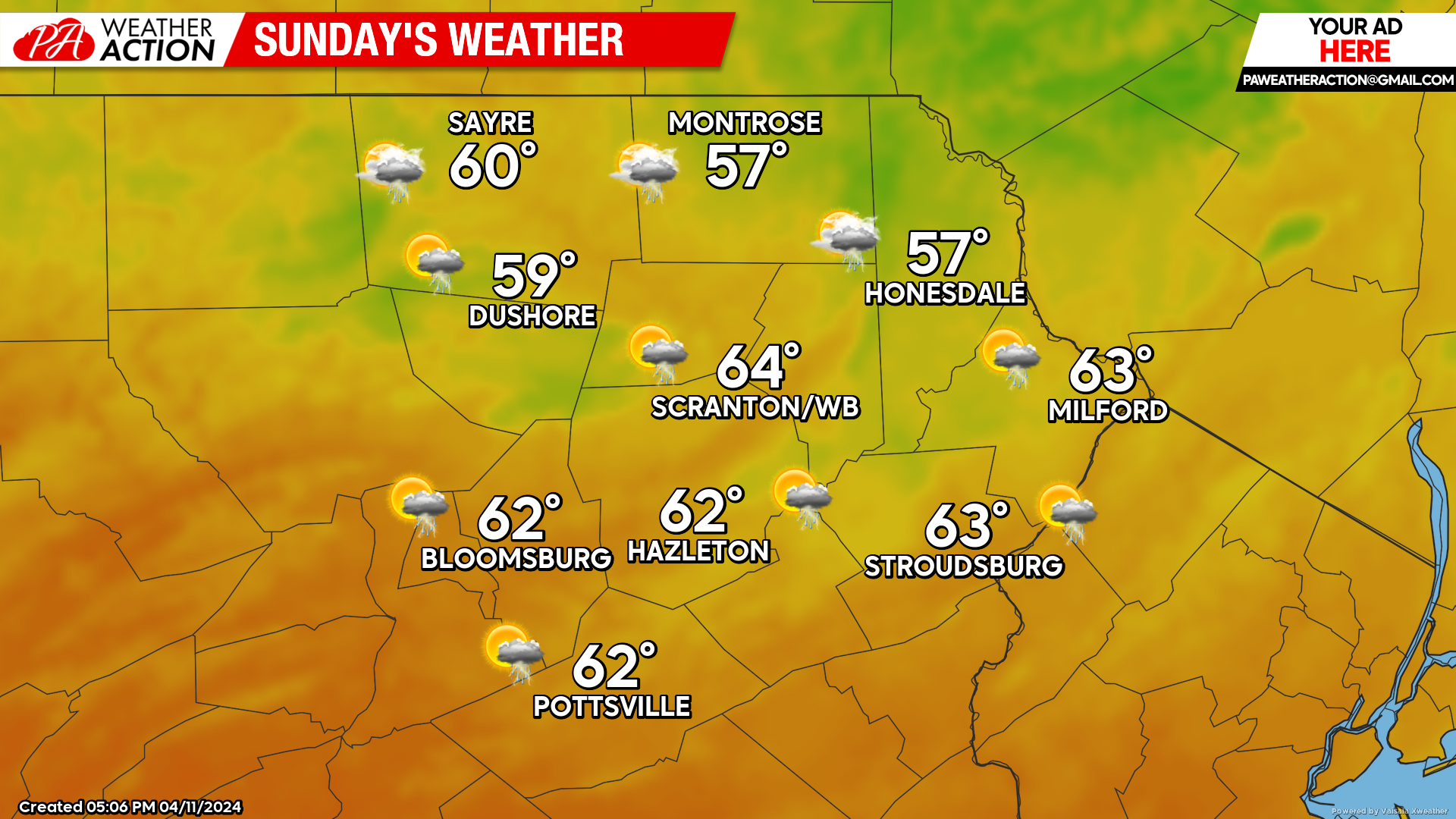
SUNDAY
A mid-level disturbance diving southeastward through New York State will draw milder temperatures into our area. North of the NY-PA border will experience clouds and showers much of the day. South of the NY-PA border will experience some sun and drier conditions than in NY, but still with the opportunity for a few showers or thunderstorms.
BEYOND SUNDAY
Next week will be yet another warmer-than-normal week. The week will start dry, but there will be multiple opportunities for rain mid-late week.


You must be logged in to post a comment.